
The depopulated village of Al-Khalisa / District of Safed
Al-Khalisa
About the depopulated village of Al-Khalisa
- District
- Safed
- Date Al-Khalisa was occupied
- 11 May 1948
- Population in 1948
- 2,130
- Military operation
- Operation Yiftach
- Brigade that carried it out
- Palmach
- Who defended the village
- Local Palestinian militia
- Distance from the governorate centre
- 28 (km) North East of Safad
- Elevation above sea level
- 150 m
- Cause of displacement
- Massacre occured by Zionist troops against the town's inhabitants.
- Extent of destruction
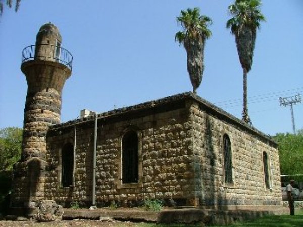
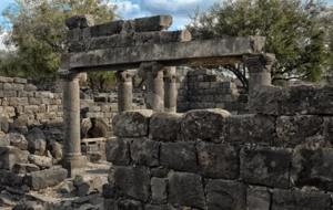
- The village has been mostly destroyed with exception of the village school, a British Mandate government's office, and the village mosque.
- Ethnic cleansing
- al-Khalisa inhabitants were completely ethnically cleansed.
Hover a dot to read the village name, or click to open its card.
Borders of the depopulated village of Al-Khalisa
Al-Khalisa was a depopulated Palestinian village in the Safad Subdistrict. Its population was officially recorded as 1,840 in 1945 and was later estimated at approximately 2,134 in 1948. The village was occupied in May 1948, its inhabitants were displaced, and many of its houses were subsequently burned or destroyed.
The village extended across a low hill on the northwestern edge of the al-Hula Plain, a location that protected it from the seasonal flooding associated with Lake al-Hula. It overlooked the plain to the north and south and stood on the main road running from al-Mutilla in the north to Safad and Tiberias in the south, close to the Lebanese border. Its proximity to both Lebanon and Syria gave al-Khalisa particular importance as a commercial centre.
Population of al-Khalisa
The 1931 census recorded 1,369 inhabitants living in 259 houses: 1,340 Muslims, 26 Christians, and three Jews. The population rose to 1,840 in 1945, comprising 1,820 Muslims and 20 Christians. A later estimate placed the village's population at approximately 2,134 in 1948 and the number of houses at 403. In 1998, the number of refugees from al-Khalisa and their descendants was estimated at 13,108.
Population Figures for al-Khalisa
- 1596160
- Late nineteenth centuryApproximately 50
- 19311,369
- 19451,840
- 1948 estimateApproximately 2,134
- Estimated refugees and descendants, 199813,108
* The figures for 1596, 1931, and 1945 are historical counts or official statistics. The 1948 and 1998 figures are later estimates rather than census totals.
Number of Houses in al-Khalisa
- 1931259
- 1948 estimate403
* The 1931 figure is from the official census; the 1948 figure is a later estimate.
Economic Life in al-Khalisa
- Al-Khalisa's economy was based on agriculture, livestock raising, and commerce. The village benefited from fertile land and from its strategic location near the Lebanese and Syrian borders.
- Its position encouraged trade with nearby Palestinian, Lebanese, and Syrian communities. In the years before the Nakba, the villagers held a weekly market every Tuesday, known as the Tuesday Market, where agricultural produce, textiles, and locally made goods were sold. Local accounts state that merchants from Safad offered to lease the market for 11,000 Palestinian pounds, but the villagers declined the offer; this amount has not been independently confirmed in the principal statistical sources.
- The residents obtained drinking water from several springs.
Land of al-Khalisa
In 1944/45, 3,775 dunams were devoted to cereal cultivation, while 5,586 dunams were irrigated or used for orchards.
Land Ownership in al-Khalisa
- Palestinian ownership10,773 dunums96%
- Jewish ownership0 dunums0%
- Public land507 dunums4%
* One dunam equals approximately 1,000 square metres.
Land Use in al-Khalisa, 1944/45
- Palestinian ownership (dunams)
- Public land (dunams)
- Irrigated land and orchards5,586 dunums
- Cereal cultivation3,775 dunums
- Cultivable land9,361 dunums
- Built-up area20 dunums
- Uncultivated land1,899 dunums
- Total land area11,280 dunums
* One dunam equals approximately 1,000 square metres.
Education in al-Khalisa
The village had one elementary school for boys, which also admitted pupils from neighbouring villages.
Occupation and Depopulation of al-Khalisa
On 11 May 1948, the Haganah rejected al-Khalisa's request for an “agreement.” Israeli historian Benny Morris writes that the villagers, believing themselves to be in danger, decided to leave. News that Safad, the subdistrict capital, had fallen on the same day also influenced their decision. Yigal Allon, commander of Operation Yiftach, sought to remove as much of the area's Palestinian population as possible during the campaign, which provides important context for the rejection of the proposed truce.
Zionist forces probably entered al-Khalisa shortly afterwards during Operation Yiftach, the wider military offensive in eastern Galilee. Plan Dalet had called for the occupation of the British police station in the village, although the precise date on which that order was implemented is unclear.
Villagers interviewed in later years by Palestinian historian Nafez Nazzal provided a more detailed account. They stated that most residents left after hearing of Safad's fall and sought refuge in Hunin to the northwest. The village militia reportedly remained for several more days, until al-Khalisa came under heavy fire from the direction of the Jewish settlement of Manara and an armoured unit was seen approaching. Because Zionist forces controlled the roads, the militiamen withdrew through the hills to Hunin. The villagers were subsequently displaced from there into Lebanon.
In the following weeks, some villagers returned briefly to retrieve money buried on their land or to harvest tobacco and grain. They reported that Israeli forces had burned and destroyed many houses and that the village had been left in ruins. These details derive from later oral testimony and should be distinguished from the official demographic and land records.
Israeli Settlement on al-Khalisa's Lands
Kiryat Shmona was established on the village site in 1950.
Al-Khalisa Today
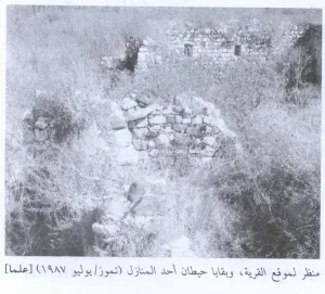
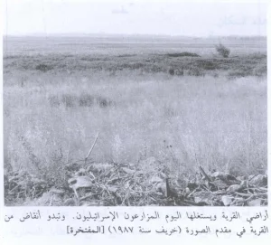
Stone rubble from the village houses marks the site. The former school and several British Mandate administrative buildings remain, as do the village mosque and its minaret. The level land surrounding the site has been used for cultivation by Kiryat Shmona, while the mountainous areas are wooded or used as pasture. Kiryat Shmona, established in 1950, occupies the former village site.
Sources
Photo gallery


Photos from the village's people
Photos sent in by visitors and published after review.
Add a photo of this village
Log in to add photos of this village.
Other villages from Safed

More from the archive


 Download Our Palestine App
The whole archive in the palm of your hand: depopulated villages, the Nakba, the massacres and Al-Aqsa — free, with no ads to erase the story.
Download Our Palestine App
The whole archive in the palm of your hand: depopulated villages, the Nakba, the massacres and Al-Aqsa — free, with no ads to erase the story.



Comments
No comments yet — be the first to write one.
Add your comment
Name and email are optional. Comments appear after review.