
The depopulated village of Kirad al-Ghannama / District of Safed
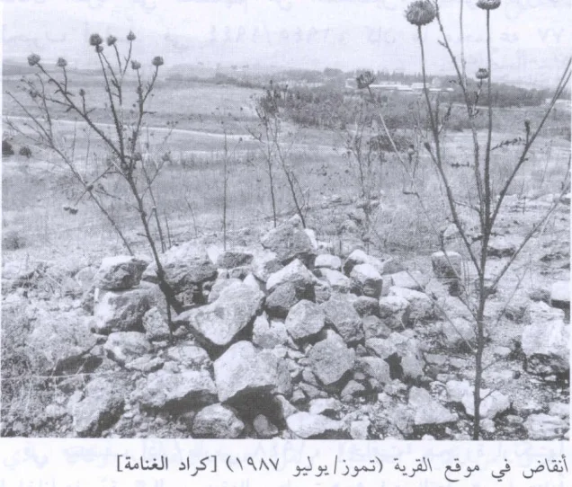
Kirad al-Ghannama
About the depopulated village of Kirad al-Ghannama
- District
- Safed
- Date Kirad al-Ghannama was occupied
- 16 March 1948
- Population in 1948
- 410
- Military operation
- Operation Yiftach
- Brigade that carried it out
- Palmach
- Distance from the governorate centre
- 11 (km) North East of Safad
- Elevation above sea level
- 150 m
- Cause of displacement
- Influence of fall of, or exoduce from, neighboring town
- Extent of destruction
- The village has been completely destroyed, and only the rubble of destroyed houses left behind.
- Ethnic cleansing
- In mid-March, the inhabitants of Kiradal-Ghannama were partially terrorized into fleeing their homes after the massacre perpetrated in al-Husayniyya, and in 1956 the DMZ's 2,200 inhabitants were all terrorized into fleeing to Syria by the Israeli Army.
Hover a dot to read the village name, or click to open its card.
Borders of the depopulated village of Kirad al-Ghannama
Kirad al-Ghannama – Depopulated Palestinian Village of Safad
Kirad al-Ghannama was a Palestinian village in the Safad Subdistrict, approximately 11 kilometers northeast of Safad. It stood on a gently sloping volcanic outcrop at the southern edge of the al-Hula Plain and overlooked the plain to the north. Its neighboring village, Kirad al-Baqqara, was described by Walid Khalidi as its “twin.”
Kirad al-Ghannama's history of displacement differed from that of many Palestinian villages permanently emptied in 1948. Its inhabitants left and returned more than once between 1948 and 1951. The village subsequently fell within the Demilitarized Zone established by the 1949 Syrian-Israeli General Armistice Agreement, and its Palestinian population remained connected to the village until the final expulsion to Syria in 1956.
Basic Information
| Field | Information |
|---|---|
| Name | Kirad al-Ghannama |
| Arabic name | كراد الغنّامة |
| Subdistrict | Safad |
| Region | Galilee – southern edge of the al-Hula Plain |
| Distance from Safad | Approximately 11 km northeast |
| Elevation | Approximately 150 m according to PalQuest; the Palestine Encyclopedia gives approximately 175 m |
| Palestine Grid | 205/269 |
| Total land area | 3,975 dunums |
| Population in 1945 | 350 |
| Houses in 1931 | 54 |
| 1948 displacement | Temporary evacuation in March, followed by another temporary or partial evacuation on 22 April during Operation Yiftach |
| 1948 military context | Operation Yiftach |
| Military unit in 1948 | Palmach forces conducted Operation Yiftach; a separate direct First Battalion attack on Kirad al-Ghannama itself is not conclusively documented |
| Status after 1949 | Part of the Israel-Syria Demilitarized Zone |
| Final expulsion | 30 October 1956 according to a later UN record; Khalidi states more generally that the village was emptied by 1956 |
| 1956 military unit | A Palestinian oral-history compilation attributes the expulsion to Unit 101; this identification is not independently established in Khalidi's account |
| Israeli settlements on village land | None according to Khalidi; Gadot and Ayyelet ha-Shahar were nearby |
Name and Etymology
Mustafa Murad al-Dabbagh suggested that the word Kirad may be a corruption of Akrad, “Kurds,” referring to Kurdish groups who settled in Palestine during or after the medieval period. He also recorded an alternative explanation connecting the term with karrada, associated with traditional water-lifting devices known as kurud.
The Palestine Encyclopedia states that the area was historically frequented by Kurdish and Bedouin pastoralists and that some eventually settled there, producing the two neighboring villages of Kirad al-Ghannama and Kirad al-Baqqara. Local tradition connects the second part of the name, al-Ghannama, with sheep herding and the importance of flocks to the village economy.
These remain historical and traditional explanations rather than a conclusively established linguistic derivation.
Location and Geography
Kirad al-Ghannama stood on a volcanic outcrop at the southern edge of the al-Hula Plain. The site sloped gently, and the village houses were largely constructed of adobe or mud brick and roofed with timber.
Kirad al-Baqqara lay to the east, Tulayl to the north, al-Husayniyya to the northwest, Marus to the west, al-Wayziyya to the south, and Yarda to the southeast. Wadi Mushayrifa ran between the areas of the two Kirad villages, while Wadi Waqqas passed west of Kirad al-Ghannama.
The village was linked by secondary routes to the Safad-Qunaytra road and the area of the Banat Ya'qub Bridge. Most local roads between the neighboring agricultural settlements were unpaved.
Water Resources
Water was relatively abundant. Khalidi records wells, springs, and nearby Wadi Waqqas as sources used by the villagers. Palestinian local documentation also identifies seasonal watercourses including Wadi Waqqas, Wadi al-Nashif, and Masil al-Dabbagha.
These resources supported agriculture and livestock, although most cultivated land remained dependent on rainfall.
Population
- 1931265Official Government of Palestine census
- 1945350Official Mandate-period statistics
- 1948406Later estimate published by Palestine Remembered, not an official census
- 19982,493Later estimate of refugees and descendants, not an official census
The population recorded in the 1931 census was Muslim. A figure of 365 for 1931 appearing in one Palestine Encyclopedia entry conflicts with the official census-based figure of 265 and is therefore not used here.
Number of Houses
- 193154Official 1931 census figure
- 194882Later estimate, not an official Government of Palestine census figure
Land Ownership, 1944/45
- Palestinian3,795 dunums95%
- Transferred to Zionists175 dunums4%
- Public5 dunums<1%
The original Mandate statistics used the categories Arab, Jewish, and Public. The three categories total exactly 3,975 dunums, matching the village's total land area.
Land Use, 1944/45
- Palestinian
- Transferred to Zionists
- Public
- Citrus and bananas77 dunums
- Plantations and irrigable land20 dunums
- Cereals3,626 dunums
- Built-up land64 dunums
- Non-cultivable land188 dunums
The table balances exactly: 77 + 20 + 3,626 + 64 + 188 = 3,975 dunums. Some secondary online tables incorrectly place all 188 dunums of non-cultivable land in the Palestinian category; the official breakdown is 183 Palestinian and five public dunums.
Economy and Agriculture
The village economy depended primarily on agriculture and livestock raising. Grain occupied the largest cultivated area: 3,626 dunums when all ownership categories are counted. Palestinian-owned land also included 77 dunums devoted to citrus and bananas and 20 dunums classified as plantations or irrigable land.
Sheep raising was particularly important, alongside goats and cattle. Dairy products and agricultural produce supplied household needs, while surpluses were traded in nearby villages and markets.
Education
Palestinian sources disagree on the organization of education in Kirad al-Ghannama. The Palestine Encyclopedia states that children from Kirad al-Ghannama and Kirad al-Baqqara attended a shared school with approximately fifty boys and girls.
By contrast, a Palestinian village-history project based in part on oral testimony states that Kirad al-Ghannama had no formal school and that two shaykhs taught boys in private homes, providing basic reading, writing, arithmetic, and Qur'anic instruction.
Because no original school register or equally decisive record has been located, the two accounts should remain visible rather than treating either as conclusively established.
Archaeological Sites
Several archaeological sites lay near the village. Khirbat Nijmat al-Subh and Tall al-Safa contained columns, wall remains, and cisterns. Palestinian local documentation additionally records stone heaps, burials, presses, and carved rock around Tall al-Safa.
Approximately two kilometers to the southwest stood Tall al-Qadah, which Khalidi identifies as a large Bronze-Iron Age site.
Temporary Displacement in March 1948
The first documented displacement occurred in mid-March 1948. Khalidi, citing Israeli sources, reports that a Haganah attack in the neighboring village of al-Husayniyya caused dozens of deaths and prompted the temporary evacuation of Kirad al-Ghannama.
This was not the village's final depopulation. Its inhabitants, or at least a substantial portion of them, subsequently returned.
Operation Yiftach and the 22 April 1948 Evacuation
A second displacement occurred during Operation Yiftach. On 22 April 1948 the villagers, or part of the population, left again. Khalidi links this departure to the effect of a direct military assault on a nearby village, possibly al-'Ulmaniyya, which had been attacked on 20 April.
Palestine Remembered lists the Palmach's First Battalion as the military unit associated with the village's depopulation. The First Battalion was indeed a major participant in Operation Yiftach, but Khalidi's village-specific account does not establish a separate direct First Battalion assault on Kirad al-Ghannama on 22 April. Operation Yiftach is therefore best understood as the military context of this second evacuation rather than 22 April being treated as the village's final occupation date.
The Demilitarized Zone
Israel and Syria signed their General Armistice Agreement on 20 July 1949. The agreement created Demilitarized Zones between the forces and provided for the gradual restoration of normal civilian life within them.
Kirad al-Ghannama lay within this zone. Its Palestinian population therefore did not disappear permanently from the village in 1948. Residents returned, and the village continued to exist during the following years amid continuing disputes over civilian residence, land use, and control of the Demilitarized Zone.
The 1951 Removal and Return
In the spring of 1951 Arab civilians were removed from portions of the Demilitarized Zone. Palestinian sources record that residents of Kirad al-Ghannama and Kirad al-Baqqara were among those transferred, with a number taken to the village of Sha'ab in the Acre Subdistrict.
On 18 May 1951 the United Nations Security Council adopted Resolution 93. Among its provisions, the Council determined that Arab civilians removed from the Demilitarized Zone should be permitted to return forthwith to their homes and restricted further population transfers without the procedures established under the armistice machinery.
Later United Nations records confirm that inhabitants of Baqqara and Ghannama returned following the resolution. Palestine Remembered also preserves community documentation of a 1951 petition in which residents of the two villages appealed to United Nations officials for restoration to their homes.
Final Expulsion in 1956
Kirad al-Ghannama remained inhabited after residents returned in the aftermath of the 1951 events. Pressure on the Arab population of the Demilitarized Zone nevertheless continued during the following years.
Khalidi records that by 1956 the approximately 2,200 Arab inhabitants of the Demilitarized Zone as a whole had been driven out, and Kirad al-Ghannama was emptied for a third time.
A later United Nations record states that the inhabitants of Baqqara and Ghannama were forced across into Syria on 30 October 1956. One Palestinian village-history compilation is internally inconsistent, giving both 30 October and 30 November in different sections. The article therefore uses 30 October while noting the discrepancy.
The same Palestinian compilation attributes the final expulsion to Unit 101. Because this unit-level identification is not independently specified in Khalidi's published village account, it is retained only as an attributed claim rather than a definitive military identification.
Cause of Depopulation
Kirad al-Ghannama cannot accurately be assigned a single depopulation cause or date. The March 1948 evacuation followed events in neighboring al-Husayniyya. The second evacuation on 22 April occurred within the context of Operation Yiftach and under the influence of an attack on a neighboring village. Residents later returned, were removed again in 1951, returned after United Nations intervention, and were finally expelled to Syria in 1956.
Destruction
Village buildings were damaged or destroyed during successive phases of displacement, and Palestinian oral-history material records that returning villagers rebuilt homes after earlier removals, particularly after their return in 1951.
Khalidi's later field description confirms that the village ultimately became a ruined site, with only house rubble remaining. It is therefore inaccurate to assign the village's final destruction automatically to 22 April 1948; the process continued through the later history of the Demilitarized Zone and culminated in the 1956 expulsion.
Ethnic Cleansing in Source Classification
Palestine Remembered classifies Kirad al-Ghannama using the term “ethnic cleansing.” The specific documented events include repeated displacement in 1948, subsequent returns, inclusion within the 1949 Demilitarized Zone, the removal and return of residents in 1951, and the final expulsion of the remaining villagers toward Syria in 1956, followed by the destruction of the village site.
Occupation and Depopulation Chronology
| Date | Event |
|---|---|
| Mid-March 1948 | Temporary evacuation following the attack on neighboring al-Husayniyya; residents later returned. |
| 20 April 1948 | Attack on nearby al-'Ulmaniyya, which Khalidi considers a possible immediate factor in the subsequent evacuation of Kirad al-Ghannama. |
| 22 April 1948 | Second temporary or partial evacuation during Operation Yiftach. |
| 1948–1949 | Residents or a substantial part of the population returned; the April evacuation was not final. |
| 20 July 1949 | Israel-Syria General Armistice Agreement; Kirad al-Ghannama became part of the Demilitarized Zone. |
| 30–31 March 1951 | Arab civilians were removed from the central sector of the Demilitarized Zone; residents of the two Kirad villages were affected. |
| 18 May 1951 | UN Security Council Resolution 93 called for the return of Arab civilians removed from the Demilitarized Zone. |
| 1951 | Residents of Kirad al-Ghannama and Kirad al-Baqqara returned to the area. |
| 30 October 1956 | Final expulsion toward Syria according to a later United Nations record; one Palestinian secondary source alternatively gives 30 November. |
| After the final expulsion | The village was destroyed and its inhabitants did not return to permanent residence there. |
Israeli Settlements on Kirad al-Ghannama's Lands
According to Walid Khalidi and PalQuest, no Israeli settlement was established on Kirad al-Ghannama's village lands. Gadot, founded in 1949, lies very close to the site, while Ayyelet ha-Shahar, founded in 1918, lies nearby to the west.
An entry in the Palestine Encyclopedia gives a different account, associating Ayyelet ha-Shahar with Kirad al-Ghannama's lands. Because Khalidi's village-specific description explicitly distinguishes the nearby settlements from the village lands, this article follows his classification while preserving the source disagreement.
Kirad al-Ghannama Today
According to the field description used by Walid Khalidi before the publication of All That Remains in 1992, only the rubble of the village houses remained standing at the site. Wild vegetation, grasses, shrubs, and some trees covered the area, while surrounding lands were used for cultivation and livestock grazing.
Palestine Remembered contains later community documentation of the site, including photographs taken during subsequent visits, with material dating to 2014. These document continuing rubble, vegetation, and surviving trees around the former village area.
Such material constitutes community documentation rather than a comprehensive archaeological or cadastral survey. Khalidi's description likewise derives from fieldwork conducted before the 1992 publication of All That Remains and should be treated as a documented historical description, not as a comprehensive direct field verification of the site's condition in 2026.
Sources
- PalQuest – Interactive Encyclopedia of the Palestine Question: Kirad al-Ghannama
- Palestine Remembered – Kirad al-Ghannama, Safad
- Palestine Remembered – Kirad al-Ghannama entry from Walid Khalidi's All That Remains
- Palestine Encyclopedia – Kirad al-Baqqara and Kirad al-Ghannama
- Palestinian Villages Encyclopedia – Kirad al-Ghannama
- United Nations – Israel-Syria General Armistice Agreement, 20 July 1949
- United Nations – Security Council Resolution 93 (1951)
Photo gallery
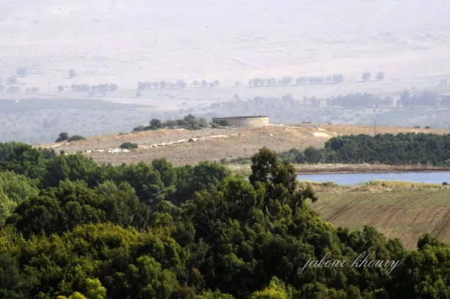
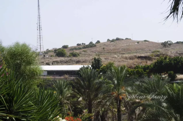
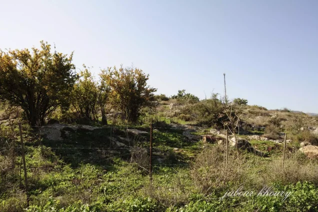

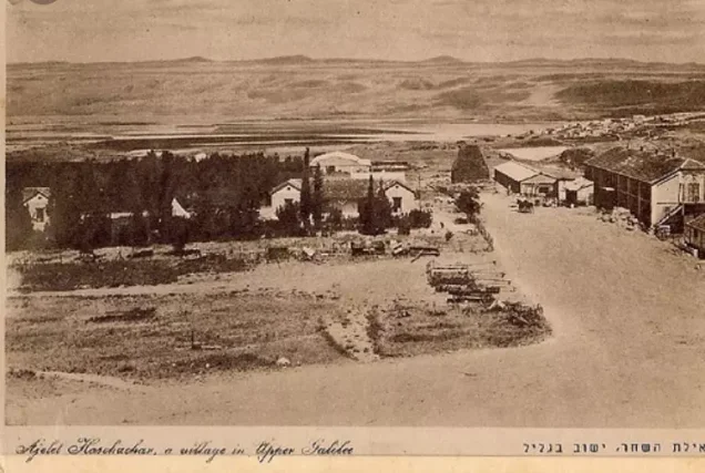
Photos from the village's people
Photos sent in by visitors and published after review.
Add a photo of this village
Log in to add photos of this village.
Other villages from Safed

More from the archive



 Download Our Palestine App
The whole archive in the palm of your hand: depopulated villages, the Nakba, the massacres and Al-Aqsa — free, with no ads to erase the story.
Download Our Palestine App
The whole archive in the palm of your hand: depopulated villages, the Nakba, the massacres and Al-Aqsa — free, with no ads to erase the story.



Comments
No comments yet — be the first to write one.
Add your comment
Name and email are optional. Comments appear after review.