
The depopulated village of Al-Dirdara / District of Safed
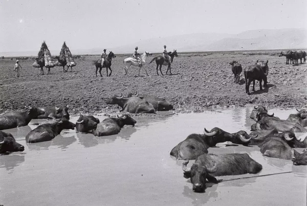
Al-Dirdara
About the depopulated village of Al-Dirdara
- District
- Safed
- Date Al-Dirdara was occupied
- 01 May 1948
- Population in 1948
- 120
- Military operation
- Operation Yiftach
- Brigade that carried it out
- Palmach
- Distance from the governorate centre
- 13 (km) East of Safad
- Elevation above sea level
- 75 m
- Cause of displacement
- Military assault by Zionist troops
- Extent of destruction
- The village has been completely obliterated
- Ethnic cleansing
- al-Dirdara was ethnically cleansed as a result of psychological warfare conducted on late April 1948.
- Settlements built on the land of Al-Dirdara before 1948
- Eyal (Abandoned)
- Settlements built on the built-up area of Al-Dirdara after 1948
- Ashmora (Abandoned)
Hover a dot to read the village name, or click to open its card.
Borders of the depopulated village of Al-Dirdara
Al-Dirdara – Depopulated Palestinian Village in Safad Subdistrict
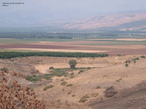
Al-Dirdara was a Palestinian village in the Safad subdistrict of Galilee, situated approximately 13 kilometers east of Safad at an average elevation of about 75 meters above sea level. The village stood on level ground overlooking the al-Hula Plain and facing the mountain range to the east.
The official 1944/45 population figure was 100, but this statistical unit included both Al-Dirdara and Mazari' al-Daraja and therefore should not be treated as an independent count of Al-Dirdara alone. The same statistical unit had a registered land area of 6,361 dunums.
The precise date on which Al-Dirdara was first occupied is not known. Walid Khalidi suggests that it may have fallen during Operation Yiftach in late April or May 1948. What is certain is that it was in Israeli hands by early July 1948. During July, the village was subsequently used as a launching point for Operation Berosh against Syrian forces on the border front.
Key Facts about Al-Dirdara
| Field | Information |
|---|---|
| Name | Al-Dirdara |
| Subdistrict | Safad |
| Status | Depopulated Palestinian village |
| Distance from Safad | Approximately 13 km east |
| Average elevation | Approximately 75 m above sea level |
| Population, 1944/45 | 100; the figure includes Mazari' al-Daraja |
| Registered land area | 6,361 dunums; the statistics include Mazari' al-Daraja |
| First occupation | Exact date unknown; possibly late April or May 1948 |
| Probable military operation | Operation Yiftach |
| Unit specifically occupying the village | Not independently documented; the Palmach First Battalion spearheaded Operation Yiftach as a whole |
| Confirmed military control | Al-Dirdara was in Israeli hands by early July 1948 |
| Later military operation | Used as a launching point for Operation Berosh in July 1948 |
| Extent of destruction | The village was largely destroyed and the site became a mound of stone and earth |
| Settlement on village land | Eyal, established in 1947 and subsequently rebuilt and renamed ha-Goverim and later Ashmura |
Location of Al-Dirdara
Al-Dirdara lay in the eastern part of the Safad subdistrict in the al-Hula Plain region near the Syrian frontier. It occupied level terrain, facing higher ground to the east and overlooking the plain to the north and south.
Local maps place Al-Dirdara near al-Dirbashiyya, Tulayl, Kirad al-Baqqara, Mansurat al-Khayt, and the al-Hula area. Its official 1944/45 statistics were combined with those of Mazari' al-Daraja.
Al-Dirdara before the Nakba
Most village houses were built of mud, although some were constructed from stone. Fertile agricultural land surrounded the settlement, particularly to the south and southwest.
Agriculture formed the basis of village life. Documented crops included cereals, vegetables, citrus fruit, figs, and olives, supported by the fertile environment and water resources of the al-Hula region.
Population of Al-Dirdara
- 1944/45100Official statistics, but the figure includes Al-Dirdara and Mazari' al-Daraja together
- 1948360Later estimate reported by Palestine Remembered, not an official census
- 19982,208 refugeesLater refugee and descendant estimate reported by Palestine Remembered
PalQuest does not provide a separately documented 1931 population figure for Al-Dirdara, and no unverified number has therefore been added.
The 1948 and 1998 figures should not be attributed to British Mandatory Village Statistics, notwithstanding the general source note displayed beneath the Palestine Remembered population table; both are chronologically later estimates.
Number of Houses
The principal sources reviewed do not provide a separately documented house count for Al-Dirdara in 1931 or 1948. No house total has therefore been inferred from population figures or imported from an unsupported secondary source.
Land Ownership of Al-Dirdara and Mazari' al-Daraja
The combined registered land area of Al-Dirdara and Mazari' al-Daraja in the 1944/45 statistics was 6,361 dunums.
- Arab4,443 dunums70%
- Jewish1,829 dunums29%
- Public89 dunums1%
The figures balance correctly: 4,443 + 1,829 + 89 = 6,361 dunums.
The Arabic Palestine Remembered page contains a serious display problem in its simplified ownership table: it shows 4,443 Palestinian dunums, zero “Transferred to Zionists,” and 89 Communal/Public dunums, while displaying a total of only 89 and omitting the 1,829 dunums recorded in the official statistics under the Jewish category. For this reason, this article retains the original official categories Arab / Jewish / Public instead of reconstructing a simplified ownership table from inconsistent data.
Land Use in 1944/45
PalQuest records a combined total of 4,247 dunums as cultivated or cultivable land for the statistical unit of Al-Dirdara and Mazari' al-Daraja.
Walid Khalidi further records that 1,623 dunums were devoted to cereals and approximately 795 dunums were irrigated or used for orchards.
- Total cultivated/cultivable land4,247 dunums64%
- Cereals1,623 dunums24%
- Irrigated land or plantationsApproximately 795 dunums12%
The available PalQuest table does not provide a complete breakdown sufficient to reconstruct every land-use category across Arab, Jewish, and Public ownership with confidence. A full detailed table has therefore not been manufactured through arithmetic inference alone.
Economic Life in Al-Dirdara
The economy was based primarily on agriculture. The fertile soils and water resources of the al-Hula Plain supported cereals, vegetables, citrus, figs, and olives.
Cultivation was particularly important to the south and southwest of the village. The documented irrigated and plantation acreage also demonstrates the role of irrigated farming alongside cereal production.
Water Resources
Al-Dirdara belonged to the water-rich environment surrounding the al-Hula Plain. The principal Khalidi entry, however, does not provide a complete independent list of named village springs or wells, and specific water-source names have therefore not been added without separate verification.
Education and Institutions
The principal sources reviewed do not provide sufficient documented information about an independent school in Al-Dirdara, its founding date, or pupil numbers. No unsupported educational data have therefore been included.
The sources used here likewise do not provide sufficient documentation for a specific mosque or shrine within the village to justify presenting one as a verified institution.
Operation Yiftach
Operation Yiftach was conducted between 15 April and 25 May 1948 to gain control of eastern Galilee before the end of the British Mandate. It was organized by Palmach commander Yigal Allon, and the Palmach's First Battalion served as the spearhead of the operation as a whole.
Walid Khalidi suggests that Al-Dirdara may have been occupied during this campaign in late April or May. The village-specific entry, however, does not independently identify the First Battalion as the unit that entered Al-Dirdara itself.
The First Battalion's prominent role in Operation Yiftach should therefore not automatically be converted into a village-specific attribution without separate evidence.
Occupation and Depopulation of Al-Dirdara
The precise date on which Al-Dirdara was occupied is not known. Walid Khalidi states that it may have fallen during Operation Yiftach in late April or May 1948.
Palestine Remembered lists 1 May 1948 as a summary occupation date and identifies Operation Yiftach and the Palmach First Battalion. The detailed Khalidi narrative reproduced on the same page, however, explicitly states that the precise date is unknown. The 1 May date is therefore not treated here as conclusively established.
What can be stated with confidence is that Al-Dirdara was in Israeli hands by early July 1948, at the end of the first truce.
The principal village entry does not provide an independently established date on which all inhabitants left or were expelled. Khalidi does state, however, that the people of Al-Dirdara had been expelled before the settlement on village land was subsequently rebuilt.
Palestine Remembered classifies the village's complete depopulation as ethnic cleansing and associates it with military assault and psychological warfare in late April. In more narrowly documented terms, Al-Dirdara lost its Palestinian population during the 1948 conquest of eastern Galilee, while the precise date and immediate mechanism of final depopulation remain uncertain in Khalidi's village account.
Operation Berosh and the Syrian Counterattack
By July 1948, Al-Dirdara had become an important military position on the Syrian front. Walid Khalidi, citing the Israeli History of the War of Independence, records that the village was used as one of the launching points for Operation Berosh, an Israeli attack against the Syrian bridgehead during the “Ten Days” between the two truces, 8–18 July.
Syrian forces subsequently attempted to retake Al-Dirdara. According to the Haganah account relayed by Khalidi, the Syrian force encountered a minefield and withdrew after suffering substantial losses. The casualty details should be treated as an Israeli military account quoted by Khalidi rather than as an independently verified Palestinian figure.
Al-Dirdara and the Demilitarized Zone
Under the Syrian-Israeli Armistice Agreement signed in July 1949, Al-Dirdara and the surrounding area were designated part of the Demilitarized Zone.
This postwar status distinguishes Al-Dirdara from many other depopulated villages, because its site remained directly connected with the Syrian frontier dispute and the later history of the Demilitarized Zone.
Occupation Chronology
- 15 April – 25 May 1948
Operation Yiftach
The Palmach campaign for control of eastern Galilee.
- Late April or May 1948
Possible first occupation of Al-Dirdara
Walid Khalidi states that the village may have been occupied during Operation Yiftach but gives no exact date.
- 1 May 1948
Palestine Remembered summary date
Displayed in the site's summary table but inconsistent with the explicit uncertainty in Khalidi's detailed narrative; not treated as conclusively established.
- Early July 1948
Confirmed control
Al-Dirdara was definitely in Israeli hands by the end of the first truce.
- During 8–18 July 1948
Operation Berosh
Al-Dirdara served as one of the launching points for an Israeli attack against the Syrian bridgehead.
- After Operation Berosh, July 1948
Syrian attempt to recapture the village
Syrian forces attempted to retake the position but withdrew after encountering a minefield, according to the Haganah account cited by Khalidi.
- July 1949
Demilitarized Zone
The Syrian-Israeli Armistice Agreement placed Al-Dirdara and its surroundings within the Demilitarized Zone.
- Precise date not documented
Destruction
The village was largely destroyed, and the site later appeared as a mound of stones and earth.
Israeli Settlement on Al-Dirdara's Lands
The settlement of Eyal was established on Al-Dirdara's lands in 1947, before the Nakba.
| Settlement / Name | Date | Details |
|---|---|---|
| Eyal | 1947 | Established on Al-Dirdara's land before 1948 |
| ha-Goverim | After 1948 | Name given to the rebuilt settlement after the wartime destruction and the expulsion of Al-Dirdara's inhabitants |
| Ashmura | 1953 | Later name of the settlement; Khalidi records that it subsequently became uninhabited |
Eyal should therefore not be described as a post-1948 settlement. It had been established in 1947, although it was destroyed during the war and later rebuilt and renamed after the village's depopulation.
Al-Dirdara Today
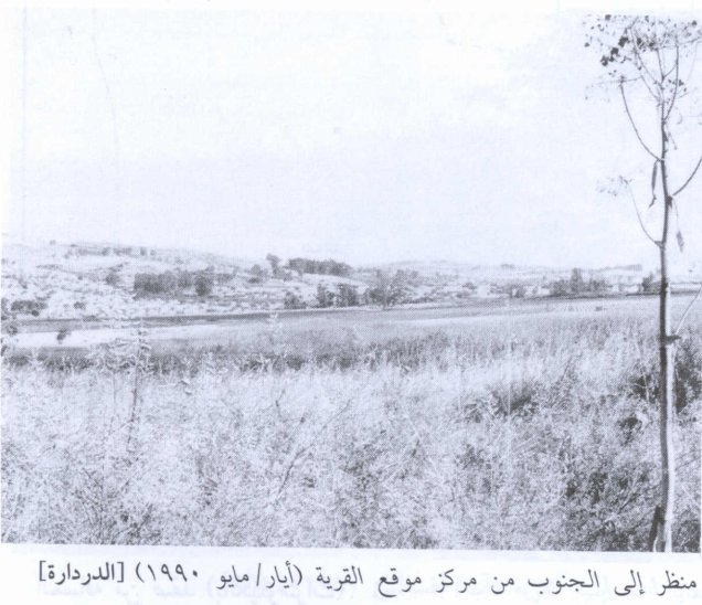
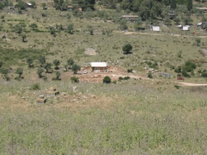
In Walid Khalidi's field description, the village site had become a mound of stones and earth overgrown with trees. A canal at the northern edge carried water from north to south, while the surrounding land was cultivated.
PalQuest dates Hasan Hawari's field photograph of the village site to May 1990. The description therefore reflects field documentation undertaken before the publication of All That Remains in 1992 and should not be treated as a comprehensive direct field verification of Al-Dirdara's condition in 2026.
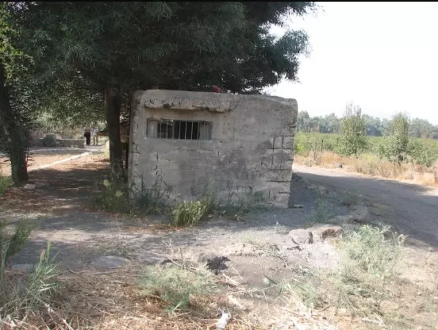
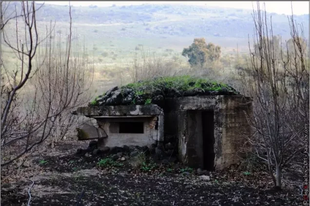
Palestine Remembered also contains later community documentation referring to house rubble, trees, and recreational use of part of the site. Such material is useful as later community documentation but does not constitute an independent comprehensive survey of all village lands.
Sources
- PalQuest – Interactive Encyclopedia of the Palestine Question: Al-Dirdara
- PalQuest – Operation Yiftach
- Palestine Remembered – Al-Dirdara, Safad District
- Walid Khalidi – All That Remains: Al-Dirdara
- Mustafa Murad al-Dabbagh – Biladuna Filastin: Mazari' al-Daraja, Al-Dirdara and Mansurat al-Khayt
- Institute for Palestine Studies – All That Remains, Walid Khalidi
Photo gallery



Photos from the village's people
Photos sent in by visitors and published after review.
Add a photo of this village
Log in to add photos of this village.
Other villages from Safed

More from the archive



 Download Our Palestine App
The whole archive in the palm of your hand: depopulated villages, the Nakba, the massacres and Al-Aqsa — free, with no ads to erase the story.
Download Our Palestine App
The whole archive in the palm of your hand: depopulated villages, the Nakba, the massacres and Al-Aqsa — free, with no ads to erase the story.



Comments
No comments yet — be the first to write one.
Add your comment
Name and email are optional. Comments appear after review.