
The depopulated village of Al-'Ulmaniyya / District of Safed
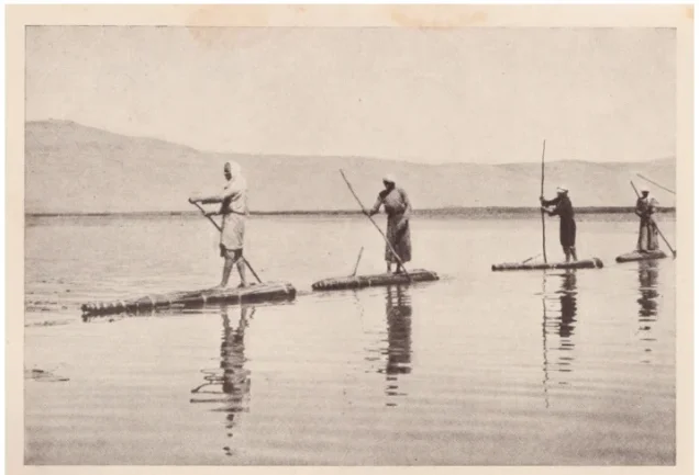
Al-'Ulmaniyya
About the depopulated village of Al-'Ulmaniyya
- District
- Safed
- Date Al-'Ulmaniyya was occupied
- 20 April 1948
- Population in 1948
- 300
- Military operation
- Operation Yiftach
- Brigade that carried it out
- Palmach
- Distance from the governorate centre
- 14.5 (km) North East of Safad
- Elevation above sea level
- 75 m
- Cause of displacement
- Military assault by Zionist troops
- Extent of destruction
- The village has been completely destroyed soon after occupation.
- Ethnic cleansing
- The village has been mostly ethnically cleansed and terrorized after the massacre at the nearby village of al-Husayniyya
Hover a dot to read the village name, or click to open its card.
Borders of the depopulated village of Al-'Ulmaniyya
Al-'Ulmaniyya – Depopulated Palestinian Village of the Safad Subdistrict
Al-'Ulmaniyya was a Palestinian village in the Safad Subdistrict, situated in the southwestern part of the Hula Plain near the western shore of Lake al-Hula, at an elevation of approximately 75–80 metres above sea level.
PalQuest places the village approximately 14.5 km from Safad, while the Palestinian Encyclopedia gives a road distance of about 23 km, of which 22 km were paved and 1 km was unpaved.
Al-'Ulmaniyya had an official population of 260 in 1944/45 and a registered land area of 1,169 dunums, all classified in the Arab ownership category. Cereal cultivation and livestock raising formed the basis of its economy.
Name of Al-'Ulmaniyya
The principal sources record the village as al-'Ulmaniyya. The sources reviewed do not provide a sufficiently documented linguistic explanation of the name, so no speculative etymology is presented as established fact.
Location
Al-'Ulmaniyya stood in the southwestern section of the Hula Plain. The Palestinian Encyclopedia places it approximately half a kilometre from the western shore of Lake al-Hula.
Its elevation is given as approximately 75 metres by PalQuest and about 80 metres by the Palestinian Encyclopedia.
A secondary road connected the village with the main route leading toward Safad. 'Arab al-Zubayd lived roughly 1.5 km northwest of the village centre.
Al-'Ulmaniyya Through History
In 1596, al-'Ulmaniyya was a village in the nahiya of Jira in the Ottoman district of Safad, with an estimated population of approximately 55.
The inhabitants paid taxes on wheat and barley as well as goats, beehives, water buffaloes, orchards, and other forms of agricultural production.
Late nineteenth-century survey material recorded cattle sheds and traces of older ruins at the site, indicating continued use of the locality and the presence of remains from earlier settlement.
Village Layout
The built-up area of al-'Ulmaniyya extended generally along a north–south axis. Some houses were associated with members of 'Arab al-Zubayd, who lived about 1.5 km from the village centre.
The built-up area covered approximately 9 dunums in the 1944/45 statistics, making al-'Ulmaniyya one of the smaller villages of the Safad Subdistrict in physical size.
Population of Al-'Ulmaniyya
- 1596Approx. 55Estimate derived from Ottoman fiscal records, not a modern census.
- 1922122Official census figure for al-'Ulmaniyya separately.
- 1931432Official combined figure for al-'Ulmaniyya and 'Arab al-Zubayd; not the population of al-'Ulmaniyya alone.
- 1944/45260Official separate figure for al-'Ulmaniyya.
- 1948302Later Palestine Remembered estimate, not an official census.
- 19981,852 refugeesLater Palestine Remembered estimate of the village refugee population and descendants.
The apparent fall from 432 inhabitants in 1931 to 260 in 1944/45 should not be interpreted as a population decline in al-'Ulmaniyya itself. The 1931 figure included 'Arab al-Zubayd, while the 1944/45 figure referred to al-'Ulmaniyya separately.
Number of Houses
- 1931100Official combined count for al-'Ulmaniyya and 'Arab al-Zubayd, not a separate house count for al-'Ulmaniyya.
The principal sources reviewed do not provide a securely documented independent number of houses for al-'Ulmaniyya alone in 1931.
Land Ownership in Al-'Ulmaniyya
The registered village lands totalled 1,169 dunums in the 1944/45 statistics. Using the ownership terminology employed by Palestine Remembered, they were distributed as follows:
- Palestinian1,169 dunums100%
- Transferred to Zionists0 dunums0%
- Communal/Public0 dunums0%
All registered land was therefore classified in the Arab ownership category, with no land recorded as Jewish or Public.
Land Use in 1944/45
- Arab
- Cereals1,135 dunums
- Built-up Area9 dunums
- Non-Cultivable Land25 dunums
A total of 1,135 dunums—approximately 97 percent of the village land—was devoted to cereals, while built-up and non-cultivable areas totalled 34 dunums.
Economic Life
Agriculture formed the basis of al-'Ulmaniyya's economy, with cereals constituting the principal crop immediately before the Nakba. In 1944/45, 1,135 dunums were devoted to cereal cultivation.
Livestock raising was also important. Earlier Ottoman fiscal records mention goats, beehives, water buffaloes, wheat, barley, and orchards.
Water Resources
The inhabitants relied on nearby springs for drinking and domestic water.
The Palestinian Encyclopedia identifies 'Ayn al-'Ulmaniyya near the southeastern edge of the village and 'Ayn Umm Hawran approximately 1 km to the west.
Education and Public Services
The principal sources reviewed do not document a formal school in al-'Ulmaniyya. The Palestinian Encyclopedia states that the village lacked significant public services.
No school, pupil numbers, or other undocumented public institutions are therefore added.
Archaeological Remains
Remains at the site indicated earlier occupation, and artificial caves cut into the rock lay northwest of the village.
The principal sources do not provide sufficiently precise archaeological dating to assign these remains to a specific period.
The First Stage of Population Flight
Walid Khalidi records two accounts concerning the depopulation of al-'Ulmaniyya and notes that they need not be mutually exclusive.
According to the first account, some inhabitants left after the Haganah assault on nearby al-Husayniyya on 18 January 1948, an attack Khalidi characterizes as a massacre.
This first departure may have been partial or temporary, since another account indicates that people remained in al-'Ulmaniyya until April.
Operation Yiftach and Final Depopulation
Operation Yiftach began on 15 April 1948 and was carried out by Palmach forces with the objective of seizing eastern Galilee within the framework of Plan Dalet.
According to an Israeli military intelligence report relayed by Khalidi, the inhabitants of al-'Ulmaniyya left on 20 April 1948, several days after the beginning of Operation Yiftach.
The account suggests that the population departed either because of a direct military attack or out of fear of an impending attack. Khalidi considers this second exodus likely to have been final, given the broader depopulation of eastern Galilee during Operation Yiftach.
Palestine Remembered lists 20 April as the village's occupation date. The detailed evidence establishes that date more securely as the date of final population departure than as an independently documented date of military entry into the village.
Military Unit
Operation Yiftach was carried out by Palmach forces, and the Palmach First Battalion served as the spearhead of the operation as a whole.
Palestine Remembered identifies the First Battalion as the attacking unit at al-'Ulmaniyya. Khalidi's village-specific entry, however, does not independently identify the battalion that entered al-'Ulmaniyya itself.
The most precise formulation is therefore: Military operation: Operation Yiftach; general force involved: Palmach; village-specific occupying unit: not independently established in the principal village entry.
Occupation and Depopulation Chronology
- 18 January 1948
Massacre at nearby al-Husayniyya
The Haganah attacked nearby al-Husayniyya. One account states that the event prompted some inhabitants of al-'Ulmaniyya to leave.
- After 18 January 1948
Possible first displacement
This phase was probably partial or temporary, since inhabitants apparently remained in the village until April.
- 15 April 1948
Beginning of Operation Yiftach
Palmach forces launched the operation to seize eastern Galilee.
- 20 April 1948
Probable final depopulation
An Israeli intelligence report relayed by Khalidi states that the inhabitants left because of a direct assault or fear of attack.
- During Operation Yiftach
Military control
The village fell within the area brought under Zionist control, but the principal village entry does not give a separately documented exact date of military entry.
Israeli Settlements on Al-'Ulmaniyya Village Lands
Walid Khalidi and PalQuest state that no Israeli settlement was established on al-'Ulmaniyya village land.
Yesud HaMa'ala, established in 1883, lies approximately 2.5 km southeast of the village site but is not situated on al-'Ulmaniyya land.
An automated Palestine Remembered field labels Yesud HaMa'ala as a settlement that took village land, but the detailed Khalidi text reproduced on the same site explicitly states that no Israeli settlements stand on al-'Ulmaniyya land. This article follows the detailed historical account.
Al-'Ulmaniyya Today
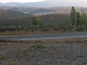
In the field description published by Walid Khalidi in All That Remains, eucalyptus trees grew so densely across the village site that traces of the former settlement were difficult to identify.
Some surrounding land was cultivated, while other areas remained marshy or had become part of the Lake Hula nature reserve.
The historical description also stated that a road to the nature reserve was then under construction. This reflects conditions at the time of fieldwork conducted before the publication of All That Remains in 1992 and should not be presented as a description of road conditions in 2026.
Palestine Remembered also contains later photographs, maps, oral-history material, and community contributions relating to al-'Ulmaniyya. Their upload dates should not automatically be treated as dates of photography, and collectively they do not constitute an independent comprehensive field survey of the site in 2026.
Sources
- PalQuest – Al-'Ulmaniyya
- PalQuest – 'Arab al-Zubayd, for the combined 1931 census figures
- PalQuest – Operation Yiftach
- Palestine Remembered – Al-'Ulmaniyya, Safad
- Palestine Remembered – Al-'Ulmaniyya entry from Walid Khalidi's All That Remains
- Palestinian Encyclopedia – Al-'Ulmaniyya
- Institute for Palestine Studies – Walid Khalidi, All That Remains
Photo gallery

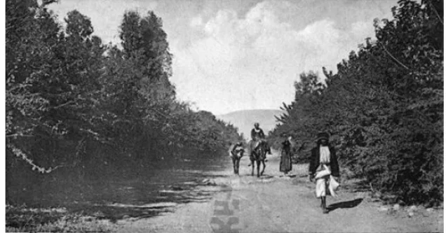
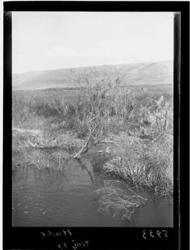

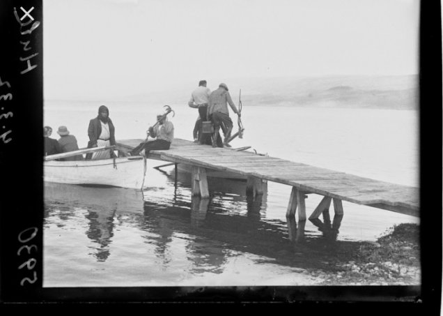

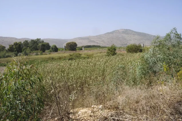


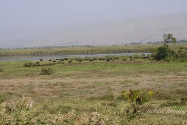
Photos from the village's people
Photos sent in by visitors and published after review.
Add a photo of this village
Log in to add photos of this village.
Other villages from Safed

More from the archive



 Download Our Palestine App
The whole archive in the palm of your hand: depopulated villages, the Nakba, the massacres and Al-Aqsa — free, with no ads to erase the story.
Download Our Palestine App
The whole archive in the palm of your hand: depopulated villages, the Nakba, the massacres and Al-Aqsa — free, with no ads to erase the story.



Comments
No comments yet — be the first to write one.
Add your comment
Name and email are optional. Comments appear after review.