
The depopulated village of Qabba'a / District of Safed

Qabba'a
About the depopulated village of Qabba'a
- District
- Safed
- Date Qabba'a was occupied
- 26 May 1948
- Population in 1948
- 530
- Military operation
- Operation Yiftach
- Brigade that carried it out
- Palmach
- Distance from the governorate centre
- 6 (km) North East of Safad
- Elevation above sea level
- 500 m
- Cause of displacement
- Military assault by Zionist troops
- Extent of destruction
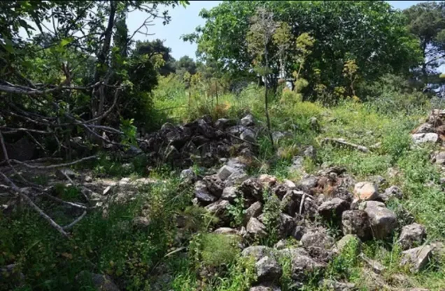
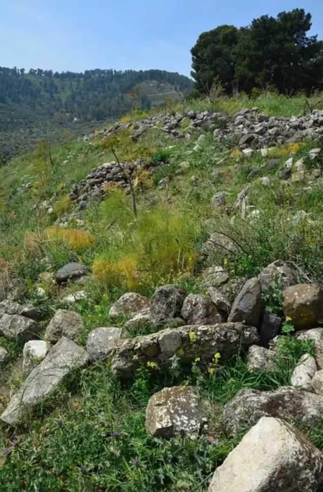
- The village has been completely destroyed, and only house walls and rubble left behind
- Ethnic cleansing
- Qabba'a inhabitants were completely ethnically cleansed.
Hover a dot to read the village name, or click to open its card.
Borders of the depopulated village of Qabba'a
Qabba'a – Depopulated Palestinian Village of the Safad District
Qabba'a was a depopulated Palestinian village in the Safad District. It stood on the northeastern slope of Mount Kan'an in Upper Galilee, overlooking the Jordan Valley between Lake al-Hula and Lake Tiberias. The village lay approximately 6 kilometers northeast of Safad at an average elevation of about 500 meters above sea level.
On the night of 2 May 1948, Palmach units subjected Qabba'a to mortar bombardment during Operation Yiftach. According to the account reproduced by Walid Khalidi, the shelling was intended to induce the inhabitants to leave. Khalidi places the village's capture in the first half of Operation Yiftach after this bombardment, while several later Palestinian indexes give 26 May as the date of final depopulation or occupation. These dates should therefore be distinguished rather than collapsed into a single event.
Location and Geography
Qabba'a stood on the northeastern slope of Mount Kan'an, facing northeast and overlooking the low-lying Jordan Valley between Lakes al-Hula and Tiberias.
It was approximately 6 kilometers northeast of Safad and had an average elevation of about 500 meters above sea level.
A dirt track linked Qabba'a with the nearby village of 'Ammuqa, less than two kilometers to the northeast.
The Palestinian Encyclopedia places the village on a rocky spur between two small watercourses: the upper course of Wadi Waqqas to the north and the upper course of Wadi al-Mushayrifa to the south.
Neighboring village lands included those of 'Ammuqa, Mughr al-Khayt, Biriyya, and al-Wayziyya, while Marus lay to the north.
Name and Historical Background
The Arabic name is Qabba'a. Palestinian sources offer linguistic interpretations connecting it with the Arabic root q-b-', but the precise historical etymology is not securely established and should not be reduced to a single certain derivation.
In 1596, Qabba'a was a village in the nahiya of Jira in the liwa' of Safad, with an estimated population of approximately ninety-nine.
The inhabitants paid taxes on wheat, barley, olives, vineyards, goats, beehives, and other agricultural produce and property.
Late nineteenth-century travelers described Qabba'a as a stone-built village situated on a ridge. Approximately 150 Muslims lived there and cultivated olives and arable land.
Built Environment
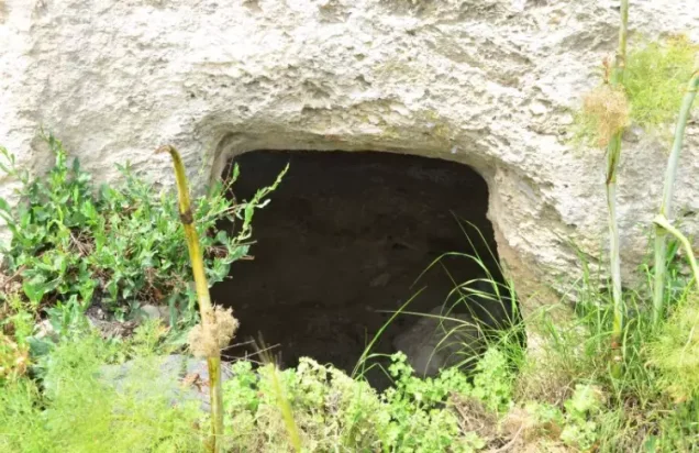
The houses of Qabba'a stood close together and were largely constructed of stone and mud. Some structures were cut into the rock.
A small marketplace, a mosque, and a school stood in the center of the village. These features are directly documented in Walid Khalidi's village description.
The 1944/45 official statistics classified 66 dunams as built-up land. Like the other 1944/45 figures, however, this number belongs to a statistical unit that also included Jaza'ir al-Hindaj and Mughr al-Duruz.
Population and Houses
The inhabitants of Qabba'a were Muslims.
- 1596About 99Estimate derived from Ottoman tax records
- 1922179Official Mandate census; all inhabitants were Muslims
- 1931256Official census; all inhabitants were Muslims
- 1944/45460Official estimate, but the statistical entry includes Qabba'a, Jaza'ir al-Hindaj, and Mughr al-Duruz together
- 1948About 534Later Palestine Remembered estimate derived from a demographic series based on the combined 1945 figure
- 1998About 3,277 refugees and descendantsLater demographic estimate and subject to the same caution concerning the combined 1945 base
The official 1931 census recorded 44 houses. The figure of approximately 91 houses for 1948 is a later estimate rather than an official Mandate census count.
Mosque, School, and Marketplace
Qabba'a had a mosque, a school, and a small marketplace in its center, all explicitly documented by Khalidi.
The principal source does not provide sufficient information about the school's foundation date, enrollment, or grade levels, so unsupported figures have not been added.
Palestine Remembered currently contains a generic entry indicating a church, but this is not supported by Khalidi's village description, which states that all inhabitants were Muslims. A church is therefore not treated as an established feature of Qabba'a.
Water Resources
Qabba'a was surrounded by four springs. The villagers used spring water for domestic purposes and for irrigating part of their agricultural land.
Some farming was rainfed, while orchards and other fields benefited from the nearby springs.
The Palestinian Encyclopedia likewise emphasizes the availability of groundwater and springs around the village. The principal entry does not provide an authoritative list of all four spring names, so uncertain names are not added here.
Economic Life and Agriculture
Agriculture was the principal source of livelihood. Villagers grew cereals and vegetables on the level lands and cultivated grapes, figs, and olives on the slopes of Mount Kan'an.
They also raised cattle, sheep, and goats and maintained beehives, making animal husbandry and honey production important supplementary activities.
In the 1944/45 statistics, 7,966 dunams were devoted to cereals and 379 dunams were classified as plantations or irrigable land.
Palestine Remembered and supporting Palestinian local documentation also give a crop-specific figure of approximately 650 dunams planted with olives. This should not be added again to the overall land-use totals.
Methodological Note on the 1944/45 Statistics
The 1944/45 figures must not be presented as if they refer solely to the residential core of Qabba'a.
PalQuest explicitly states that the official population, land-ownership, and land-use entry includes:
Qabba'a + Jaza'ir al-Hindaj + Mughr al-Duruz.
The following tables therefore represent that combined statistical unit.
Land Ownership, 1944/45
The combined statistical unit covered 13,817 dunams. Under the official Government of Palestine classification, ownership was:
- Arab13,437 dunums97%
- Jewish0 dunums0%
- Public380 dunums3%
Palestine Remembered presents the same totals using its simplified terminology: 13,437 dunams “Palestinian,” 0 dunams “Transferred to Zionists,” and 380 dunams “Communal/Public.” The source's term “Transferred to Zionists” should be retained when reproducing that classification.
Land Use, 1944/45
- Arab
- Public
- Cereals7,966 dunums
- Plantations and irrigable land379 dunums
- Total cultivable/cultivated land8,345 dunums
- Non-cultivable land5,406 dunums
- Built-up land66 dunums
- Total non-cultivable and built-up5,472 dunums
The official table balances exactly: 8,345 dunams of cultivable or cultivated land plus 5,472 dunams of built-up and non-cultivable land equal the total 13,817 dunams.
Palestine Remembered's simplified display places all 7,966 cereal dunams in the Palestinian column. The official table shows that 307 of those dunams were classified as Public, so they have been kept separate above.
Archaeological Remains
Qabba'a and its surroundings contained substantial archaeological remains indicating long-term settlement in the area.
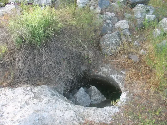
Documented features include caves, wells, water cisterns, rock-cut tombs, and other rock-cut remains.
Supporting Palestinian documentation also describes a water pool near a spring and a tomb cut into a large rock.
The principal sources do not provide sufficient archaeological dating to assign all these remains to a single historical period.
Operation Yiftach
Operation Yiftach began on 15 April and officially ended on 25 May 1948. It was conducted under Plan Dalet with the objective of establishing control over eastern Galilee before the end of the British Mandate.
The Palmach formed the main striking force, and its First Battalion spearheaded the operation at the general campaign level. PalQuest explicitly lists Qabba'a among the Palestinian villages affected by Operation Yiftach.
The First Battalion's leading role in the overall operation should not automatically be interpreted as proof that it was the specifically documented village-level unit in every locality.
The 2 May 1948 Bombardment
On the night of 2 May 1948, Palmach units subjected Qabba'a to intermittent mortar fire.
Walid Khalidi records, through the account he cites, that a participating officer described the bombardment as intended to induce the Arab inhabitants ultimately to leave.
Nearby Fir'im and Mughr al-Khayt, south of Qabba'a, were subjected to similar mortar attacks that same night as military pressure intensified around Safad.
Occupation and Depopulation
The exact final occupation date is disputed.
Khalidi states that Zionist forces took Qabba'a during the first half of Operation Yiftach after the village had been subjected to the night of mortar bombardment on 2 May. His village entry does not provide a separate exact day for the subsequent physical entry.
Supporting Palestinian local documentation treats 2 May itself as the occupation date, arguing that the shelling caused the population to leave and was followed by Palmach control of the village.
Palestine Remembered, WAFA, and Palestine Open Maps, however, index 26 May 1948 as the date of depopulation or occupation.
This creates a chronological difficulty because PalQuest gives 25 May as the official end of Operation Yiftach, while Khalidi's detailed narrative places the taking of Qabba'a in the first half of the operation.
The most cautious reconstruction therefore distinguishes the documented mortar attack and early displacement on 2 May, the capture of the village during the first half of Yiftach according to Khalidi, and the later indexed date of 26 May for final depopulation.
Military Unit
The force explicitly identified in Khalidi's village-specific account is Palmach units.
The Palmach's First Battalion spearheaded Operation Yiftach overall, and both Palestine Remembered and supporting Palestinian local documentation index the First Battalion as the unit associated with Qabba'a.
Because Khalidi's village entry itself does not specifically name the First Battalion, the most precise village-level formulation is “Palmach units,” while noting that the First Battalion is the probable and commonly indexed formation in supporting Palestinian sources.
Occupation Chronology
- 15 April 1948
Beginning of Operation Yiftach
Palmach forces began the campaign to take eastern Galilee under the framework of Plan Dalet.
- Night of 2 May 1948
Mortar bombardment of Qabba'a
Palmach units shelled the village with mortars in an attack intended to induce the population to leave.
- Night of 2 May 1948
Bombardment of Fir'im and Mughr al-Khayt
The two nearby villages were attacked in a similar manner during the same night.
- First half of Operation Yiftach, after 2 May
Capture according to Khalidi's detailed account
The village was taken after the bombardment, but Khalidi does not provide a separate exact entry date.
- 10–11 May 1948
Fall of Safad
The attacks on villages around Mount Kan'an formed part of the military pressure preceding the final capture of Safad.
- 25 May 1948
Official end of Operation Yiftach
PalQuest's formal end date for the operation.
- 26 May 1948
Later indexed depopulation date
Used by Palestine Remembered, WAFA, and Palestine Open Maps, but it conflicts with Khalidi's detailed chronology and the formal end date of Yiftach and is therefore not treated as the sole definitive occupation date.
- Exact date not documented
Destruction of the village
Most village structures were subsequently destroyed, but the principal source does not provide a precise demolition date.
Israeli Settlements on Village Lands
According to Walid Khalidi and PalQuest, no Israeli settlement was established on the lands of Qabba'a itself.
Hatzor HaGelilit, established in 1953, lies approximately three kilometers south of the village site but is not located on Qabba'a's lands.
This distinction is important: proximity to the village does not by itself establish that a settlement was built within its cadastral boundaries.
Qabba'a Today
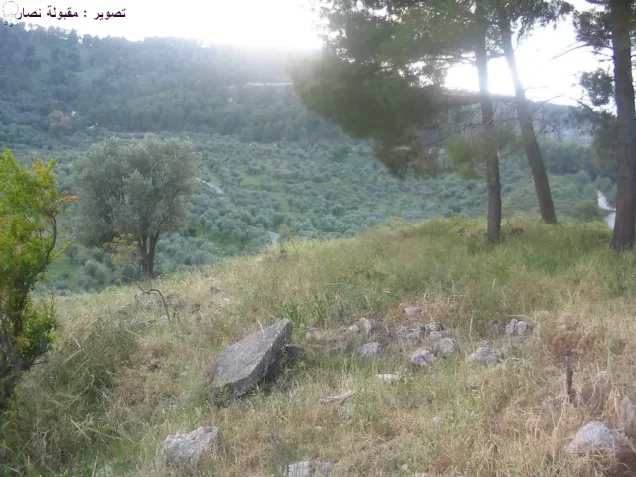
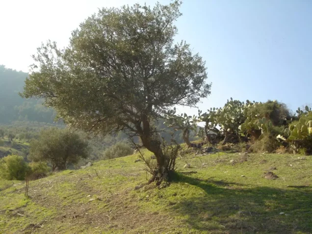
According to the field description published in Walid Khalidi's All That Remains, stone rubble from destroyed houses covered the village site, where shrubs, grass, cactuses, and fig and pine trees grew.
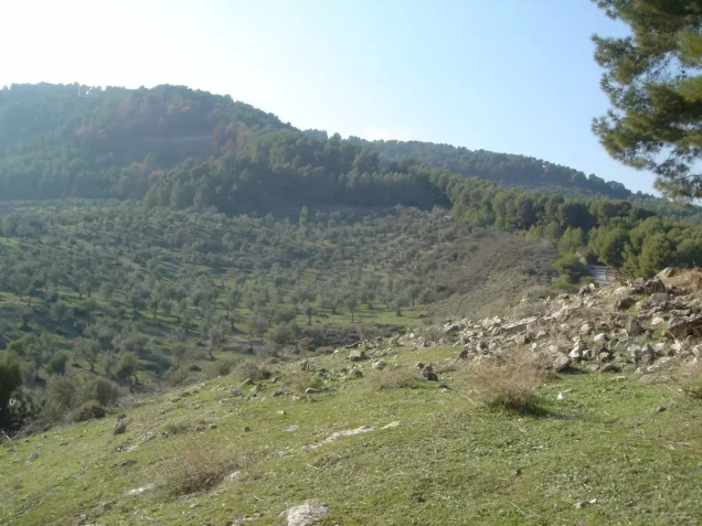
Most surrounding lands were cultivated, while some areas were forested and others were used for grazing.
This description should not be treated as a comprehensive field verification of conditions in 2026. Fieldwork for All That Remains was conducted between 1987 and 1990 and therefore records the condition of the site during that survey period.
Sources
- PalQuest – Interactive Encyclopedia of the Palestine Question: Qabba'a
- PalQuest – Operation Yiftach
- Palestine Remembered – Qabba'a, Safad District
- Palestinian Encyclopedia – Qabba'a
- Palestinian Villages Encyclopedia – Qabba'a; supporting Palestinian documentation
- Census of Palestine 1931 – Safad Sub-District: Qabba'a, 256 inhabitants and 44 houses
- WAFA – Palestinian towns and villages occupied and depopulated in 1948
- Institute for Palestine Studies – Walid Khalidi, All That Remains
- PalQuest – All That Remains: Methodology
Photo gallery







Photos from the village's people
Photos sent in by visitors and published after review.
Add a photo of this village
Log in to add photos of this village.
Other villages from Safed

More from the archive



 Download Our Palestine App
The whole archive in the palm of your hand: depopulated villages, the Nakba, the massacres and Al-Aqsa — free, with no ads to erase the story.
Download Our Palestine App
The whole archive in the palm of your hand: depopulated villages, the Nakba, the massacres and Al-Aqsa — free, with no ads to erase the story.



Comments
No comments yet — be the first to write one.
Add your comment
Name and email are optional. Comments appear after review.