
The depopulated village of Fir'im / District of Safed
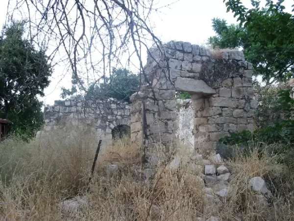
About the depopulated village of Fir'im
- District
- Safed
- Date Fir'im was occupied
- 26 May 1948
- Population in 1948
- 860
- Military operation
- Operation Yiftach
- Brigade that carried it out
- Palmach
- Distance from the governorate centre
- 4 (km) North East of Safad
- Elevation above sea level
- 500 m
- Cause of displacement
- Military assault by Zionist troops
- Extent of destruction
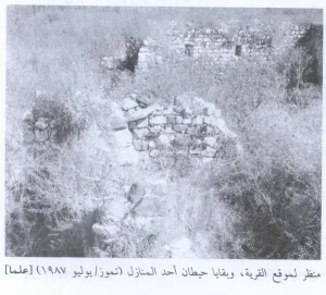
- The village has been completely destroyed, and only house rubble left behind.
- Ethnic cleansing
- Fir'im inhabitants were completely ethnically cleansed.
- Settlements built on the built-up area of Fir'im after 1948
- Part of Hatzor HaGlilit
Hover a dot to read the village name, or click to open its card.
Borders of the depopulated village of Fir'im
Fir'im – Depopulated Palestinian Village of the Safad Subdistrict
Fir'im was a Palestinian village in the Safad Subdistrict, situated on the southeastern slope of Mount Kan'an in Upper Galilee at an average elevation of approximately 500 metres above sea level. From its elevated position it overlooked the Jordan Valley area between Lakes Tiberias and al-Hula.
The Palestinian Encyclopedia places Fir'im approximately 15 km northeast of Safad by road, about 12.5 km of which was paved. PalQuest and Palestine Remembered currently display a conflicting distance of 4 km. Because the sources differ, that discrepancy is preserved rather than silently resolved.
Fir'im was a densely built Muslim village whose economy depended mainly on fruit trees, olives, cereals, and livestock. It had a village council, a boys' elementary school, and two olive presses.
Name of Fir'im
Walid Khalidi records that the village was already known by the name Fir'im during the Crusader period.
Palestine Remembered and some later Palestinian local sources offer an etymological interpretation connecting the name with a Canaanite form rendered as Periya'im and meaning “abundant in fruit.” This derivation is not presented as established in Khalidi's village entry, so it is treated here as a traditional or secondary interpretation rather than a proven linguistic origin.
Location
Fir'im stood on a shoulder of the southeastern slope of Mount Kan'an in Upper Galilee, approximately 500 metres above sea level, overlooking the lowlands between Lakes Tiberias and al-Hula.
The Palestinian Encyclopedia gives a road distance of approximately 15 km northeast of Safad, including about 12.5 km of paved road. PalQuest and Palestine Remembered list a conflicting figure of 4 km. The more detailed Palestinian Encyclopedia road description is used here while the discrepancy is explicitly recorded.
Wadi Muwayla passed immediately south of the village and fed Wadi Fir'im, which ran roughly a quarter of a kilometre to the south. Wadi al-Maghar lay about half a kilometre northeast, with its lower course, known as Wadi al-Mushayrifa, flowing toward the Jordan River south of Lake al-Hula.
'Ayn al-Muwayla lay approximately half a kilometre west of Fir'im, while 'Ayn Fir'im was located about three-quarters of a kilometre southwest of the village.
Fir'im Through History
Fir'im was known by its present name during the Crusader period. In 1596 it formed part of the nahiya of Jira in the Ottoman district of Safad and had an estimated population of approximately 446. Villagers paid taxes on wheat, barley, olives, goats, beehives, and a press used for processing olives or grapes.
In the late nineteenth century, travellers described Fir'im as a stone-built village located at the end of a mountain ridge. One contemporary description estimated its population at about 200 and recorded small gardens, fig trees, and olive cultivation.
Village Layout
Fir'im was densely built. Its stone houses followed a general northwest–southeast axis corresponding to the shape of the ridge on which the village stood.
The built-up area covered approximately 17 dunums in 1944/45. A village council composed of representatives of the local families dealt with communal and administrative matters.
Population of Fir'im
- 1596Approx. 446Estimate derived from Ottoman fiscal records, not a modern census.
- Late 19th centuryApprox. 200Estimate recorded in a contemporary description of the village.
- 1922449Official Government of Palestine census; all inhabitants were Muslim. Palestine Remembered and the Palestinian Encyclopedia reproduce the conflicting figure 499.
- 1931527Official census; the population was Muslim.
- 1944/45740Official Government of Palestine statistics.
- 1948858Later Palestine Remembered estimate, not an official census.
- 19985,272 refugeesLater estimate of the refugee population and descendants published by Palestine Remembered.
Number of Houses
- 1931109Official Government of Palestine census.
- 1948177Later Palestine Remembered estimate, not an official count.
Land Ownership in Fir'im
The registered village lands totalled 2,191 dunums in the 1944/45 statistics. Using the terminology employed by Palestine Remembered, ownership was distributed as follows:
- Palestinian2,023 dunums92%
- Transferred to Zionists163 dunums7%
- Communal/Public5 dunums<1%
These figures correspond to the official categories of 2,023 Arab dunums, 163 Jewish dunums, and 5 Public dunums.
Land Use in 1944/45
The official Arab / Jewish / Public categories are retained in the land-use table, with Public land kept separate from Arab land:
- Arab
- Jewish
- Public
- Cereals851 dunums
- Plantations and Irrigable Land947 dunums
- Built-up Area17 dunums
- Non-Cultivable Land376 dunums
A total of 1,798 dunums was therefore classified as cultivated or cultivable: 1,635 Arab dunums and 163 Jewish dunums. Built-up and non-cultivable land totalled 393 dunums.
In the 1942/43 season, approximately 700 dunums were planted with olive trees. This was a crop-specific figure within the agricultural area and should not be added again to the village's total land area.
Economic Life in Fir'im
Agriculture formed the basis of the village economy. Fruit trees were the principal crops, followed by cereals. Orchards surrounded Fir'im on several sides and were particularly concentrated to the north, northeast, west, and southwest.
Olive cultivation was especially important. About 700 dunums were planted with olives in 1942/43, and the village had two non-mechanized olive presses.
The Palestinian Encyclopedia also records livestock raising as part of the local economy.
Water Resources
Springs and wells supplied the inhabitants with water for drinking, domestic purposes, and irrigation. Among the nearby sources were 'Ayn al-Muwayla west of the village and 'Ayn Fir'im to the southwest.
Education
Fir'im had an elementary school for boys. Palestine Remembered states that its highest class was the fourth elementary grade in the early 1940s. The principal sources reviewed do not establish a documented foundation year for the school.
Palestine Remembered also preserves community-posted copies of administrative documents relating to teachers associated with Fir'im School during the 1940s, further confirming the presence of a formal educational institution before the Nakba.
Archaeological Remains
An archaeological site near Fir'im contained ruins of buildings and rock-cut tombs. Palestinian local sources record additional archaeological localities nearby, but the available evidence is insufficient to assign all of these remains securely to specific historical periods.
Occupation and Depopulation of Fir'im
The depopulation of Fir'im occurred in more than one stage and should not be reduced to a single date.
On the night of 2 May 1948, Palmach units subjected Fir'im, Mughr al-Khayt, and Qabba'a to mortar fire in the course of Operation Yiftach. Walid Khalidi, citing an Israeli military report, records that the attacks were intended to induce the Arab inhabitants eventually to flee.
The bombardment caused displacement, but Fir'im was not completely emptied that night. Later evidence indicates that some inhabitants remained in the village after the 2 May attack.
Palestinian historian 'Arif al-'Arif wrote that the fall of Fir'im damaged morale among the inhabitants of Safad. Since Safad itself fell on 10–11 May, this statement appears to refer to an early phase in Fir'im's collapse or attack rather than to its final depopulation later in the month.
The strongest documented date for the final emptying of Fir'im is 26 May 1948. Khalidi cites a military intelligence report filed in June stating that the village was evacuated on that date following a direct assault.
Operation Yiftach and the Military Unit
Fir'im was among the villages affected by Operation Yiftach, carried out by Palmach forces in eastern Galilee between 15 April and 25 May 1948 within the framework of Plan Dalet. The operation sought to secure eastern Galilee and resulted in the depopulation of Palestinian communities throughout the region.
The Palmach's First Battalion spearheaded Operation Yiftach as a whole, and Palestine Remembered lists the First Battalion as the attacking unit for Fir'im. Khalidi's village-specific entry, however, does not independently identify the exact sub-unit that carried out the final direct assault of 26 May.
The most precise formulation is therefore: Military operation: Operation Yiftach; general force involved: Palmach; specific unit responsible for the final village assault: not independently identified in the principal Fir'im entry.
PalQuest dates the formal end of Operation Yiftach to 25 May, whereas the intelligence report places Fir'im's final evacuation on 26 May. Fir'im's depopulation should therefore be understood as a process initiated within Operation Yiftach and completed immediately after its formal end.
Occupation Chronology
- 15 April 1948
Beginning of Operation Yiftach
Palmach forces launched Operation Yiftach to seize eastern Galilee.
- Night of 2 May 1948
First documented attack on Fir'im
Fir'im, Mughr al-Khayt, and Qabba'a were subjected to mortar fire intended to induce population flight.
- After 2 May 1948
Partial displacement
Part of the population left after the bombardment, but evidence indicates that some inhabitants remained.
- Early May 1948
Early phase of the village's fall
'Arif al-'Arif states that the fall of Fir'im weakened morale in Safad, although the precise military status of the village at this stage remains unclear.
- 10–11 May 1948
Occupation of Safad
Safad was occupied during Operation Yiftach after a series of attacks on the city and surrounding Palestinian villages.
- 25 May 1948
Formal end of Operation Yiftach
PalQuest identifies this as the formal end date of the operation.
- 26 May 1948
Final depopulation of Fir'im
A military intelligence report later cited by Khalidi states that the village was fully evacuated on this date following a direct assault.
Israeli Settlements and Hatzor HaGlilit
Palestinian sources differ over whether Hatzor HaGlilit was established on Fir'im village land.
Walid Khalidi's entry, reproduced by PalQuest, explicitly states that no Israeli settlements were established on Fir'im lands and places Hatzor HaGlilit, founded in 1953, approximately 1 km from the village site.
The Palestinian Encyclopedia, by contrast, states that the settlement was established in 1953 in the southeastern part of Fir'im's lands, approximately 1 km from the village site.
There is also a directional inconsistency within PalQuest: the Arabic entry places Hatzor HaGlilit southwest of the village, whereas the English entry places it southeast. The Palestinian Encyclopedia also places it to the southeast, making southeast the better-supported directional description.
Because the sources directly disagree over the land boundary, this article does not present the location of Hatzor HaGlilit on Fir'im lands as an undisputed fact. Khalidi states that it lies outside the village lands, while the Palestinian Encyclopedia gives a different account.
Fir'im Today
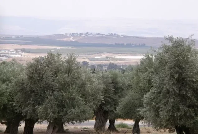
In the field description published by Walid Khalidi in All That Remains, rubble from the destroyed houses was scattered across the village site and some of the old olive terraces remained.
Olive trees and cactus grew on and around the site. Small portions of the surrounding lands had been wooded, while most were being used as pasture.
This description derives from fieldwork carried out before the publication of All That Remains in 1992 and does not constitute direct, comprehensive field verification of conditions in 2026. Palestine Remembered contains later community documentation of the ruins and surrounding olive groves, but upload dates should not automatically be treated as dates of a systematic modern survey.
Sources
- PalQuest – Fir'im
- PalQuest – Operation Yiftach
- Palestine Remembered – Fir'im, Safad
- Palestine Remembered – Fir'im entry from Walid Khalidi's All That Remains
- Palestinian Encyclopedia – Fir'im
- Institute for Palestine Studies – Walid Khalidi, All That Remains
- Government of Palestine – Report and General Abstracts of the Census of 1922
- Government of Palestine – Census of Palestine 1931
- Palestinian Central Bureau of Statistics – Historical Census and Statistical Reports
Photo gallery
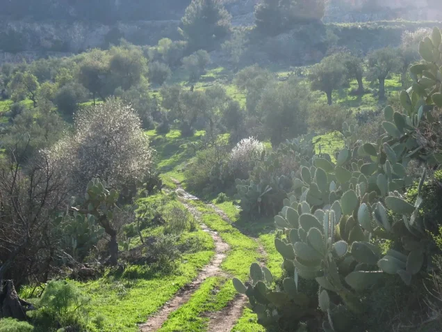
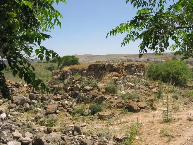
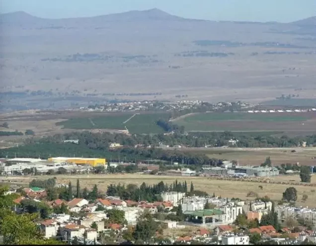
Photos from the village's people
Photos sent in by visitors and published after review.
Add a photo of this village
Log in to add photos of this village.
Other villages from Safed


More from the archive



 Download Our Palestine App
The whole archive in the palm of your hand: depopulated villages, the Nakba, the massacres and Al-Aqsa — free, with no ads to erase the story.
Download Our Palestine App
The whole archive in the palm of your hand: depopulated villages, the Nakba, the massacres and Al-Aqsa — free, with no ads to erase the story.



Comments
No comments yet — be the first to write one.
Add your comment
Name and email are optional. Comments appear after review.