
The depopulated village of Lazzaza / District of Safed
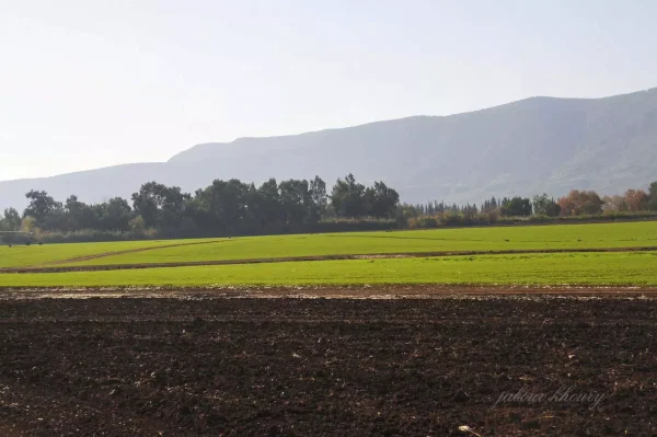
Lazzaza
About the depopulated village of Lazzaza
- District
- Safed
- Date Lazzaza was occupied
- 21 May 1948
- Population in 1948
- 270
- Military operation
- Operation Yiftach
- Brigade that carried it out
- Palmach
- Distance from the governorate centre
- 27.5 (km) North East of Safad
- Elevation above sea level
- 75 m
- Cause of displacement
- Haganah 'Wispering' campaign (psychological warfare)
- Extent of destruction
- The village has been mostly destroyed with the exception of few stone houses remain.
- Ethnic cleansing
- Lazzaza was ethnically cleansed as a result of psychological warfare conducted between 10th and 15th May of 1948.
- Settlements built on the land of Lazzaza before 1948
- Beit Hillel
Hover a dot to read the village name, or click to open its card.
Lazzaza – Depopulated Palestinian Village of the Safad Subdistrict
Lazzaza was a Palestinian village in the Safad Subdistrict, situated on flat land in the northern Hula Plain close to the Hasbani River, approximately 27.5 km northeast of Safad and about 75 metres above sea level.
Its Palestinian inhabitants were predominantly Muslim and relied primarily on agriculture, supplemented by livestock raising, beekeeping, and fishing. In 1944/45, Lazzaza itself had 230 Arab inhabitants. The official statistical unit recorded 330 people because it also included 100 Jewish residents of the neighboring settlement of Beyt Hillel.
Name of Lazzaza
The village is recorded as Lazzaza. Some later Palestinian sources suggest a possible connection with the Arabic verb lazza, meaning to press, bind, or attach something closely. The principal historical sources do not establish this etymology conclusively, so it is treated here as a possible interpretation rather than a proven origin.
Location
Lazzaza stood on level ground in the northern section of the Hula Plain, close to the Hasbani River, approximately 27.5 km northeast of Safad and about 75 metres above sea level.
Its proximity to the river and the fertile soils of the Hula Plain provided favorable conditions for agriculture, livestock raising, and fishing.
Lazzaza in the Late Nineteenth Century
In the late nineteenth century, the Survey of Western Palestine described Lazzaza as an adobe-built village standing on a plain near a river, with an estimated population of approximately 70.
Population of Lazzaza
The Palestinian population of Lazzaza must be distinguished from the official statistical unit that included the neighboring Jewish settlement of Beyt Hillel in 1944/45.
- 1931176Official census for Lazzaza; 39 occupied houses were recorded.
- 1944/45230 ArabsThe Palestinian population of Lazzaza within the official statistical unit.
- 1944/45330 totalCombined statistical unit: 230 Arabs in Lazzaza plus 100 Jews in Beyt Hillel.
- 1948Approx. 167 ArabsLater estimate derived from Palestine Remembered's combined figure of 267, which explicitly includes 100 Jews; not an official census.
Palestine Remembered also publishes an estimate of 1,638 refugees in 1998. That number appears to be tied to the combined population baseline that included Beyt Hillel's Jewish residents, so it is not treated here as a reliable independent estimate of Lazzaza's Palestinian refugee population.
Number of Houses
- 193139Official census.
- 194859Later Palestine Remembered estimate, not an official Government of Palestine count.
Lazzaza Lands and the Statistical Combination with Beyt Hillel
The 1944/45 land figures require particular caution. Beyt Hillel was administratively combined with Lazzaza, so the total of 1,586 dunums and its ownership categories represent a combined statistical unit rather than an independent land-ownership table for Lazzaza alone.
- Arab377 dunums24%
- Jewish942 dunums59%
- Public267 dunums17%
PalQuest's entry for al-Zuq al-Tahtani clarifies the reason for this statistical complication. The land occupied by Beyt Hillel was administratively combined with Lazzaza by 1944, but subsequent land-survey maps place Beyt Hillel on land belonging to al-Zuq al-Tahtani. The 942 dunums in the official Jewish category therefore should not automatically be described as land transferred from Lazzaza itself.
Land Use in 1944/45
The following table likewise represents the combined Lazzaza–Beyt Hillel statistical unit:
- Arab
- Jewish
- Public
- Cereals214 dunums
- Plantations and Irrigable Land1,040 dunums
- Built-up45 dunums
- Non-Cultivable287 dunums
The Arab category totalled 377 dunums, of which 330 were cultivated or cultivable: 95 dunums of cereals and 235 dunums of plantations and irrigable land.
Some digital reproductions of the All That Remains text incorrectly give 2,235 dunums of irrigated land or orchards. The PalQuest table and detailed official figures establish the correct number as 235 dunums.
Economic Life in Lazzaza
Agriculture was the principal source of livelihood. The fertility of the northern Hula Plain and the availability of water near the Hasbani River supported diverse cultivation.
Walid Khalidi identifies onions, corn, and fruit among the village's principal crops. The inhabitants also raised livestock, kept bees, and engaged in fishing in the Hasbani River.
Water Resources
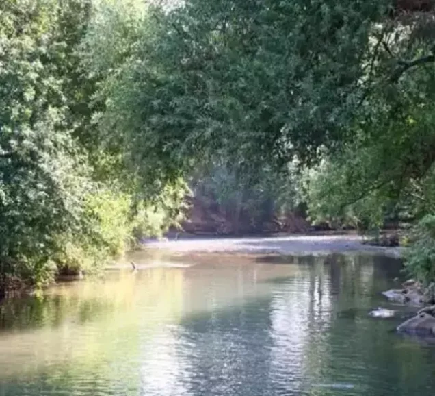
The nearby Hasbani River was a defining element of Lazzaza's geography and economy. Its water and the wider hydrological conditions of the northern Hula Plain supported orchards and irrigated agriculture and also provided opportunities for fishing.
Education
Lazzaza had its own elementary school. In 1945, 26 pupils were enrolled.
The principal sources reviewed do not provide a sufficiently documented foundation date for the school, so no unsupported date is added.
Occupation and Depopulation of Lazzaza
The depopulation of Lazzaza was associated with Operation Yiftach and the campaign of psychological warfare directed at Palestinian communities in eastern Galilee during May 1948.
Walid Khalidi, discussing Israeli historian Benny Morris and the sources on which that account relies, records that Palmach commander Yigal Allon devised a “whispering campaign” in which warnings and threats were conveyed to Palestinian villagers in an effort to induce flight.
Allon stated that this campaign was implemented between 10 and 15 May 1948. Khalidi, however, notes a chronological difficulty in attributing Lazzaza's depopulation solely to that campaign, because the villagers were reportedly said to have left on 21 May, several days after the campaign had ended.
21 May is therefore the strongest available date for the reported departure of Lazzaza's Palestinian inhabitants, but it should not automatically be treated as a separately verified date of military entry. Palestine Remembered lists 21 May as the occupation date, whereas Khalidi's detailed account presents it primarily as the date on which the villagers fled.
Operation Yiftach and the Military Unit
Lazzaza was among the Palestinian villages affected by Operation Yiftach, which lasted from 15 April to 25 May 1948 and was designed to secure eastern Galilee before the end of the British Mandate.
Palmach forces carried out the operation under the direction of Yigal Allon, and the Palmach First Battalion spearheaded the operation as a whole.
Palestine Remembered identifies the First Battalion as the unit that occupied Lazzaza. Khalidi's village-specific entry, however, does not independently identify the battalion that entered Lazzaza or establish the precise military-entry date.
The most precise formulation is therefore: Military operation: Operation Yiftach; general force involved: Palmach; village-specific occupying unit: not independently established in the principal Lazzaza entry.
Occupation Chronology
- 15 April 1948
Beginning of Operation Yiftach
Palmach forces launched Operation Yiftach to seize eastern Galilee.
- 10–15 May 1948
Psychological-warfare campaign
According to the account discussed by Khalidi, the “whispering campaign” sought to frighten Palestinian villagers in eastern Galilee into leaving.
- 21 May 1948
Departure of Lazzaza's inhabitants
The villagers were reportedly said to have left on this date. The gap between this date and the earlier whispering campaign introduces uncertainty over the precise cause of departure.
- During the final days of Operation Yiftach
Military control of the village
Lazzaza was among the communities affected by the operation, but the principal village entry does not independently establish the exact day of military entry or the specific battalion involved.
- 25 May 1948
End of Operation Yiftach
The operation ended after Zionist forces had taken control of eastern Galilee and depopulated numerous Palestinian communities.
Beyt Hillel and Lazzaza Village Lands
Beyt Hillel was established in 1940 immediately northwest of the Lazzaza village site. Walid Khalidi explicitly states that it was not founded on Lazzaza village land.
PalQuest's al-Zuq al-Tahtani entry further clarifies that land occupied by Beyt Hillel had been administratively combined with Lazzaza by 1944, but subsequent land-survey maps showed that the settlement actually stood on land belonging to al-Zuq al-Tahtani.
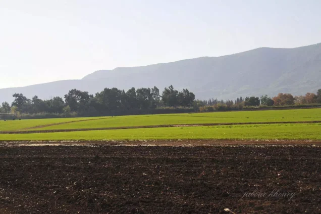
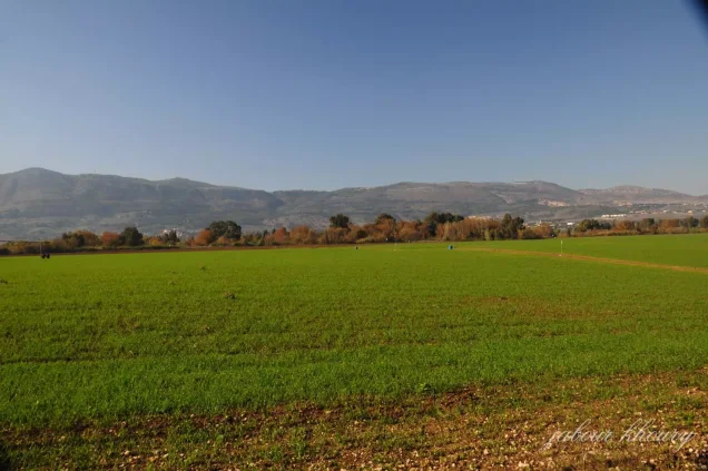
After the Nakba, residents of Beyt Hillel cultivated land surrounding the former Lazzaza site. This later use should be distinguished from the separate question of the land on which Beyt Hillel itself was originally founded.
Lazzaza Today
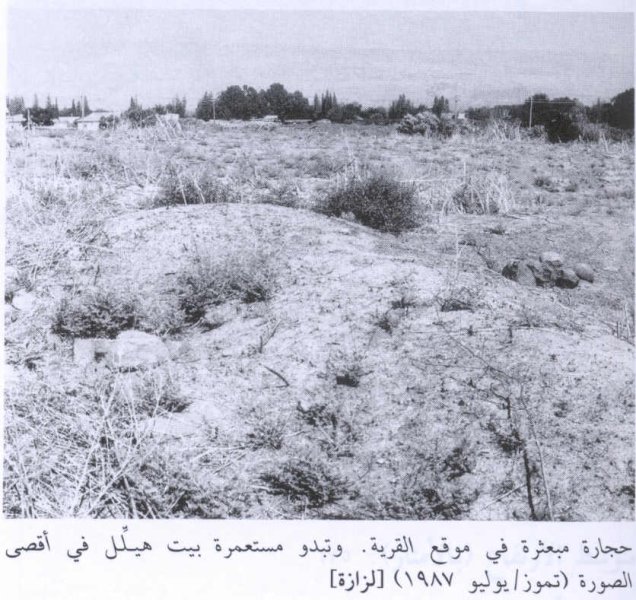
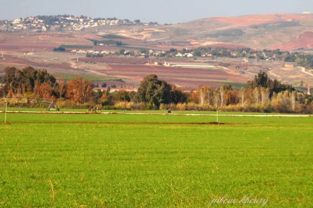
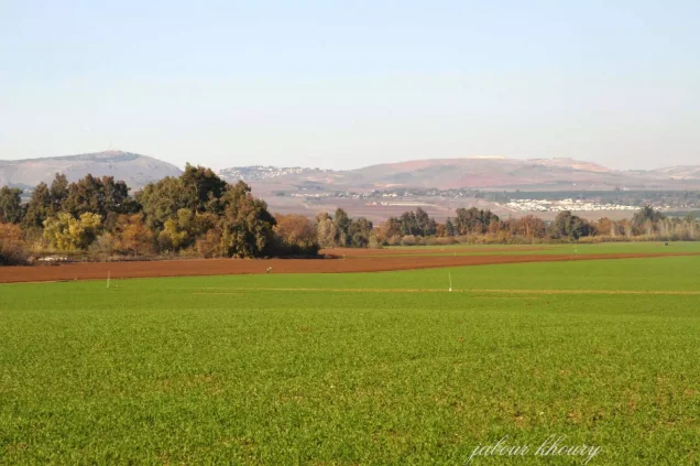
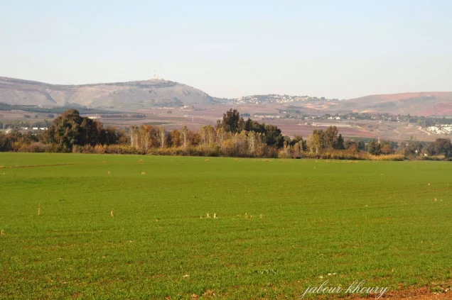
In Walid Khalidi's field documentation, only scattered stones remained across the Lazzaza village site, while surrounding lands were being cultivated by residents of Beyt Hillel.
PalQuest reproduces a photograph of the village site taken by Garo Nalbandian in July 1987, showing scattered stones at the former village site with Beyt Hillel visible in the distance.
This is therefore historical field documentation from the late 1980s, prior to the publication of All That Remains in 1992, and should not be presented as direct and comprehensive field verification of conditions at the site in 2026.
Sources
- PalQuest – Lazzaza
- PalQuest – Operation Yiftach
- PalQuest – Al-Zuq al-Tahtani, for the location and administrative treatment of Beyt Hillel
- Palestine Remembered – Lazzaza, Safad
- Palestine Remembered – Lazzaza entry from Walid Khalidi's All That Remains
- Institute for Palestine Studies – Walid Khalidi, All That Remains
- Government of Palestine – Village Statistics 1944/45, digital reference
Photo gallery
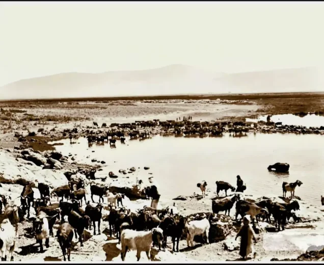
Photos from the village's people
Photos sent in by visitors and published after review.
Add a photo of this village
Log in to add photos of this village.
Other villages from Safed


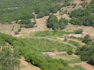

More from the archive



 Download Our Palestine App
The whole archive in the palm of your hand: depopulated villages, the Nakba, the massacres and Al-Aqsa — free, with no ads to erase the story.
Download Our Palestine App
The whole archive in the palm of your hand: depopulated villages, the Nakba, the massacres and Al-Aqsa — free, with no ads to erase the story.



Comments
No comments yet — be the first to write one.
Add your comment
Name and email are optional. Comments appear after review.