
The depopulated village of 'Arab al-Zubayd / District of Safed
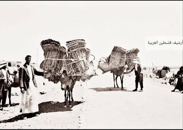
'Arab al-Zubayd
About the depopulated village of 'Arab al-Zubayd
- District
- Safed
- Date 'Arab al-Zubayd was occupied
- 20 April 1948
- Population in 1948
- 432
- Military operation
- Operation Yiftach
- Distance from the governorate centre
- 15 (km) North East of Safad
- Elevation above sea level
- 100 m
- Cause of displacement
- Fear of Jewish attack, or of being caught in the fighting
- Extent of destruction
- In August 1948, the village has been completely obliterated
- Ethnic cleansing
- 'Arab al-Zubayd inhabitants were completely ethnically cleansed.
Hover a dot to read the village name, or click to open its card.
Borders of the depopulated village of 'Arab al-Zubayd
'Arab al-Zubayd – A Depopulated Palestinian Village in the Safad Subdistrict
'Arab al-Zubayd was a Palestinian village in the Safad Subdistrict, approximately 15 km northeast of Safad. It stood at the foot of the Upper Galilee hills where they descend toward the al-Hula Plain, at an average elevation of about 100 meters above sea level.
The inhabitants were displaced during the Nakba and the occupation of Palestine in 1948. Walid Khalidi, citing Israeli historian Benny Morris, reports that the villagers left on 20 April 1948 because they feared a possible attack during the early phase of Operation Yiftach. The source does not independently establish that this was the date on which military forces physically occupied the village, and the date of population departure should therefore be distinguished from a separately verified occupation date.
- Subdistrict
- Safad
- Distance from Safad
- Approximately 15 km northeast
- Average elevation
- Approximately 100 m above sea level
- Population in 1931
- 432 – Official census for the combined unit of 'Arab al-Zubayd and al-'Ulmaniyya; 427 Muslims and 5 Christians
- Number of Houses in 1931
- 100 – Official census; includes both 'Arab al-Zubayd and al-'Ulmaniyya
- Population in 1944/1945
- 890 – Official statistics for Mallaha and 'Arab al-Zubayd combined; not a separate village total
- Total Land Area in 1945
- 2,168 dunams
- Documented principal exodus
- 20 April 1948, according to Benny Morris as cited by Walid Khalidi
- Direct military occupation date
- Not independently established in the principal sources
- Military operation
- The village lay within the scope of Operation Yiftach
- Military unit
- No village-specific assault unit is independently established; the Palmach First Battalion spearheaded Operation Yiftach generally
- Cause of Depopulation
- Fear of Jewish attack, or of being caught in the fighting
- Israeli settlements on village land
- None identified by Khalidi or PalQuest
Location and Geography of 'Arab al-Zubayd
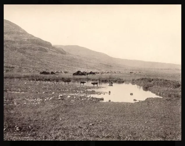
The village stood immediately west of the al-Mutilla–Safad–Tiberias highway, at the lower slopes of the Upper Galilee mountains as they descend toward the al-Hula Plain.
Its lands contained numerous springs, particularly to the north and northeast. Together these springs fed the al-Barid River, which flowed into the al-Hula marshes.
Palestine Remembered lists the lands of al-'Ulmaniyya, Baysamun, Harrawi, and Dayshum among those adjoining the village area. Its map also places Mallaha roughly to the northeast, Dayshum to the west, al-'Ulmaniyya to the southeast, and Lake al-Hula to the east.
Name of the Village
Walid Khalidi notes that the name of 'Arab al-Zubayd suggests that the inhabitants were associated with the Banu Zubayd tribe. This should be retained as a suggestion based on the village name rather than treated as definitive genealogical proof in the absence of an independent documented genealogy.
Population of 'Arab al-Zubayd
The population figures require particular care because the British Mandate authorities did not use the same statistical unit for the village in every census.
In the official 1922 census, 'Arab al-Zubayd was recorded separately with 257 inhabitants: 255 Muslims and two Melkite Christians. The frequently repeated figure of 697 was not the population of 'Arab al-Zubayd alone; it was the combined total for Mallaha, with 440 inhabitants, and 'Arab al-Zubayd, with 257.
In the 1931 census, 'Arab al-Zubayd was enumerated together with al-'Ulmaniyya. The combined unit contained 432 inhabitants living in 100 occupied houses. It recorded 427 Muslims and five Christians, but the census figure does not allow the population of 'Arab al-Zubayd to be separated from that of al-'Ulmaniyya.
In the 1944/45 statistics, 'Arab al-Zubayd was instead combined with Mallaha. Their joint population was 890, recorded as Muslims. The figure therefore cannot accurately be presented as the population of 'Arab al-Zubayd alone.
- 1922257Official census for 'Arab al-Zubayd alone; 255 Muslims and 2 Melkite Christians
- 1931432Official census for the combined unit of 'Arab al-Zubayd and al-'Ulmaniyya; 427 Muslims and 5 Christians
- 1944/45890Official statistics for Mallaha and 'Arab al-Zubayd combined; not a separate village total
The principal sources used here do not provide a sufficiently reliable separate population estimate for 'Arab al-Zubayd alone in 1948, so no figure has been derived from the combined Mallaha–'Arab al-Zubayd total.
Number of Houses
The 1931 census recorded 100 occupied houses, but this figure applied to the combined statistical unit of 'Arab al-Zubayd and al-'Ulmaniyya and cannot be treated as the number of houses in 'Arab al-Zubayd alone.
- 1931100Official census; includes both 'Arab al-Zubayd and al-'Ulmaniyya
Land of 'Arab al-Zubayd
Land statistics for 1944/45 also combined 'Arab al-Zubayd with Mallaha. The total of 2,168 dunums therefore represents the joint statistical unit rather than the land area of 'Arab al-Zubayd alone.
Because the official source uses the categories Arab, Jewish, and Public, those categories are retained here:
- Arab1,838 dunums85%
- Jewish294 dunums14%
- Public36 dunums2%
All of these figures apply to Mallaha and 'Arab al-Zubayd together and should not be used to derive a separate land total for 'Arab al-Zubayd without independent cadastral documentation.
Land Use in 1944/45
- Arab
- Jewish
- Public
- Cereals2,055 dunums
- Built-up land20 dunums
- Non-cultivable land93 dunums
A total of 2,055 dunums, about 95 percent of the joint statistical unit, were classified as cultivable. All of this cultivable land was devoted to cereals in the official table: 1,761 Arab dunums and 294 Jewish dunums.
Economic Life in 'Arab al-Zubayd
Cereal cultivation formed the basis of the village economy. Khalidi records that 1,761 dunums were devoted to cereals in 1944/45. The detailed official table shows that this was the Arab cereal acreage within the statistical unit shared with Mallaha, alongside 294 Jewish dunums also used for cereals.
Water resources were equally important. Numerous springs were located on the village lands, especially to the north and northeast, and their waters collectively fed the al-Barid River before it entered the al-Hula marshes.
Water
'Arab al-Zubayd was notable for the abundance of springs on its lands. Khalidi particularly identifies springs north and northeast of the village, whose combined waters formed the al-Barid River.
After the village was depopulated, irrigation works made use of these local water resources.
Education and Services
The principal sources used for this article do not provide sufficiently documented evidence of a formal school in 'Arab al-Zubayd, its founding date, or pupil numbers. No unsupported educational data have therefore been added.
Archaeology near 'Arab al-Zubayd
The archaeological remains associated with Mallaha should not be transferred to 'Arab al-Zubayd. The description of a mound containing ruins and earlier structures belongs to Mallaha.
Palestine Remembered separately lists a site known as the “Cave of 'Arab Zubayd” west of Lake al-Hula and describes it as an archaeological cave. Khalidi's village entry does not provide further archaeological details that would support a broader description.
Displacement during Operation Yiftach
Operation Yiftach began on 15 April 1948 and continued until 25 May. It was aimed at securing eastern Galilee. Palmach forces played the central role, and the Palmach's First Battalion served as the spearhead of the operation generally.
'Arab al-Zubayd is listed among the villages affected by Operation Yiftach. Khalidi, citing Benny Morris, reports that the villagers feared a possible attack and left on 20 April 1948. Khalidi adds that, if this date is correct, their departure occurred at the very beginning of the operation, before the attack on Safad and before the occupation of any of the nearby villages.
Accordingly, 20 April 1948 is best treated as the documented date of the principal exodus in this account rather than as an independently verified date of a military assault or occupation of the village.
Palestine Remembered identifies the Palmach's First Battalion as the attacking unit. While that battalion is independently documented as the spearhead of Operation Yiftach generally, Khalidi's village-specific account does not document a direct First Battalion assault on 'Arab al-Zubayd. Its general operational role should therefore not be converted into a village-specific identification without additional evidence.
- 15 April 1948
Beginning of Operation Yiftach
Operation to seize eastern Galilee; the Palmach First Battalion spearheaded the operation generally
- 20 April 1948
Departure of 'Arab al-Zubayd's inhabitants
According to Benny Morris as cited by Khalidi; attributed to fear of a possible attack
- Not established
Direct military entry into the village
The principal sources do not provide a separate documented occupation date
- 25 May 1948
End of Operation Yiftach
End of the operation in eastern Galilee
Destruction of 'Arab al-Zubayd after its Depopulation
The village was not immediately destroyed following the departure of its inhabitants. Khalidi, citing Morris, reports that in August 1948 units of the Golani Brigade were preparing to demolish 'Arab al-Zubayd.
Members of the nearby kibbutz Sha'ar ha-'Amaqim objected to the proposed demolition. The dispute eventually reached an Israeli cabinet meeting, where David Ben-Gurion denied that he had authorized the destruction of the houses and promised an investigation.
The objection did not result in the return of the Palestinian inhabitants. According to the account transmitted by Khalidi, it merely delayed the destruction of the village for several months, after which its destruction became irreversible.
Israeli Settlements on the Lands of 'Arab al-Zubayd
Walid Khalidi and PalQuest identify no Israeli settlement established on the lands of 'Arab al-Zubayd, either before or after 1948. Nearby settlements should therefore not be classified as having been built on village land without independent cadastral evidence.
'Arab al-Zubayd Today
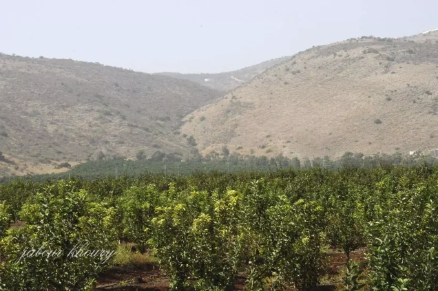
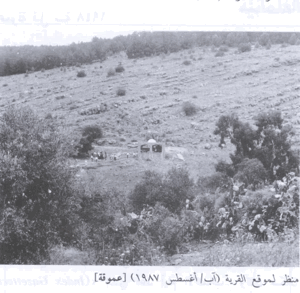
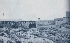
According to the field description published by Walid Khalidi in All That Remains, only scattered rubble remained of 'Arab al-Zubayd, buried beneath thickets of trees, grass, and thorny vegetation. Irrigation works drew on the village's water resources, while the nearby mountainous land was used for grazing.
Part of the plain bordering the village site had been converted into an Israeli nature reserve, while the remaining surrounding land was being cultivated by Israeli farmers.
This description derives from fieldwork conducted before the publication of All That Remains in 1992 and should not be treated as direct field verification of conditions at the site in 2026. Palestine Remembered contains later community documentation showing stone remains and foundations in parts of the site and cultivated land nearby, but upload dates do not necessarily establish when those materials were recorded and they do not constitute a comprehensive current survey.
Sources
- PalQuestPalQuest – Interactive Encyclopedia of the Palestine Question: 'Arab al-Zubayd
- PalQuestPalQuest – Operation Yiftach
- PalQuestPalQuest – Mallaha: Statistical Data Shared with 'Arab al-Zubayd
- Palestine RememberedPalestine Remembered – 'Arab al-Zubayd, Safad
- Palestine RememberedPalestine Remembered – 'Arab al-Zubayd entry from All That Remains
- Institute for Palestine StudiesWalid Khalidi – All That Remains, Institute for Palestine Studies
- pcbs.gov.psPalestinian Central Bureau of Statistics – Historical Census Reports, including the 1922 Census
- pcbs.gov.psGovernment of Palestine – Census of Palestine 1931
- fada.birzeit.eduBirzeit University Repository – Census of Palestine 1931
Photo gallery



Photos from the village's people
Photos sent in by visitors and published after review.
Add a photo of this village
Log in to add photos of this village.
Other villages from Safed


More from the archive



 Download Our Palestine App
The whole archive in the palm of your hand: depopulated villages, the Nakba, the massacres and Al-Aqsa — free, with no ads to erase the story.
Download Our Palestine App
The whole archive in the palm of your hand: depopulated villages, the Nakba, the massacres and Al-Aqsa — free, with no ads to erase the story.



Comments
No comments yet — be the first to write one.
Add your comment
Name and email are optional. Comments appear after review.