
The depopulated village of Al-Mansura (Safed) / District of Safed

Al-Mansura (Safed)
About the depopulated village of Al-Mansura (Safed)
- District
- Safed
- Date Al-Mansura (Safed) was occupied
- 25 May 1948
- Population in 1948
- 418
- Military operation
- Operation Yiftach
- Brigade that carried it out
- Not identified in the sources; Operation Yiftach was carried out by the Yiftach Brigade, spearheaded by the Palmach's First Battalion
- Distance from the governorate centre
- 31 km northeast of Safad
- Elevation above sea level
- 100 m
- Cause of displacement
- Psychological warfare (the 'whispering campaign') and direct military assault by Israeli occupation forces at the end of Operation Yiftach
- Extent of destruction
- The village has been completely obliterated
- Ethnic cleansing
- al-Mansura inhabitants were completely ethnically cleansed.
- Settlements built on the land of Al-Mansura (Safed) before 1948
- She'ar Yashuv (established in 1940, about 1 km northeast of the village site)
Hover a dot to read the village name, or click to open its card.
Borders of the depopulated village of Al-Mansura (Safed)
al-Mansura: A Depopulated Palestinian Village in the Safad District
al-Mansura was a Palestinian village in the Safad District, located approximately 31 km northeast of Safad on flat terrain near the western bank of the Banyas River, close to the Palestine–Syria frontier, at an average elevation of about 100 metres above sea level. Its inhabitants were displaced during the Nakba and the occupation of Palestine in 1948. The village was depopulated on 25 May 1948, at the end of Operation Yiftach, through a combination of psychological warfare, pressure, and direct military assault.
- Subdistrict
- Safad
- Distance from district center
- 31 km northeast of Safad
- Average Elevation
- 100 m above sea level
- Population in 1931
- 89
- Number of Houses in 1931
- 18
- Population in 1944/1945
- 360
- Estimated Population in 1948
- About 418 – a later demographic estimate, not an official census
- Total Land Area in 1945
- 1,544 dunams – 1,254 Arab-owned, 175 Jewish-owned and 115 public land
- Attack and Depopulation
- The village saw clashes in the early months of the war, among them the arrival of a fifteen-man Haganah platoon at its outskirts on 5 March 1948, when one villager was wounded in the brief clash that followed. It was then depopulated on 25 May 1948, at the end of Operation Yiftach, as a result of psychological warfare and direct military assault according to Khalidi, and its inhabitants went to Syria according to an Israeli intelligence report published by PalQuest.
- Final Israeli Control
- 25 May 1948, the day the village was depopulated, the last day of Operation Yiftach, which occupied the whole area; the available sources give no other date for the entry of Israeli occupation forces into the village
- Military Operation
- Operation Yiftach
- Military Unit
- The available sources do not identify the unit that entered the village; PalQuest names the Yiftach Brigade as the unit that carried out Operation Yiftach, spearheaded by the Palmach's First Battalion
- Cause of Depopulation
- Psychological warfare (the 'whispering campaign') and direct military assault by Israeli occupation forces at the end of Operation Yiftach
- Settlements Documented on Village Lands
- She'ar Yashuv, established in 1940, before the Nakba, about 1 km northeast of the village site; Khalidi lists it under Israeli settlements on village lands
Location of al-Mansura
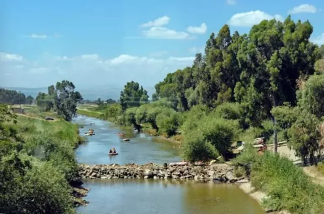
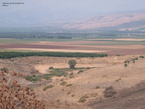
al-Mansura stood on flat terrain close to the western bank of the Banyas River in the northeastern part of the Safad District, not far from the Palestine–Syria frontier.
The village was approximately 31 km northeast of Safad and had an average elevation of about 100 metres above sea level.
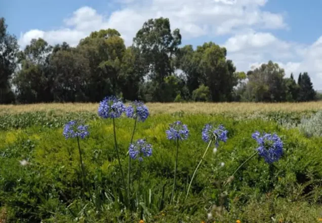
Agricultural land surrounded the village in a water-rich area close to tributaries feeding the Jordan River system.
Palestine Remembered's maps place nearby Palestinian localities including al-Shawka al-Tahta, al-Khisas, al-'Abisiyya, and Qaytiyya, with the Syrian frontier to the east.
The Name al-Mansura
The Arabic name al-Mansura derives linguistically from the root associated with victory and may be translated broadly as “the victorious” or “the one granted victory.”
Walid Khalidi and PalQuest, however, do not provide a documented historical explanation for why this particular village bore the name. The linguistic meaning should therefore not be presented as a confirmed account of the village's naming.
al-Mansura before the Nakba
Travellers who passed through the area in the late nineteenth century described al-Mansura as a settlement of stone-and-mud houses on a plain near a river and surrounded by agricultural land.
One contemporary description estimated its population at approximately seventy Muslims.
In the modern period immediately before the Nakba, the village population was entirely Muslim.
Architecture of al-Mansura
The village houses were described in the late nineteenth century as being built of stone and mud.
The built-up area amounted to only 5 dunums in the 1944/45 statistics, reflecting the small size of the residential core in comparison with the surrounding agricultural land.
The principal approved sources do not provide a detailed description of the village street pattern or internal quarters immediately before the Nakba.
Education and Public Services
Khalidi's PalQuest entry and Palestine Remembered's principal village file do not provide sufficiently documented information concerning an independent school, mosque, clinic, or other specific public institution in al-Mansura before the Nakba.
No such institution is therefore asserted without clearer evidence from the approved sources.
Economic Life in al-Mansura
Agriculture is the principal economic activity clearly documented in the approved village sources.
In 1944/45, a total of 1,424 dunums was classified as irrigated or used for plantations.
Of this land, 1,249 dunums were Palestinian and 175 dunums belonged to the category represented here as “Transferred to Zionists.”
The official village table used here does not separately list cereal, citrus, or olive acreage. Specific crops and acreages are therefore not added without stronger documentation.
Land Ownership in al-Mansura
The total registered land area of al-Mansura was 1,544 dunums in the 1944/45 statistics.
Land ownership in al-Mansura, 1944/45, using the terminology of Palestine Remembered
- Palestinian1,254 dunums81%
- Transferred to Zionists175 dunums11%
- Communal115 dunums7%
Palestinian land represented approximately 81.2 percent of the total, land in the category “Transferred to Zionists” approximately 11.3 percent, and communal/public land approximately 7.4 percent.
Land Use in al-Mansura, 1944/45
Land use in al-Mansura, separating ownership categories according to PalQuest's detailed statistics
- Palestinian
- Transferred to Zionists
- Communal/Public
- Plantations and irrigable land1,424 dunums
- Built-up area5 dunums
- Non-cultivable land115 dunums
A total of 1,424 dunums, approximately 92 percent of the village lands, was cultivated or cultivable.
Built-up and non-cultivable land together amounted to 120 dunums, approximately 8 percent of the total.
Palestine Remembered places 115 dunums of non-arable land in its Palestinian column, while PalQuest's detailed table classifies all 115 dunums as public land. The communal/public category is therefore shown separately above.
Population of al-Mansura
Population of al-Mansura in selected years
- Late nineteenth centuryApproximately 70Historical traveller's estimate
- 192241Official Government of Palestine census; all Muslim
- 193189Official British Mandate census
- 1944/45360Official statistics; all inhabitants recorded as Muslim
- 1948418Later estimate published by Palestine Remembered
- Estimated refugees in 19982,565Later estimate published by Palestine Remembered
Number of Houses in al-Mansura
Number of houses in al-Mansura
- 193118Official British Mandate census
- 194884Later estimate published by Palestine Remembered
Archaeological Sites around al-Mansura
Walid Khalidi records the presence of several khirbas and archaeological tells in the vicinity of al-Mansura without naming all of them individually.
Palestine Remembered provides a more detailed list:
- Tall al-Turmus, east of the village.
- al-Nabi Huda, east of the village.
- Khirbat al-Buhayrat, east of the village.
- Khirbat al-'Umayri, east of the village.
- Tall al-Mun'atifa, northeast of the village.
These detailed place names are attributed specifically to Palestine Remembered because Khalidi's principal entry refers only generally to nearby khirbas and archaeological tells.
Clashes near al-Mansura before its Depopulation
Several clashes occurred near al-Mansura during the early months of 1948.
On the afternoon of 12 February, a British patrol engaged an Arab force near the village that contemporary press reports described as numerically superior. Khalidi considers it most likely to have been a unit of the Arab Liberation Army.
One British soldier was killed. The press report did not state whether the Arab force suffered casualties.
On the afternoon of 5 March 1948, a Haganah platoon of approximately fifteen men reached the outskirts of al-Mansura, according to the Palestinian newspaper Filastin as reproduced by Khalidi.
A brief clash followed in which one villager was wounded.
Operation Yiftach and the Depopulation of al-Mansura
al-Mansura was depopulated during the final stage of Operation Yiftach, which ran from 15 April to 25 May 1948 and aimed to secure eastern Galilee.
At the broader operational level, the Yiftach Brigade and Palmach forces conducted the operation, with the Palmach's First Battalion spearheading substantial parts of the offensive.
PalQuest's account of Operation Yiftach describes the use of both direct military assaults and psychological warfare to drive Palestinian inhabitants from eastern Galilee. Palestinians who remained in a number of localities after their capture were expelled.
The dedicated al-Mansura entry does not identify which battalion entered the village itself. No specific battalion is therefore assigned to the village without direct evidence.
Depopulation of al-Mansura on 25 May 1948
al-Mansura was depopulated on 25 May 1948, the final day of Operation Yiftach.
Walid Khalidi describes the cause as a combination of psychological warfare and direct military assault, the same pattern that affected other Palestinian villages in eastern Galilee during the closing phase of the operation.
Psychological warfare was especially important in this region. Operation Yiftach included a “whispering campaign” designed to spread fear and persuade Palestinian inhabitants to leave before advancing forces reached their villages.
PalQuest also publishes an Israeli intelligence report dated 30 June 1948 that records al-Mansura's depopulation on 25 May, attributes it to the “whispering operation,” and states that the villagers went to Syria.
The same report states that the departure of al-Mansura's inhabitants influenced the residents of neighboring al-'Abisiyya, who also left on 25 May.
This Israeli intelligence document is not used here independently. Its information is included because it is preserved and published within PalQuest and is read alongside Khalidi's Palestinian reference work.
- Date of depopulation: 25 May 1948.
- Military operation: Operation Yiftach.
- Principal force in the broader operation: Yiftach Brigade / Palmach forces.
- Village-specific occupying battalion: not identified in the principal source.
- Mechanisms of displacement: psychological warfare and the whispering campaign, together with military pressure and direct assault.
- Destination recorded in the PalQuest-published intelligence report: Syria.
- Regional effect: al-Mansura's evacuation contributed to the departure of inhabitants of neighboring al-'Abisiyya.
Occupation and Depopulation Chronology
- 12 February 1948
Clash near the village
The New York Times reported a skirmish near the village that afternoon between a British patrol and a 'superior' Arab force, which Khalidi considers most probably an Arab Liberation Army unit; the patrol lost one soldier, and the report did not mention Arab casualties.
- 5 March 1948
Arrival of a Haganah force at the village outskirts and a clash
A platoon of fifteen Haganah men arrived at the outskirts of the village in the afternoon, according to the Palestinian newspaper Filastin as cited by Khalidi; a brief clash ensued, in which one villager was wounded.
- 15 April 1948
Beginning of the military operation
Operation Yiftach, masterminded by Palmach commander Yigal Allon to gain control of eastern Galilee, began, spearheaded by the Palmach's First Battalion; PalQuest lists al-Mansura among the villages affected by the operation.
- 25 May 1948
Depopulation of the village
The village was depopulated at the end of Operation Yiftach as a result of the same combination of psychological warfare and direct military assault that had caused the depopulation of the other villages in the area, according to Khalidi. An Israeli intelligence report dated 30 June 1948, published by PalQuest, records that its inhabitants fled to Syria on 25 May as a result of the Israeli 'whispering operation'.
Settlement Associated with al-Mansura's Lands
Khalidi lists She'ar Yashuv in the section concerning Israeli settlements associated with al-Mansura's village lands.
- She'ar Yashuv: established in 1940, before the Nakba, approximately 1 km northeast of the village site.
She'ar Yashuv should therefore not be described as a settlement founded after al-Mansura's 1948 depopulation; it had already been established in 1940.
al-Mansura Today
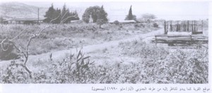
According to the field description published by Walid Khalidi in All That Remains, al-Mansura's buildings had been almost completely obliterated, making traces of the former village difficult to identify.
The village site had been converted into a fish hatchery containing a series of fish-breeding pools.
A narrow strip of thorny vegetation and trees remained between some of the pools.
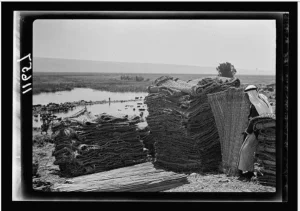
Palestine Remembered preserves historical photographs, maps, and oral-history materials relating to al-Mansura, its lands, and the Banyas River, but the available material does not constitute a comprehensive independent contemporary field survey of the entire site.
The principal field description therefore comes from research published in Khalidi's 1992 volume and should not be presented as a direct field verification of the site's condition in 2026.
The approved sources used here do not provide a sufficiently comprehensive and independent recent survey to establish the precise condition of every part of al-Mansura today.
Sources
- PalQuestPalQuest – Interactive Encyclopedia of the Palestine Question: al-Mansura, Safad District
- PalQuestPalQuest – Operation Yiftach
- PalQuestPalQuest – Israeli Intelligence Report on the Depopulation of Palestine, 30 June 1948
- Palestine RememberedPalestine Remembered – al-Mansura, Safad District
- Palestine RememberedPalestine Remembered – al-Mansura entry from All That Remains
- archive.orgGovernment of Palestine – Census of Palestine, 1922
- Institute for Palestine StudiesInstitute for Palestine Studies – All That Remains, Walid Khalidi
Photo gallery



Photos from the village's people
Photos sent in by visitors and published after review.
Add a photo of this village
Log in to add photos of this village.
Other villages from Safed
More from the archive



 Download Our Palestine App
The whole archive in the palm of your hand: depopulated villages, the Nakba, the massacres and Al-Aqsa — free, with no ads to erase the story.
Download Our Palestine App
The whole archive in the palm of your hand: depopulated villages, the Nakba, the massacres and Al-Aqsa — free, with no ads to erase the story.



Comments
No comments yet — be the first to write one.
Add your comment
Name and email are optional. Comments appear after review.