
The depopulated village of 'Akbara / District of Safed
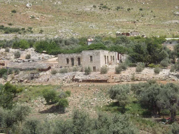
'Akbara
About the depopulated village of 'Akbara
- District
- Safed
- Date 'Akbara was occupied
- 09 May 1948
- Population in 1948
- 450
- Military operation
- Operation Yiftach
- Brigade that carried it out
- Palmach
- Distance from the governorate centre
- 2.5 (km) South of Safad
- Elevation above sea level
- 300 m
- Cause of displacement
- Military assault by Zionist troops
- Extent of destruction
- The village has not been completely destroyed. Some internal Palestinian refugees (from Qaddita and Dallata) are currently living in the village.
- Ethnic cleansing
- Many of 'Akbara's senior citizens, women and children fled to al-Fradaiyya and al-Sammui' when 'Ayn al-Zaytun was occupied on 1st-3rd om May 1948, on 9th-11th of May 1948 was completely ethnically cleansed.
- Refugees' migration routes
- Almost all the villagers stayed at al-Farradiyya and al-Sammu'i, until these village were ethnically cleansed later.
Hover a dot to read the village name, or click to open its card.
Borders of the depopulated village of 'Akbara
Akbara – Depopulated Palestinian Village of Safad
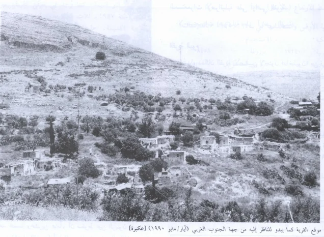
Akbara was a Palestinian village in the Safad Subdistrict of Galilee, located approximately 2.5 kilometers south of Safad at an average elevation of about 300 meters above sea level. Its houses extended along both sides of a deep north-south wadi cutting through a south-facing slope, with a hill rising opposite the village across the valley.
Akbara had a population of 390 in the official 1944/45 statistics and a total land area of 3,224 dunums. Agriculture and animal husbandry formed the basis of the local economy, with cereals, orchards, olives, and figs among the principal crops.
Because Akbara lay immediately south of Safad, it acquired particular military significance in spring 1948. On 9 May, units of the Palmach's First Battalion attacked the village during Operation Yiftach in an action intended, according to the operational orders cited by Walid Khalidi, to increase pressure on Safad and create the impression that the city was about to be encircled.
Basic Information
| Field | Information |
|---|---|
| Name | Akbara / 'Akbara |
| Arabic name | عَكْبَرَة |
| Subdistrict | Safad |
| Location relative to Safad | South of Safad |
| Distance from Safad | Approximately 2.5 km according to Khalidi and PalQuest |
| Average elevation | Approximately 300 m above sea level |
| Palestine Grid | 197/260 |
| Total land area | 3,224 dunums |
| Population in 1944/45 | 390 |
| Houses in 1931 | 49 |
| Attack and occupation date | 9 May 1948 |
| Military operation | Operation Yiftach |
| Military unit | Palmach First Battalion |
| Cause of depopulation | Partial flight began before the assault because of events at 'Ayn al-Zaytun and news of Dayr Yasin; the remaining population was displaced in the context of the direct military assault on Akbara |
| Destruction | Extensive but incomplete; Khalidi documented fifteen surviving old houses and the school building |
| Israeli settlements on village lands | None according to Walid Khalidi and PalQuest |
Name and Earlier History
The name Akbara appears in earlier historical sources in forms including Achabare and Acchabaron. Khalidi associates these ancient forms with Khirbat al-'Uqayba, southeast of the Palestinian village.
The principal sources used here do not establish a definitive linguistic derivation of the Arabic name. Claims connecting it conclusively to a particular ancient people or ethnonym are therefore not adopted without independent linguistic or historical evidence.
Location and Geography
Akbara stood on both sides of a deep valley running north to south through a south-facing slope. A hill rose opposite the village across the wadi.
A dirt road linked the village with nearby Safad, giving Akbara close economic and social connections with the subdistrict capital.
Palestinian local documentation places Safad to the north, al-Zahiriyya al-Tahta toward the northwest, Zanghariyya lands to the east, and additional Palestinian village and khirba lands to the south and southeast.
Akbara in the Nineteenth Century
The Survey of Western Palestine described Akbara in the late nineteenth century as a stone-and-adobe village with approximately ninety inhabitants.
The villagers cultivated figs and olives, demonstrating the long-standing importance of tree crops in the local agricultural economy.
Population
- Late nineteenth centuryApprox. 90Historical estimate recorded by the Survey of Western Palestine
- 1922147Official Government of Palestine census; all Muslims
- 1931275Official Government of Palestine census; all Muslims
- 1944/45390Official Mandate-period estimate
- 1948402Later Palestine Remembered estimate, not an official census
- 19981,852Later estimate of refugees and descendants, not an official census
The figure of 360 recorded for 1961 should not be inserted into a continuous population table for the original pre-Nakba community. It relates to the post-1948 population established in the Akbara area, which consisted largely of internally displaced Palestinians from other villages.
Number of Houses
- 193149Official census figure
- 194853Later Palestine Remembered estimate, not an official Government of Palestine figure
Land Ownership, 1944/45
- Palestinian3,167 dunums98%
- Transferred to Zionists0 dunums0%
- Public57 dunums2%
The original Government of Palestine statistics used the categories Arab, Jewish, and Public. No land was recorded in the Jewish ownership category, while 57 dunums were classified as public.
The figures balance exactly: 3,167 + 57 = 3,224 dunums.
Land Use, 1944/45
- Palestinian
- Public
- Cereals2,232 dunums
- Plantations and irrigable land199 dunums
- Built-up area6 dunums
- Non-cultivable land787 dunums
The table balances exactly: 2,232 + 199 + 6 + 787 = 3,224 dunums.
Olive Cultivation
Palestine Remembered separately lists approximately 200 dunums of olive groves. This figure is not presented as an additional land-use category in the official PalQuest table.
Because olive cultivation is a crop-specific figure within cultivated land, it is retained as separate agricultural information and is not added again to the 1944/45 land-use total.
Economy and Agriculture
Akbara's economy rested on agriculture, animal husbandry, exchange with neighboring villages, and employment in nearby Safad.
Cereal cultivation occupied the largest recorded area, while orchards, irrigated plots, olives, and figs were also important. The nineteenth-century description of the village already recorded olive and fig cultivation.
Education
Akbara had a school building, and Khalidi's later fieldwork recorded the school as one of the structures that remained standing after the village's depopulation.
Palestine Remembered identifies it as a boys' school. The principal sources consulted do not provide a reliably documented founding year, enrollment figure, or number of teachers, so no unsupported figures are supplied.
Mosque
Akbara had a mosque serving its predominantly Muslim population.
According to testimony from former villagers collected by Palestinian historian Nafez Nazzal and reproduced by Khalidi, part of the mosque was destroyed during the 9 May 1948 assault.
The principal village-level sources do not establish the existence of an active church in Akbara immediately before the Nakba. Older ruins interpreted as a possible historical church belong to the archaeological landscape and should not be confused with the village's modern places of worship.
Archaeology and Khirbat al-'Uqayba
Khirbat al-'Uqayba lay southeast of Akbara and is associated by Khalidi with the Roman settlement known as Achabare or Acchabaron.
The khirba was reportedly still inhabited in 1904.
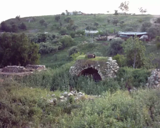
Excavations in the area uncovered building foundations, hewn stones, and wine presses. Palestinian local documentation also records cisterns, graves, an olive press, and rock-cut remains in the wider Akbara area, although these features should not all be assigned to one archaeological period without specialist evidence.
Operation Yiftach
Akbara lay within the area of Operation Yiftach, conducted by Palmach forces in eastern Galilee during April and May 1948.
Before the final assault on Safad, attacks on surrounding Palestinian villages were used to weaken the city's defenses and morale and to tighten military pressure around it.
Because Akbara lay immediately south of Safad while 'Ayn al-Zaytun lay to the north, the attacks on these villages contributed to the perception among Safad's Palestinian population that the city was being encircled.
Flight Before the Assault
Part of Akbara's population left before troops entered the village.
Former villagers interviewed by Palestinian historian Nafez Nazzal stated that the fall of 'Ayn al-Zaytun and news of the Dayr Yasin massacre influenced some families to leave.
Khalidi's account indicates that most residents had already left by the time the assault began on 9 May, while a small group of men remained to defend the village.
The Assault on Akbara – 9 May 1948
On 9 May 1948, units of the Palmach's First Battalion attacked Akbara during Operation Yiftach.
The operational purpose cited by Khalidi included creating a sense among the Palestinian residents of Safad that they were about to be surrounded and that escape routes might be cut.
The attacking force's orders also alleged that Akbara served as a transit point for Syrians attempting to aid Safad and as a base for attacks on Jewish traffic. This is presented as the rationale stated in the military orders, not as an independent conclusion of this article.
Resistance and Depopulation
Former villagers reported that approximately fifteen to twenty local defenders resisted the assault but were overwhelmed and withdrew toward the outskirts of the village.
The Palmach units did not remain in Akbara for long. Villager testimony states that they destroyed several houses and part of the mosque and removed livestock.
Most of Akbara's residents sought refuge in al-Farradiyya and al-Sammu'i to the west and remained there until those villages were also occupied and depopulated.
Some villagers returned temporarily to retrieve food and personal belongings, indicating that many initially expected the displacement to be temporary.
Cause of Depopulation
Palestine Remembered classifies the cause of depopulation as direct military assault.
The fuller chronology shows that part of the population left before the attack under the influence of surrounding military events and reports from 'Ayn al-Zaytun and Dayr Yasin, while those who remained were displaced during or immediately after the 9 May assault.
The most accurate description is therefore a combination of psychological pressure generated by surrounding events, anticipatory flight, and direct military attack.
Destruction
Akbara suffered partial destruction during the assault. Sources cited by Khalidi report that several houses were blown up and part of the mosque was damaged.
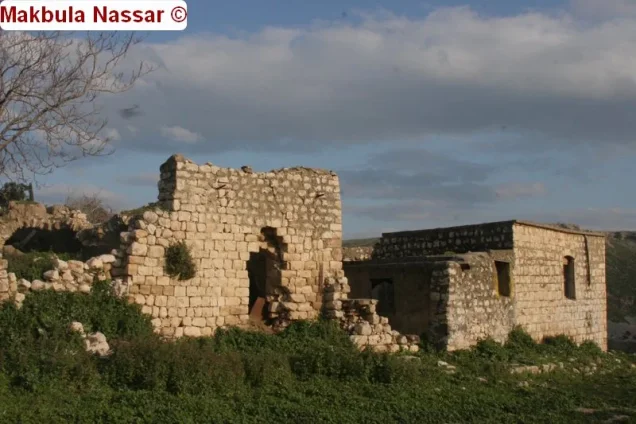
The village was not completely destroyed. Khalidi's later fieldwork recorded fifteen surviving old houses together with the school building.
“Extensive but incomplete destruction” is therefore more accurate than describing Akbara as having been entirely erased.
Akbara after 1948
Akbara's post-Nakba history differed from that of many completely abandoned village sites because the area became a place where internally displaced Palestinians from other Safad villages were gathered.
In early June 1949, people who had remained in al-Ja'una, al-Khisas, and Qaytiyya were transported by truck to the Akbara area, according to the account cited by Khalidi.
Displaced Palestinians from other villages, including Qaddita, were also gathered there, and the sources describe living conditions as remaining extremely difficult for years.
In a later phase, the old Akbara houses were inhabited particularly by internally displaced families from Qaddita and Dallata, while the original inhabitants of Akbara had themselves been dispersed elsewhere.
Old Akbara and Modern Akbara
The original Palestinian village site must be distinguished from the planned modern locality also called Akbara.
From around 1980, families living at the old site were gradually relocated to the newly planned village approximately half a kilometer away.
According to Khalidi, one condition for moving to the new housing was that each family demolish its house at the old village site.
The modern Akbara locality had been placed administratively under the municipality of Safad in 1977.
Later population figures for modern Akbara should therefore not be treated as a continuous demographic series for the original village population. The post-1948 community consisted primarily of internally displaced Palestinians and their descendants, particularly from Qaddita and Dallata.
Ethnic Cleansing in Source Classification
Palestine Remembered classifies the displacement of Akbara's original population using the term “complete ethnic cleansing.” The term is retained here only as an attributed source classification.
The more specifically documented events are the pre-assault departure of some residents, the First Battalion attack on 9 May, resistance by a small group of village defenders, the flight of the remaining population toward al-Farradiyya and al-Sammu'i, partial destruction of the village, and the absence of a collective permanent return by Akbara's original inhabitants.
Occupation and Depopulation Chronology
| Date | Event |
|---|---|
| Late April–early May 1948 | Military pressure around Safad increases, affecting villages surrounding the city. |
| Early May 1948 | Some Akbara residents leave following the fall of 'Ayn al-Zaytun and news of the Dayr Yasin massacre. |
| 9 May 1948 | The Palmach's First Battalion attacks Akbara during Operation Yiftach. |
| 9 May 1948 | Approximately fifteen to twenty village defenders resist before withdrawing toward the outskirts. |
| 9 May 1948 | Several houses and part of the mosque are destroyed, livestock is removed, and most residents take refuge in al-Farradiyya and al-Sammu'i. |
| 10–11 May 1948 | The final assault on Safad takes place and the city falls during Operation Yiftach. |
| Immediately afterward | Some Akbara villagers temporarily return for food and personal belongings, believing that return may still be possible. |
| Early June 1949 | Internally displaced Palestinians from al-Ja'una, al-Khisas, and Qaytiyya are transferred to the Akbara area; families from additional villages are also gathered there. |
| 1977 | The modern Akbara locality is placed administratively under Safad municipality. |
| From around 1980 | Families living at the old site, especially internally displaced people from Qaddita and Dallata, are gradually relocated to the planned modern Akbara approximately half a kilometer away. |
Israeli Settlements on Akbara's Lands
According to Walid Khalidi and PalQuest, no Israeli settlement was established on Akbara's village lands.
This should be distinguished from the expansion of nearby Safad and from the planned modern Akbara locality inhabited by Palestinians displaced internally from other villages. The latter is not classified here as an Israeli settlement established on the village lands.
Akbara Today
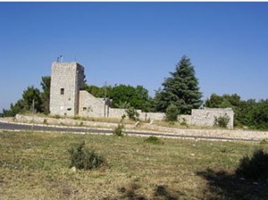
According to the field description used by Walid Khalidi before the publication of All That Remains in 1992, fifteen houses from old Akbara were still standing, together with the former school building.
Internally displaced families from Qaddita and Dallata had lived in the surviving old houses after the Nakba and were gradually relocated, from around 1980 onward, to the planned modern Akbara approximately half a kilometer away.
Palestine Remembered also contains more recent Palestinian community documentation, including material uploaded in 2025 describing portions of the former village lands as incorporated into recreational and walking or cycling areas while village remains continue to be documented.
Such material constitutes Palestinian community documentation rather than a comprehensive archaeological or cadastral survey. Khalidi's account likewise represents documented historical fieldwork conducted before the 1992 publication of All That Remains and should not be treated by itself as a complete field verification of conditions in 2026.
Sources
- PalQuest – Interactive Encyclopedia of the Palestine Question: Akbara
- PalQuest – Operation Yiftach
- Palestine Remembered – Akbara, Safad Subdistrict
- Palestine Remembered – Akbara entry from Walid Khalidi's All That Remains
- Palestinian Villages Encyclopedia – Akbara
- Palestinian Villages Encyclopedia – Modern Akbara and the post-1949 period
- Government of Palestine – Census of Palestine 1922
- Government of Palestine – Census of Palestine 1931: Safad Subdistrict
Photo gallery






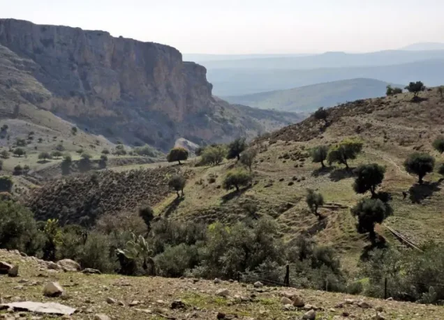
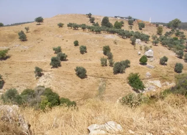


Photos from the village's people
Photos sent in by visitors and published after review.
Add a photo of this village
Log in to add photos of this village.
Other villages from Safed
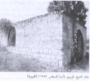

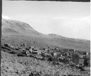
More from the archive



 Download Our Palestine App
The whole archive in the palm of your hand: depopulated villages, the Nakba, the massacres and Al-Aqsa — free, with no ads to erase the story.
Download Our Palestine App
The whole archive in the palm of your hand: depopulated villages, the Nakba, the massacres and Al-Aqsa — free, with no ads to erase the story.



Comments
No comments yet — be the first to write one.
Add your comment
Name and email are optional. Comments appear after review.