
The depopulated village of Khirbat Karraza / District of Safed
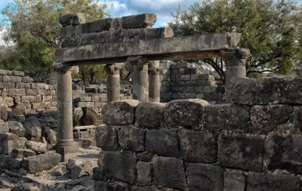
Khirbat Karraza
About the depopulated village of Khirbat Karraza
- District
- Safed
- Date Khirbat Karraza was occupied
- 04 May 1948
- Military operation
- Operation Yiftach
- Brigade that carried it out
- Palmach
- Elevation above sea level
- 50 m
Hover a dot to read the village name, or click to open its card.
Khirbat Karraza – Depopulated Palestinian Hamlet of Safad
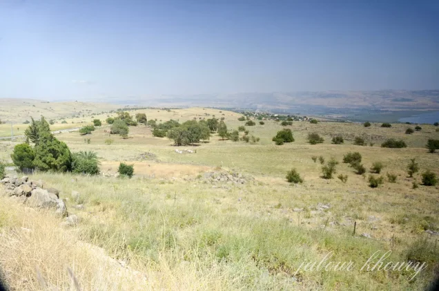
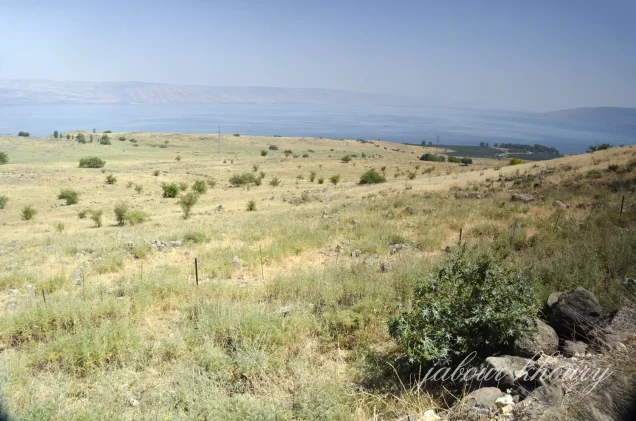
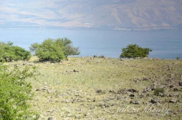
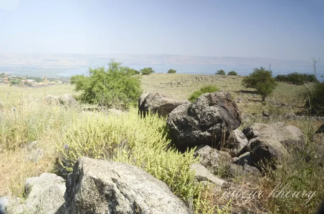
Khirbat Karraza was a depopulated Palestinian hamlet in the Safad Subdistrict, situated southeast of Safad on a small hill underlain by volcanic rock. It lay approximately 8.5 kilometers from Safad and about four kilometers north of the shore of Lake Tiberias.
Khirbat Karraza was a semi-settled Bedouin community associated with the Zanghariyya tribe. Many of its inhabitants belonged to the Sawalima branch. In 1948 it contained a permanent core of approximately fifteen stone houses as well as roughly the same number of tents used by semi-pastoral residents when moving with their livestock.
The hamlet was not recorded as an independent population and land unit in the principal Mandate statistical tables. The Institute for Palestine Studies included Khirbat Karraza in its list of depopulated Palestinian villages after field interviews with former inhabitants established that it was inhabited in 1948 and contained a permanent core of stone structures.
Basic Information
| Field | Information |
|---|---|
| Name | Khirbat Karraza |
| Arabic name | خِرْبَة كَرّازَة |
| Subdistrict | Safad |
| Region | Eastern Galilee – north of Lake Tiberias |
| Distance from Safad | Approximately 8.5 km |
| Location relative to Safad | Southeast of Safad |
| Distance from Lake Tiberias | Approximately 4 km north of the shoreline |
| Average elevation | Approximately 50 m above sea level according to PalQuest |
| Palestine Grid | 203/257 |
| Population | No independently documented Mandate-period population figure |
| Buildings in 1948 | Approximately 15 stone houses and a comparable number of tents |
| Tribal affiliation | Zanghariyya; many residents belonged to the Sawalima branch |
| Official independent land area | No separate figure is available in Village Statistics 1945 |
| Occupation date | 3–4 May 1948; several Palestinian sources use 4 May, while the Palestine Land Society register gives 3 May |
| Military operation | Operation Matateh (“Broom”), a sub-operation of Operation Yiftach |
| Military unit | Palmach; Palestine Remembered attributes the action to the First Battalion, but Khalidi's village-specific account does not independently identify the battalion |
| Cause of depopulation | Military operations and the forced clearing of the area during Operation Matateh; the precise village-specific sequence is not independently documented |
| Extent of destruction | Extensive destruction, although Khalidi documented surviving village houses |
| Israeli settlements on village land | No settlement is specifically documented by Khalidi as having been established on Khirbat Karraza's own lands |
Khirbat Karraza as an Inhabited Hamlet
Khirbat Karraza does not appear as an independent village in several of the principal official statistical lists. Field documentation was therefore particularly important in establishing the nature of the community.
The Institute for Palestine Studies explains that Khirbat Karraza was added to its list of depopulated villages after interviews with former residents established that the hamlet was inhabited in 1948 and possessed a permanent core of stone buildings.
The word “khirba” should therefore not be understood here as meaning an uninhabited archaeological ruin. Khirbat Karraza was a living Palestinian community combining permanent residence with semi-pastoral mobility.
Location and Boundaries
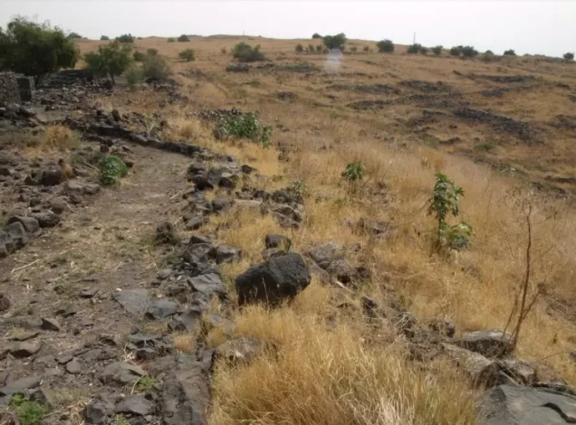
Khirbat Karraza stood on a small volcanic hill between Safad and Lake Tiberias.
Palestinian local documentation places Khirbat Jissi of the Zanghariyya to the north, Khirbat Khati to the northeast, 'Arab al-Shamalina to the east, Khirbat Abu Zayna to the southeast, the encampments of 'Arab al-Samakiyya and Lake Tiberias to the south, 'Arab al-Sayyad to the southwest, Jubb Yusuf to the west, and Safad to the northwest.
Local documentation also associates the site with Wadi al-Wabdani, although secondary sources differ over the precise elevation and the size of the immediate settlement site.
Population and Tribal Affiliation
Khirbat Karraza lay within the territory inhabited by the Zanghariyya Bedouin tribe. Walid Khalidi records that many of the hamlet's inhabitants belonged to the Sawalima branch of that tribe.
The residents were semi-nomadic. In addition to permanent stone houses, they used tents when moving with their livestock.
Population Statistics
| Year | Population | Note |
|---|---|---|
| 1922 | No separate documented figure | Khirbat Karraza was not recorded as an independent census unit |
| 1931 | No separate documented figure | Residents of the area were included within larger tribal and territorial units |
| 1945 | No separate documented figure | Khirbat Karraza does not appear as an independent unit in Village Statistics 1945 |
| 1948 | Unknown with precision | Approximately 15 stone houses and a similar number of tents are documented |
Some Palestinian local sources state that residents were statistically absorbed into the larger 'Arab al-Shamalina and Zanghariyya communities. The population totals of those larger units should not be reassigned to Khirbat Karraza itself.
Number of Houses
Walid Khalidi documented approximately fifteen stone houses at Khirbat Karraza in 1948, together with a roughly equal number of tents.
This is a historical description of the settlement immediately before depopulation, not an independent official census count of houses.
Land and Land Ownership
Village Statistics 1945 contains no independent Khirbat Karraza entry from which a reliable land ownership or land-use table can be constructed.
A Palestinian village-history source gives approximately 70 dunums for the immediate hamlet site and states that it stood on lands associated with 'Arab al-Shamalina. This figure, however, is not presented as a separate official Khirbat Karraza land total in the Government of Palestine statistics and is therefore not treated here as the hamlet's total land area.
Likewise, the 16,690 dunums recorded for 'Arab al-Shamalina in the 1945 statistics belonged to a much larger tribal-territorial unit and cannot be reassigned wholesale to Khirbat Karraza.
Economy
The inhabitants combined semi-permanent settlement with pastoral mobility. The presence of both stone houses and tents reflects a way of life closely connected to livestock raising.
Grain also formed part of the local economy. Residents stored grain beside the shrine of Shaykh Ramadan, relying on the sanctity of the site to protect it from theft.
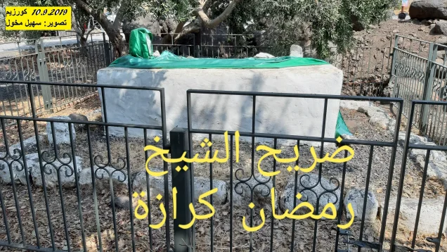
The Shrine of Shaykh Ramadan
A shrine dedicated to a local Muslim saint, Shaykh Ramadan, stood in the northern part of the hamlet.
The shrine was built around his tomb and had an economic as well as religious function. Villagers stored grain beside it, trusting that the sanctity of the shrine would deter theft.
No separate mosque is independently documented in the principal sources used here, so none is asserted beyond the Shaykh Ramadan shrine.
Education and Services
No independently documented school has been located for Khirbat Karraza in the principal sources consulted, and no reliable enrollment or teacher figures are available.
Given the small and semi-pastoral character of the community, no school, clinic, or administrative building should be assumed without documentary evidence.
Khirbat Karraza and Ancient Khorazin
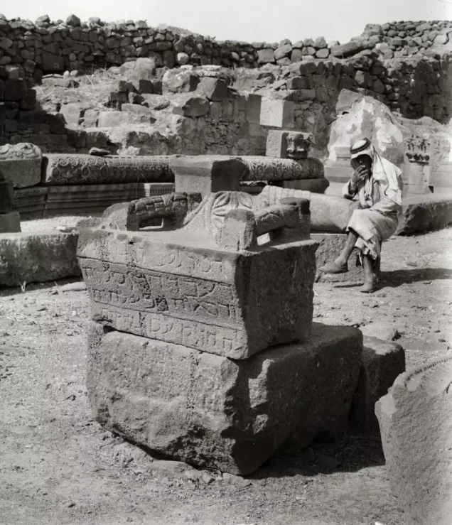
The Palestinian hamlet of Khirbat Karraza stood close to the archaeological site of ancient Khorazin. The modern Palestinian community and the ancient settlement should not simply be treated as the same historical settlement.
The sources used by Khalidi state that ancient Khorazin was mentioned in the New Testament and that a synagogue was built there during the third century A.D. and later destroyed in the fourth century.
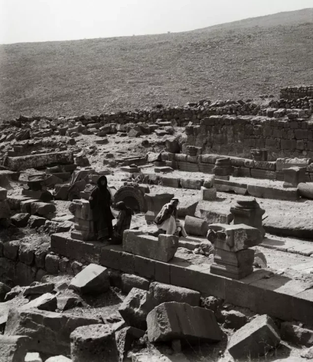
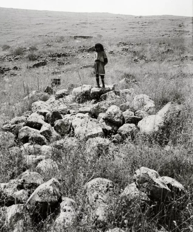
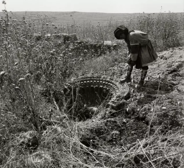
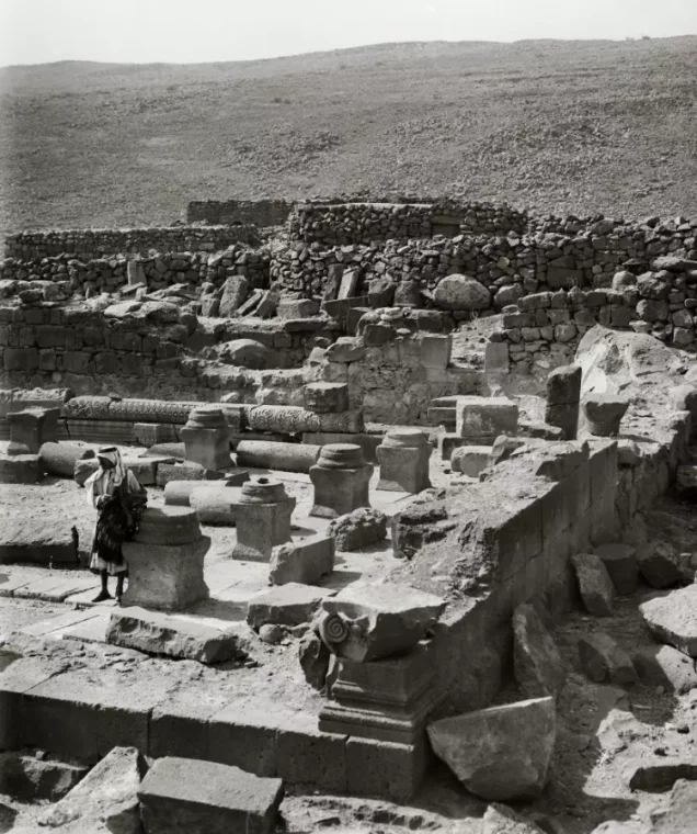
Archaeological excavations uncovered remains of ancient Khorazin and its synagogue, while a field of dolmens was recorded east and southeast of the Palestinian village site.
Some Palestinian local sources connect the Arabic name Karraza etymologically with ancient Khorazin. Khalidi, however, limits his statement to the hamlet's proximity to the ancient site and does not establish a definitive linguistic derivation. The etymological link should therefore remain qualified.
Operation Yiftach
Operation Yiftach began on 15 April 1948 and continued until 25 May. Its objective was the military conquest of eastern Galilee before the end of the British Mandate.
The Palmach's First Battalion spearheaded the broader operation, during which Palmach forces attacked numerous Palestinian villages and Bedouin communities in eastern Galilee.
Operation Matateh (“Broom”)
On 4 May 1948, Haganah and Palmach forces carried out a subsidiary operation known as Operation Matateh, or “Broom,” within the wider framework of Operation Yiftach.
The operation targeted the region between the Hula basin, Lake Tiberias, and the Jordan River. Operational orders cited in the sources called for attacks on communities including the Zanghariyya, 'Arab al-Shamalina, and al-Tabigha, the removal of their inhabitants, and the destruction of houses.
Khirbat Karraza lay geographically and socially within this zone, and Palestinian sources associate its depopulation with the same operation.
Occupation and Depopulation
Palestinian sources differ by one day over the occupation date. Palestine Remembered and a Palestinian village-history encyclopedia give 4 May 1948, while the Palestine Land Society's Register of Depopulated Localities gives 3 May.
Because Operation Matateh itself is documented as having been executed on 4 May, this article uses 4 May as the more likely date while preserving 3 May as a documented alternative.
Khalidi's village-specific account does not provide a detailed description of the troops' entry into Khirbat Karraza or the exact circumstances in which every resident departed. A separate battle or detailed sequence should therefore not be invented.
Military Unit
Palestine Remembered attributes Khirbat Karraza's occupation to the Palmach's First Battalion. The First Battalion did indeed spearhead Operation Yiftach as a whole.
However, Khalidi's Khirbat Karraza entry does not independently identify the battalion that entered the hamlet. The First Battalion attribution is therefore retained as a source-specific identification rather than treated as independently established village-level fact.
Cause of Depopulation
Khirbat Karraza was depopulated in the context of a military operation intended to clear Palestinian inhabitants from the area east of Safad and north of Lake Tiberias.
Accounts of Operation Matateh state that residents of targeted villages and encampments fled or were expelled as Palmach forces advanced and that houses were subsequently demolished.
For Khirbat Karraza itself, however, no separate detailed account establishes whether all residents left immediately before the troops arrived or were expelled after their entry. The most accurate formulation is therefore that the hamlet was depopulated through the military offensive and the broader forced clearing of the region.
Destruction
Palestine Remembered's statistics field describes Khirbat Karraza as completely destroyed except for the shrine of Shaykh Ramadan.
The detailed field account reproduced from Walid Khalidi contradicts that simplified classification: it records that some village houses remained standing, that ruins of additional houses survived, and that one old house had been renovated.
The more precise conclusion is therefore that Khirbat Karraza suffered extensive destruction, but not every village structure disappeared.
Ethnic Cleansing in Source Classification
Palestine Remembered uses the classification “complete ethnic cleansing” for Khirbat Karraza. This article retains the phrase only as an attributed source classification.
The directly documented facts are that the Palestinian community ceased to reside at the site during the May 1948 military operations, that the locality lay within an area targeted for population removal and demolition, and that its original residents did not resume permanent residence there after the Nakba.
Occupation Chronology
| Date | Event |
|---|---|
| 15 April 1948 | Operation Yiftach begins in eastern Galilee. |
| 22 April 1948 | The Yiftach command recommends the removal of Bedouin communities between the Jordan River, Jubb Yusuf, and Lake Tiberias. |
| 3 May 1948 | Date given for Khirbat Karraza in the Palestine Land Society register. |
| 4 May 1948 | Operation Matateh (“Broom”) is carried out; this is the occupation date used by Palestine Remembered and Palestinian village documentation for Khirbat Karraza. |
| 4–5 May 1948 | Communities in the operational zone are emptied and houses demolished; a complete independent sequence for Khirbat Karraza itself is not available. |
| After depopulation | The hamlet suffers extensive destruction, although later fieldwork documents surviving houses and the tomb of Shaykh Ramadan. |
Israeli Settlements on Khirbat Karraza's Lands
According to Walid Khalidi and PalQuest, the settlements of Khorazin and Amnon were not established on the lands of Khirbat Karraza itself.
Both were built near the site in 1983, but on lands belonging to the depopulated village of al-Samakiyya in the Tiberias Subdistrict, approximately 3.5 kilometers to the south.
They should therefore not be listed as settlements established on Khirbat Karraza's lands merely because of their geographical proximity.
Khirbat Karraza Today
According to the fieldwork used by Walid Khalidi before the publication of All That Remains in 1992, the Khirbat Karraza site had become an archaeological and tourist area.
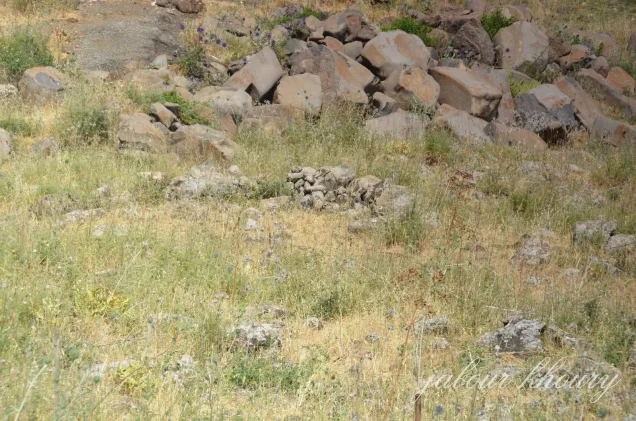
Some village houses were still standing, together with ruins of other houses, and one old house had been renovated.
The tomb of Shaykh Ramadan also remained. The shrine building that had surrounded it had disappeared, while the tomb itself was deteriorating and surrounded by large carob trees.
This description derives from fieldwork conducted before the 1992 publication of All That Remains. It should therefore be treated as documented historical field evidence rather than a comprehensive direct survey of the site's condition in 2026.
Sources
- PalQuest – Interactive Encyclopedia of the Palestine Question: Khirbat Karraza
- PalQuest – Methodology and the inclusion of Khirbat Karraza
- PalQuest – Operation Yiftach
- PalQuest – al-Zanghariyya and Operation Matateh
- PalQuest – 'Arab al-Shamalina and Operation Matateh
- Palestine Remembered – Khirbat Karraza, Safad Subdistrict
- Palestine Remembered – Khirbat Karraza entry from Walid Khalidi's All That Remains
- Palestinian Villages Encyclopedia – Khirbat Karraza / Zanghariyya
- Palestine Land Society – Register of Depopulated Localities in Palestine
- Palestine Land Society – Atlas of Palestine 1917–1966
Photo gallery
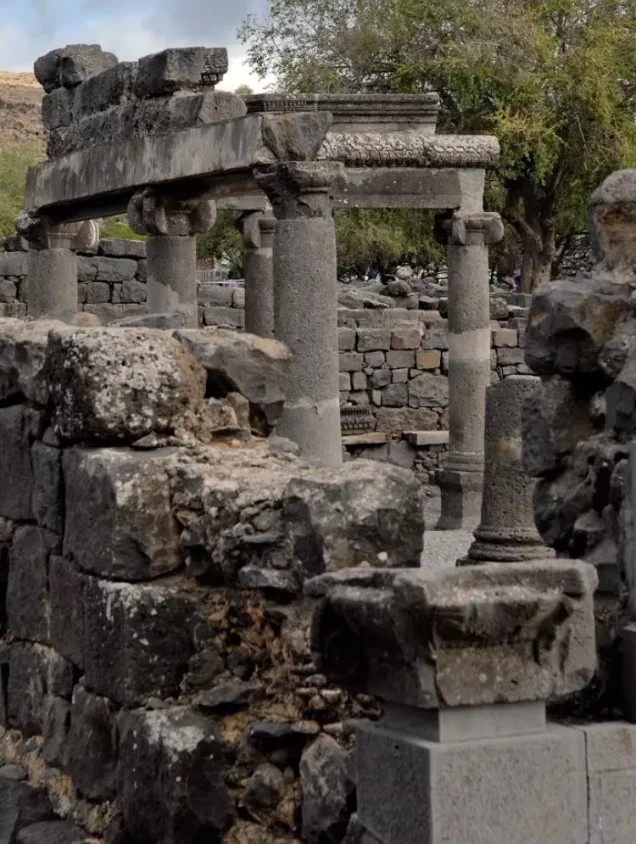
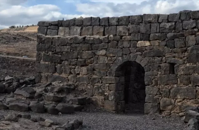

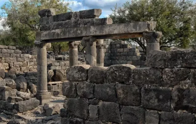
Photos from the village's people
Photos sent in by visitors and published after review.
Add a photo of this village
Log in to add photos of this village.
Other villages from Safed


More from the archive


 Download Our Palestine App
The whole archive in the palm of your hand: depopulated villages, the Nakba, the massacres and Al-Aqsa — free, with no ads to erase the story.
Download Our Palestine App
The whole archive in the palm of your hand: depopulated villages, the Nakba, the massacres and Al-Aqsa — free, with no ads to erase the story.



Comments
No comments yet — be the first to write one.
Add your comment
Name and email are optional. Comments appear after review.