
The depopulated village of Al-Salihiyya / District of Safed
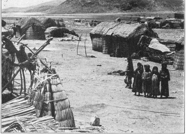
Al-Salihiyya
About the depopulated village of Al-Salihiyya
- District
- Safed
- Date Al-Salihiyya was occupied
- 25 May 1948
- Population in 1948
- 1,763
- Military operation
- Operation Yiftach
- Brigade that carried it out
- Not identified in the sources; Operation Yiftach was carried out by the Palmach's Yiftach Brigade, spearheaded by its First Battalion
- Distance from the governorate centre
- 25 km northeast of Safad
- Elevation above sea level
- 75 m
- Cause of displacement
- The fall of the village to Israeli occupation forces in the course of Operation Yiftach; Khalidi (PalQuest) does not state whether the inhabitants fled under direct attack or because of the psychological warfare that accompanied the operation in eastern Galilee
- Extent of destruction
- The village has been completely destroyed.
- Ethnic cleansing
- al-Salihiyya inhabitants were completely ethnically cleansed.
- Settlements built on the built-up area of Al-Salihiyya after 1948
- No Israeli settlements on village lands, according to Khalidi (PalQuest); Kefar Blum, founded in 1943, lies just northwest of the site on lands that traditionally belonged to the village of Qaytiyya
Hover a dot to read the village name, or click to open its card.
Borders of the depopulated village of Al-Salihiyya
al-Salihiyya: A Depopulated Palestinian Village in the Safad District
al-Salihiyya was a Palestinian village in the Safad District, situated on flat terrain in the al-Hula Plain approximately 25 kilometres northeast of Safad, at an average elevation of about 75 metres above sea level. Its population reached 1,520 in the 1944/1945 statistics. The village fell on 25 May 1948 during the final day of Operation Yiftach. Its inhabitants were displaced and the village was completely destroyed during the Nakba and the occupation of Palestine in 1948.
- Subdistrict
- Safad
- Distance from district center
- 25 km northeast of Safad
- Average Elevation
- 75 m above sea level
- Population in 1931
- 1,281
- Number of Houses in 1931
- 257
- Population in 1944/1945
- 1,520
- Estimated Population in 1948
- About 1,763 – a later demographic estimate, not an official census
- Total Land Area in 1945
- 5,607 dunams
- Attack and Depopulation
- The village fell to Israeli occupation forces on 25 May 1948 in the course of Operation Yiftach, on the day the operation ended. Khalidi (PalQuest) gives no details of the attack on the village or of how its inhabitants were displaced.
- Final Israeli Control
- 25 May 1948, the final day of Operation Yiftach
- Military Operation
- Operation Yiftach
- Military Unit
- The sources do not identify the unit that entered the village; Operation Yiftach was carried out by the Palmach (Yiftach Brigade), with its First Battalion as the spearhead, according to PalQuest
- Cause of Depopulation
- The fall of the village to Israeli occupation forces in the course of Operation Yiftach; Khalidi (PalQuest) does not state whether the inhabitants fled under direct attack or because of the psychological warfare that accompanied the operation in eastern Galilee
- Settlements Documented on Village Lands
- No Israeli settlements on village lands, according to Khalidi (PalQuest); Kefar Blum, founded in 1943, lies just northwest of the site on lands that traditionally belonged to the village of Qaytiyya
Location
al-Salihiyya stood on flat terrain in the al-Hula Plain, approximately 25 kilometres northeast of Safad and at an average elevation of about 75 metres above sea level.
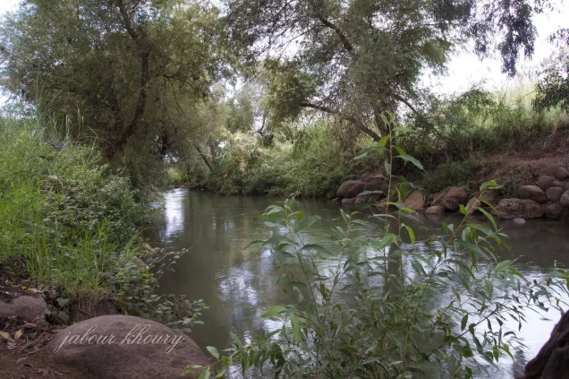
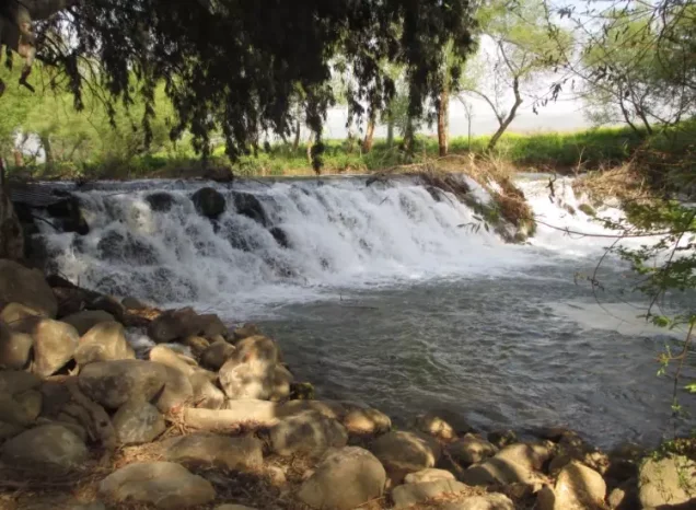
It was located near the intersection of the Jordan River and Wadi Tur'an, which flowed toward Lake al-Hula approximately 4 kilometres south of the village.
A network of secondary roads connected al-Salihiyya with neighbouring Palestinian villages, and the village houses clustered around these routes.
Neighbouring Villages and Areas
Historical maps and local geographical documentation place a number of Palestinian villages around al-Salihiyya.
- Qaytiyya to the north.
- al-Dawwara to the northeast.
- al-Muftakhira to the east.
- Khiyam al-Walid approximately to the southeast.
- Lake al-Hula and the al-Hula Plain to the south.
- al-Zawiya to the southwest.
- al-Na'ima to the west.
These directions describe the relative locations of neighbouring communities and should not be treated as precise cadastral boundaries without reference to official land-demarcation maps.
al-Salihiyya in the Late Ottoman Period
Travellers and surveyors who visited al-Salihiyya in the late nineteenth century described it as an adobe-built village situated on cultivable land in a plain near marshes and waterways.
The Survey of Western Palestine estimated approximately 90 inhabitants in 1881.
A small marketplace stood at the centre of the village, while houses clustered around the local road network.
Architecture and Public Facilities
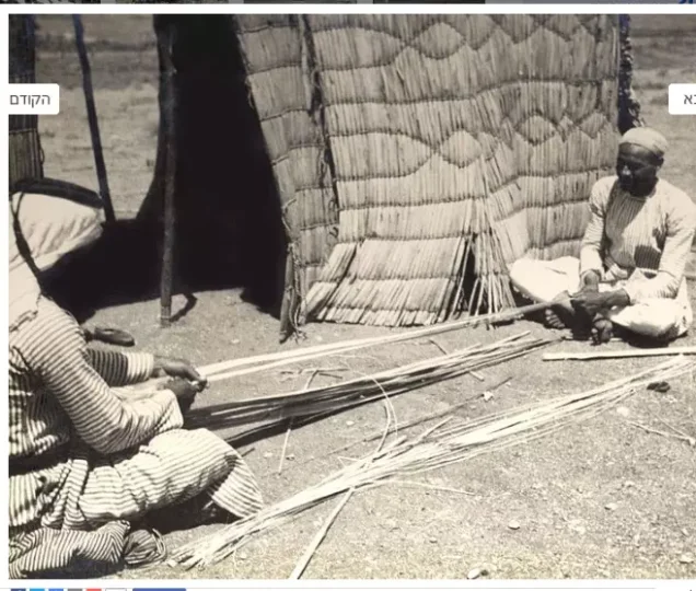
The houses of al-Salihiyya were originally constructed primarily of adobe, reflecting the building traditions of the al-Hula Plain.
The village contained a small marketplace, a mosque, and an elementary school for boys.
The 1944/1945 statistics recorded a built-up area of 119 dunams within the statistical unit: 94 Arab-owned dunams and 25 Jewish-owned dunams.
Population
The 1931 census recorded 1,281 inhabitants in al-Salihiyya living in 257 houses.
The detailed census recorded 1,279 Muslims and two Christians.
According to the 1944/1945 statistics, the village population reached 1,520.
The figure of approximately 1,763 inhabitants in 1948 is a later demographic estimate rather than an official British Mandate census figure.
Palestine Remembered estimates the number of refugees and their descendants at approximately 10,828 in 1998.
Population of al-Salihiyya
- Late nineteenth centuryAbout 90Survey of Western Palestine estimate
- 19311,2811,279 Muslims and two Christians; 257 houses
- 1944/19451,520Government of Palestine statistics
- 1948About 1,763Later estimate
- 199810,828Estimate of refugees and their descendants
Number of Houses
The 1931 census recorded 257 houses in al-Salihiyya.
The figure of approximately 353 houses in 1948 is a later estimate rather than an official census count.
Education
al-Salihiyya had an elementary school for boys.
Local Palestinian documentation states that the Mandate authorities opened the school during the 1942/1943 academic year and that its highest grade was the fourth elementary grade.
Walid Khalidi's principal village entry does not specify the school's opening year, and 1942/1943 is therefore presented here as a detail from local Palestinian documentation.
Economic Life
Agriculture formed the main basis of al-Salihiyya's economy, benefiting from the fertile land and abundant water of the al-Hula Plain.
The inhabitants cultivated cereals extensively, while vegetables and fruit were grown particularly in the eastern and northern portions of the village lands.
Livestock and animal products provided additional income, together with limited commercial and craft activities.
Land Ownership
According to the 1944/1945 statistics, al-Salihiyya had a total land area of 5,607 dunams.
Arab ownership amounted to 4,528 dunams, Jewish ownership to 789 dunams, while 290 dunams were classified as public land.
Land Ownership in al-Salihiyya in 1944/1945
- Arab ownership4,528 dunums81%
- Jewish ownership789 dunums14%
- Public land290 dunums5%
Land Use
According to the 1944/1945 statistics, cereal cultivation covered 4,994 dunams: 4,230 Arab-owned dunams and 764 Jewish-owned dunams.
A further 23 Arab-owned dunams were irrigated or used for plantations.
The built-up area covered 119 dunams: 94 Arab-owned and 25 Jewish-owned.
Uncultivable land covered 471 dunams: 181 Arab-owned dunams and 290 dunams of public land.
Land Use in al-Salihiyya in 1944/1945, in Dunams
- Arab
- Jewish
- Public
- Irrigated and plantation land23 dunums
- Cereals4,994 dunums
- Built-up area119 dunums
- Uncultivable land471 dunums
Operation Yiftach
Operation Yiftach was conducted from 15 April to 25 May 1948 in eastern Galilee and the al-Hula region.
It was carried out by Palmach forces reorganized within the Yiftach Brigade, with the Palmach's First Battalion serving as the spearhead of the operation.
The operation sought to establish Zionist control over eastern Galilee, Safad, and the al-Hula region and affected dozens of Palestinian villages, including al-Salihiyya.
Military assaults were accompanied by psychological warfare.
One of the most significant measures was a so-called “whispering” or rumour campaign conducted between 10 and 15 May, which sought to frighten Palestinian inhabitants of eastern Galilee and the al-Hula villages into leaving.
Details originating in Israeli accounts are cited here only as transmitted through PalQuest, a Palestinian intermediary source, and not through direct reliance on the original Israeli material.
The Occupation and Depopulation of al-Salihiyya
al-Salihiyya fell on 25 May 1948, the final day of Operation Yiftach.
The date 1 May 1948 that appears in some cards or compilations does not apply to al-Salihiyya and most likely reflects confusion with nearby al-Hula villages that were attacked or depopulated during the first days of May.
Palestine Remembered attributes the direct action at al-Salihiyya to the Palmach's First Battalion.
PalQuest confirms that al-Salihiyya was affected by Operation Yiftach and identifies the First Battalion as the operation's spearhead, but its village-specific entry does not independently identify the battalion that directly entered al-Salihiyya.
The most precise formulation is therefore that al-Salihiyya was occupied during Operation Yiftach, with the Palmach First Battalion identified by Palestine Remembered as the attacking unit.
The psychological warfare conducted in the al-Hula region, together with direct military advances, contributed to the depopulation of Palestinian communities across the area.
By the end of the operation, al-Salihiyya had been emptied of its Palestinian inhabitants, and the village was subsequently completely destroyed.
Occupation and Depopulation Chronology
- 15 April 1948
Beginning of the military operation
Operation Yiftach, launched by the Palmach under Yigal Allon to seize eastern Galilee before the end of the British Mandate on 15 May 1948, began; PalQuest lists al-Salihiyya among the villages it affected.
- 25 May 1948
Final occupation
Al-Salihiyya fell in the course of Operation Yiftach, on the day the operation ended, according to Khalidi (PalQuest). The available sources do not name the unit that entered the village or say when its inhabitants left.
Israeli Settlements and al-Salihiyya's Lands
Shamir
Shamir was not established on al-Salihiyya's lands. It was founded in 1944 on lands belonging to the neighbouring Palestinian village of al-Muftakhira.
Kefar Blum
According to Walid Khalidi and the village-specific PalQuest entry, no Israeli settlement was established directly on al-Salihiyya's lands.
Kefar Blum, founded in 1943, lies immediately northwest of the village site and is identified by the village-specific account as standing on lands traditionally belonging to Qaytiyya.
A broader Palestine Remembered settlement index also associates Kefar Blum with al-Salihiyya and al-Na'ima. In the absence of a detailed cadastral reconciliation of this discrepancy, this article follows the village-specific Walid Khalidi and PalQuest account while noting the differing broader index.
al-Salihiyya After the Nakba
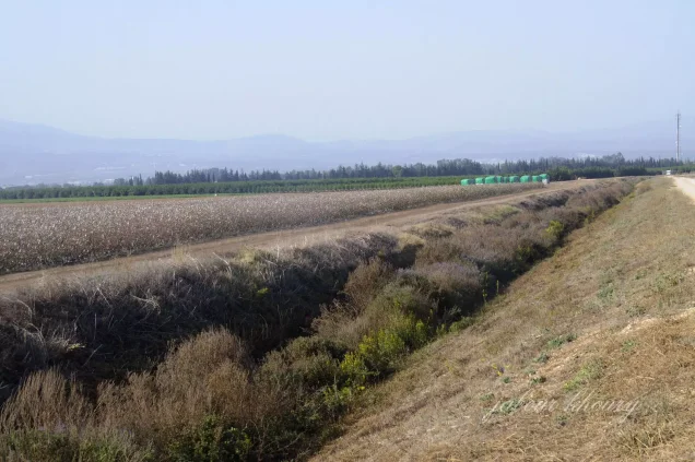
According to the field documentation relied upon by Walid Khalidi, al-Salihiyya was completely obliterated and no visible trace of the village remained.
The surrounding lands were cultivated, particularly by residents of nearby Kefar Blum.
Khalidi's description reflects the condition of the site during his field documentation and should not necessarily be treated as a comprehensive survey updated to 2026.
Sources
- PalQuest – Interactive Encyclopedia of the Palestine Question: al-Salihiyya.
- PalQuest: الصالحية.
- PalQuest: Operation Yiftach.
- PalQuest: al-Muftakhira, for the location of Shamir.
- Palestine Remembered: al-Salihiyya, Safad District.
- Walid Khalidi, All That Remains: al-Salihiyya, as reproduced by Palestine Remembered.
- Palestinian Villages Encyclopedia: al-Salihiyya – local documentation on education and social history.
- Walid Khalidi, All That Remains, entry on al-Salihiyya.
- Government of Palestine, Census of Palestine, 1931.
- Government of Palestine, Department of Statistics, Village Statistics, 1945.
Photo gallery

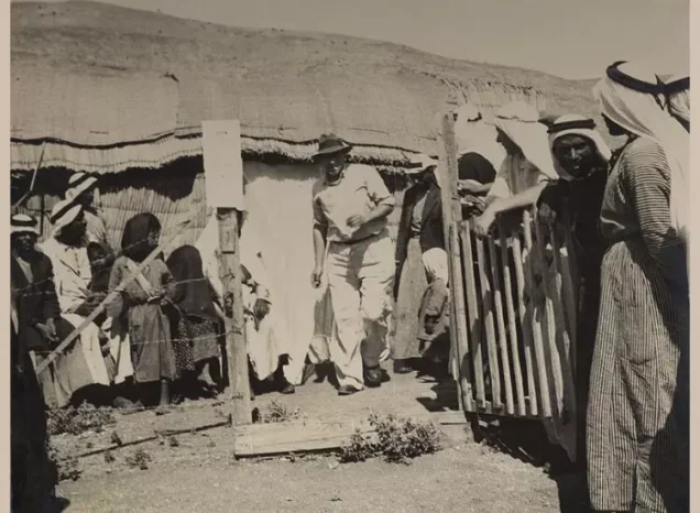

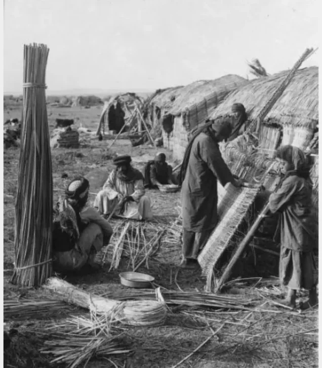
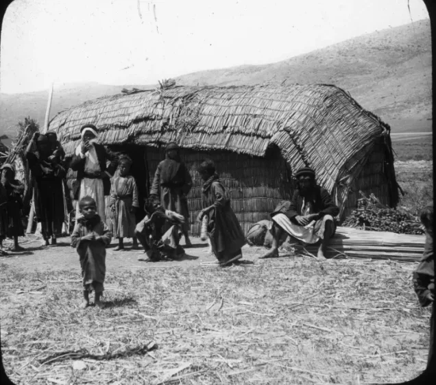

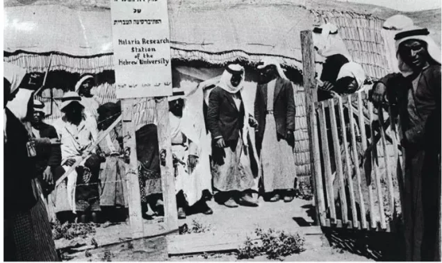


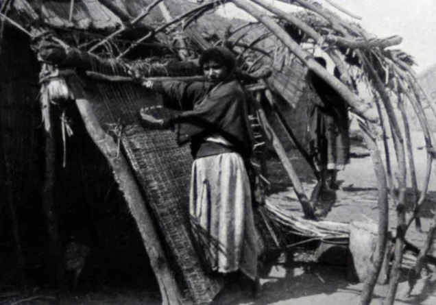



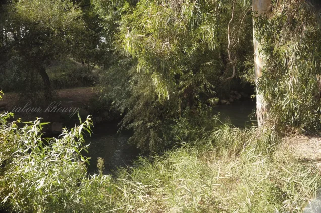
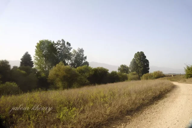
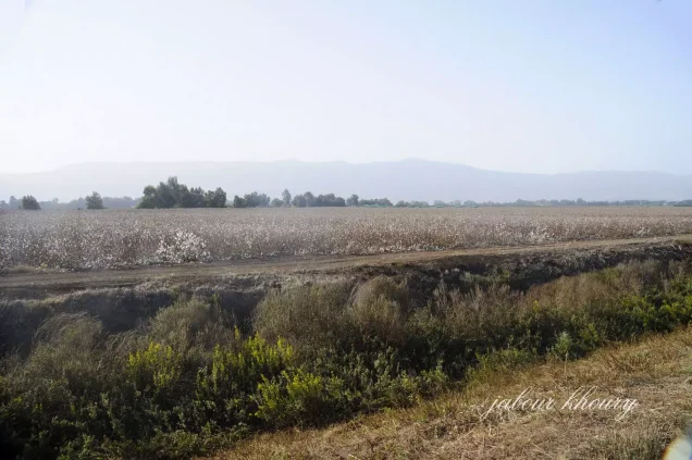

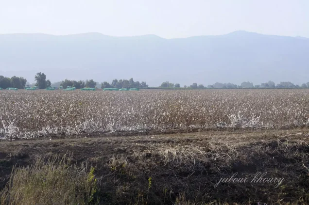


Photos from the village's people
Photos sent in by visitors and published after review.
Add a photo of this village
Log in to add photos of this village.
Other villages from Safed


More from the archive



 Download Our Palestine App
The whole archive in the palm of your hand: depopulated villages, the Nakba, the massacres and Al-Aqsa — free, with no ads to erase the story.
Download Our Palestine App
The whole archive in the palm of your hand: depopulated villages, the Nakba, the massacres and Al-Aqsa — free, with no ads to erase the story.



Comments
No comments yet — be the first to write one.
Add your comment
Name and email are optional. Comments appear after review.