
The depopulated village of Qaddita / District of Safed
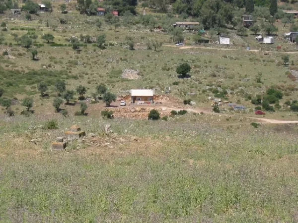
Qaddita
About the depopulated village of Qaddita
- District
- Safed
- Date Qaddita was occupied
- 11 May 1948
- Population in 1948
- 280
- Military operation
- Operation Yiftach
- Brigade that carried it out
- Palmach
- Distance from the governorate centre
- 5 (km) Northwest of Safad
- Elevation above sea level
- 750 m
- Cause of displacement
- Influence of fall of, or exoduce from, neighboring town
- Extent of destruction
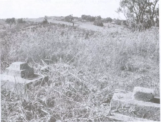
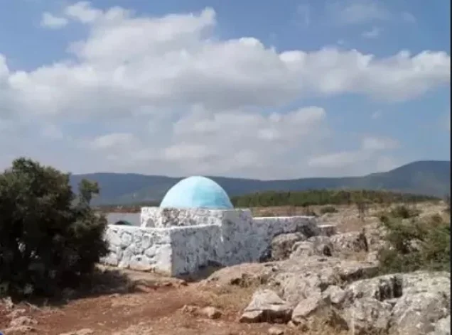
- The village has been mostly destroyed with the exception of the village cemetery and rubble from destroyed houses
- Ethnic cleansing
- Qaddita was mostly ethnically cleansed, some villagers were allowed to stay in 'Akbara (Safad).
Hover a dot to read the village name, or click to open its card.
Borders of the depopulated village of Qaddita
Qaddita – Depopulated Palestinian Village of Safad
Qaddita was a depopulated Palestinian village in the Safad Subdistrict of Upper Galilee. It stood on a hillside facing southeast, northwest of the city of Safad. PalQuest gives an average elevation of approximately 750 meters above sea level and a distance of 4.5 kilometers from Safad, although some Palestinian local compilations give a distance of approximately 7 kilometers.
The village lay among a cluster of Upper Galilee villages: Taytaba to the north, 'Ammuqa to the east, 'Ayn al-Zaytun to the south, Mirun to the southwest, Safsaf to the west, and al-Jish to the northwest. A secondary road connected Qaddita with the main road leading to Safad.
Basic Information
| Field | Information |
|---|---|
| Name | Qaddita |
| Arabic name | قَدِّيتا |
| Subdistrict | Safad |
| Region | Upper Galilee |
| Location relative to Safad | Northwest of Safad |
| Distance from Safad | Approximately 4.5 km according to PalQuest; some other Palestinian sources give about 7 km |
| Elevation | Approximately 750 m above sea level |
| Palestine Grid | 194/267 |
| Total land area | 2,441 dunums |
| Population in 1945 | 240 |
| Depopulation | The village was empty of its inhabitants by 11 May 1948 |
| Military context | Operation Yiftach |
| Military unit | Palmach forces operated in the area; the First Battalion spearheaded Operation Yiftach, but a direct First Battalion assault on Qaddita itself is not conclusively documented |
| Documented cause of depopulation | Impact of the fall of Safad; the sources do not establish a direct assault on Qaddita before its evacuation |
| Date of destruction | Not established with precision |
Name and Etymology
Walid Khalidi and Palestinian reference works suggest that Qaddita may be a corruption of the Syriac word Kaddisha, meaning “sacred.” Older Western sources also rendered the village name as Kadditha.
Location and Geography
Qaddita stood on an elevated slope in Upper Galilee and faced southeast. In the modern period its built-up area extended along a northwest–southeast axis that followed the contours of the hillside. Its stone houses were grouped closely together.
The village was surrounded by Taytaba to the north, 'Ammuqa to the east, 'Ayn al-Zaytun to the south, Mirun to the southwest, Safsaf to the west, and al-Jish to the northwest. A secondary road connected it with the main road to Safad.
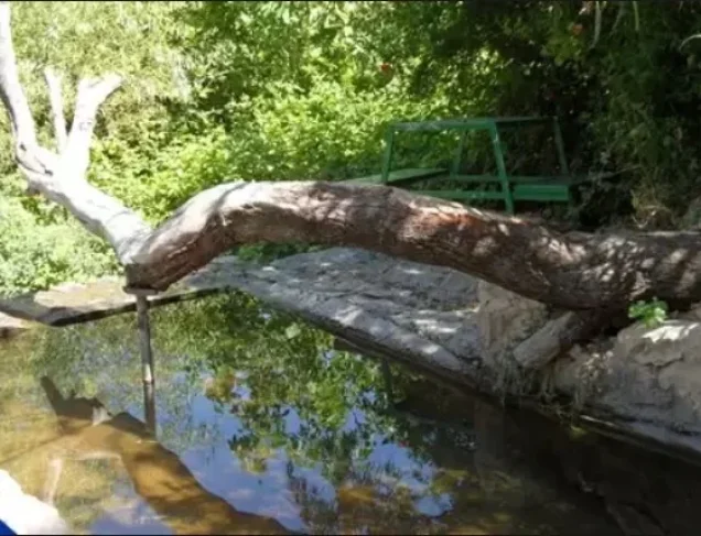
The nineteenth-century Survey of Western Palestine described Qaddita as a stone-and-mud village situated on a hillside amid fig gardens and also recorded a pool and a spring in its vicinity.
Qaddita in the Ottoman Period and the Nineteenth Century
In 1596 Qaddita belonged to the nahiya of Jira in the liwa' of Safad. Its population has been estimated at approximately 149 people from Ottoman tax records. The villagers paid taxes on wheat, barley, vineyards, goats, beehives, and other agricultural production. This figure is an estimate derived from a fiscal register rather than a modern population census.
Qaddita was badly affected by the Galilee earthquake of 1 January 1837. When Edward Robinson travelled through the area in the following year, he referred to the vineyards and fig trees surrounding the village and to the severe earthquake damage it had suffered.
In the 1870s the village was described as a small settlement of roughly ten houses or large household compounds. The Survey of Western Palestine in 1881 described Kadditha as a stone-and-mud village inhabited by about 200 Muslims, with fig gardens on the surrounding slope.
Population
- 1596Approx. 149Estimate derived from an Ottoman tax register, not a modern census
- Late nineteenth centuryApprox. 200Historical estimate recorded by the Survey of Western Palestine
- 1922110Official Government of Palestine census
- 1931170Official Government of Palestine census
- 1945240Official Mandate-period statistics
- 1948278Later estimate, not an official census
- 19981,710Later estimate of refugees and descendants, not an official census
The village population recorded during the British Mandate period was entirely Muslim.
Number of Houses
- 193132Recorded in the official 1931 census
- 194852Later estimate; not an official Mandate census figure
Land Ownership, 1944/45
- Palestinian2,440 dunums100%
- Transferred to Zionists0 dunums0%
- Public1 dunums<1%
The original official statistics used the categories Arab, Jewish, and Public. They recorded 2,440 dunums in the Arab category, no land in the Jewish category, and one dunum of public land. The categories total exactly 2,441 dunums.
Land Use, 1944/45
- Palestinian
- Public
- Cereals1,452 dunums
- Plantations and irrigable land150 dunums
- Built-up land31 dunums
- Non-cultivable land808 dunums
The land-use figures balance exactly: 1,452 + 150 + 31 + 808 = 2,441 dunums.
In the 1942/43 season, 77 dunums of village land were planted with olive trees. Because this figure relates to a different agricultural season and represents a crop-specific figure, it should not be added separately to the 1944/45 land-use total.
Economy and Agriculture
Qaddita's economy was based on agriculture and animal husbandry. Grain was among its principal crops, together with grapes, figs, pomegranates, and olives. Sixteenth-century fiscal records also refer to wheat, barley, vineyards, goats, and beehives.
In 1944/45, 1,452 dunums were devoted to cereals and another 150 dunums were classified as plantations or irrigable land, demonstrating the importance of agriculture to the village economy.
Water and Archaeological Remains
The Survey of Western Palestine recorded a pool and a spring near Qaddita. Rock-cut cisterns recorded around the village also indicate the use of water-storage installations.
Palestinian reference material identifies two nearby ruin sites. Khirbat Rubayyis, northwest of the village, contained remains of foundations and walls as well as pottery fragments. Khirbat al-Qayyuma contained building remains, a column, rock-cut cisterns, burials, and a press. These remains are not assigned here to a specific archaeological period because the sources consulted do not establish such a dating with sufficient certainty.
Education and Public Services
The principal sources consulted do not provide independent documentation of a school in Qaddita before the Nakba. A Palestinian reference compilation states that the village had no administrative or service buildings. Accordingly, no local school, enrolment figures, or teacher numbers can be established from the available documentation.
Occupation and Depopulation
Qaddita was depopulated in the context of Operation Yiftach, launched by Palmach forces in eastern Galilee between mid-April and 25 May 1948. The capture of Safad and its surrounding area formed a central stage of the operation.
According to the material cited by Walid Khalidi and PalQuest from Israeli military intelligence, several Galilee villages were evacuated directly after the fall of Safad, Qaddita among them. By 11 May 1948, the village had been emptied of its residents under the impact of Safad's fall.
The available historical account does not establish that Qaddita was subjected to a separate direct attack before it was emptied. Khalidi's account notes that it is unclear whether Haganah forces mounted a direct assault on Qaddita when they entered it. It is therefore important to distinguish between Qaddita's inclusion within the geographical and military scope of Operation Yiftach and proof that a specific unit captured it in a distinct village battle.
Palestine Remembered lists the Palmach's First Battalion as the attacking unit. The First Battalion did indeed spearhead Operation Yiftach as a whole. However, because Khalidi's village-specific narrative does not independently establish a direct First Battalion attack on Qaddita, this attribution should be treated cautiously rather than as a conclusive identification of the unit that entered the village.
Cause of Depopulation
The intelligence report cited in Khalidi's account attributes Qaddita's evacuation to the impact of the fall of Safad. The most cautious formulation is therefore that the village population left amid the military collapse around Safad and the pressure generated by Operation Yiftach, while the available sources do not conclusively document a direct assault on Qaddita before its evacuation.
A later stage of displacement is also documented. Khalidi reports that in 1949 some refugees from Qaddita were transported to 'Akbara, immediately south of Safad, where they endured extremely difficult living conditions for years.
Destruction
The historical source does not establish a precise date for Qaddita's destruction, nor does it establish that the houses were destroyed when forces entered the village in May 1948. Later fieldwork documented that most of the village's buildings had disappeared, leaving stone rubble and cemetery remains.
It is therefore more accurate to state that Qaddita was largely destroyed after its depopulation while leaving the exact date and process of demolition unresolved, rather than automatically assigning the destruction to 11 May 1948.
Ethnic Cleansing in Source Classification
Palestine Remembered classifies Qaddita using the term “ethnic cleansing.” The more specifically documented events are that the village was emptied in the context of Operation Yiftach and the fall of Safad, that some villagers were later removed or transferred to 'Akbara, that the village became largely destroyed, and that its original inhabitants were unable to return to their village.
Occupation Chronology
| Date | Event |
|---|---|
| 15 April 1948 | Operation Yiftach began in eastern Galilee. |
| 9 May 1948 | Units of the Palmach's First Battalion attacked 'Akbara as part of the pressure exerted on Safad. |
| 10–11 May 1948 | The final assault on Safad took place and the city fell during Operation Yiftach. |
| By 11 May 1948 | Qaddita had been emptied of its inhabitants under the impact of Safad's fall. The sources do not establish a separate direct assault on Qaddita before this. |
| After depopulation | Occupation forces entered the village, but the exact date and mechanism of the destruction of its houses are not conclusively documented. |
| 1949 | Some Qaddita refugees were transported to 'Akbara, according to the account cited by Walid Khalidi. |
Israeli Settlements on Qaddita's Lands
According to the fieldwork used by Walid Khalidi before the publication of All That Remains in 1992, there were no Israeli settlements on Qaddita's village lands. Sifsofa, to the northwest, had been established on the lands of Safsaf, while Dalton, to the northeast, had been established on the lands of Dallata.
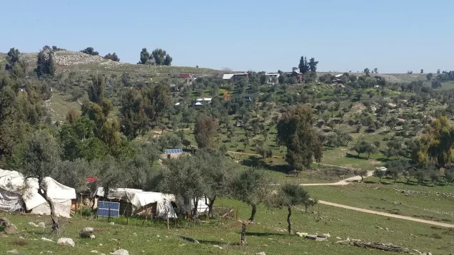
Later Palestinian community documentation published by Palestine Remembered in 2003, however, identifies houses belonging to an “unrecognized settlement” on Qaddita's lands. Khalidi's statement should therefore be understood in its historical timeframe rather than treated as a description of conditions in 2026; later documentation indicates that land use at the site subsequently changed.
Qaddita Today
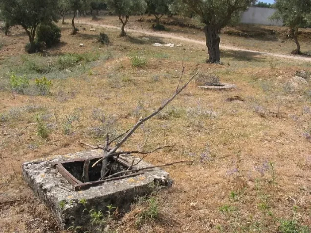
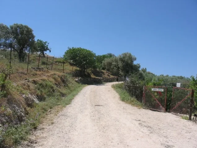
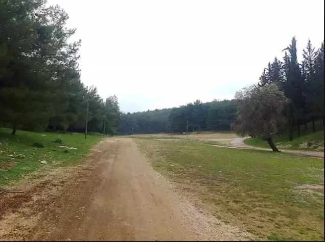
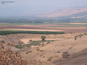
According to the field description published by Walid Khalidi, only several cemetery tombs and scattered stone rubble from destroyed houses remained at the village site. Thorns and wild vegetation covered the area, together with a number of neglected fig and olive trees, while nearby settlements had planted forests and fruit trees on portions of the surrounding land.
Later Palestinian community documentation from 2003 records remains of the cemetery, ruined houses, wells, and houses associated with an unrecognized settlement on parts of the village lands. This material constitutes later community documentation rather than a comprehensive archaeological or cadastral survey.
Khalidi's description derives from fieldwork conducted before the 1992 publication of All That Remains. It should therefore be understood as a documented historical description rather than a comprehensive, direct field verification of Qaddita's condition in 2026.
Sources
- PalQuest – Interactive Encyclopedia of the Palestine Question: Qaddita
- PalQuest – Operation Yiftach
- Palestine Remembered – Qaddita, Safad District
- Palestine Remembered – Qaddita entry from Walid Khalidi's All That Remains
- Palestinian Villages Encyclopedia – Qaddita and bibliography
- Survey of Western Palestine – Birzeit University Repository copy
Photo gallery
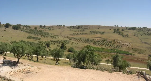

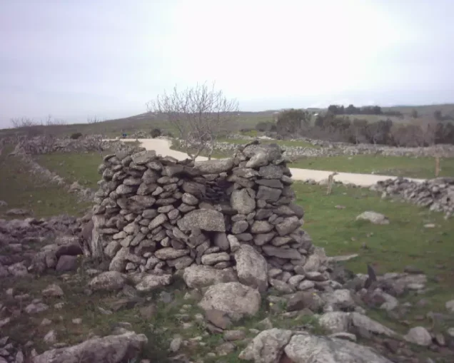
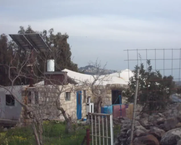

Photos from the village's people
Photos sent in by visitors and published after review.
Add a photo of this village
Log in to add photos of this village.
Other villages from Safed


More from the archive



 Download Our Palestine App
The whole archive in the palm of your hand: depopulated villages, the Nakba, the massacres and Al-Aqsa — free, with no ads to erase the story.
Download Our Palestine App
The whole archive in the palm of your hand: depopulated villages, the Nakba, the massacres and Al-Aqsa — free, with no ads to erase the story.



Comments
No comments yet — be the first to write one.
Add your comment
Name and email are optional. Comments appear after review.