
The depopulated village of Safsaf / District of Safed
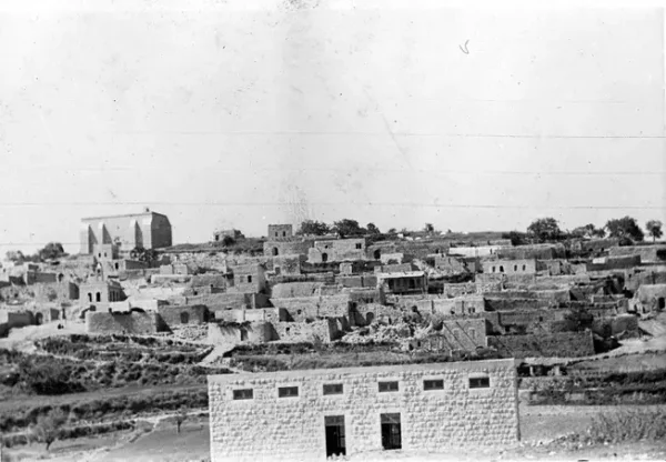
About the depopulated village of Safsaf
- District
- Safed
- Date Safsaf was occupied
- 29 October 1948
- Population in 1948
- 1,060
- Military operation
- Operation Hiram
- Who defended the village
- Local militia & Arab Liberation Army
- Distance from the governorate centre
- 7 (km) North West of Safad
- Elevation above sea level
- 750 m
- Cause of displacement
- Expulsion by Zionist troops
- Extent of destruction
- The village has been mostly destroyed with the exception of few houses (some are inhabited by Jewish settlers)
- Ethnic cleansing
- Safsaf inhabitants were completely ethnically cleansed.
- Settlements built on the built-up area of Safsaf after 1948
- Or HaGanuz
Hover a dot to read the village name, or click to open its card.
Borders of the depopulated village of Safsaf
Safsaf – Safad Subdistrict
Safsaf was a depopulated Palestinian village in the Safad subdistrict of Upper Galilee. It stood about 7 km northwest of the city of Safad at an average elevation of approximately 750 meters. Its lands covered 7,391 dunums, and its population reached 910 in the official 1944/45 statistics. Israeli occupation forces captured the village during Operation Hiram in late October 1948, and a documented massacre took place in the immediate aftermath of its occupation.
Location of Safsaf
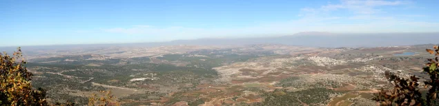
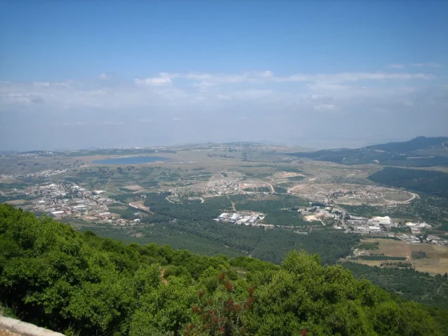
The village stood on a low hill that sloped slightly toward the southwest and was connected by a spur road to the highway leading to Safad. During the later Mandate period, Safsaf lay east of the Safad–Tarshiha highway, with the built-up village extending along a northeast–southwest axis.
Palestine Remembered identifies the lands of al-Jish, Mirun, Qaddita, and Bayt Jann as adjoining Safsaf's lands. Its surrounding-villages diagram also places Sa'sa' roughly to the northwest, al-Jish to the north, Taytaba to the northeast, Qaddita to the east, Mirun to the south, and Bayt Jann to the west. These directions are best treated as a description of the surrounding localities rather than a complete cadastral survey of every village boundary.
Name and Historical Background
The Arabic name Safsaf refers to the willow tree. Walid Khalidi records that the site was known as Safsofa during the Roman period.
In 1596, Safsaf was part of the nahiya of Jira in the liwa' of Safad, with an estimated population of about 138. The village paid taxes on wheat, barley, olives, fruit, goats, and beehives.
Late nineteenth-century travelers described Safsaf as a small village with approximately 100 inhabitants. The Survey of Western Palestine noted decorated stones, apparently originating in an earlier structure, reused in the entrance of the mosque. This observation should not be treated by itself as proof of a specific archaeological identification, but it indicates the presence of older architectural material at the site.
Population of Safsaf
- 1596138Estimate derived from an Ottoman tax register; not a modern census
- Late 19th centuryAbout 100Approximation recorded by travelers
- 1922521Official Census of Palestine
- 1931662Official Census of Palestine; the population was entirely Muslim
- 1944/45910Official Mandate-era village statistics
- 19481,056Later estimate published by Palestine Remembered; not an official census
- 19986,483 refugeesLater estimate of refugees and descendants; not a British Mandate statistic
Houses and Built Environment
The official 1931 census recorded 124 houses in Safsaf. The village center contained its mosque, several shops, and its school.
Palestine Remembered also cites local research by Mohammad Edghaim estimating that Safsaf had approximately 214 houses in 1947. This is not an official Government of Palestine figure and should therefore be kept distinct from the documented 1931 census total.
Land Ownership in Safsaf
Palestine Remembered presents the land-ownership figures using the following terminology, which is retained here to reflect the wording of that source:
- Palestinian5,344 dunums72%
- Transferred to Zionists0 dunums0%
- Communal/Public2,047 dunums28%
PalQuest presents the same underlying 1944/45 statistics under the official categories Arab and Public: 5,344 dunums were Arab-owned and 2,047 dunums were public land. No Jewish-owned area is recorded. The principal totals therefore agree across the two sources.
Land Use in 1944/45
- Arab
- Public
- Cereals2,586 dunums
- Plantations and irrigable land769 dunums
- Built-up area62 dunums
- Non-cultivable land3,974 dunums
A total of 3,355 dunums was classified as cultivable, while built-up and non-cultivable land together accounted for 4,036 dunums. Palestine Remembered separately lists 488 dunums of olive groves. This crop-specific figure should not be added again to the overall agricultural total when calculating the village's total area.
Economic Life in Safsaf
Agriculture was the foundation of the village economy. Part of the cultivated land depended on rainfall, while springs supplied water for irrigated farming. In 1944/45, 2,586 dunums were planted with cereals and 769 dunums were irrigated or used for orchards.
Olive trees and other fruit trees were cultivated, especially on land north of the village. Historical sources also mention figs and grapevines. The 1596 tax register records wheat, barley, olives, fruit, goats, and beehives among the village's agricultural and pastoral production.
Water
Springs were used to irrigate part of Safsaf's agricultural land, alongside rain-fed cultivation. An eyewitness account collected by Palestinian historian Nafez Nazzal also refers to the village spring in describing events surrounding the massacre. The principal sources reviewed here, however, do not provide a sufficiently documented list of the names and locations of all the village's springs or wells.
Education in Safsaf
Safsaf had an elementary school established during the British Mandate. Palestine Remembered describes it as a boys' school whose highest class reached the fourth grade.
The archival material indexed by Palestine Remembered includes records concerning teachers associated with Safsaf's school from the 1920s onward and correspondence with the Department of Education during the 1940s about teachers, registration, and classrooms. The reviewed core sources do not establish one definitive founding date for the school, so no unsupported date has been assigned to it here.
The Mosque and Religious Life
According to Walid Khalidi and PalQuest, Safsaf's inhabitants were all Muslims. A mosque stood in the village center beside several shops. The principal sources reviewed do not provide enough verified information to assign a construction date to the mosque.
Military Context before the Occupation
Walid Khalidi, citing Palestinian historian Aref al-Aref, states that during the early months of the 1948 war Safsaf served as headquarters of the Arab Liberation Army's Second Yarmuk Battalion, commanded by Adib al-Shishakli, who later became president of Syria.
During the final assault, local militiamen and Arab Liberation Army volunteers were present in and around the village. Eyewitness accounts state that the defenders were surprised by an attack from three directions and eventually withdrew with ALA volunteers toward Lebanon, while many civilians remained behind.
Occupation and Depopulation of Safsaf
Operation Hiram began on 28 October 1948 and continued through 31 October. It was a large-scale Israeli offensive aimed at occupying the remaining areas of Upper Galilee outside Israeli control. Khalidi describes Safsaf as the first village occupied during the operation.
The village was attacked by a force from the Sheva' or Seventh Brigade consisting of two platoons of armored cars and an armored or tank company. Safsaf fell shortly before dawn on 29 October 1948 after a brief battle.
The capture of the village did not immediately mean the departure of every inhabitant. According to testimonies collected by Nafez Nazzal and reproduced by Khalidi, a substantial number of villagers remained after the Israeli occupation forces entered. In the following days some residents were told that they could remain, but villagers gradually left at night in small groups until Safsaf was empty.
Occupation Chronology
- 28 October 1948
Beginning of Operation Hiram
The large-scale Israeli offensive in Upper Galilee began.
- Before dawn, 29 October 1948
Assault and occupation
A force from the Sheva' / Seventh Brigade, including two platoons of armored cars and an armored company, attacked Safsaf and captured it after a brief battle.
- 30 October 1948 according to PalQuest's Operation Hiram chronology
Safsaf massacre
Mass killings and assaults against civilians occurred after the village came under Israeli control. Sources differ over the number of victims and some details.
- Following days
Departure and depopulation of remaining residents
Some villagers remained briefly after the occupation, but residents gradually left under cover of darkness until the village was empty.
- Later; exact date not established by the core sources
Destruction of most of the village
Most houses were destroyed, although a small number of buildings survived.
The Safsaf Massacre
Safsaf was the site of one of the documented massacres that occurred in Galilee during the closing days of October 1948. The surviving records and testimonies do not provide a single uncontested death toll, so the differing accounts should be presented rather than merged into one supposedly definitive number.
Walid Khalidi relays an Israeli report concerning the events at Safsaf that records 52 men being bound and killed, together with additional killings and reported sexual assaults, including the rape of a fourteen-year-old girl.
An eyewitness from Safsaf interviewed by Palestinian historian Nafez Nazzal gave a different figure, stating that about seventy men were blindfolded and shot. His testimony also described four girls being taken into empty houses and sexually assaulted. Palestine Remembered's village summary gives an approximate overall figure of around 65 victims.
Because these accounts differ, the available evidence does not justify presenting one exact number as the definitive death toll of the Safsaf massacre. What is firmly established in the sources reviewed by Khalidi and Nazzal is that mass killings and assaults on civilians took place after the village had come under Israeli control.
Displacement and Refugees
Many of Safsaf's displaced residents fled toward Lebanon, while others eventually reached Syria and other locations. Palestine Remembered estimates that the village's refugee population and descendants numbered 6,483 in 1998. This is a later estimate and not a British Mandate census figure.
Israeli Settlements on Safsaf Village Lands
In 1949 Israel established the settlement of ha-Shahar on Safsaf's lands; it was later renamed Sifsofa. A second settlement, Bar Yochay, was established on village land in 1979.
According to Khalidi, both settlements are very close to the original village site, if not partly situated directly on it.
Safsaf Today
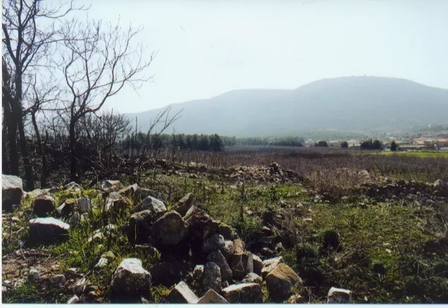
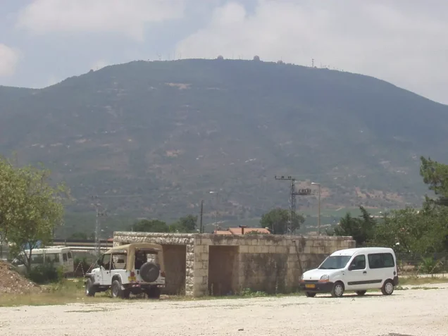
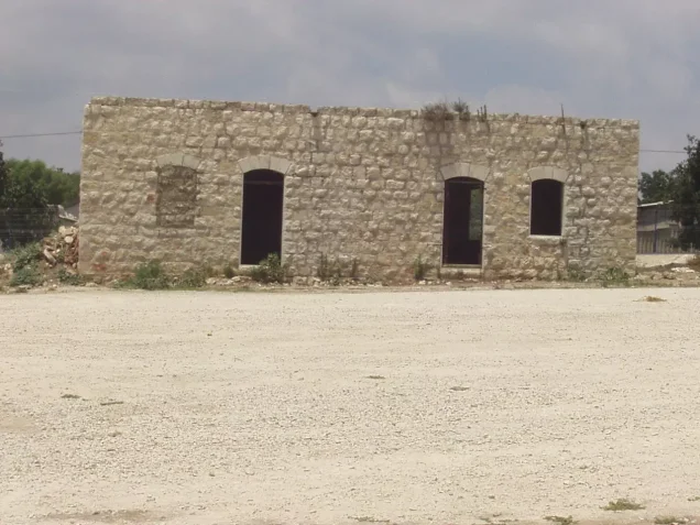
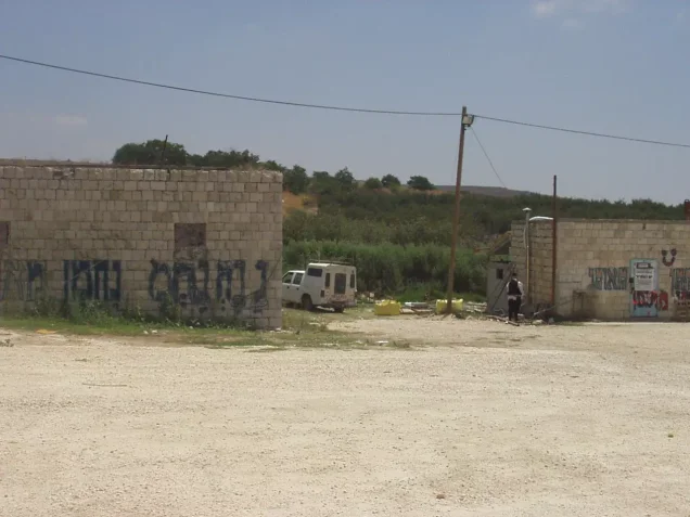
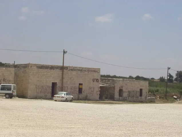
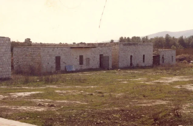
Walid Khalidi described the village site as overgrown with grass and scattered trees, with a few terraces and piles of stone from destroyed houses still visible. A limited number of houses remained standing and some were inhabited, while parts of the surrounding land were cultivated by the nearby settlements and other areas had been forested.
This description is based on fieldwork undertaken before the publication of All That Remains in 1992 and therefore should not be treated as a direct field verification of conditions at Safsaf in 2026.
Palestine Remembered also hosts later community documentation of the site, including material labeled with dates or captions referring to 1999, 2002, and February 2022. Such material can help trace later changes at the site, but it is community documentation rather than an independent and comprehensive contemporary field survey.
Sources
- PalQuestPalQuest – Safsaf
- PalQuestPalQuest – Operation Hiram
- Palestine RememberedPalestine Remembered – Safsaf, Safad District
- Palestine RememberedPalestine Remembered – Safsaf entry from Walid Khalidi's All That Remains
- Institute for Palestine StudiesInstitute for Palestine Studies – Walid Khalidi, All That Remains
- Institute for Palestine StudiesPalQuest – Methodology and bibliography of All That Remains, including Nafez Nazzal and Aref al-Aref
Photo gallery
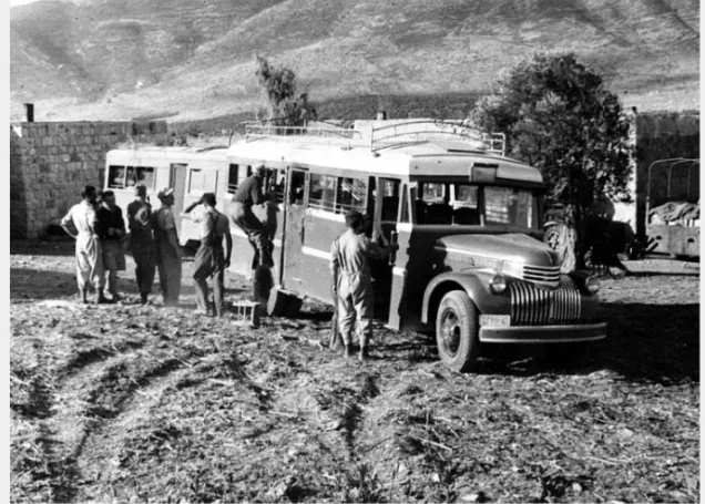
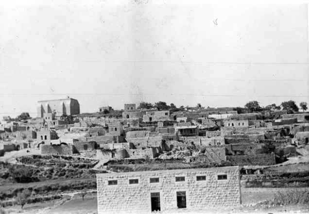
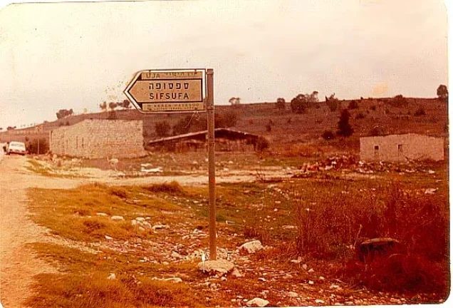
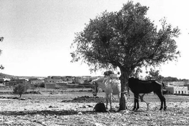
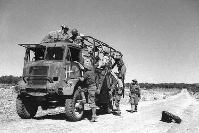
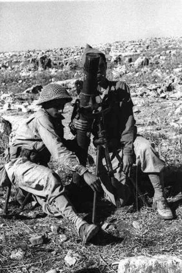

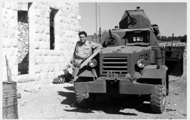
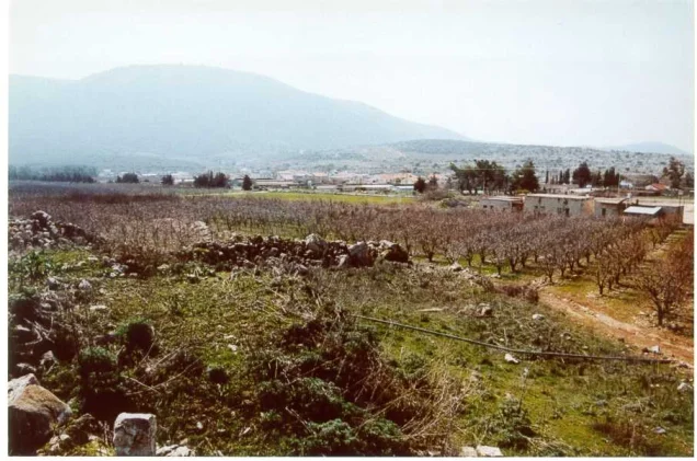


Photos from the village's people
Photos sent in by visitors and published after review.
Add a photo of this village
Log in to add photos of this village.
Other villages from Safed
More from the archive



 Download Our Palestine App
The whole archive in the palm of your hand: depopulated villages, the Nakba, the massacres and Al-Aqsa — free, with no ads to erase the story.
Download Our Palestine App
The whole archive in the palm of your hand: depopulated villages, the Nakba, the massacres and Al-Aqsa — free, with no ads to erase the story.



Comments
No comments yet — be the first to write one.
Add your comment
Name and email are optional. Comments appear after review.