
The depopulated village of Al-Butayha / District of Safed
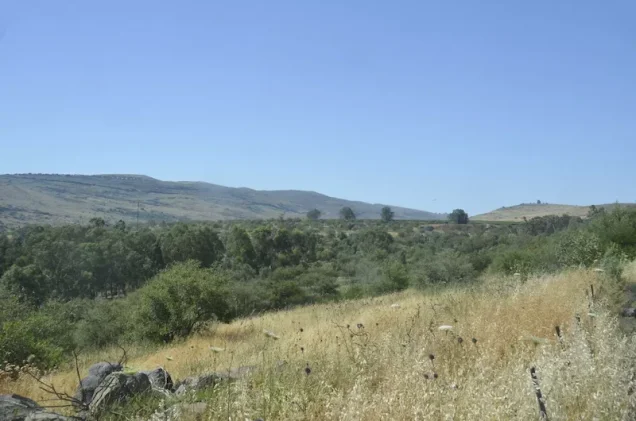
Al-Butayha
About the depopulated village of Al-Butayha
- District
- Safed
- Date Al-Butayha was occupied
- 04 May 1948
- Population in 1948
- 754
- Military operation
- Operation Yiftach
- Brigade that carried it out
- Palmach
- Who defended the village
- Local militia & Arab Liberation Army
- Distance from the governorate centre
- 13 (km) South East of Safad
- Elevation above sea level
- -200 m
- Cause of displacement
- Expulsion by Zionist troops
- Extent of destruction
- The village has been completely destroyed, and only house walls and rubble left behind.
- Ethnic cleansing
- al-Butayha inhabitants were completely ethnically cleansed.
- Refugees' migration routes
- Refugees were mostly forced into Syria.
Hover a dot to read the village name, or click to open its card.
Al-Butayha – Depopulated Palestinian Village of the Safad Subdistrict
Al-Butayha was a Palestinian village in the Safad Subdistrict, situated in a hilly area close to the Syrian frontier, approximately 13 km southeast of Safad and about 200 metres below sea level.
The village lay roughly 0.25 km east of the Jordan River and approximately 2 km north of Lake Tiberias. Its inhabitants were displaced in the context of Operation Matate, or “Broom,” on 4 May 1948, a sub-operation of the wider Operation Yiftach in eastern Galilee.
Name of Al-Butayha
The Arabic name al-Butayha refers to low-lying marshy or waterlogged land, a description consistent with the village's location near the Jordan River and Lake Tiberias.
The Arab geographer al-Qalqashandi mentioned al-Butayha in 1459 as a locality in the Safad district. During the British Mandate, modern al-Butayha was classified as a hamlet or farm in the Palestine Index Gazetteer.
Location
Al-Butayha stood approximately 13 km southeast of Safad in a hilly area close to the Syrian frontier, at an average elevation of about 200 metres below sea level.
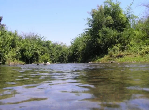
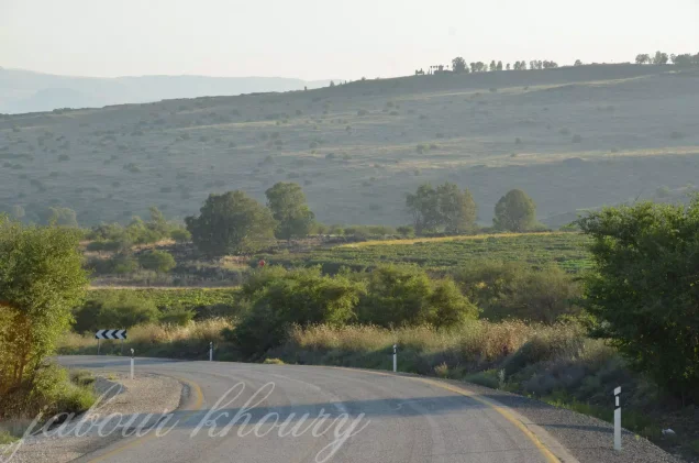
It was located roughly a quarter of a kilometre east of the Jordan River and about 2 km north of Lake Tiberias. Water, marshy lowlands, and the Jordan Valley landscape were therefore central features of its geography.
The village formed part of the rural and Bedouin landscape shared with 'Arab al-Shamalina, al-Zanghariyya, and other communities around the northern shore of Lake Tiberias and the Jordan River.
The Settlement Before the Nakba
Al-Butayha was not a large, densely built village. The Palestine Index Gazetteer classified it as a hamlet. More importantly, the Government of Palestine's 1944/45 statistics did not tabulate al-Butayha separately from 'Arab al-Shamalina; the two communities formed a single statistical unit.
Population and land figures must therefore be used cautiously, since the published official statistics do not permit the figures for al-Butayha alone to be separated from those of 'Arab al-Shamalina.
Population of Al-Butayha
- 1944/45650Official figure, but it covers al-Butayha and 'Arab al-Shamalina together; it is not a separate population count for al-Butayha.
- 1948754Later Palestine Remembered estimate based on the combined 1945 figure; it should not be treated as a secure separate estimate for al-Butayha alone.
- 19984,630 refugeesLater Palestine Remembered estimate that carries the same statistical limitation because its baseline includes 'Arab al-Shamalina.
The principal sources reviewed do not provide a separate official population figure that can confidently be assigned to al-Butayha alone in either 1922 or 1931. PalQuest records 551 inhabitants in 1931 for 'Arab al-Shamalina, but does not state that this figure belongs to al-Butayha or to a combined unit.
Number of Houses
The principal sources do not provide a securely documented separate house count for al-Butayha. No figure from a neighboring or statistically associated community is therefore transferred to the village, and no house count is inferred from population estimates.
Land Ownership of Al-Butayha and 'Arab al-Shamalina
The statistical unit combining al-Butayha and 'Arab al-Shamalina covered 16,690 dunums in the 1944/45 statistics. This total should not be presented as the separate land area of al-Butayha alone.
Using the ownership terminology employed by Palestine Remembered, the combined unit was recorded as follows:
- Palestinian16,690 dunums100%
- Transferred to Zionists0 dunums0%
- Communal/Public0 dunums0%
Palestine Remembered currently displays “0” in its total field, an obvious presentation error. The arithmetic and PalQuest's official category confirm a total of 16,690 dunums, all recorded in the Arab category. These figures apply to the combined statistical unit.
Land Use in 1944/45
The following land-use figures also cover al-Butayha and 'Arab al-Shamalina together:
- Arab
- Cereals3,842 dunums
- Plantations and Irrigable Land238 dunums
- Non-Cultivable Land12,610 dunums
The combined unit therefore contained 4,080 dunums of cultivated or cultivable land, approximately one quarter of the total, while 12,610 dunums were classified as non-cultivable.
No clear separate built-up figure appears in the official table available for this unit, so none is inferred.
Economic Life
Agriculture was the principal documented economic activity. The joint 1944/45 statistics with 'Arab al-Shamalina record 3,842 dunums devoted to cereals and 238 dunums of plantations or irrigable land.
The village's proximity to the Jordan River and Lake Tiberias and the abundance of water in the wider area supported irrigated cultivation alongside cereal farming.
The principal sources reviewed do not provide sufficiently documented information about specific crafts, markets, or other independent economic institutions in al-Butayha itself.
Water Resources
Water was a defining feature of al-Butayha's landscape. The village stood approximately 0.25 km from the Jordan River and about 2 km from Lake Tiberias in a low-lying area whose very name referred to marshy ground.
The core sources used here do not provide a sufficiently verified list of individual village wells or springs to support a more detailed catalogue, so only the securely documented geographical water resources are included.
Education and Public Services
The principal sources reviewed do not provide sufficiently documented information confirming a formal school, mosque, or specific public institution in al-Butayha, or any foundation dates for such institutions. No unsupported information is therefore added simply to fill these sections.
Occupation and Depopulation of Al-Butayha
The occupation and depopulation of al-Butayha were associated with Operation Matate, or “Broom,” a Haganah offensive carried out on 4 May 1948 as a sub-operation of Operation Yiftach.
Operation Matate was intended to take control of and clear the Palestinian population from the area north of Lake Tiberias and near the Jordan River. Walid Khalidi states that al-Butayha's location indicates that it was targeted during this offensive.
Palestine Remembered lists 4 May 1948 as al-Butayha's occupation date, corresponding to the day on which Operation Matate was implemented.
A documentary qualification is nevertheless important: Khalidi's village-specific entry infers al-Butayha's inclusion from its location and the course of the operation rather than quoting a separate operational order naming the village, as exists for several neighboring communities. The date of 4 May is therefore the strongest available operational date while this evidentiary distinction is retained.
Khalidi, citing the Israeli sources he discusses, records that Zionist forces justified the offensive by alleging that inhabitants of the area had harassed traffic travelling to and from the Jewish settlement of Rosh Pinna.
Operation Matate / Broom and Operation Yiftach
Operation Matate formed part of the wider Operation Yiftach. Operation Yiftach ran from 15 April to 25 May 1948 and was carried out by Palmach forces in order to seize control of eastern Galilee.
Operation Matate itself was implemented on 4 May and concentrated on the area around the Jordan River and north of Lake Tiberias. In several neighboring villages, the operational orders explicitly called for residents to be expelled and houses blown up.
Palestine Remembered identifies the Palmach First Battalion as the unit responsible for the attack on al-Butayha. PalQuest independently confirms that the First Battalion spearheaded Operation Yiftach as a whole. Khalidi's al-Butayha entry, however, does not independently identify the specific battalion that entered the village itself.
The most precise formulation is therefore: Military operation: Operation Matate / Broom, within Operation Yiftach; general force involved: Haganah/Palmach; village-specific attacking battalion: not independently established in the principal al-Butayha entry.
Occupation Chronology
- 15 April 1948
Beginning of Operation Yiftach
Palmach forces began Operation Yiftach with the objective of taking eastern Galilee.
- 4 May 1948
Operation Matate / Broom
The sub-operation was launched in the area north of Lake Tiberias and near the Jordan River, and al-Butayha is identified as a community targeted in its course.
- Probably 4 May 1948
Occupation and depopulation
Palestine Remembered lists this as the occupation date, while Khalidi connects al-Butayha to Operation Matate on the basis of its location and the operation's course.
- Approximately 5 May 1948
Destruction in occupied villages
Sources discussed by Khalidi state that Palmach sappers razed many houses in villages occupied during the offensive on the following day.
- During Operation Matate
Flight toward Syria
Syrian sources cited in the account reported approximately 2,000 additional refugees reaching Syria as a regional result of the operation. This was not a village-specific refugee total for al-Butayha.
Israeli Settlements on Al-Butayha Village Lands
Almagor was established in 1961, and Khalidi records that its inhabitants use al-Butayha village land.
A recreation area known as Park HaYarden lies approximately 200 metres south of the village site. It should be distinguished from Almagor itself when describing post-1948 use of the area.
Al-Butayha Today
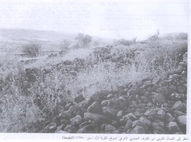
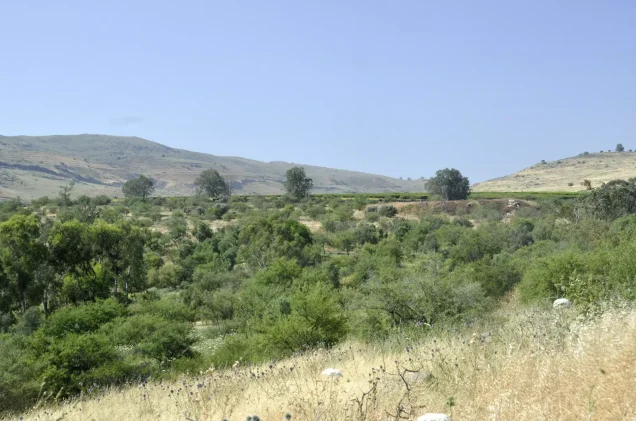
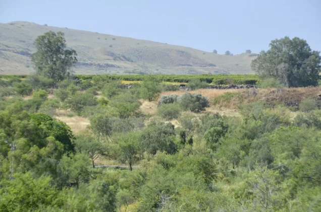
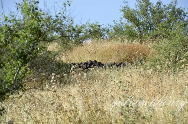
In the field description published by Walid Khalidi in All That Remains, only portions of the black basalt walls of the destroyed village houses remained.
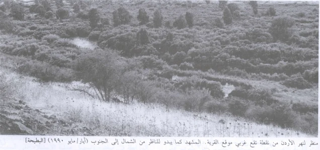
Doum palms and olive trees grew among the ruins, while tall eucalyptus trees stood along the northern edge of the site together with scattered patches of cactus. A man-made water canal ran north–south before turning east near the northern edge of the site.
Palestine Remembered reproduces photographs associated with Khalidi's documentation labelled 1990. The description can therefore be situated in field documentation from around 1990, prior to the publication of All That Remains in 1992, and should not be presented as direct and comprehensive verification of conditions in 2026.
Sources
- PalQuest – Al-Butayha
- PalQuest – 'Arab al-Shamalina, for the combined statistical unit
- PalQuest – Operation Yiftach
- Palestine Remembered – Al-Butayha, Safad
- Palestine Remembered – Al-Butayha entry from Walid Khalidi's All That Remains
- Institute for Palestine Studies – Walid Khalidi, All That Remains
- Government of Palestine – Village Statistics 1944/45, digital reference hosted by Palestine Remembered
Photo gallery

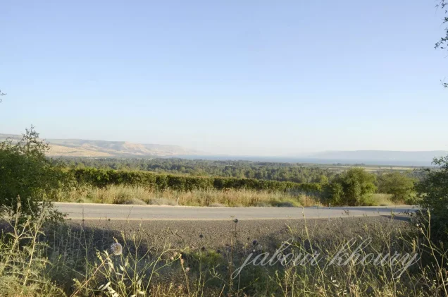
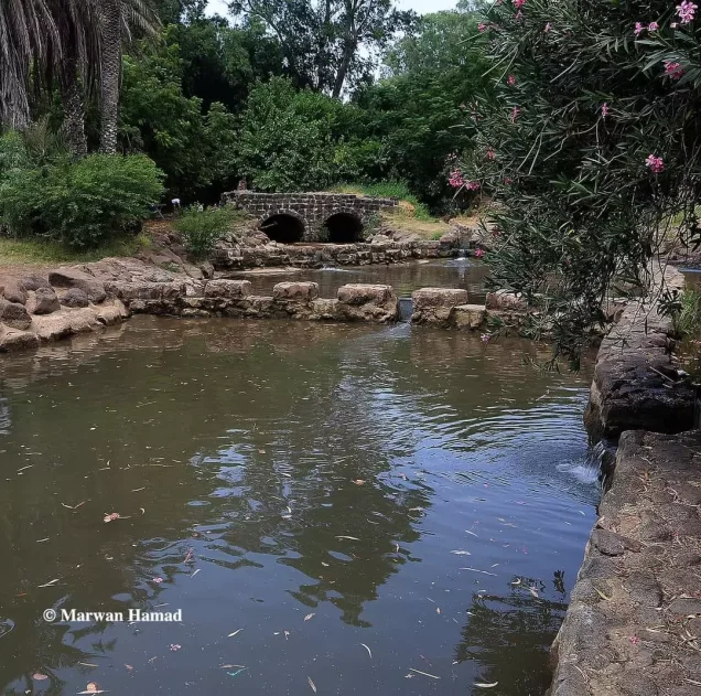
Photos from the village's people
Photos sent in by visitors and published after review.
Add a photo of this village
Log in to add photos of this village.
Other villages from Safed


More from the archive



 Download Our Palestine App
The whole archive in the palm of your hand: depopulated villages, the Nakba, the massacres and Al-Aqsa — free, with no ads to erase the story.
Download Our Palestine App
The whole archive in the palm of your hand: depopulated villages, the Nakba, the massacres and Al-Aqsa — free, with no ads to erase the story.



Comments
No comments yet — be the first to write one.
Add your comment
Name and email are optional. Comments appear after review.