
The depopulated village of Al-Dirbashiyya / District of Safed
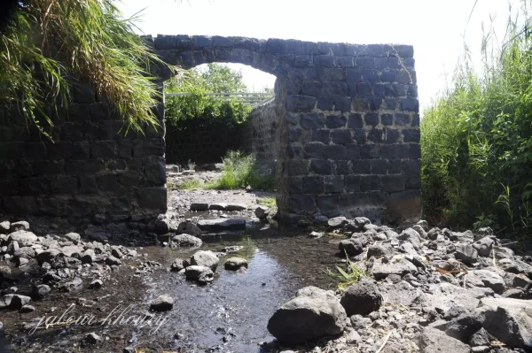
Al-Dirbashiyya
About the depopulated village of Al-Dirbashiyya
- District
- Safed
- Date Al-Dirbashiyya was occupied
- 10 May 1948
- Population in 1948
- 360
- Military operation
- Operation Yiftach
- Brigade that carried it out
- Palmach
- Who defended the village
- Local militia & Arab Liberation Army
- Distance from the governorate centre
- 20 (km) North East of Safad
- Elevation above sea level
- 100 m
- Cause of displacement
- Influence of fall of, or exoduce from, neighboring town
- Extent of destruction
- The village has been completely obliterated, and only house rubble left behind
- Ethnic cleansing
- al-Dirbashiyya inhabitants were completely ethnically cleansed.
Hover a dot to read the village name, or click to open its card.
Borders of the depopulated village of Al-Dirbashiyya
al-Dirbashiyya: A Depopulated Palestinian Village in the Safad District
al-Dirbashiyya was a Palestinian village in the Safad District, situated on the lower slopes of the Golan Heights near the Syrian frontier, approximately 20 km northeast of Safad and at an average elevation of about 100 metres above sea level. The village overlooked the Hula Plain to the west, where extensive marshlands lay below it. Its Muslim inhabitants depended principally on agriculture, especially early-ripening vegetables. Al-Dirbashiyya was depopulated during the Nakba and the occupation of Palestine in 1948 in the context of Operation Yiftach. The precise date of its occupation is unknown; Walid Khalidi suggests that, because of its isolated location, it may not have been captured until the final stages of the operation in late May.
Location of al-Dirbashiyya
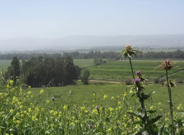
al-Dirbashiyya stood on the lower slopes of the Golan Heights close to the Palestine–Syria frontier and overlooked the Hula Plain to the west.
The village was approximately 20 km northeast of Safad and had an average elevation of about 100 metres above sea level.
The lands west of the village were largely marshland, with scattered palm trees, while some areas south of the village were wooded.
In broad geographic terms, Ghuraba lay to the north, al-Dirdara to the south, Syrian territory to the east, and Lake Hula, its marshes, and the Hula Plain to the west.
Architecture of al-Dirbashiyya
The village extended along a north–south axis, and its houses were dispersed across the site without a regular settlement pattern.
al-Dirbashiyya was relatively small and was classified as a hamlet in the Palestine Index Gazetteer.
Despite its size, the village contained several small shops.
During the British Mandate, the authorities also constructed a police station at al-Dirbashiyya.
The 1944/45 land-use statistics do not record a separate built-up-area figure for the village, so no unsupported residential acreage is added.
Population of al-Dirbashiyya
The inhabitants of al-Dirbashiyya were all Arab Muslims.
The official 1944/45 statistics recorded a population of 310.
Population of al-Dirbashiyya in the available records
- 1944/45310Official statistics; all Arab Muslims
- 1948406Later estimate published by Palestine Remembered
- Estimated refugees in 19982,493Later estimate published by Palestine Remembered
The principal approved sources used here do not provide a securely documented independent population figure for al-Dirbashiyya in the 1931 census, so no unsupported figure is added.
Number of Houses
PalQuest, Khalidi's principal entry, and the Palestine Remembered statistical page do not provide a securely documented official house count for al-Dirbashiyya in 1931 or 1948.
No speculative house figure is therefore included.
Public Facilities
The village contained several shops, and the British Mandate authorities established a police station there.
The principal approved sources do not provide sufficiently documented information concerning an independent school or clinic in al-Dirbashiyya.
No unsupported educational or medical details are therefore added.
Water Resources
al-Dirbashiyya stood in a water-rich environment on the eastern edge of the Hula Plain.
Marshlands extended west of the village, and the available water resources supported extensive irrigated vegetable cultivation and orchards.
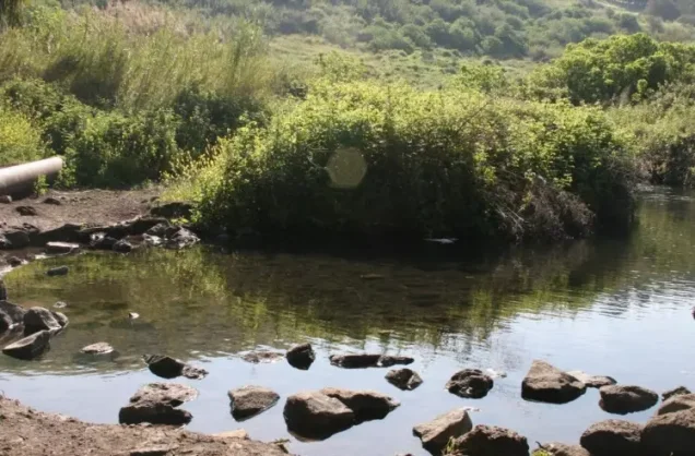
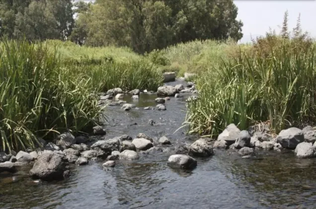
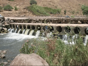
Later community documentation on Palestine Remembered identifies 'Ayn al-Tina and a watercourse south of the village, together with remains associated with a grain mill.
These latter details derive from later community documentation rather than from the principal official statistical description.
The Shrine of al-Samadi
A shrine dedicated to a Muslim holy man known as al-Samadi stood between al-Dirbashiyya and Lake Hula.
This is the principal religious landmark explicitly documented in Khalidi's village entry.
The approved sources do not provide a securely documented biography of al-Samadi or a construction date for the shrine, so no unsupported traditions are added.
Economic Life in al-Dirbashiyya
Agriculture was the mainstay of the village economy.
Most village income came from vegetables, especially early-ripening produce that benefited from the area's relatively warm climate.
In 1944/45, 2,763 dunums were irrigated or used for plantations.
This represented approximately 96 percent of al-Dirbashiyya's registered land, demonstrating the exceptional importance of irrigated agriculture to the village economy.
Land Ownership in al-Dirbashiyya
The total registered land area of al-Dirbashiyya was 2,883 dunums in the 1944/45 statistics.
Land ownership in al-Dirbashiyya, 1944/45
- Palestinian2,767 dunums96%
- Transferred to Zionists0 dunums0%
- Communal/Public116 dunums4%
No land was recorded in the category “Transferred to Zionists.”
Palestinian land represented approximately 96 percent of the registered area, while public/communal land accounted for about 4 percent.
Land Use in al-Dirbashiyya, 1944/45
PalQuest's detailed land-use table uses the categories Arab and Public, which are kept separate below.
Land use in al-Dirbashiyya, 1944/45
- Arab
- Public
- Plantations and irrigable land2,763 dunums
- Non-cultivable land120 dunums
Cultivated or cultivable land totaled 2,763 dunums, approximately 96 percent of the village area.
Non-cultivable land amounted to 120 dunums, approximately 4 percent.
The simplified Palestine Remembered presentation may give the impression that all 120 non-arable dunums were Palestinian. PalQuest's detailed figures show that only 4 dunums were Arab land, while 116 were public land.
No separate built-up-area figure is given in the detailed official table.
Archaeological and Historical Landmarks
Khalidi's principal entry does not provide a detailed archaeological inventory for al-Dirbashiyya.
The main historical and religious landmark explicitly documented is the shrine of al-Samadi between the village and Lake Hula.
Later community documentation on Palestine Remembered also records remains associated with a grain mill and water channels, but these materials do not constitute a systematic archaeological survey.
Operation Yiftach and al-Dirbashiyya
al-Dirbashiyya was occupied and depopulated in the context of Operation Yiftach, conducted by Palmach forces in eastern Galilee from 15 April to 25 May 1948.
The Palmach's First Battalion was among the principal forces operating in eastern Galilee and spearheaded Operation Yiftach at the broader operational level.
The operation brought Safad, the Hula region, and much of northeastern Galilee under Zionist control and caused the displacement of numerous Palestinian villages through direct assault, expulsion, fear, and psychological warfare.
Occupation and Depopulation of al-Dirbashiyya
The precise date on which al-Dirbashiyya was occupied is not known.
Walid Khalidi states only that the village was captured during Operation Yiftach sometime in May 1948.
Because al-Dirbashiyya was relatively isolated near the Syrian frontier, Khalidi considers it possible that the village remained outside Zionist control longer than some neighboring Hula communities and was not taken until the final week of May.
Palestine Remembered's summary table gives 10 May 1948 as the occupation date, lists the Palmach's First Battalion as the attacking unit, and associates the exodus with the fall or departure of a neighboring community.
Its own detailed historical narrative, however, reproduces Khalidi's account and explicitly states that the occupation date is unknown and that al-Dirbashiyya may not have fallen until the last week of May.
This article therefore does not present 10 May as a confirmed occupation date.
Since Operation Yiftach formally ended on 25 May, the most cautious formulation is that al-Dirbashiyya was probably occupied during the final stages of Operation Yiftach in late May 1948, without assigning a precise day.
Likewise, although the Palmach's First Battalion spearheaded Operation Yiftach generally and is named by Palestine Remembered, Khalidi's dedicated village entry does not independently identify it as the specific force that stormed al-Dirbashiyya.
- Military operation: Operation Yiftach.
- Operation Yiftach dates: 15 April–25 May 1948.
- Exact date of al-Dirbashiyya's occupation: unknown.
- Khalidi's assessment: possibly the last week of May because of the village's isolated location.
- 10 May date in Palestine Remembered's summary table: not confirmed by its detailed historical narrative.
- Palmach First Battalion: spearheaded Operation Yiftach overall and is listed by Palestine Remembered, but Khalidi does not independently establish it as the village-specific assault force.
- Documented direct battle inside al-Dirbashiyya: not described in the principal source.
Israeli Settlements on al-Dirbashiyya's Lands
Walid Khalidi identifies no Israeli settlement established on al-Dirbashiyya's registered village lands.
Nearby Israeli settlements should therefore not be attributed to the village unless a source specifically establishes that they were founded within its cadastral boundaries.
al-Dirbashiyya Today
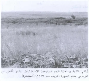
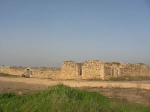
According to the field description published by Walid Khalidi in All That Remains, rubble from the destroyed Palestinian houses was scattered throughout the village site.
A section of a cement-lined irrigation canal and the remains of terraces in several fields also survived.
At the time of Khalidi's documentation, the village lands were used mainly for livestock grazing.
Grass, cactus plants, Christ's-thorn, and eucalyptus trees covered much of the site and surrounding lands.
Palestine Remembered preserves later community documentation, including photographs uploaded in 2012 and 2015 showing house remains, the mill area, 'Ayn al-Tina, and views toward the Hula Plain.
A further series of photographs and community material concerning the destroyed village site was uploaded on 26 June 2025.
These upload dates do not by themselves establish the date on which every image was taken, and the contributions do not constitute an independent systematic survey of the entire village site.
Khalidi's description, published in 1992, therefore remains the principal systematic field account used here. The approved sources do not provide a sufficiently comprehensive independent contemporary survey to verify the precise condition of every part of al-Dirbashiyya in 2026.
Sources
- PalQuestPalQuest – Interactive Encyclopedia of the Palestine Question: al-Dirbashiyya
- PalQuestPalQuest – Operation Yiftach
- Palestine RememberedPalestine Remembered – al-Dirbashiyya, Safad District
- Palestine RememberedPalestine Remembered – al-Dirbashiyya entry from All That Remains
- Palestine RememberedPalestine Remembered – documentation of village and mill remains, uploaded in 2012
- Palestine RememberedPalestine Remembered – view from al-Dirbashiyya toward the Hula Plain, uploaded in 2015
- Palestine RememberedPalestine Remembered – community documentation of al-Dirbashiyya, uploaded in 2025
- Institute for Palestine StudiesInstitute for Palestine Studies – All That Remains, Walid Khalidi
Photo gallery
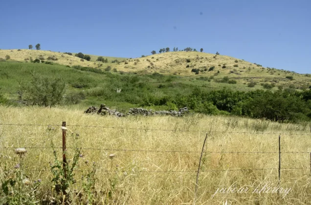

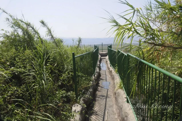
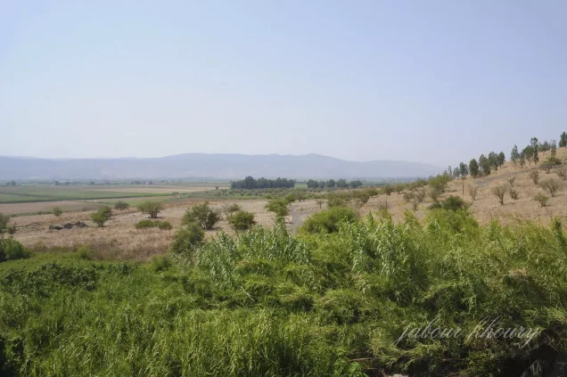


Photos from the village's people
Photos sent in by visitors and published after review.
Add a photo of this village
Log in to add photos of this village.
Other villages from Safed

More from the archive



 Download Our Palestine App
The whole archive in the palm of your hand: depopulated villages, the Nakba, the massacres and Al-Aqsa — free, with no ads to erase the story.
Download Our Palestine App
The whole archive in the palm of your hand: depopulated villages, the Nakba, the massacres and Al-Aqsa — free, with no ads to erase the story.



Comments
No comments yet — be the first to write one.
Add your comment
Name and email are optional. Comments appear after review.