
The depopulated village of Khiyam al-Walid / District of Safed
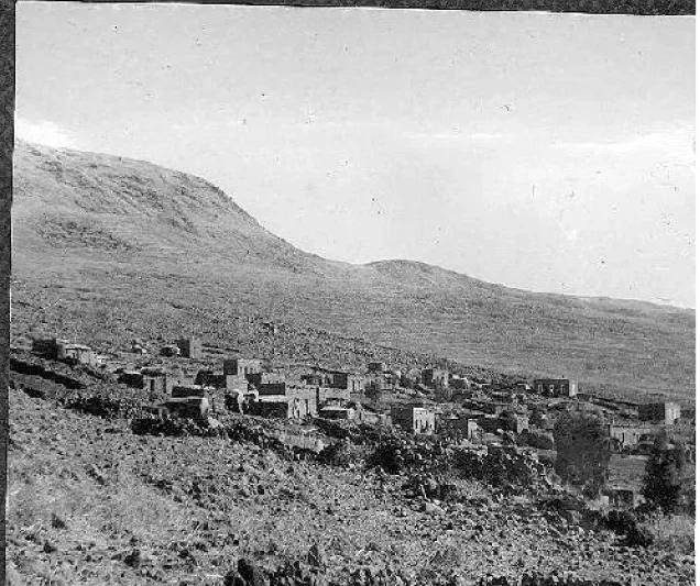
Khiyam al-Walid
About the depopulated village of Khiyam al-Walid
- District
- Safed
- Date Khiyam al-Walid was occupied
- 01 May 1948
- Population in 1948
- 330
- Military operation
- Operation Yiftach
- Brigade that carried it out
- Palmach
- Distance from the governorate centre
- 25 km northeast of Safad
- Elevation above sea level
- 150 m
- Cause of displacement
- Fear of Jewish attack, or of being caught in the fighting
- Extent of destruction
- Destruction, rubble identified
- Ethnic cleansing
- Completely ethnically cleansed
- Settlements built on the land of Khiyam al-Walid before 1948
- Ma'ale Habashan
Hover a dot to read the village name, or click to open its card.
Borders of the depopulated village of Khiyam al-Walid
Khiyam al-Walid – Depopulated Palestinian Village of the Safad Subdistrict
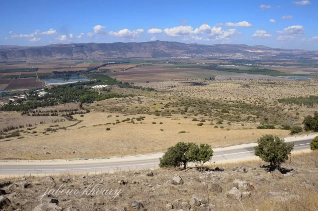
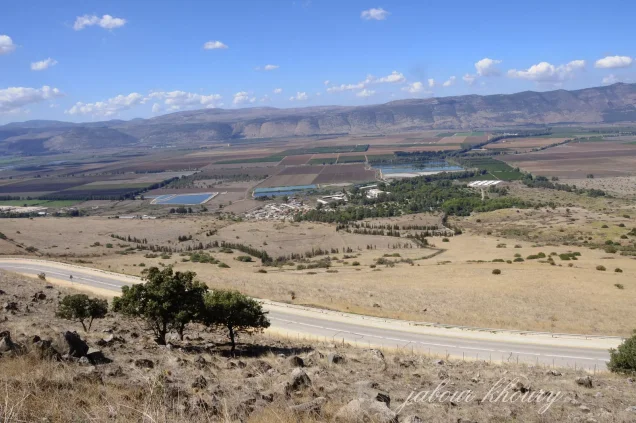
Khiyam al-Walid was a Palestinian village in the Safad Subdistrict. It stood on a low hill at the eastern edge of the Hula Plain, close to the Syrian–Palestinian frontier, approximately 25.5 km northeast of Safad and about 150 metres above sea level.
The village overlooked the Hula Plain to the west and had an official population of 280 in 1944/45. According to an Israeli military report relayed by Walid Khalidi, its inhabitants left on 1 May 1948 out of fear of a possible military attack. Khalidi, however, considers it more likely that the village itself was occupied later, in late May, during the final stages of Operation Yiftach.
Name of Khiyam al-Walid
The village name means “the tents of al-Walid.” Walid Khalidi notes that it may have referred to the tents of the army of Khalid ibn al-Walid, the seventh-century Muslim commander associated with the conquest of Syria.
This is presented in the source as a possibility rather than a proven etymology. Local tradition also held that a Muslim holy man known as Shaykh Ibn al-Walid was buried in the village. A shrine built over his tomb formed part of the village mosque.
Location
Khiyam al-Walid stood on a low hill along the eastern edge of the Hula Plain, overlooking the plain to the west. It lay approximately 25.5 km northeast of Safad at an average elevation of about 150 metres above sea level.
The village was close to the Syrian–Palestinian frontier. Nearby Palestinian localities included al-Zawiya to the west, al-Muftakhira to the north, Ghuraba to the south, and al-Salihiyya toward the northwest, while Syrian territory extended to the east and northeast.
The Village Before the Nakba
Khiyam al-Walid was classified as a hamlet in the Palestine Index Gazetteer compiled during the British Mandate. Its inhabitants were predominantly Muslim.
The built-up area had a roughly rectangular form, with houses aligned along the road leading to al-Zawiya. As the village expanded, new houses were constructed farther east, closer to a spring that provided the principal source of drinking water.
The spring offered a more suitable source of drinking water than nearby Lake Hula, in a region where malaria remained a serious health problem during the Mandate period.
Population of Khiyam al-Walid
- 1931181Official British Mandate census.
- 1944/45280Official Government of Palestine statistics.
- 1948325Later Palestine Remembered estimate, not an official census.
- 19981,995 refugeesLater Palestine Remembered estimate of the refugee population and descendants.
The principal sources reviewed do not provide a securely documented separate population figure for Khiyam al-Walid in the 1922 census, so no unsupported figure is added.
Number of Houses
- 193142Official census.
- 194875Later Palestine Remembered estimate, not an official Government of Palestine count.
Land Ownership in Khiyam al-Walid
The registered lands of Khiyam al-Walid totalled 4,215 dunums in the 1944/45 statistics. Using the terminology employed by Palestine Remembered, ownership was distributed as follows:
- Palestinian161 dunums4%
- Transferred to Zionists3,901 dunums93%
- Communal/Public153 dunums4%
These figures correspond exactly to the official categories of 161 Arab dunums, 3,901 Jewish dunums, and 153 Public dunums.
Land Use in 1944/45
The official Arab / Jewish / Public categories are retained in the following table. This also corrects the simplified Palestine Remembered table, which incorrectly presents the full 161 Arab dunums as uncultivated even though 153 of those dunums were plantations or irrigable land.
- Arab
- Jewish
- Public
- Plantations and Irrigable Land2,752 dunums
- Cereals502 dunums
- Non-Cultivable Land961 dunums
A total of 3,254 dunums was therefore classified as cultivated or cultivable, consisting of 153 Arab dunums and 3,101 Jewish dunums. The remaining 961 dunums were recorded as non-cultivable.
The published PalQuest table does not provide a clear separate figure for the built-up area, so no independent built-up total is inferred.
Economic Life in Khiyam al-Walid
The local economy was connected to agriculture and the fertile, well-watered environment of the Hula Plain. In 1944/45, 153 dunums of Arab land were irrigated or used for plantations.
By 1944/45, most of the registered village land was classified as Jewish ownership: 3,901 dunums, including 2,599 dunums devoted to plantations and irrigable cultivation and 502 dunums planted with cereals.
The principal sources reviewed do not provide sufficient documentation for specific village markets, crafts, presses, or other independent commercial activities, so such details are not added without evidence.
Water Resources
A spring east of the original village centre was the principal documented source of drinking water. As Khiyam al-Walid expanded, newer houses were constructed toward the east to provide easier access to it.
Khalidi notes that the villagers used the spring for drinking and that it provided a healthier alternative to the waters of nearby Lake Hula in an area historically affected by malaria.
Education
The principal sources reviewed do not provide sufficiently documented information confirming a formal school in Khiyam al-Walid, its foundation date, or enrolment figures. No unsupported educational details are therefore added.
The Mosque and the Shrine of Shaykh Ibn al-Walid
Khiyam al-Walid had a mosque. According to local tradition recorded by Khalidi, a Muslim holy man known as Shaykh Ibn al-Walid was buried in the village, and a shrine constructed over his tomb formed part of the mosque.
An automated field on Palestine Remembered also lists a church, but Khalidi's detailed village account does not independently document one. It is therefore not included here as an established village institution.
Depopulation and Occupation
The departure of the population and the military occupation of Khiyam al-Walid should be treated as separate events.
According to an Israeli military report prepared in late June 1948 and relayed by Walid Khalidi, the village was emptied of its inhabitants on 1 May 1948. The report claimed that the villagers left because they feared a possible attack by Jewish forces.
Khalidi does not, however, identify 1 May as the date on which troops entered Khiyam al-Walid. He considers it more likely that the village itself was occupied later, when Zionist forces consolidated their control of eastern Galilee in late May during the final stages of Operation Yiftach.
Palestine Remembered lists 1 May 1948 in its “occupation date” field. The detailed evidence supports that date more securely as the date of population departure than as a separately verified date of military occupation.
Operation Yiftach and the Military Unit
Khiyam al-Walid is explicitly listed by PalQuest among the Palestinian villages affected by Operation Yiftach, which ran from 15 April to 25 May 1948 within the framework of Plan Dalet and sought to secure eastern Galilee.
Palmach forces carried out the operation under the command of Yigal Allon, with the Palmach's First Battalion serving as the spearhead of the operation as a whole.
Palestine Remembered identifies the Palmach First Battalion as the attacking unit for Khiyam al-Walid. Khalidi's village-specific entry, however, does not independently identify the unit that actually entered Khiyam al-Walid.
The most precise formulation is therefore: Military operation: Operation Yiftach; general force involved: Palmach; village-specific occupying unit: not independently identified in the principal village entry.
Occupation Chronology
- 15 April 1948
Beginning of Operation Yiftach
Palmach forces began Operation Yiftach with the objective of securing eastern Galilee.
- 1 May 1948
Population departure
According to an Israeli military report relayed by Khalidi, the village was emptied on this date and the population left out of fear of a possible military attack.
- May 1948
Continuation of Operation Yiftach
Military operations and psychological-warfare measures continued across eastern Galilee throughout the month.
- Probably late May 1948
Occupation of Khiyam al-Walid
Khalidi considers it likely that the village was occupied when Zionist forces consolidated control over eastern Galilee during the final stages of Operation Yiftach. The precise date of entry is not established.
- 25 May 1948
Formal end of Operation Yiftach
PalQuest identifies this as the formal end date of Operation Yiftach.
Israeli Settlements on Khiyam al-Walid Lands
Lehavot HaBashan was established in 1945 on Khiyam al-Walid village land, immediately west of the village site.
Its establishment therefore predates the Nakba and the depopulation of Khiyam al-Walid in 1948. It should not be described as a settlement founded after the occupation of the village; it represents documented pre-1948 Zionist settlement on village land.
Khiyam al-Walid Today
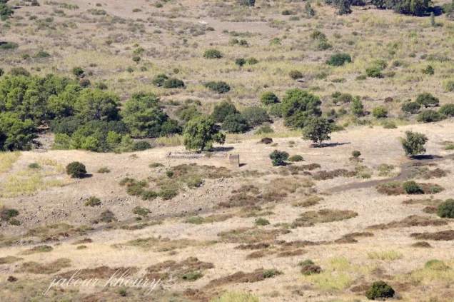
In the field description published by Walid Khalidi in All That Remains, the village site was deserted and overgrown with wild grass and thorns. A few carob trees remained, along with piles of stones and collapsed terraces.
The surrounding lands were being used by Israeli farmers as grazing land.
This description derives from field research carried out before the publication of All That Remains in 1992 and does not constitute direct, comprehensive field verification of the site's condition in 2026.
Sources
- PalQuest – Khiyam al-Walid
- PalQuest – Operation Yiftach
- Palestine Remembered – Khiyam al-Walid, Safad
- Palestine Remembered – Khiyam al-Walid entry from Walid Khalidi's All That Remains
- Institute for Palestine Studies – Walid Khalidi, All That Remains
- Government of Palestine – Village Statistics 1944/45, digital reference
- Government of Palestine – Census of Palestine 1931
Photo gallery



Photos from the village's people
Photos sent in by visitors and published after review.
Add a photo of this village
Log in to add photos of this village.
Other villages from Safed
More from the archive



 Download Our Palestine App
The whole archive in the palm of your hand: depopulated villages, the Nakba, the massacres and Al-Aqsa — free, with no ads to erase the story.
Download Our Palestine App
The whole archive in the palm of your hand: depopulated villages, the Nakba, the massacres and Al-Aqsa — free, with no ads to erase the story.



Comments
No comments yet — be the first to write one.
Add your comment
Name and email are optional. Comments appear after review.