
The depopulated village of Al-Farradiyya / District of Safed
Al-Farradiyya
About the depopulated village of Al-Farradiyya
- District
- Safed
- Date Al-Farradiyya was occupied
- 30 October 1948
- Population in 1948
- 777
- Military operation
- Operation Hiram
- Brigade that carried it out
- Golani Brigade
- Distance from the governorate centre
- 8 (km) South West of Safad
- Elevation above sea level
- 375 m
- Cause of displacement
- Expulsion by Zionist troops
- Extent of destruction
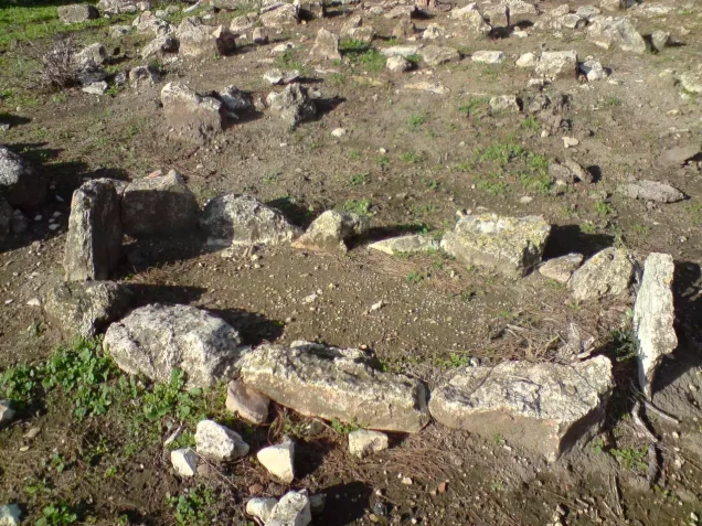
- The village has been completely destroyed, and only house walls and rubble left behind.
- Ethnic cleansing
- al-Farradiyya inhabitants were completely ethnically cleansed.
- Refugees' migration routes
- Parod and Shefer
Hover a dot to read the village name, or click to open its card.
Borders of the depopulated village of Al-Farradiyya
Al-Farradiyya: A Depopulated Palestinian Village in the Safad District
Al-Farradiyya was a Palestinian village in the Safad District, located about 8 kilometres southwest of the city of Safad, at an average elevation of approximately 375 metres above sea level. The village came under Israeli control during Operation Hiram on 30 October 1948, but many of its inhabitants remained there until the final expulsion was carried out in February 1949, in the context of the Nakba and the occupation of Palestine in 1948.
- Subdistrict
- Safed
- Distance from district center
- 8 km South West of Safad
- Average Elevation
- 375 meters above sea level
- Population in 1931
- 465 inhabitants - Official census
- Number of Houses in 1931
- 101 houses - Official census
- Population in 1944/1945
- 670 inhabitants - Government of Palestine statistics
- Estimated Population in 1948
- 777 inhabitants - a later demographic estimate, not an official census
- Total Land Area in 1945
- 19,747 dunams
- Attack and Depopulation
- During the Nakba, al-Farradiyya became a place of refuge for residents of nearby Palestinian villages. In early May 1948, people from Akbara and al-Zahiriyya al-Tahta sought refuge there after fleeing Zionist military operations associated with Operation Yiftach in the Safad area.
- Final Israeli Control
- 30 October 1948
- Military Operation
- Hiram
- Military Unit
- Golani Brigade
- Cause of Depopulation
- Expulsion by Zionist troops
Location and History
Al-Farradiyya stood on the southern slope of Mount Zabud, and the main Nazareth–Safad road passed directly to its north. Springs flowing from Mount al-Jarmaq to the north supplied the village with abundant water.
Sources suggest that al-Farradiyya may have stood on the site of a locality known in the Roman period as Parod. The Arab geographer al-Muqaddasi, who lived in the tenth century CE, referred to it as “al-Faradhiyya” and described it as a large village known for its fruit orchards, vineyards, and abundant water.
In 1596, al-Farradiyya was part of the Jira subdistrict of the Safad district, with an estimated population of about 237. Its inhabitants paid taxes on wheat, barley, goats, beehives, pastureland, and other products.
In the late nineteenth century, al-Farradiyya was described as a stone-built village situated on a plain. Its population was estimated at about 150, and the inhabitants cultivated small gardens, figs, and olives.
Population
The population of al-Farradiyya was 362 in the 1922 census and rose to 465 in the 1931 census, when 101 houses were recorded. In the 1944/1945 Village Statistics, the village population was 670 Arabs.
The sources indicate that most of the village inhabitants were Muslims. The reviewed sources do not provide sufficient evidence to confirm the frequently repeated claim that all the inhabitants were Muslims except for one Christian, and that statement has therefore not been adopted here.
Palestine Remembered gives an estimated population of 777 for 1948 and an estimated 4,773 refugees and descendants in 1998. These figures are estimates and do not represent official censuses conducted by the Government of Palestine.
Population of al-Farradiyya
- 1596237Historical estimate
- Late nineteenth centuryAbout 150Historical estimate
- 1922362Official census
- 1931465Official census
- 1944/1945670Government of Palestine statistics
- 1948777Estimate published by Palestine Remembered
- 19984,773Estimate of refugees and their descendants
Number of Houses
Recorded and estimated number of houses in al-Farradiyya
- 1931101Official census
- 1948168Estimate published by Palestine Remembered
Land of Al-Farradiyya
According to the 1944/1945 statistics, the total land area of al-Farradiyya was 19,747 dunams. Arabs owned 15,228 dunams, while 4,519 dunams were classified as public land. The statistics record no Jewish land ownership within the village boundaries.
Land ownership in al-Farradiyya in 1944/1945
- Arab ownership15,228 dunums77%
- Jewish ownership0 dunums0%
- Public land4,519 dunums23%
Agriculture and Land Use
Al-Farradiyya had a prosperous agricultural sector. Its inhabitants cultivated cereals, orchards, and fruit trees, including figs, olives, grapes, and other crops.
According to the detailed 1944/1945 land-use table published by PalQuest, 4,183 dunams were devoted to cereals, including 4,137 dunams of Arab-owned land and 46 dunams of public land. A further 1,182 dunams were classified as irrigated or plantation land, all of them Arab-owned.
There is a discrepancy in the sources: the narrative text reproduced from Walid Khalidi’s All That Remains gives 4,147 dunams for cereals, while the detailed statistical table gives 4,183 dunams. The latter figure is used below because it is broken down by ownership category and is consistent with the total land figures.
Palestine Remembered also reports that approximately 703 dunams were planted with olive trees.
Land use in al-Farradiyya in 1944/1945, in dunams
- Arab
- Public
- Cereals4,183 dunums
- Irrigated and plantation land1,182 dunums
- Built-up area25 dunums
- Uncultivable land14,357 dunums
The Model Agricultural Farm
Al-Farradiyya was known for an experimental model farm covering about 300 dunams of village land. It was established to improve varieties of apples, figs, grapes, apricots, pears, and almonds, as well as to develop new types of seeds.
The farm included a nursery where approximately 2,000 trees were cultivated for distribution to farmers. The centre also provided agricultural extension services to farmers in the Safad and Acre districts, including advice on poultry breeding and beekeeping.
The centre was supervised by a Palestinian agricultural engineer who had pursued higher studies at the University of Montpellier in France and began working at the centre in 1932.
Education and Village Landmarks
Al-Farradiyya had an elementary school for boys. Palestine Remembered states that the highest class available was the fourth elementary grade. Students wishing to continue their education had to attend schools outside the village.
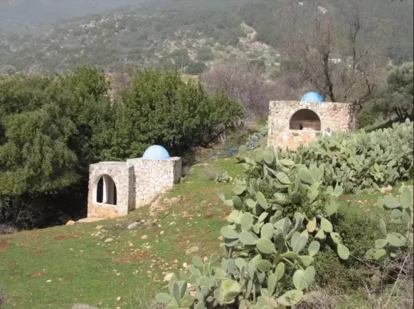
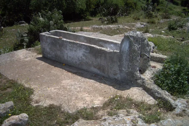
The village also contained the shrine of Shaykh Mansur, described by Walid Khalidi as a religious scholar. Remains of water-powered grain mills and an old water channel were also located near the village.
- An elementary school for boys.
- The experimental model agricultural farm.
- The shrine of Shaykh Mansur.
- Water-powered grain mills.
- An old water channel.
The Nakba and the Occupation of Al-Farradiyya
During the Nakba, al-Farradiyya became a place of refuge for residents of nearby Palestinian villages. In early May 1948, people from Akbara and al-Zahiriyya al-Tahta sought refuge there after fleeing Zionist military operations associated with Operation Yiftach in the Safad area.
Operation Hiram and the Capture of the Village
Operation Hiram began on 28 October 1948 and continued until 31 October. Its objective was to seize control of the Upper and Central Galilee. Several Israeli brigades participated in the operation, including the Golani, Carmeli, Oded, Sheva, and Givati brigades.
Al-Farradiyya came under Israeli control on 30 October 1948 during Operation Hiram. PalQuest, drawing on Walid Khalidi’s documentation, indicates that the village apparently was not subjected to a direct assault on that day. Golani Brigade units advanced northward from Eilabun toward Sa'sa', and al-Farradiyya became surrounded by Israeli forces from several directions.
Palestine Remembered, however, identifies Operation Hiram as the military operation associated with the occupation of the village and lists the Golani Brigade as the attacking unit. Because the sources differ in their level of detail, it is more accurate to state that al-Farradiyya came under Israeli control during the advance of forces participating in Operation Hiram, with the Golani Brigade documented as operating in its immediate vicinity, without asserting with certainty that the brigade directly stormed the village itself.
Residents Remaining after October 1948
The establishment of Israeli control over the area in October 1948 did not result in the immediate displacement of all the inhabitants of al-Farradiyya. Many residents remained in their homes for several months after Operation Hiram.
During December 1948 and January 1949, pressure increased to remove the remaining inhabitants. PalQuest, in its presentation of Walid Khalidi’s research and citing information attributed to Israeli historian Benny Morris, reports that on 15 December 1948 a committee adopted a proposal to expel 261 people who remained in al-Farradiyya and Kafr Inan.
This information is included because it is reported by PalQuest, a Palestinian source used in this article, rather than through direct reliance on an Israeli source.
Final Expulsion in February 1949
The remaining inhabitants of al-Farradiyya were expelled in February 1949. The sources indicate that some were transferred to another village under Israeli control, while others were sent to the Triangle area in the West Bank.
Palestine Remembered gives 1 February 1949 as the date of occupation and depopulation, while PalQuest makes a clearer distinction between the village coming under Israeli control on 30 October 1948 and the final expulsion of its inhabitants in February 1949. This article therefore distinguishes between the date of military control and the date of final displacement.
Fate of the Population and Buildings
The Palestinian inhabitants of al-Farradiyya were displaced during the Nakba and became refugees and internally displaced Palestinians. After the village was emptied, most of its buildings were destroyed, leaving piles of stones from demolished houses and a limited number of scattered remains.
Occupation and Depopulation Chronology
- May 1948
The Nakba and the Occupation of Al-Farradiyya
During the Nakba, al-Farradiyya became a place of refuge for residents of nearby Palestinian villages. In early May 1948, people from Akbara and al-Zahiriyya al-Tahta sought refuge there after fleeing Zionist military operations associated with Operation Yiftach in the Safad area.
- 28 October 1948
Operation Hiram and the Capture of the Village
Operation Hiram began on 28 October 1948 and continued until 31 October. Its objective was to seize control of the Upper and Central Galilee.
- February 1949
Final Expulsion in February 1949
The remaining inhabitants of al-Farradiyya were expelled in February 1949. The sources indicate that some were transferred to another village under Israeli control, while others were sent to the Triangle area in the West Bank.
Israeli Settlements Established on the Lands of Al-Farradiyya
Parod
Parod was established in 1949 on the lands of al-Farradiyya, approximately 300 metres east of the destroyed village site.
Shefer
Shefer was established in 1950 on the lands of al-Farradiyya, north of the village site.
Kaddarim
Kaddarim was established in 1980 east of the village site and was later relocated to a site southeast of the village in 1987.
- Parod, established in 1949.
- Shefer, established in 1950.
- Kaddarim, established in 1980 and relocated southeast in 1987.
The Site of Al-Farradiyya Today
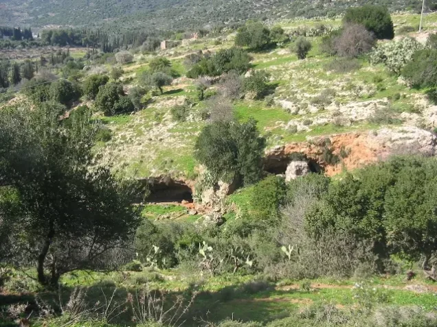
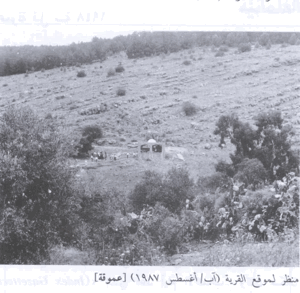
According to the field description documented by Walid Khalidi, the village site became deserted and was covered with thorny wild vegetation, trees, and piles of stones from the destroyed houses. Cactus plants also grew in the surrounding lands.
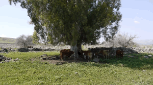
Parts of the surrounding land were used for grazing, while other areas were planted with trees and converted into recreational spaces. This description reflects the period in which the original field documentation was conducted and should not be interpreted as a field survey of the site in 2026.
Sources
- PalQuest – Interactive Encyclopedia of the Palestine Question: Al-Farradiyya.
- PalQuest: Operation Hiram.
- Palestine Remembered: Al-Farradiyya, Safad District.
- Walid Khalidi, All That Remains: Historical account of al-Farradiyya, reproduced by Palestine Remembered.
- Government of Palestine, Department of Statistics, Village Statistics, 1945, as reproduced in PalQuest and the Palestinian sources cited above.
- Walid Khalidi, All That Remains, entry on al-Farradiyya, as reproduced by PalQuest and Palestine Remembered.
``` seo_keywords: Al-Farradiyya, Farradiyya, depopulated Palestinian villages, Safad villages, Nakba, Nakba 1948, Operation Hiram, Golani Brigade, Safad, Parod, Shefer, Kaddarim, Walid Khalidi seo_description: Al-Farradiyya was a Palestinian village in the Safad District. Explore its population, land, agriculture, Operation Hiram, and final displacement in 1949.
Photo gallery








Photos from the village's people
Photos sent in by visitors and published after review.
Add a photo of this village
Log in to add photos of this village.
Other villages from Safed


More from the archive



 Download Our Palestine App
The whole archive in the palm of your hand: depopulated villages, the Nakba, the massacres and Al-Aqsa — free, with no ads to erase the story.
Download Our Palestine App
The whole archive in the palm of your hand: depopulated villages, the Nakba, the massacres and Al-Aqsa — free, with no ads to erase the story.



Comments
No comments yet — be the first to write one.
Add your comment
Name and email are optional. Comments appear after review.