
The depopulated village of Jahula / District of Safed
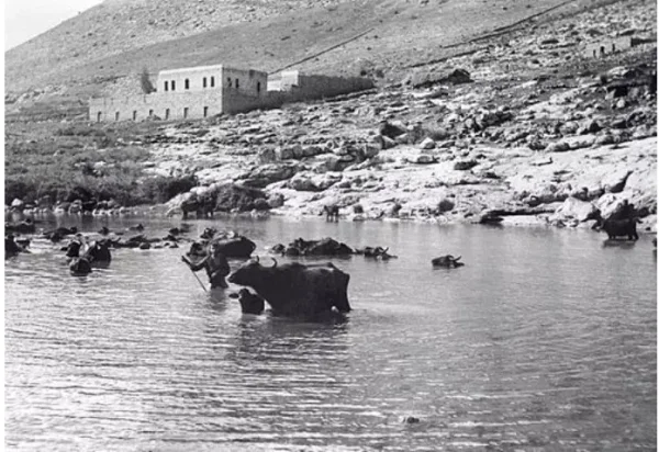
About the depopulated village of Jahula
- District
- Safed
- Date Jahula was occupied
- 01 May 1948
- Population in 1948
- 490
- Military operation
- Operation Yiftach
- Brigade that carried it out
- Palmach
- Distance from the governorate centre
- 11 (km) North East of Safad
- Elevation above sea level
- 150 m
- Cause of displacement
- Military assault by Zionist troops
- Extent of destruction
- The village has been completely obliterated, and only house rubble left behind.
- Ethnic cleansing
- Jahula inhabitants were completely ethnically cleansed.
Hover a dot to read the village name, or click to open its card.
Borders of the depopulated village of Jahula
Jahula: A Depopulated Palestinian Village in the Safad District
Jahula was a Palestinian village in the Safad District, situated in the foothills of the Galilee Mountains overlooking the Hula Plain from the west, at an average elevation of about 150 metres above sea level. PalQuest gives its distance from Safad as approximately 19 km. Most inhabitants worked in agriculture, while some were employed in stone quarries north of the village. Jahula also had a mosque surrounding the shrine of Shaykh Salih. Its inhabitants were displaced during the Nakba and the occupation of Palestine in 1948. The exact date cannot be established, but Walid Khalidi considers it most likely that Jahula fell near the end of Operation Yiftach, around 24–25 May 1948.
Location of Jahula
Jahula stood in the foothills of the Galilee Mountains and overlooked the Hula Plain to the west.
The village extended broadly along the Tiberias–al-Mutilla highway, which connected it with the wider eastern Galilee road network.
PalQuest records Jahula as approximately 19 km from Safad and at an average elevation of about 150 metres above sea level.
Palestine Remembered's statistical header instead gives a distance of 11 km northeast of Safad. Because of this source discrepancy, this article follows the 19 km figure in PalQuest/Khalidi while explicitly recording the alternative figure.
Nearby Palestinian localities included al-Buwayziyya to the north, al-Zawiya to the northeast, Qadas to the west, al-Nabi Yusha' to the southwest, and Baysamun to the south, while the Hula Plain extended east and southeast.
Jahula in the Ottoman Period
In 1596, Jahula was a village in the nahiya of Jira within the liwa of Safad, with an estimated population of approximately 28.
The inhabitants paid taxes on wheat and barley, as well as goats, beehives, and water buffalo.
These records point to a mixed agricultural and pastoral economy in the area during the early Ottoman period.
Architecture of Jahula
Jahula's houses were constructed of masonry, principally stone.
The settlement extended along the main road rather than forming a large compact urban core.
The Arab built-up area amounted to 64 dunums in the 1944/45 statistics.
The principal approved sources do not provide a detailed breakdown of the village quarters or the number of individual public buildings immediately before the Nakba.
The Mosque and Shrine of Shaykh Salih
The village mosque stood, according to Khalidi, approximately 1 km north of the village site.
The mosque surrounded the shrine of Shaykh Salih, a locally venerated religious figure.
Some later local material gives a distance of approximately 2 km, but the Khalidi/PalQuest entry gives about 1 km, which is the figure adopted here.
Water Supply
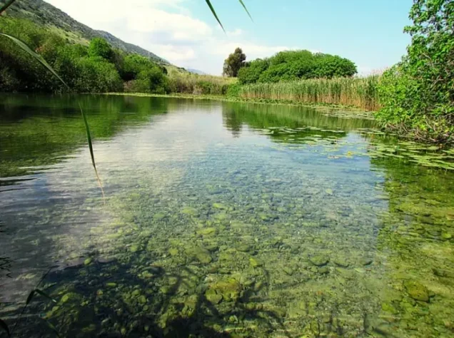
The villagers obtained drinking water from a spring on the northern edge of Jahula.
Later community documentation on Palestine Remembered identifies 'Ayn Jahula locally as 'Ayn Balata.
The spring became one of the best-known surviving landmarks of the village site and, according to Khalidi's field description, remained in use after the Palestinian population had been displaced.
Education in Jahula
Mandate-era administrative documents preserved on Palestine Remembered confirm the existence of a school in Jahula.
One document dated 6 May 1938 concerns a teacher requesting transfer to the Jahula school.
Another letter, dated 18 September 1946, concerns the appointment of an additional teacher to the village.
These documents establish that the school operated during the 1930s and 1940s. The published material, however, does not provide a securely verified enrollment total, so no unsupported pupil figure is added.
Economic Life in Jahula
Agriculture was the principal source of livelihood.
Cereals, especially wheat and barley, were among the best-documented crops.
In 1944/45, a total of 2,017 dunums was devoted to cereals: 1,626 Palestinian dunums and 391 dunums in the category represented here as “Transferred to Zionists.”
A further 100 dunums of irrigated or plantation land fell within the Jewish land category in the official statistics.
Some villagers also worked in stone quarries north of the village.
Local historical material additionally describes livestock raising, fishing, vegetables, and fruit cultivation. These accounts are valuable for community history, but Khalidi's principal entry does not provide detailed late-Mandate statistics for those activities, so they are not converted into firm quantitative claims here.
Land Ownership in Jahula
The total registered land area of Jahula was 3,869 dunums in the 1944/45 statistics.
Land ownership in Jahula, 1944/45
- Palestinian1,991 dunums51%
- Transferred to Zionists583 dunums15%
- Communal/Public1,295 dunums33%
Palestinian land represented approximately 51.5 percent of the total, land in the category “Transferred to Zionists” about 15.1 percent, and communal/public land approximately 33.5 percent.
Land Use in Jahula, 1944/45
Land use in Jahula, separating ownership categories according to PalQuest's detailed statistics
- Palestinian
- Transferred to Zionists
- Communal/Public
- Plantations and irrigable land100 dunums
- Cereals2,017 dunums
- Built-up area64 dunums
- Non-cultivable land1,688 dunums
Cultivated or cultivable land totaled 2,117 dunums, approximately 55 percent of Jahula's lands: 1,626 Palestinian dunums and 491 dunums in the category “Transferred to Zionists.”
Built-up and non-cultivable land together amounted to 1,752 dunums, approximately 45 percent of the total.
Palestine Remembered's simplified table presents 1,596 dunums of non-arable land in the Palestinian column. PalQuest's detailed statistics show that this combines 301 Palestinian dunums with 1,295 public dunums. The public category is therefore separated above.
Population of Jahula
Population of Jahula in selected years
- 159628Estimate derived from Ottoman records
- 1922214Official British Mandate census; all Muslim
- 1931357Official British Mandate census; all Muslim
- 1944/45420Official statistics
- 1948487Later estimate published by Palestine Remembered
- Estimated refugees in 19982,992Later estimate published by Palestine Remembered
Some local historical writing identifies Jahula's inhabitants with the Ghawarna communities of the Jordan and Hula valleys. This identification is not made in Khalidi's principal PalQuest entry and is therefore not presented here as a definitive classification of the entire village population.
Number of Houses in Jahula
Number of houses in Jahula
- 193190Official British Mandate census
- 1948122Later estimate published by Palestine Remembered
Archaeology of Jahula
Jahula's site preserves evidence of settlement reaching far back into prehistory.
Archaeological excavations conducted in 1986 near 'Ayn Jahula found evidence that the area had been inhabited from approximately the seventh through the third millennium BCE.
Later community documentation on Palestine Remembered identifies the spring locally as 'Ayn Balata.
References found in some local material to a purported Frankish name rendered as “Noire Grade,” and to nearby Blida in Lebanon, could not be clearly corroborated in the principal approved sources used for this article and are therefore not presented as established archaeological facts about Jahula.
Operation Yiftach and Jahula
Jahula's depopulation occurred in the context of Operation Yiftach, conducted by Palmach forces in eastern Galilee from 15 April to 25 May 1948.
The Palmach's First Battalion spearheaded the broader operation, whose objective was to seize eastern Galilee and depopulate its Palestinian communities.
Operation Yiftach combined direct military attacks, expulsions following occupation, and psychological warfare designed to induce inhabitants to flee.
The fact that the First Battalion spearheaded the broader operation does not automatically establish that it was the village-specific unit that entered every locality unless the dedicated village source states so explicitly.
Occupation and Depopulation of Jahula
Walid Khalidi states that the exact date of Jahula's occupation cannot be determined.
He considers it most likely that the village was taken near the end of Operation Yiftach, at approximately the same time as al-Zawiya, 4.5 km to the northeast, and Mallaha, 3.5 km to the southeast.
al-Zawiya was depopulated on 24 May 1948 as a result of direct military assault, while Mallaha fell at approximately 25 May.
The most cautious date range for Jahula is therefore around 24–25 May 1948. This is a historical inference based on the sequence of nearby village occupations rather than a directly documented village-specific date.
Palestine Remembered's statistical header, by contrast, lists 1 May 1948 and identifies the Palmach First Battalion as the attacking unit, with direct military assault as the cause of depopulation.
This date conflicts with the historical narrative reproduced on the same site from Khalidi, which places Jahula's occupation near the end of Operation Yiftach. This article therefore follows Khalidi's more cautious chronology and does not present 1 May as a confirmed occupation date.
- Military operation: Operation Yiftach.
- Operation dates: 15 April–25 May 1948.
- Exact occupation date: uncertain.
- Most likely period according to Khalidi: near the end of Operation Yiftach, approximately 24–25 May 1948.
- Date listed in Palestine Remembered's statistical header: 1 May 1948, inconsistent with Khalidi's narrative.
- Palmach First Battalion: spearheaded Operation Yiftach overall and is identified by Palestine Remembered as the attacking unit at Jahula.
- Village-specific occupying unit in Khalidi's account: not definitively established.
- Fate of the population: displaced during the conquest of eastern Galilee in the Nakba.
Israeli Settlements Associated with Jahula
Khalidi identifies no Israeli settlement established directly on Jahula's village lands.
The settlement of Yiftach lies approximately 2 km northwest of the former village site but is not listed as standing on Jahula's lands.
Jahula Today
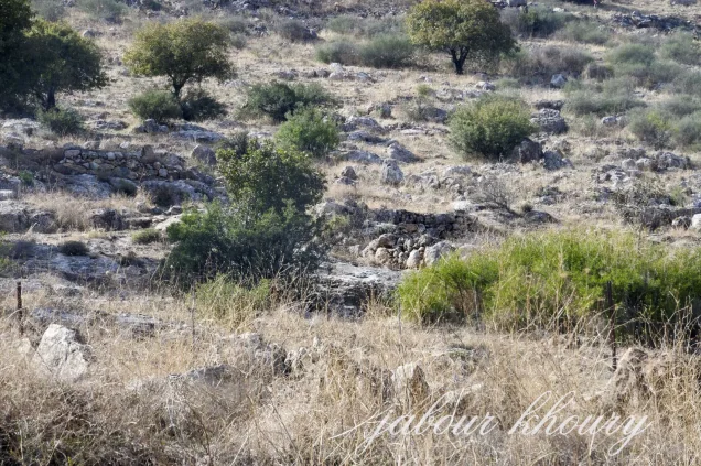
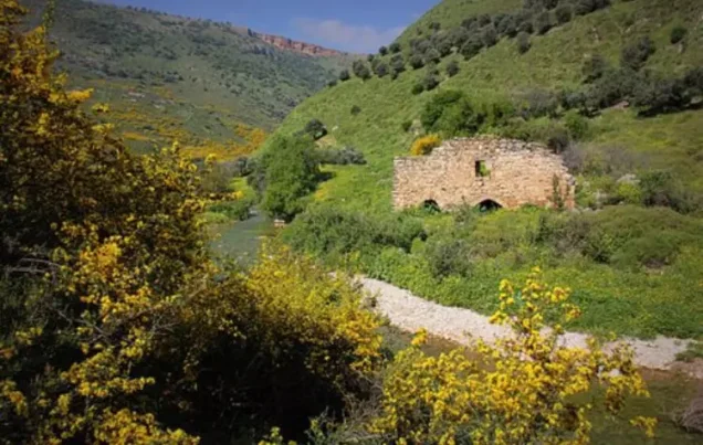
According to the field description published by Walid Khalidi in All That Remains, only a few stone terraces remained from the destroyed village.
The site was enclosed by barbed wire, with trees and cactus plants growing across it.
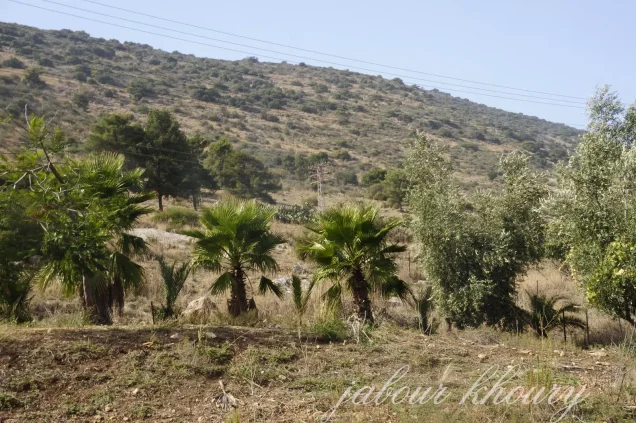
The village spring remained in use, while parts of Jahula's lands were planted with cotton and watermelons and the more hilly sections were wooded.
Palestine Remembered contains later community documentation of the 'Ayn Jahula/'Ayn Balata area, including a photographed visit conducted in May 2021 and uploaded to the site in 2025.
Additional historical maps and Mandate-era documents were uploaded in 2025 and 2026. Their upload dates should not be confused with the dates of the original material or treated as contemporary field verification.
These photographs and community contributions are useful historical documentation but do not constitute a systematic independent archaeological or field survey of the entire site.
The principal site description therefore remains Khalidi's historical field account. The approved sources used here do not provide a sufficiently comprehensive independent contemporary survey to verify the precise condition of every surviving feature of Jahula in 2026.
Sources
- PalQuestPalQuest – Interactive Encyclopedia of the Palestine Question: Jahula
- PalQuestPalQuest – Operation Yiftach
- PalQuestPalQuest – al-Zawiya: late Operation Yiftach chronology
- Palestine RememberedPalestine Remembered – Jahula, Safad District
- Palestine RememberedPalestine Remembered – Jahula entry from All That Remains
- Palestine RememberedPalestine Remembered – 1938 Mandate-era document referring to the Jahula school
- Palestine RememberedPalestine Remembered – 1946 document concerning an additional teacher in Jahula
- Palestine RememberedGovernment of Palestine – Census of Palestine, 1931
- archive.orgGovernment of Palestine – Census of Palestine, 1922
- Institute for Palestine StudiesInstitute for Palestine Studies – All That Remains, Walid Khalidi
Photo gallery
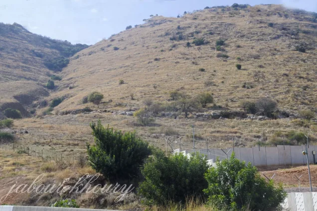
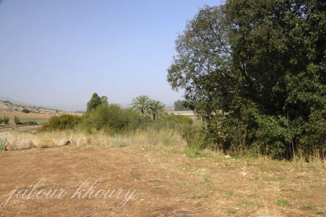

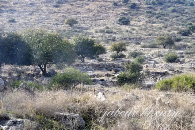
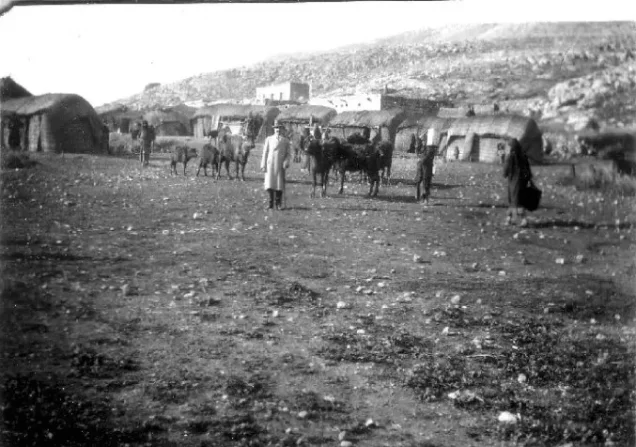
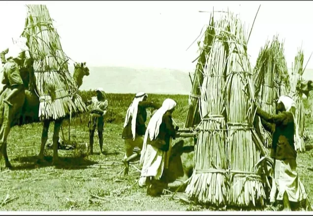
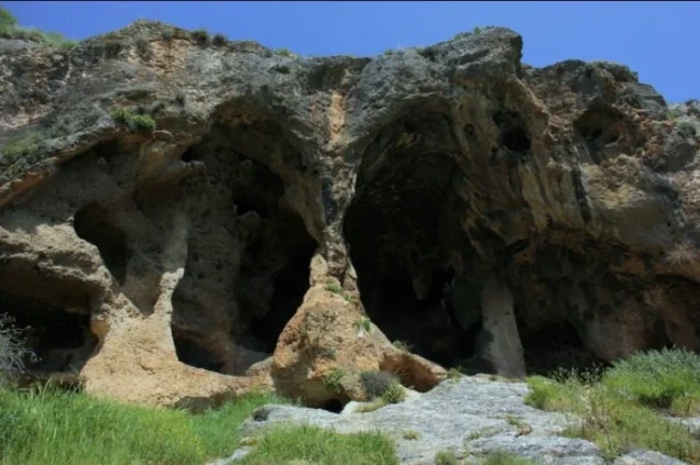

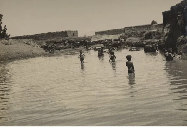
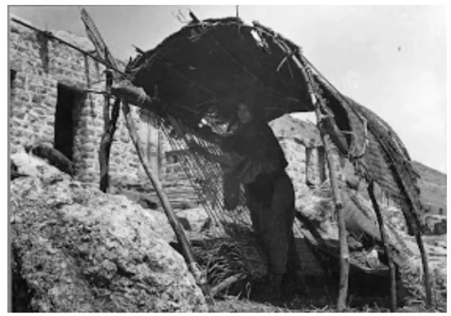
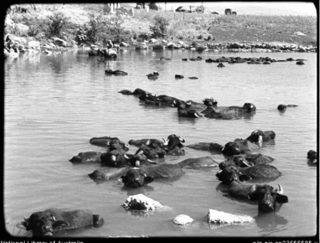
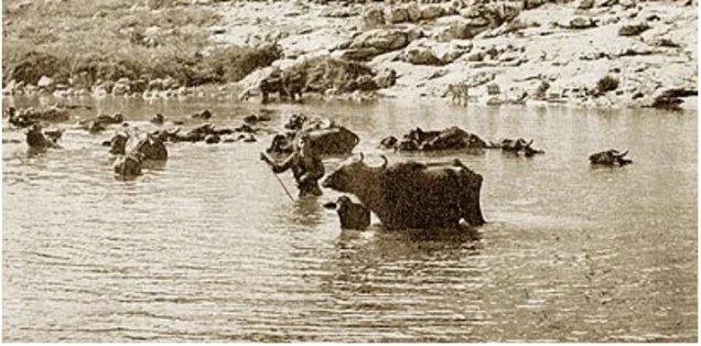
Photos from the village's people
Photos sent in by visitors and published after review.
Add a photo of this village
Log in to add photos of this village.
Other villages from Safed

More from the archive



 Download Our Palestine App
The whole archive in the palm of your hand: depopulated villages, the Nakba, the massacres and Al-Aqsa — free, with no ads to erase the story.
Download Our Palestine App
The whole archive in the palm of your hand: depopulated villages, the Nakba, the massacres and Al-Aqsa — free, with no ads to erase the story.



Comments
No comments yet — be the first to write one.
Add your comment
Name and email are optional. Comments appear after review.