
The depopulated village of Kirad al-Baqqara / District of Safed

Kirad al-Baqqara
About the depopulated village of Kirad al-Baqqara
- District
- Safed
- Date Kirad al-Baqqara was occupied
- 22 April 1948
- Population in 1948
- 420
- Military operation
- Operation Yiftach
- Brigade that carried it out
- Palmach
- Distance from the governorate centre
- 11 (km) North West of Safad
- Elevation above sea level
- 125 m
- Cause of displacement
- Influence of fall of, or exoduce from, neighboring town
- Extent of destruction
- The village has been completely destroyed, and only the rubble of destroyed houses left behind.
- Ethnic cleansing
- In 1956, the DMZ's 2,200 inhabitants have been terrorized into fleeing to Syria.
Hover a dot to read the village name, or click to open its card.
Borders of the depopulated village of Kirad al-Baqqara
Kirad al-Baqqara – Palestinian Village in the Safad Subdistrict
Kirad al-Baqqara was a Palestinian village in the Safad subdistrict of Galilee. It stood on the southern edge of the al-Hula Plain, approximately 11 kilometers northeast of Safad, at an average elevation of about 125 meters above sea level.
The village occupied a dark volcanic basalt outcrop amid the sedimentary formations characteristic of the southern Hula basin. It lay east of its twin village, Kirad al-Ghannama, at a slightly lower elevation, with Wadi Mushayrifa running between them.
Kirad al-Baqqara had an official population of 360 Muslims in 1944/45 and a registered land area of 2,262 dunums.
Its displacement cannot accurately be reduced to a single event in 1948. Many or most residents left on 22 April 1948 during Operation Yiftach, but Khalidi explicitly states that this evacuation was temporary, incomplete, or both. Residents later returned. Under the 1949 Syrian–Israeli General Armistice Agreement, the village became part of the Demilitarized Zone, after which its inhabitants experienced another forced removal in 1951, a UN-supported return, and finally permanent expulsion in 1956.
Key Facts about Kirad al-Baqqara
| Field | Information |
|---|---|
| Name | Kirad al-Baqqara |
| Subdistrict | Safad |
| Distance from Safad | Approximately 11 km northeast |
| Average elevation | Approximately 125 m above sea level |
| Mandate classification | Hamlet |
| Population, 1931 | 245 Muslims in 54 occupied houses |
| Population, 1944/45 | 360 Muslims |
| Registered land area | 2,262 dunums |
| First major evacuation | 22 April 1948; temporary or incomplete |
| 1948 military operation | Operation Yiftach |
| 1948 military unit | Palmach/Yiftach forces at operation level; the direct village-level unit is not independently established |
| Demilitarized Zone status | From the Syrian–Israeli General Armistice Agreement of 20 July 1949 |
| Forced removal in 1951 | Spring 1951, followed by a UN Security Council demand permitting return |
| Final expulsion | 30 October 1956 |
| Extent of destruction | The village was destroyed in later stages; rubble, stone piles, and house fragments remained |
| Israeli settlements on village land | None documented |
Kirad al-Baqqara and Kirad al-Ghannama
Kirad al-Baqqara and Kirad al-Ghannama were neighboring twin villages on the southern edge of the Hula Plain.
Kirad al-Baqqara stood east of Kirad al-Ghannama at a slightly lower elevation, with Wadi Mushayrifa separating the two.
Their inhabitants originated in pastoral groups that settled in the fertile and well-watered region because of its rich grazing lands.
Khalidi associates the name Baqqara with cattle raising, while Ghannama reflects sheep raising.
The Name “Kirad”
Mustafa Murad al-Dabbagh suggests that “Kirad” may be a variation of “Akrad,” meaning Kurds, reflecting Kurdish groups who settled in Palestine during the medieval period and afterward.
He also records an alternative interpretation connecting the name to irrigation workers known as karrada.
Local oral-history accounts emphasize that the villagers themselves spoke Arabic and did not preserve a Kurdish language.
The Kurdish explanation is therefore best treated as a historical interpretation of the place name rather than a definitive genealogical statement about every village family.
Location
Kirad al-Baqqara stood on a basalt outcrop on the southern edge of the al-Hula Plain, west of the Jordan River system and close to Wadi Mushayrifa.
Its proximity to the Banat Ya'qub Bridge and the Syrian frontier became particularly important after the 1948 war and the creation of the Syrian–Israeli Demilitarized Zone.
Local Palestinian documentation places Tulayl to the north, al-Husayniyya to the northwest, Kirad al-Ghannama to the west, al-Wayziyya to the southwest, Yarda to the south, and the Syrian frontier to the east.
Population
- 1931245Official Census of Palestine; all Muslims
- 1944/45360Official Village Statistics; all Muslims
- 1948418Later Palestine Remembered estimate, not an official census
- 19982,565Later estimate of refugees and descendants, not an official census
Number of Houses
- 193154Official Census of Palestine figure
- 194892Later Palestine Remembered estimate
The official 1931 census confirms 54 occupied houses. A figure of 34 repeated in some derivative websites is not supported by the official table.
Land Ownership
The registered village land area in 1944/45 totaled 2,262 dunums.
- Palestinian / Arab2,141 dunums95%
- Transferred to Zionists121 dunums5%
- Communal/Public0 dunums0%
The figures balance exactly: 2,141 + 121 = 2,262 dunums.
Some secondary local pages reproduce 2,261 dunums, but the official statistical breakdown and PalQuest support 2,262.
Land Use in 1944/45
- Arab
- Jewish
- Cereals2,082 dunums
- Plantations and irrigable land60 dunums
- Non-cultivable land120 dunums
The figures balance exactly: 2,082 + 60 + 120 = 2,262 dunums.
No separate built-up acreage appears in PalQuest's land-use table.
Economic Life
Agriculture and animal husbandry formed the basis of the village economy.
Grain was the principal crop, especially fodder crops such as maize. Villagers also cultivated onions and citrus fruit.
In 1944/45, 1,961 Arab dunums were devoted to cereals and 60 dunums to irrigated cultivation or orchards.
Cattle raising was especially important, alongside sheep and goats. Milk, dairy products, grain, and other agricultural surplus were traded in neighboring villages and towns.
Education
Khalidi states that Kirad al-Baqqara shared a coeducational school with Kirad al-Ghannama.
The Palestinian Encyclopedia reports that this shared school had approximately fifty boys and girls.
Local oral-history documentation, however, says that Kirad al-Baqqara did not have its own dedicated school building and that some children studied with a shaykh in Tulayl, in al-Ras al-Ahmar, or, in a small number of cases, in Safad.
These accounts are not necessarily incompatible: shared schooling may have taken place outside the built-up core of Kirad al-Baqqara or educational arrangements may have changed over time.
Local Landmarks and Water
Wadi Mushayrifa was one of the principal geographical landmarks, separating Kirad al-Baqqara from Kirad al-Ghannama.
The village lands also lay close to the Jordan River and Banat Ya'qub Bridge. Later community documentation records places such as 'Ayn Yarda and Hammam Banat Ya'qub.
Local oral history also records two revered shrines: Maqam Abu al-Rish west of the village and Maqam Banat Ya'qub to the south, with burial grounds nearby.
These shrine details derive from local community documentation rather than from Khalidi's principal village entry.
Operation Yiftach and the 1948 Evacuation
Operation Yiftach ran from 15 April to 25 May 1948 and was conducted by Palmach forces within the framework of Plan Dalet to gain control of eastern Galilee and Safad.
The Palmach's First Battalion spearheaded the overall operation, but this does not establish that it directly assaulted Kirad al-Baqqara.
Khalidi lists Kirad al-Baqqara among villages evacuated during the first week of the operation because of attacks, mortar fire, fear of reprisals, and concern about becoming caught in wider fighting.
The villagers are believed to have left on 22 April 1948.
Khalidi questions one contemporary explanation that they left because of the expected Syrian invasion, noting that the evacuation occurred more than three weeks before Syrian forces entered Palestine.
Was the Palmach First Battalion the Direct Attacking Unit?
Palestine Remembered identifies the Palmach's First Battalion as the attacking unit.
The battalion did spearhead Operation Yiftach at the campaign level. Khalidi's Kirad al-Baqqara entry, however, does not describe a direct First Battalion assault on the village itself.
The most accurate formulation is therefore: Palmach/Yiftach forces at the operation level; no direct village-specific unit is firmly established in the principal village account.
The 1948 Evacuation Was Not Final
This is essential to understanding Kirad al-Baqqara's history.
Khalidi explicitly states that the evacuation caused by Operation Yiftach was temporary, incomplete, or both.
The village's Palestinian population therefore did not permanently disappear on 22 April 1948.
Residents or a substantial part of the community returned, and the village remained inhabited after the war.
The Syrian–Israeli Demilitarized Zone
The Syrian–Israeli General Armistice Agreement was signed on 20 July 1949.
Where the Armistice Demarcation Line did not coincide with the former international frontier, the territory between them became a Demilitarized Zone in which military and paramilitary forces were prohibited.
Kirad al-Baqqara lay in the central sector of this zone.
The agreement was intended to permit the restoration and continuation of normal civilian life under the armistice regime and UN supervision.
Forced Removal in 1951
The status of the central Demilitarized Zone became increasingly contested in 1951.
Arab civilians, including residents of Kirad al-Baqqara and Kirad al-Ghannama, were removed from the zone and many were taken to Sha'ab in the Acre region.
The removal became a subject of formal UN consideration and of proceedings involving the Syrian–Israeli Mixed Armistice Commission.
Village buildings were also destroyed during this period, making later rehabilitation more difficult.
UN Security Council Resolution 93
On 18 May 1951, the UN Security Council adopted Resolution 93.
It decided that Arab civilians removed from the Demilitarized Zone by the Government of Israel should be permitted to return immediately to their homes.
The Mixed Armistice Commission was tasked with supervising their return and rehabilitation.
The resolution also stated that transfers of persons across international frontiers, armistice lines, or within the Demilitarized Zone should not take place without a prior decision of the Chairman of the Mixed Armistice Commission.
Return after 1951
A number of residents of Kirad al-Baqqara and Kirad al-Ghannama returned after UN intervention, while others remained in Sha'ab.
A later UN report recorded approximately 350 Arabs living in Baqqara, including former residents of Ghannama.
The report described very poor living conditions: people were living in tents and basic mud huts because the original buildings had been destroyed.
They had no school or medical facilities and faced restrictions on movement outside the village.
Final Expulsion in 1956
The dispute over Kirad al-Baqqara and Kirad al-Ghannama continued throughout the years of the Demilitarized Zone.
In 1956 the remaining Palestinian presence in the two villages came to an end through a further expulsion and destruction of the localities.
The best-supported date in the sources reviewed is 30 October 1956, during the Suez War.
Some Palestinian local-history pages reproduce “30 November 1956,” but the same pages elsewhere give 30 October, while academic documentation of the episode places the expulsion on 30 October.
This article therefore uses 30 October 1956 as the final expulsion date while noting the local-source discrepancy.
Military Unit in the Final Expulsion
Some local Palestinian sources attribute the 1956 expulsion to “Unit 101.”
The principal sources used here, including Khalidi, PalQuest, and UN documentation, establish the final expulsion but do not provide sufficient village-specific evidence to confirm that tactical-unit attribution.
The article therefore records the final expulsion by Israeli forces without assigning a specific unit where the evidence remains uncertain.
Cause of Depopulation
Kirad al-Baqqara cannot be accurately described with a single depopulation cause.
In 1948 the population experienced a temporary or partial flight during Operation Yiftach amid military attacks and fear of wider fighting.
Residents returned, were forcibly removed again in 1951, and some returned following UN intervention.
The final depopulation occurred in 1956 when the remaining residents were expelled and the village was destroyed.
Ethnic Cleansing
Palestine Remembered characterizes the final outcome as complete ethnic cleansing.
The documented historical sequence is more precisely described as repeated displacement, return, forcible removal, renewed return, and final expulsion.
UN documentation independently establishes the removal of Arab civilians from the Demilitarized Zone in 1951 and the Security Council's demand that they be permitted to return.
The term “ethnic cleansing” is therefore retained as an attributed characterization, while the directly documented outcome is the eventual complete removal of Kirad al-Baqqara's Palestinian community and destruction of the village by 1956.
Occupation and Displacement Chronology
- 15 April 1948
Beginning of Operation Yiftach
Palmach forces launched the campaign to control eastern Galilee and Safad.
- 22 April 1948
First evacuation
Residents left amid attacks and fear of wider fighting; Khalidi describes the evacuation as temporary or incomplete.
- After the 1948 evacuation
Return
Residents or a substantial portion of the community returned.
- 20 July 1949
Syrian–Israeli Armistice Agreement
Kirad al-Baqqara became part of the Demilitarized Zone.
- 1949–1951
Pressure on residents
Increasing pressure was applied to Arab residents of the Demilitarized Zone.
- Spring 1951
Forced removal
Residents of Kirad al-Baqqara and Kirad al-Ghannama were removed; many were taken to Sha'ab.
- 18 May 1951
Security Council Resolution 93
The Security Council required that Arab civilians removed from the Demilitarized Zone be allowed to return.
- 1951 onward
Partial return
Some villagers returned while others remained in Sha'ab.
- Mid-1950s
Continued residence
UN documentation records hundreds of Arabs living at Baqqara, including former residents of Ghannama.
- 30 October 1956
Final expulsion
The remaining inhabitants were expelled; most went to Syria.
- 1956
Final destruction
The village ceased to exist as an inhabited Palestinian community.
Israeli Settlements and Kirad al-Baqqara's Lands
Khalidi and PalQuest state that no Israeli settlement was established directly on Kirad al-Baqqara's village lands.
| Settlement | Established | Relationship to Kirad al-Baqqara |
|---|---|---|
| Gadot | 1949 | Approximately 1 km east of the village site; not documented as established on village land |
| Mishmar ha-Yarden | 1949 | Approximately 1.5 km south of the site; not documented as established on village land |
Kirad al-Baqqara Today
According to Walid Khalidi's field description, rubble, stone piles, and fragments of houses are scattered across the former village site.
Grass, Christ's-thorn trees, and cactus plants grow throughout the area.
Palestine Remembered contains later community documentation from 2005, 2011, 2012, and 2014 showing the village lands, cemetery, Wadi Yarda, Maqam Abu al-Rish, and the Banat Ya'qub area.
Such later material helps document individual surviving features and community memory but does not constitute a comprehensive archaeological or cadastral survey.
Khalidi's description derives from fieldwork undertaken before the publication of All That Remains in 1992 and should therefore be treated as documented historical site evidence rather than comprehensive direct field verification of conditions in 2026.
Sources
- PalQuest – Interactive Encyclopedia of the Palestine Question: Kirad al-Baqqara
- PalQuest – Operation Yiftach
- PalQuest – Syrian–Israeli General Armistice Agreement, 20 July 1949
- Palestine Remembered – Kirad al-Baqqara, Safad District
- Walid Khalidi – All That Remains: Kirad al-Baqqara
- Palestinian Encyclopedia – Kirad al-Baqqara and Kirad al-Ghannama
- United Nations – Security Council Resolution 93 (1951)
- United Nations – Report on Arab inhabitants of Baqqara and Ghannama in the Demilitarized Zone
- British Journal of Middle Eastern Studies – The Israeli-Syrian Mixed Armistice Commission and the fate of Krad al-Baqqara and Krad al-Ghaname, 1948–1956
- Palestinian Villages Encyclopedia – Kirad al-Baqqara and the Demilitarized Zone, local-history documentation
- Institute for Palestine Studies – All That Remains, Walid Khalidi
Photo gallery
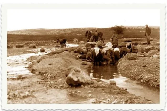


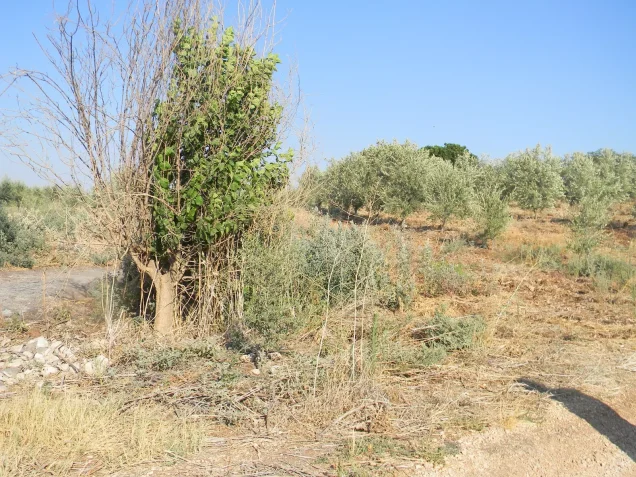
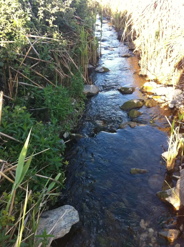

Photos from the village's people
Photos sent in by visitors and published after review.
Add a photo of this village
Log in to add photos of this village.
Other villages from Safed



More from the archive



 Download Our Palestine App
The whole archive in the palm of your hand: depopulated villages, the Nakba, the massacres and Al-Aqsa — free, with no ads to erase the story.
Download Our Palestine App
The whole archive in the palm of your hand: depopulated villages, the Nakba, the massacres and Al-Aqsa — free, with no ads to erase the story.



Comments
No comments yet — be the first to write one.
Add your comment
Name and email are optional. Comments appear after review.