
The depopulated village of Simsim / District of Gaza
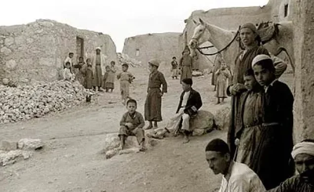
About the depopulated village of Simsim
- District
- Gaza
- Date Simsim was occupied
- 13 May 1948
- Population in 1948
- 1,500
- Military operation
- Operation Barak
- Brigade that carried it out
- Negev Brigade
- Distance from the governorate centre
- 15 (km) North East of Gaza
- Elevation above sea level
- 50 m
- Cause of displacement
- Expulsion by Zionist troops
- Extent of destruction
- The village has been completely obliterated.
- Ethnic cleansing
- Simsim inhabitants were completely ethnically cleansed.
- Settlements built on the land of Simsim before 1948
- Gvar'am
Hover a dot to read the village name, or click to open its card.
Borders of the depopulated village of Simsim
Simsim: A Depopulated Palestinian Village in the Gaza District
Simsim, also known as Sumsum, was a Palestinian village in the Gaza District, approximately 15 km northeast of Gaza city. It stood on flat ground in the coastal plain at an average elevation of about 50 metres above sea level. Its inhabitants were displaced during the Nakba and the occupation of Palestine in 1948, with the principal sources placing its capture in May 1948.
Location of Simsim
Simsim stood on flat ground in the coastal plain and was surrounded by hills. Wadi Simsim ran along its southern perimeter.
The village lay between the main coastal highway and another parallel road running from Gaza to Julis. Secondary roads connected Simsim to these routes and to neighbouring villages.
The total land area of Simsim was 16,797 dunums according to the 1944/45 statistics.
History of Simsim
The Crusaders knew the village as Semsem. In 1596, Simsim was a village in the nahiya of Gaza, within the liwa of Gaza, with an estimated population of 110. It paid taxes on wheat, barley, fruit, goats, and beehives.
By the late nineteenth century, Simsim was surrounded by gardens. It had a well, a pool, and an olive grove to the north.
Simsim was also the birthplace of Shaykh Sulayman Abd al-Qadir, known as Abu Ali, one of the leaders of the 1936 revolt against British occupation.
Architecture of Simsim
The village had an approximately circular layout. Straight, narrow streets radiated from its centre and intersected with semi-circular streets.
Simsim was divided into several quarters, the largest of which was the northern quarter. Roads connecting the village with neighbouring communities separated these quarters and also formed the axes along which the built-up area expanded.
A mosque stood at the central junction, while most village houses were built of adobe brick.
Education in Simsim
A school was founded in Simsim in 1934. In 1947 it became a shared school with the neighbouring village of Najd. According to Walid Khalidi and PalQuest, its enrolment reached approximately 150 pupils in the mid-1940s.
Palestine Remembered's statistical page gives a different figure of 45 pupils in 1947. Because the two entries conflict, the figure of 150 from Khalidi's narrative is retained here while the discrepancy is noted.
The Palestinian inhabitants of the village itself were Muslim.
Archaeological Sites in Simsim
The village lands included an archaeological mound known as al-Ras and three other archaeological sites. One of them, known as Sha'fat al-Mughur, contained a Roman cemetery with rock-cut tombs.
Economic Life in Simsim
Agriculture was the principal source of livelihood. Toward the end of the British Mandate period, residents cultivated cereals, vegetables, and fruits, including citrus.
Agriculture was both rainfed and irrigated from wells between 35 and 40 metres deep. Fruit trees and gardens surrounded Simsim, with many of the fruit trees concentrated in the southwestern lands that benefited from floodwater carried by the wadis.
In the 1944/45 statistics, 240 dunums were devoted to citrus and bananas. Another 250 dunums of Arab land and 2 dunums of Jewish land were classified as plantations and irrigable land. A total of 15,582 dunums was devoted to cereals.
Land Ownership in Simsim
The total land area of Simsim was 16,797 dunums. PalQuest presents the official categories as Arab, Jewish, and public land, while the Arabic Palestine Remembered table describes the corresponding categories as Palestinian, “transferred to Zionists,” and communal land.
Land ownership in Simsim, 1944/45
- Arab12,671 dunums75%
- Jewish3,386 dunums20%
- Public740 dunums4%
Palestine Remembered presents the same figures in its Arabic table as 12,671 Palestinian dunums, 3,386 dunums “transferred to Zionists,” and 740 dunums of communal land.
Land Use in Simsim, 1944/45
Land use in Simsim according to PalQuest
- Arab
- Jewish
- Public
- Citrus and bananas240 dunums
- Plantations and irrigable land252 dunums
- Cereals15,582 dunums
- Built-up area44 dunums
- Non-cultivable land679 dunums
The total area classified as cultivated or cultivable was 16,074 dunums: 12,576 Arab, 3,377 Jewish, and 121 public dunums. Non-cultivable and built-up land together amounted to 723 dunums.
Palestine Remembered presents some of these figures differently by incorporating public land into the Palestinian column. For example, it gives 12,207 dunums of cereal land rather than separating the figure into 12,086 Arab and 121 public dunums.
Population of Simsim
Population of Simsim in selected years
- 1596110Estimate derived from Ottoman records
- 1922760Official British Mandate census
- 1931855Official British Mandate census
- 1944/451,360Official statistics: 1,290 Arabs and 70 Jews
- 19481,496Later estimate published by Palestine Remembered, including 70 Jews
- Estimated refugees in 19989,190Later estimate published by Palestine Remembered
Walid Khalidi describes the Palestinian villagers themselves as Muslim. The 1944/45 breakdown of 1,290 Arabs and 70 Jews is a statistical classification covering the relevant village statistical unit and its lands.
Number of Houses in Simsim
Number of houses in Simsim
- 1931195Official census figure
- 1948341Later estimate published by Palestine Remembered
Occupation and Depopulation of Simsim during the Nakba
The Palmach's Negev Brigade captured Simsim during one of its northward thrusts shortly before 15 May 1948 and expelled the village's inhabitants during the Nakba.
Walid Khalidi, as reproduced by PalQuest, cites Israeli historian Benny Morris as stating that the capture occurred in the wake of the occupation of Burayr on 12–13 May 1948. Morris is not used here as an independent source; his account is mentioned only because it is quoted within the approved Palestinian reference.
Palestine Remembered gives 13 May 1948 as the occupation date and categorizes the capture under Operation Barak. However, PalQuest's dedicated entry for Simsim does not explicitly name the military operation, and PalQuest's Operation Barak page does not include Simsim in its list of affected villages. The association with Operation Barak is therefore attributed specifically to Palestine Remembered rather than presented as a point on which all sources agree.
Khalidi also records a conflicting report by the New York Times stating that Simsim was occupied approximately two months later, during the “Ten Days” between the two truces, shortly before 11 July 1948. Khalidi considers this report doubtful because it groups Simsim with villages located much farther north and regards their simultaneous capture as geographically unlikely.
- Probable occupation date: 13 May 1948, or more broadly shortly before 15 May following the fall of Burayr on 12–13 May.
- Documented attacking unit: the Palmach's Negev Brigade.
- Military operation: Palestine Remembered associates the capture with Operation Barak; Khalidi's dedicated PalQuest entry does not explicitly name the operation.
- Fate of the inhabitants: the villagers were expelled during the Nakba.
- Alternative account: occupation shortly before 11 July 1948, a version Khalidi regarded as doubtful.
Settlements Associated with the Lands of Simsim
Gevar'am was established in 1942, before the Nakba, on land that had traditionally belonged to Simsim.
Or ha-Ner was established in 1957 less than one kilometre south of the former village site. Walid Khalidi and PalQuest state, however, that it was built on the lands of the neighbouring village of Najd. It is therefore not listed here as a settlement established directly on Simsim's lands.
Simsim Today
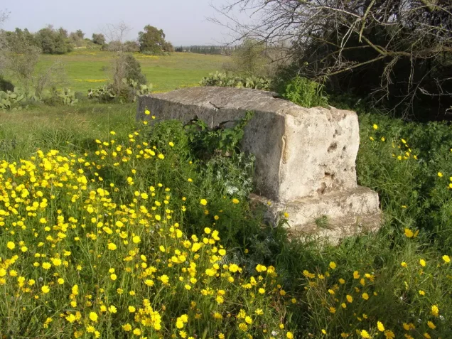
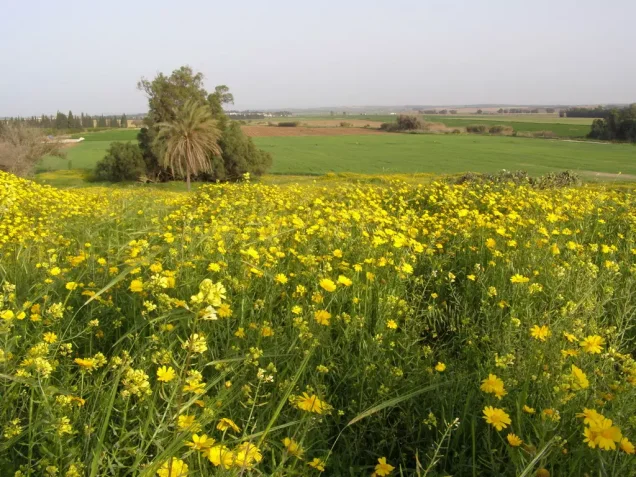
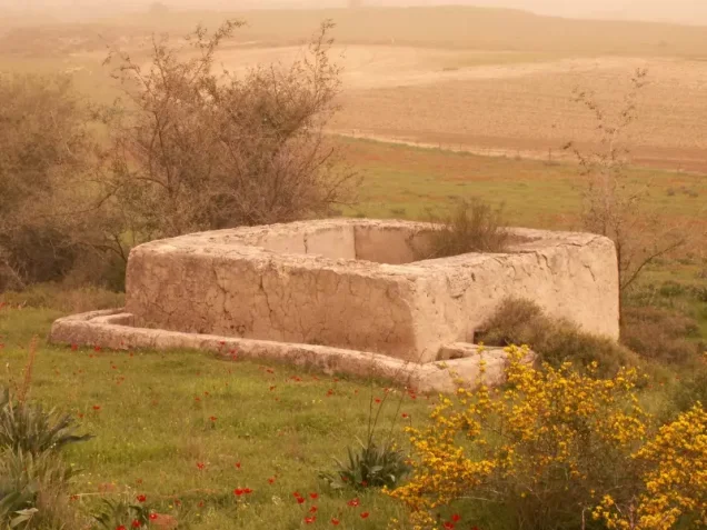
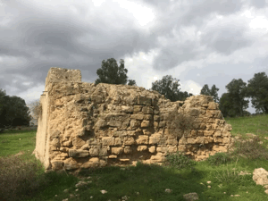
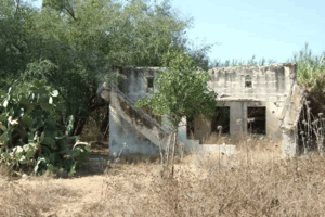
According to the field description published by Walid Khalidi in All That Remains, the village had been comprehensively destroyed and could mainly be identified by surviving cypress and sycamore trees. A pile of stones, possibly the remains of a village building, was still visible. The site was fenced and used as pasture, while surrounding lands were cultivated.
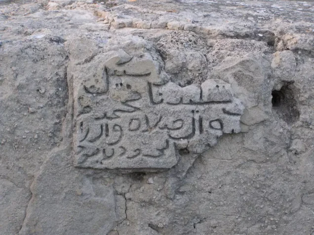
Palestine Remembered also contains field photographs taken in March 2009 documenting remains of houses, wells, rubble from the mosque, the cemetery, and other features of the village site. These photographs provide documentation more recent than Khalidi's 1992 description but do not constitute a comprehensive contemporary field survey.
The approved sources used here do not provide an independent, comprehensive field verification of the condition of every part of the Simsim site in 2026.
Sources
- PalQuestPalQuest – Interactive Encyclopedia of the Palestine Question: Simsim
- PalQuestPalQuest – Operation Barak
- Palestine RememberedPalestine Remembered – Simsim, Gaza District
- Palestine RememberedPalestine Remembered – Field Tour of Simsim, March 2009
- Institute for Palestine StudiesInstitute for Palestine Studies – All That Remains, Walid Khalidi
Photo gallery
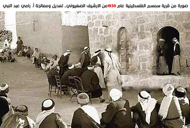
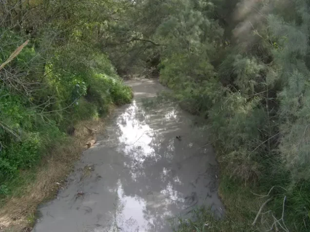
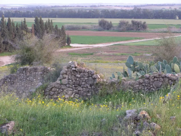
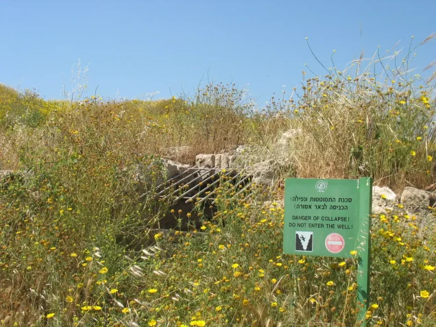
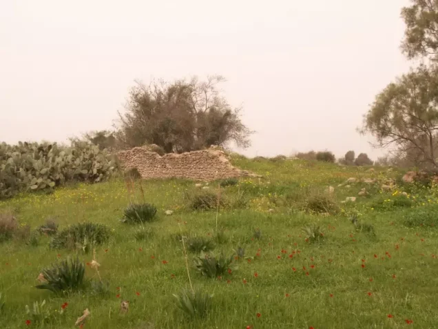
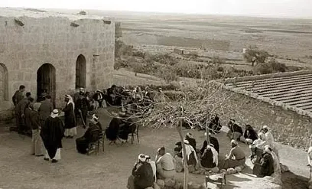
Photos from the village's people
Photos sent in by visitors and published after review.
Add a photo of this village
Log in to add photos of this village.
Other villages from Gaza
More from the archive


 Download Our Palestine App
The whole archive in the palm of your hand: depopulated villages, the Nakba, the massacres and Al-Aqsa — free, with no ads to erase the story.
Download Our Palestine App
The whole archive in the palm of your hand: depopulated villages, the Nakba, the massacres and Al-Aqsa — free, with no ads to erase the story.



Comments
No comments yet — be the first to write one.
Add your comment
Name and email are optional. Comments appear after review.