
The depopulated village of Al-Faluja / District of Gaza
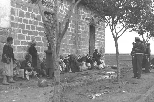
Al-Faluja
About the depopulated village of Al-Faluja
- District
- Gaza
- Date Al-Faluja was occupied
- 01 March 1949
- Population in 1948
- 33,267
- Military operation
- Operation Yoav
- Who defended the village
- Egyptian Army
- Distance from the governorate centre
- 30 (km) North East of Gaza
- Elevation above sea level
- 100 m
- Cause of displacement
- Expulsion by Zionist troops
- Extent of destruction
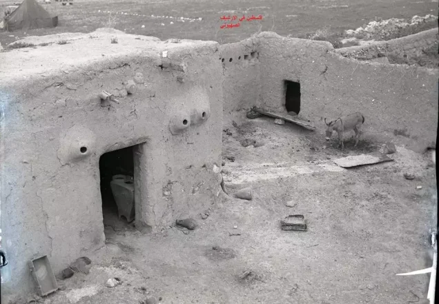
- The village was mostly destroyed with the exception of its mosque foundation.
- Ethnic cleansing
- al-Faluja inhabitants were completely ethnically cleansed. Please see the Stories & Memories section for detail account of the village cleansing.
- Settlements built on the built-up area of Al-Faluja after 1948
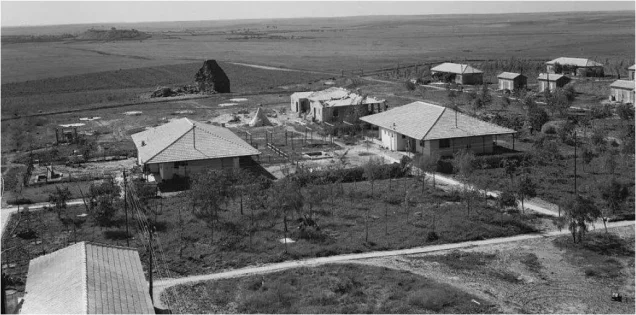
- Shahar, Nir Chen, Noga, Nehora, and part of Qiryat Gat.
Hover a dot to read the village name, or click to open its card.
Borders of the depopulated village of Al-Faluja
Al-Faluja: A Depopulated Palestinian Village in the Gaza District
Al-Faluja was a Palestinian village in the Gaza District, situated between Gaza and Hebron. Before the Nakba and the occupation of Palestine in 1948, it developed into an important commercial and agricultural centre serving numerous surrounding villages. Israeli forces besieged the village in late 1948, and it passed under Israeli control following the withdrawal of the Egyptian forces in February 1949. Despite the protections stipulated in the armistice agreement, its Palestinian population was driven out by 21 April 1949.
- Subdistrict
- Gaza
- Distance from district center
- 30 km North East of Gaza
- Average Elevation
- 100 meters above sea level
- Population in 1931
- 3,161 inhabitants - Official British Mandate census
- Number of Houses in 1931
- 685 houses - Official census figure
- Population in 1944/1945
- 4,670 inhabitants - Official population estimate
- Estimated Population in 1948
- 5,417 inhabitants - a later demographic estimate, not an official census
- Total Land Area in 1945
- 38,038 dunams
- Attack and Depopulation
- Al-Faluja endured repeated attacks in 1948 and was then besieged inside the Faluja Pocket; control passed to Israel after the Rhodes Armistice on 24 February 1949, and the village was emptied of its Palestinian population by 21 April 1949
- Final Israeli Control
- 24 February 1949
- Military Operation
- Operation Yoav
- Cause of Depopulation
- Expulsion by Zionist troops
- Settlements Documented on Village Lands
- Shahar, Nir Chen, Noga, Nehora, and part of Qiryat Gat.
Location and Geography
Al-Faluja was located approximately 30 kilometres northeast of Gaza and stood at an average elevation of about 100 metres above sea level. Its lands bordered those of Iraq al-Manshiyya, Jusayr, Hatta, Karatiyya, and Iraq Suwaydan.
The village extended across hilly terrain on the coastal plain. Wadi al-Faluja originally bordered it on the east, north, and west. The depth of the watercourse gave the village a natural defensive advantage, although it was also prone to flooding during winter.
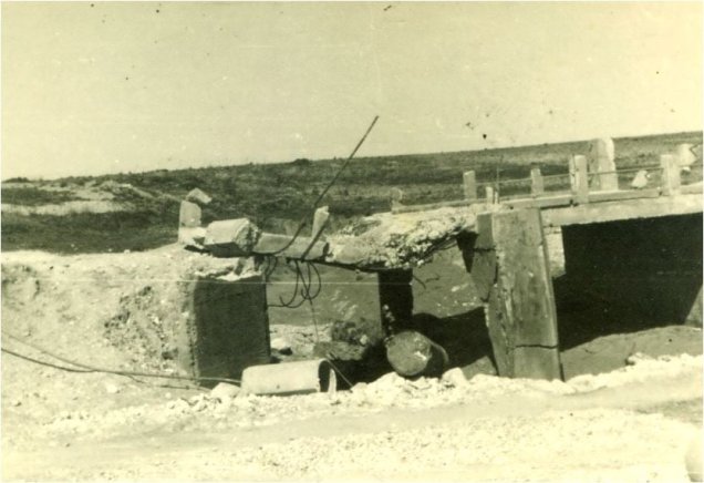
As the village expanded, its residential area crossed the wadi, dividing al-Faluja into northern and southern sections. Bridges were constructed to connect the two sections and facilitate movement, particularly during the rainy season.
Al-Faluja occupied a central position within a network of roads leading to Gaza, Hebron, Jerusalem, Jaffa, and other regional centres. This location contributed to its development as an important commercial centre before 1948.
Name and Historical Development
According to accounts collected from the villagers, al-Faluja was founded on a site previously known as Zurayq al-Khandaq. “Zurayq” is derived from the Arabic word for blue and was a popular name for lupine, a leguminous plant with blue flowers that grew around the site.
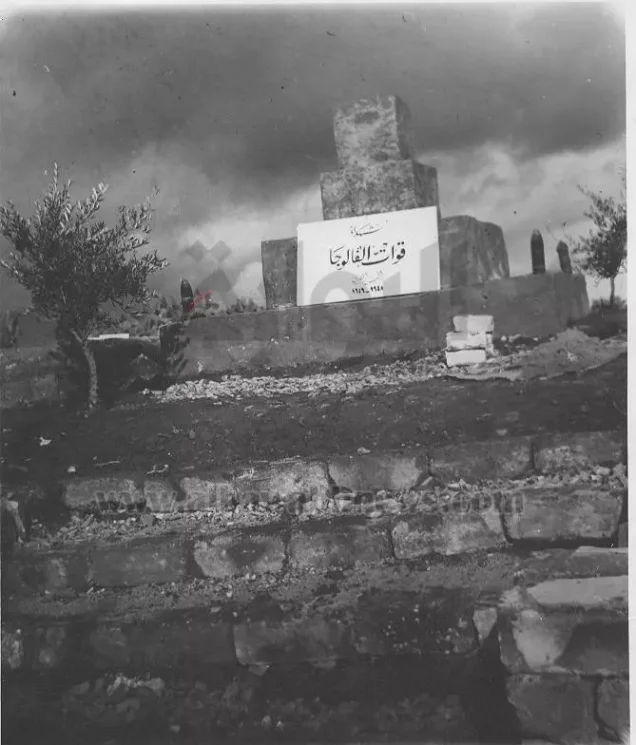
The village was later named al-Faluja in memory of the Sufi figure Shihab al-Din al-Faluji, who came to Palestine from Iraq in the early fourteenth century, settled near the site, and was buried there. The eighteenth-century Arab geographer al-Bakri al-Siddiqi recorded visiting his tomb after passing through Bayt Jibrin.
The village originally developed around the shrine of Shaykh al-Faluji. During the 1930s, its built-up area expanded substantially, and its commercial centre shifted northward, where modern houses, shops, coffee houses, and a clinic were established.
Religious and Archaeological Features
The inhabitants of al-Faluja were Muslims. They worshipped in a large and old mosque consisting of three domed halls, one of which contained the tomb of Shaykh al-Faluji. The village also contained several smaller shrines traditionally associated with religious figures.
Khirbat al-Jils was recorded as an archaeological site within or near the village’s lands. The available sources do not provide sufficient evidence to date all the village’s shrines specifically to the Crusader period; that claim has therefore not been included as an established fact.
Population
Ottoman tax records for 1596 listed 413 inhabitants in al-Faluja. This figure was derived from household-based tax records and should not be treated in the same manner as a modern population census.
The 1922 British Mandate census recorded 2,482 residents. By 1931, the population had increased to 3,161 people living in 685 houses. The official Village Statistics for 1944/45 recorded 4,670 Palestinian residents.
The figures of 5,417 inhabitants in 1948 and 33,267 refugees descended from the village in 1998 are demographic estimates published by Palestine Remembered. They are not official census totals and should therefore be clearly distinguished from the British Mandate figures.
Population figures and estimates for al-Faluja
- 1596413Estimate derived from Ottoman tax records
- 19222,482Official British Mandate census
- 19313,161Official British Mandate census
- 19454,670Official population estimate
- 19485,417Later demographic estimate
- 199833,267Estimate of refugees and their descendants
Number of Houses
Recorded and estimated number of houses in al-Faluja
- 1931685Official census figure
- 19481,173Later estimate
Education and Public Life
A boys’ school was established in al-Faluja in 1919. It had land allocated for agricultural training and a boarding section accommodating 25 pupils. In 1947, it became a junior secondary school with an enrolment of 520 pupils.
A girls’ school opened in 1940 and had 83 pupils in 1943. The presence of these two schools reflected al-Faluja’s importance as a centre serving both the village and neighbouring communities.
A local council was established in 1922. It administered public services and infrastructure, including bridges, the market, and water facilities. Shortly before the Nakba, the council began a project to bring water from a well near the village of Julis because the village’s four existing wells had become insufficient for its expanding population.
Economic Life
Most residents depended on rainfed agriculture, cultivating cereals, vegetables, and fruit. According to the official statistics for 1944/45, 36,590 dunams were planted with cereals, while 87 dunams were irrigated or used for orchards.
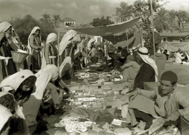
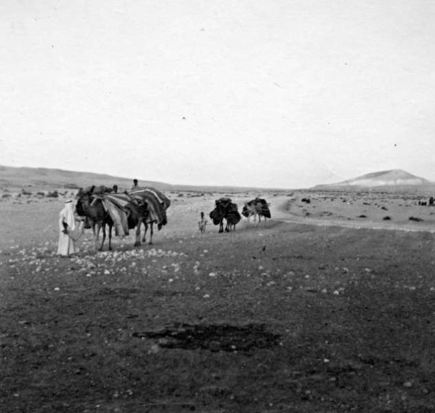
Commerce was the village’s second most important economic activity. A weekly market was held from Wednesday noon until Thursday noon on a site prepared by the local council. Traders and shoppers attended from neighbouring villages and towns, including Barqusya, Bi'lin, Summil, Zayta, and other communities.
The inhabitants also engaged in animal husbandry, poultry farming, grain milling, embroidery, weaving, and pottery. Al-Faluja had a well-known dyehouse that attracted customers from across the region.
Land Ownership
The official Village Statistics for 1944/45 recorded a total of 38,038 dunams under al-Faluja. Of this area, 37,252 dunams were under Palestinian ownership and 786 dunams were classified as public land. No Jewish land ownership was recorded within the village boundaries.
Land ownership in al-Faluja according to the 1944/45 Village Statistics
- Palestinian ownership37,252 dunums98%
- Jewish ownership0 dunums0%
- Public land786 dunums2%
Land Use
Use of al-Faluja’s land in 1944/45
- Irrigated land and orchards87 dunums<1%
- Cereal cultivation36,590 dunums49%
- Built-up area517 dunums<1%
- Total cultivable land36,677 dunums49%
- Uncultivable land844 dunums1%
Attacks, Siege, Occupation, and Depopulation
Early Attacks in 1948
Al-Faluja was attacked more than once during the early months of the Nakba. The Palestinian newspaper Filastin reported an attack on 24 February 1948 without providing details.
On 14 March 1948, an armed Haganah convoy clashed with villagers while passing through al-Faluja. According to contemporary press reports cited by PalQuest, 37 Palestinians and seven Jewish fighters were killed, while scores of Palestinians and three Jewish fighters were wounded. A Haganah demolition unit returned later that day and destroyed ten buildings, including the three-storey municipal building. Contemporary reports also identified the post office among the buildings destroyed.
The Faluja Pocket
During Operation Yoav in October 1948, Israeli forces advanced across the southern front and surrounded an Egyptian brigade and Palestinian civilians in al-Faluja and neighbouring Iraq al-Manshiyya. The encircled area became known as the “Faluja Pocket.”
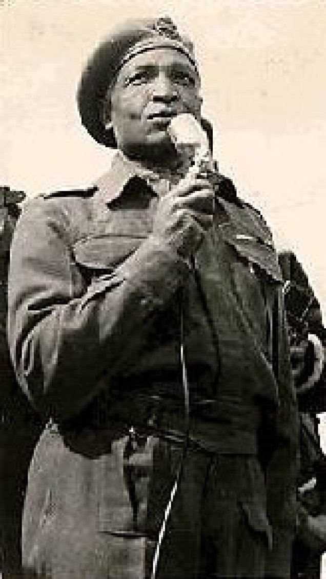
The Egyptian force resisted inside the pocket from late October 1948 until February 1949 despite the interruption of regular supply routes. Palestinian residents shared their available food and other resources with the besieged soldiers. Gamal Abdel Nasser, who later became president of Egypt, served as an officer within the encircled Egyptian force. Muhammad Naguib was also present as an Egyptian officer, while the force was commanded by Brigadier Sayyid Taha, widely known as “al-Dabba al-Sawda,” or the Black Panther.
The Armistice and Transfer of Control
Al-Faluja did not fall through a final direct assault. The Egyptian brigade remained in the pocket until the Egyptian-Israeli General Armistice Agreement was signed on 24 February 1949. Under the agreement, the Egyptian forces were permitted to withdraw, and the pocket was transferred to Israeli control.
The armistice agreement stipulated that the civilian population in the pocket should be protected and allowed to remain. Contemporary accounts indicate that only a small proportion of the civilians initially chose to leave with the Egyptian forces.
Expulsion of the Population
According to the account reproduced by PalQuest from Walid Khalidi’s All That Remains, Israeli forces violated the civilian protections of the armistice agreement almost immediately. United Nations observers documented beatings, robberies, and attempted sexual assaults by members of the local Israeli garrison.
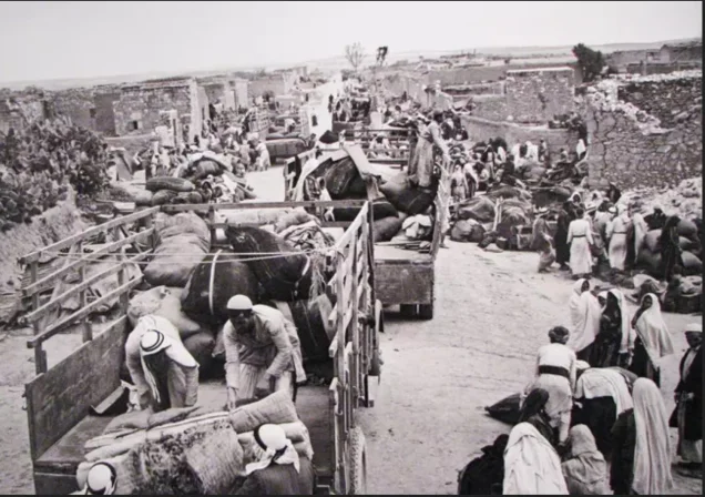
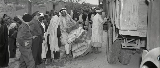
PalQuest also reports, while explicitly citing Israeli archival material reproduced in the Palestinian reference work, that intimidation and a “whispering propaganda” campaign were used to induce the inhabitants to leave. The remaining Palestinian population had been driven out by 21 April 1949, principally towards the Hebron area and the Gaza Strip.
The precise date of military control must therefore be distinguished from the date of complete depopulation: the pocket was transferred to Israeli control following the armistice agreement in February 1949, whereas the removal of its Palestinian population was completed by 21 April 1949.
The reviewed sources associate the encirclement of the pocket with Operation Yoav. They do not, however, conclusively identify a single brigade or unit as solely responsible for the intimidation, expulsion, and subsequent destruction of al-Faluja.
Occupation and Depopulation Chronology
- 24 February 1948
Early Attacks in 1948
Al-Faluja was attacked more than once during the early months of the Nakba. The Palestinian newspaper Filastin reported an attack on 24 February 1948 without providing details.
- 24 February 1949
The Armistice and Transfer of Control
Al-Faluja did not fall through a final direct assault. The Egyptian brigade remained in the pocket until the Egyptian-Israeli General Armistice Agreement was signed on 24 February 1949.
- 21 April 1949
Expulsion of the Population
According to the account reproduced by PalQuest from Walid Khalidi’s All That Remains, Israeli forces violated the civilian protections of the armistice agreement almost immediately. United Nations observers documented beatings, robberies, and attempted sexual assaults by members of the local Israeli garrison.
Settlements Established on the Village Lands
- Qiryat Gat was established in 1954, principally on the lands of Iraq al-Manshiyya between that village and al-Faluja. It subsequently expanded onto land belonging to al-Faluja.
- Shahar was established on al-Faluja’s lands in 1955.
- Noga was established on al-Faluja’s lands in 1955.
- Nir Chen was established on al-Faluja’s lands in 1955.
- Nehora was established on al-Faluja’s lands in 1956.
The Village Site Today
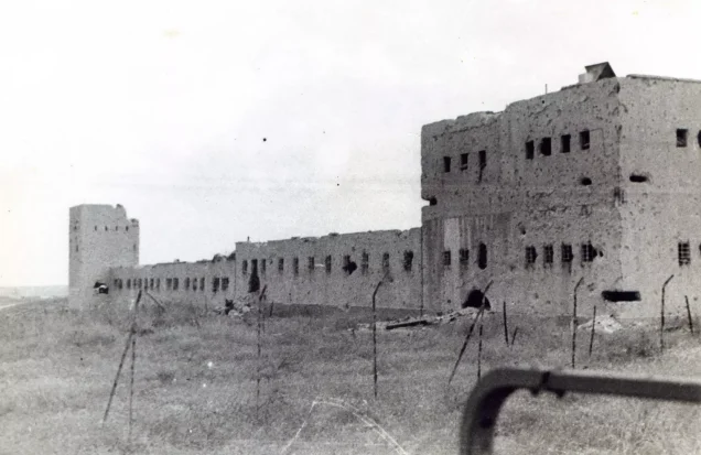
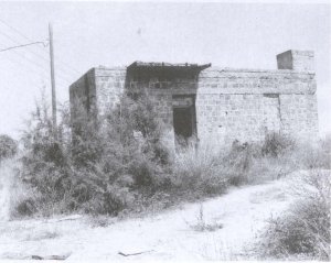
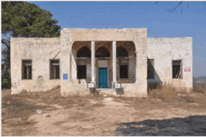
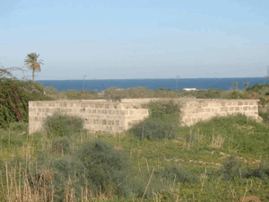
Only the foundations of al-Faluja’s mosque and small fragments of its walls remain visible. Rubble is scattered or piled around the former location of the mosque. A deteriorating well and a cistern also survive.
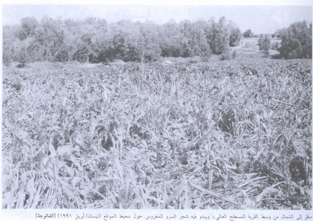
Eucalyptus trees, cactus plants, Christ’s-thorn trees, and olive trees grow across parts of the site. Israeli government buildings and an airfield were constructed on the surrounding land, while much of the village’s former agricultural area is now cultivated.
Sources
- Interactive Encyclopedia of the Palestine Question – al-Faluja
- Interactive Encyclopedia of the Palestine Question – al-Faluja, Arabic edition
- Palestine Remembered – al-Faluja, Gaza District
- Institute for Palestine Studies – All That Remains, edited by Walid Khalidi
- PalQuest – Egyptian-Israeli General Armistice Agreement, 24 February 1949
Photo gallery
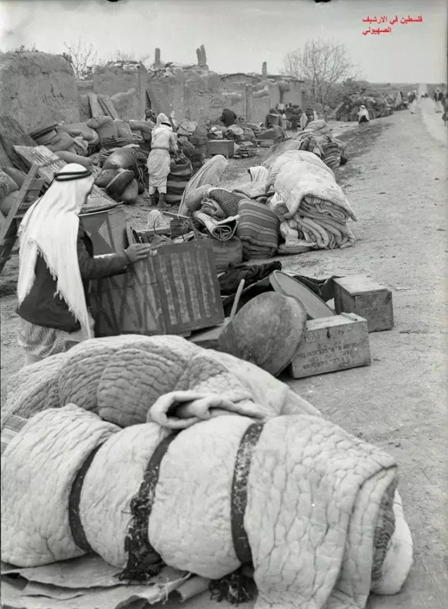
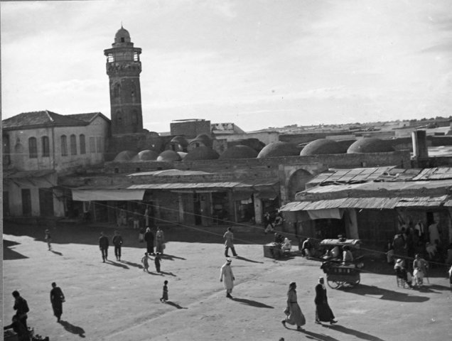
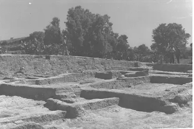
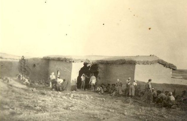
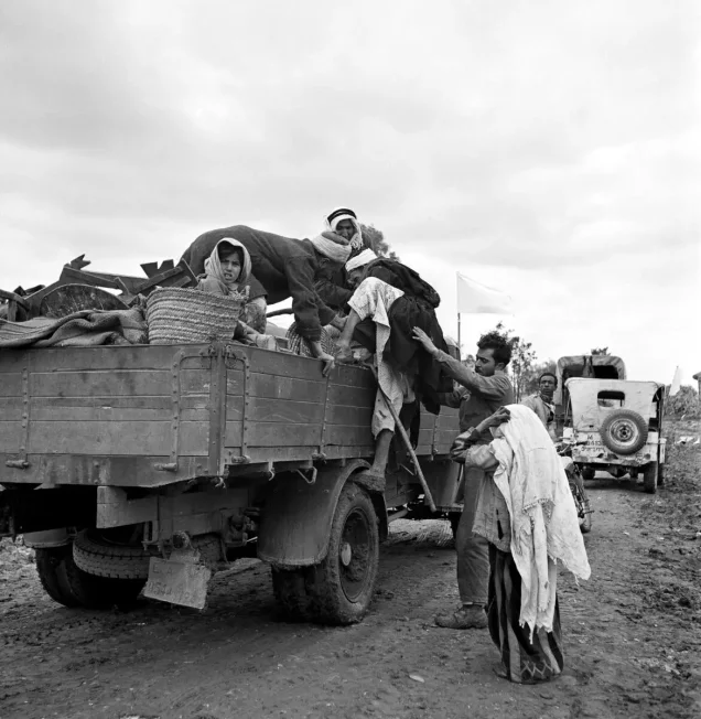
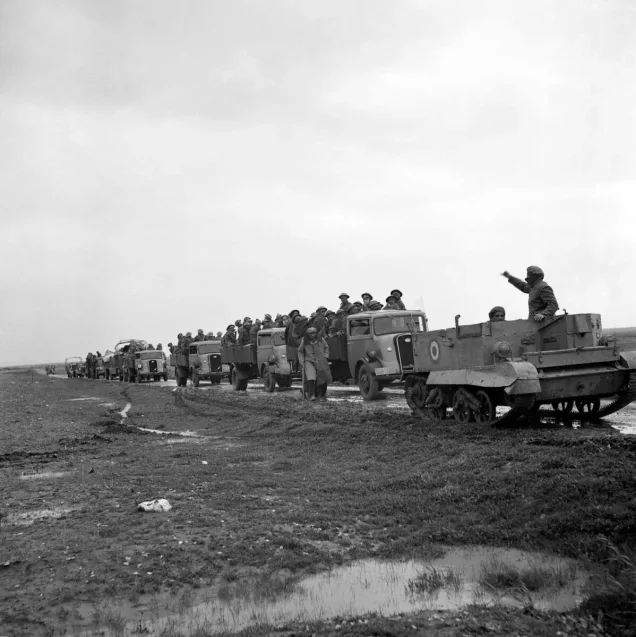
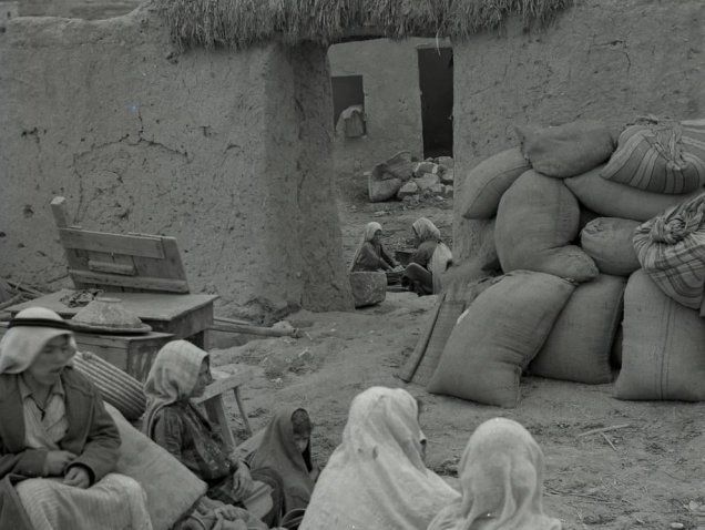
Photos from the village's people
Photos sent in by visitors and published after review.
Add a photo of this village
Log in to add photos of this village.
Other villages from Gaza
More from the archive


 Download Our Palestine App
The whole archive in the palm of your hand: depopulated villages, the Nakba, the massacres and Al-Aqsa — free, with no ads to erase the story.
Download Our Palestine App
The whole archive in the palm of your hand: depopulated villages, the Nakba, the massacres and Al-Aqsa — free, with no ads to erase the story.



Comments
No comments yet — be the first to write one.
Add your comment
Name and email are optional. Comments appear after review.