
The depopulated village of Hulayqat / District of Gaza

Hulayqat
About the depopulated village of Hulayqat
- District
- Gaza
- Date Hulayqat was occupied
- 12 May 1948
- Population in 1948
- 487
- Military operation
- Operation Barak
- Brigade that carried it out
- Givati Brigade
- Who defended the village
- Egyptian Army
- Distance from the governorate centre
- 20.5 (km) North East of Gaza
- Elevation above sea level
- 100 m
- Cause of displacement
- Influence of fall of, or exoduce from, neighboring town
- Extent of destruction
- The village was completely defaced.
- Ethnic cleansing
- Hulayqat inhabitants were completely ethnically cleansed.
Hover a dot to read the village name, or click to open its card.
Borders of the depopulated village of Hulayqat
Hulayqat – Gaza Subdistrict
Hulayqat was a depopulated Palestinian village in the Gaza subdistrict, located approximately 20.5 km northeast of Gaza at an average elevation of about 100 meters above sea level. It stood among the rolling hills of the southern coastal plain, on the eastern edge of a wadi and immediately west of the Gaza–Julis road.
The official 1931 Census of Palestine recorded 285 inhabitants, and the 1944/45 statistics recorded 420. The village lands totaled 7,063 dunums.
Hulayqat experienced several distinct stages of occupation and displacement in 1948. A major initial exodus began on 13 May after the destruction of neighboring Burayr during Operation Barak, and the Palmach established a position in Hulayqat. Egyptian forces recaptured the village on 8 July, and some villagers apparently remained or returned. The final Israeli occupation occurred during the night of 19–20 October 1948, when the Giv'ati Brigade attacked the Egyptian position at Hulayqat during the fighting associated with Operation Yoav.
Location of Hulayqat
Hulayqat stood on rolling terrain in the southern coastal plain, on the eastern side of a wadi and immediately west of the Gaza–Julis road.
This road ran broadly parallel to the main Gaza–al-Majdal–Jaffa coastal highway, connecting the village with northeastern Gaza district and the urban centers along the coast.
Secondary roads linked Hulayqat with surrounding Palestinian villages.
Neighboring Villages and Lands
Palestine Remembered identifies Kawkaba, Burayr, Barbara, and Bayt Tima among the village lands surrounding Hulayqat.
The Palestinian Encyclopedia additionally describes Kawkaba and Bayt Tima as lying to the north, Burayr to the south, Bayt Jirja to the west, and al-Faluja in the eastern geographical surroundings.
'Iraq Suwaydan and Simsim also appear among the wider nearby localities on Palestinian village maps.
Geographical proximity should be distinguished from an exact cadastral boundary; original Mandate land-demarcation maps remain the strongest evidence for individual boundary lines.
Hulayqat in the Late Nineteenth Century
Late nineteenth-century descriptions portray Hulayqat as a small village on a gentle slope, with a high sandy hill and a small garden to the west.
As the population expanded during the later Mandate period, the built-up village developed a rectangular plan whose long axis ran parallel to the main road.
Most houses were constructed of adobe and stood close together, interspersed with several small shops.
Population of Hulayqat
- 1922251Official Census of Palestine; all inhabitants were Muslims
- 1931285Official Census of Palestine; all inhabitants were Muslims
- 1944/45420Official Government of Palestine statistics
- 1948487Later Palestine Remembered estimate; not an official census
- 19982,992 refugees and descendantsLater demographic estimate published by Palestine Remembered
Number of Houses
- 193161Official Census of Palestine
- 1948104Later Palestine Remembered estimate; not an official census figure
Land Ownership in 1944/45
Hulayqat's registered lands totaled 7,063 dunums.
Using Palestine Remembered's simplified terminology:
- Palestinian6,902 dunums98%
- Transferred to Zionists0 dunums0%
- Communal/Public161 dunums2%
The official categories record 6,902 dunums as Arab and 161 as Public, with no land registered in the Jewish ownership category.
Land Use in 1944/45
- Arab
- Public
- Cereals6,636 dunums
- Plantations and irrigable land115 dunums
- Built-up land18 dunums
- Non-cultivable land294 dunums
The land-use categories therefore balance exactly with the official ownership totals.
Palestine Remembered's simplified presentation can give the impression that all 294 dunums of non-arable land were privately Palestinian-held. The official breakdown shows that 133 dunums were Arab and 161 were Public.
Economic Life in Hulayqat
The inhabitants depended primarily on rain-fed agriculture, particularly cereal cultivation, together with fruit growing.
Fruit cultivation was concentrated in the northwestern part of the village lands. In 1944/45, 6,636 dunums were devoted to cereals and 115 dunums were irrigated or used for orchards.
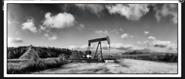
In addition to agriculture, some villagers worked in oil exploration and drilling undertaken in the area by the British Iraq Petroleum Company during the late Mandate period.
The presence of petroleum resources gave the Hulayqat region additional economic importance beyond its agricultural and later military significance.
Water
PalQuest records two wells inside the village that supplied domestic water.
Agriculture itself remained overwhelmingly dependent on rainfall, which helps explain the predominance of cereals over irrigated orchards in the 1945 statistics.
Education
Hulayqat did not have a securely documented independent school.
Children from Hulayqat shared an elementary boys' school with the neighboring villages of Bayt Tima and Kawkaba.
The shared school was built in 1946 and served pupils from the three villages during the final years of the Mandate.
Religious Life
The inhabitants recorded in the Mandate censuses were Muslims.
Khalidi's core Hulayqat entry does not securely document a separate mosque or named shrine inside the village, so none has been added without evidence.
Archaeological Sites
Several khirbas near Hulayqat contained cisterns, pools, marble fragments, and pottery sherds.
Palestine Remembered identifies Khirbat Sabans and Khirbat Milita among archaeological sites associated with the village.
These remains indicate earlier human activity in the area, although assigning each site to a particular historical period requires specialized archaeological evidence.
Hulayqat before the Nakba
Hulayqat occupied a strategically important area northeast of Gaza, along routes linking the coastal villages with the inland region, al-Faluja, and the northern Negev.
As the British Mandate approached its end, Zionist forces expanded their operations in the Gaza district, including Operation Barak, which ran from 9 to 13 May 1948.
The Giv'ati and Negev brigades participated in the broader operation, which targeted Palestinian villages in the southern and western sectors of the Haganah's operational area.
First Stage: Operation Barak and the May 1948 Exodus
The first major displacement from Hulayqat took place on 13 May 1948.
According to the account relayed by Khalidi, the Palmach's Negev Brigade destroyed neighboring Burayr, after which villagers from Hulayqat and Kawkaba began fleeing toward the Hebron hills.
The Palmach subsequently established a position in Hulayqat.
Palestine Remembered gives 12 May in its summary field for the occupation date, but the detailed Khalidi account associates the destruction of Burayr and the Hulayqat exodus with 13 May.
This article therefore treats 13 May as the better-supported date for the first major exodus and initial Zionist military control rather than treating 12 May as an unquestionable final occupation date.
Did Hulayqat Cease to Exist as a Palestinian Community in May?
No.
The May occupation was not the final military takeover, nor was the village irreversibly empty from that point onward.
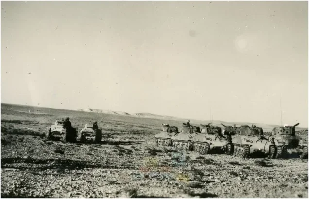
On 8 July 1948, Egyptian forces recaptured Hulayqat in a surprise armored attack from the north shortly before the end of the first truce.
The Egyptian army subsequently held the village through the second truce, and Hulayqat became part of an important Egyptian defensive line separating Israeli forces in the Negev from those farther north.
Villagers between July and October 1948
Khalidi states that some villagers apparently remained in Hulayqat throughout the second truce.
The village's depopulation was therefore a multi-stage process rather than a single event completed in May.
When heavy fighting resumed between Egyptian and Israeli forces in October, another civilian exodus took place.
Operation Yoav
Operation Yoav began on 15 October 1948 and continued until 4 November.
Its principal strategic objective was to break the Egyptian lines separating Israeli forces in the Negev from Israeli-held territory to the north and to open a continuous land route between them.
The Giv'ati, Yiftach, Negev, and Har'el brigades participated in the broader operation. At Hulayqat itself, the final battle was fought by the Giv'ati Brigade.
Final Occupation of Hulayqat
The final Israeli occupation of Hulayqat occurred during the night of 19–20 October 1948.
According to the military account relayed by Khalidi, the Giv'ati Brigade launched a two-pronged assault: one force advanced from Bayt Tima in the northwest and another from Kawkaba in the north.
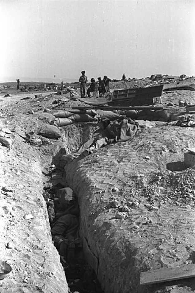
Egyptian forces had turned Hulayqat into a strong defensive position, and fighting took place at very close range in parts of the battlefield.
Khalidi cites a contemporary New York Times report stating that approximately 600 Egyptian regular soldiers defended the village and describing the fighting as among the heaviest of that campaign.
The fall of Hulayqat opened a route toward Israeli-held positions in the Negev and seriously weakened the Egyptian defensive system in the area.
The fighting also produced the final displacement of the remaining Palestinian villagers.
Military Units
The military chronology requires a distinction between the May and October phases.
May 1948: the initial exodus followed the Negev Brigade's destruction of Burayr during Operation Barak, after which the Palmach established a position in Hulayqat. Both the Giv'ati and Negev brigades participated in Operation Barak at the broader operational level.
Final occupation, 19–20 October 1948: the village-specific attacking formation was clearly the Giv'ati Brigade, which attacked the Egyptian defenses from two directions.
Attributing the entire 1948 history of Hulayqat to one brigade without distinguishing these stages would therefore be misleading.
Occupation Chronology
- 9 May 1948
Beginning of Operation Barak
The large Zionist offensive began, involving the Giv'ati and Negev brigades at the operational level.
- 12 May 1948
Palestine Remembered summary date
Listed as the occupation date in the statistical header, but it does not represent the final takeover of the village.
- 13 May 1948
Destruction of Burayr and first major exodus from Hulayqat
The Negev Brigade destroyed Burayr, prompting villagers from Hulayqat and Kawkaba to flee toward the Hebron hills.
- May 1948
Palmach position established
Palmach forces established a military position in Hulayqat after the first wave of departure.
- 8 July 1948
Egyptian recapture
Egyptian armored forces retook Hulayqat in a surprise attack from the north.
- Second truce – summer and autumn 1948
Some villagers remain
Khalidi indicates that some Palestinian inhabitants apparently remained in the village, demonstrating that depopulation was not complete in May.
- 15 October 1948
Beginning of Operation Yoav
The Israeli offensive began against Egyptian forces on the southern front with the objective of opening a route to the Negev.
- Night of 19–20 October 1948
Final assault on Hulayqat
The Giv'ati Brigade attacked from Bayt Tima in the northwest and Kawkaba in the north, producing intense close-range fighting.
- 20 October 1948
Final occupation and last civilian exodus
Hulayqat came under permanent Israeli control and the remaining Palestinian civilian presence ended in the context of the battle.
- Later; exact date not established
Destruction of the village
The village's built-up area was destroyed, but the core source does not give one precise demolition date.
Refugees from Hulayqat
Palestine Remembered estimates Hulayqat's population in 1948 at approximately 487. This is a later demographic estimate rather than an official Mandate census figure.
The same source estimates that refugees from Hulayqat and their descendants numbered approximately 2,992 in 1998.
The May account records villagers moving toward the Hebron hills after the destruction of Burayr. Because Egyptian forces later recaptured Hulayqat and some villagers apparently remained or returned, however, the displaced population should not be treated as having departed on one date or followed a single refugee route.
Israeli Settlements on Hulayqat Village Lands
Walid Khalidi, PalQuest, and Palestine Remembered state that no Israeli settlement was established on Hulayqat's village lands.
An older Palestinian Encyclopedia entry differs, stating that a settlement rendered as “Jalans,” apparently referring to Heletz, was established on Hulayqat land.
Other Palestinian sources, however, identify Heletz as having been established on the lands of neighboring Burayr, while Khalidi does not list it under Hulayqat.
Heletz is therefore not classified here as a settlement definitively established on Hulayqat's village lands without original cadastral evidence resolving the discrepancy.
The Hulayqat Oil Field
Oil exploration was already underway around Hulayqat during the late Mandate period, and some villagers worked for the British Iraq Petroleum Company.
During the 1950s, the Hulayqat area became associated with later commercial oil extraction, helping preserve the village name in geographical and economic references after the Palestinian community had been displaced.
The oil field's name and location should not, however, be used by themselves to determine the cadastral ownership of later settlements or installations.
Hulayqat Today
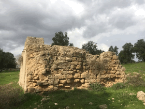
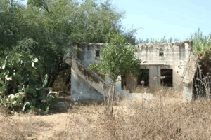
In Walid Khalidi's field description, parts of the village site were covered by woodland.
Sycamore, Christ's-thorn, and cactus grew across the site, while a modern road had covered one of the village's old roads.
This description is not direct field verification of conditions in 2026. The fieldwork for All That Remains was conducted between 1987 and 1990, before the book was published in 1992.
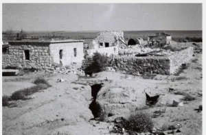
Palestine Remembered also contains later photographs and community documentation of the village site. These sources help preserve knowledge of surviving traces but do not constitute a comprehensive contemporary field survey of all former Hulayqat lands.
Sources
- PalQuestPalQuest – Hulayqat
- PalQuestPalQuest – Operation Barak
- PalQuestPalQuest – Operation Yoav
- PalQuestPalQuest – Bayt Tima; documentation of the shared school serving Hulayqat and Kawkaba
- Palestine RememberedPalestine Remembered – Hulayqat, Gaza District
- Palestine RememberedPalestine Remembered – Hulayqat entry from Walid Khalidi's All That Remains
- Institute for Palestine StudiesInstitute for Palestine Studies – Walid Khalidi, All That Remains
- pcbs.gov.psPalestinian Central Bureau of Statistics – Historical Palestinian censuses: 1922, 1931, and 1945
- palestinapedia.psPalestinian Encyclopedia – Hulayqat
- pal48.psOur Palestine – Burayr; supplementary Palestinian evidence concerning Heletz
- PalQuestPalQuest – All That Remains: Methodology and Field Research
Photo gallery



Photos from the village's people
Photos sent in by visitors and published after review.
Add a photo of this village
Log in to add photos of this village.
Other villages from Gaza
More from the archive


 Download Our Palestine App
The whole archive in the palm of your hand: depopulated villages, the Nakba, the massacres and Al-Aqsa — free, with no ads to erase the story.
Download Our Palestine App
The whole archive in the palm of your hand: depopulated villages, the Nakba, the massacres and Al-Aqsa — free, with no ads to erase the story.



Comments
No comments yet — be the first to write one.
Add your comment
Name and email are optional. Comments appear after review.