
The depopulated village of Al-Batani al-Gharbi / District of Gaza

Al-Batani al-Gharbi
About the depopulated village of Al-Batani al-Gharbi
- District
- Gaza
- Date Al-Batani al-Gharbi was occupied
- 13 May 1948
- Population in 1948
- 1,140
- Military operation
- Operation Barak
- Brigade that carried it out
- Givati Brigade
- Distance from the governorate centre
- 36 (km) North East of Gaza
- Elevation above sea level
- 25 m
- Cause of displacement
- Military assault by Zionist troops
- Extent of destruction
- The village was completely obliterated.
- Ethnic cleansing
- al-Batani al-Gharbi inhabitants were completely ethnically cleansed.
- Settlements built on the built-up area of Al-Batani al-Gharbi after 1948
- A part of Azrikam
Hover a dot to read the village name, or click to open its card.
Borders of the depopulated village of Al-Batani al-Gharbi
al-Batani al-Gharbi: A Depopulated Palestinian Village in the Gaza District
al-Batani al-Gharbi was a Palestinian village in the Gaza District, located approximately 36 km northeast of Gaza city on flat terrain in the southern coastal plain, at an average elevation of about 25 metres above sea level. Its inhabitants were displaced during the Nakba and the occupation of Palestine in 1948. The detailed accounts of Walid Khalidi and PalQuest place its occupation on 18 May 1948 during the second stage of Operation Barak.
Location of al-Batani al-Gharbi
al-Batani al-Gharbi stood on flat terrain in the southern coastal plain and was one of two neighbouring villages bearing the name al-Batani. Its twin, al-Batani al-Sharqi, lay to the east, and the terms “western” and “eastern” distinguished the two villages from one another.
The village was approximately 36 km northeast of Gaza city and had an average elevation of about 25 metres above sea level.
Secondary roads connected it with neighbouring villages and towns, including Yasur and Isdud on the main coastal highway.
During the British Mandate period, a military airfield was constructed on flat land approximately 2 km south of the village.
History of al-Batani al-Gharbi
The earliest historical reference cited by Walid Khalidi states that al-Batani was originally established as an estate or farm belonging to Mu'awiya ibn Abi Sufyan, the first Umayyad caliph, who ruled from 661 to 680 CE.
The principal sources used here do not provide enough evidence to separate the earliest history of al-Batani al-Gharbi completely from that of its eastern twin. This reference is therefore treated as relating to the historical origin of al-Batani generally.
Architecture of al-Batani al-Gharbi
In the late nineteenth century, al-Batani al-Gharbi stood on low ground and had a rectangular layout running from southeast to northwest.
Building initially spread along the two shorter sides of the rectangle and later expanded along the roads leading toward neighbouring villages.
The houses stood close together and were separated by narrow alleys. Most were constructed of adobe brick, with roofs made of wood and reeds. Scattered gardens, two ponds, and several wells were also found on the village lands.
Mosque and Local Services
The inhabitants of al-Batani al-Gharbi were Muslim. The village had its own mosque and several small shops.
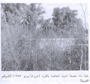
Wells scattered throughout the surrounding area provided water for domestic use and also supported irrigation.
Education in al-Batani al-Gharbi
al-Batani al-Gharbi and al-Batani al-Sharqi shared an elementary school that opened in 1947 with an initial enrolment of 119 pupils.
Palestine Remembered describes it as a boys' school, while Khalidi's PalQuest entry describes it simply as an elementary school shared by the two villages.
Economic Life in al-Batani al-Gharbi
Agriculture was the principal source of livelihood. The villagers cultivated cereals, citrus fruit, and other crops. Farming relied on both rainfall and water from wells throughout the area.
Residents also raised livestock and poultry.
According to the 1944/45 statistics, 170 dunums were devoted to citrus and bananas, 4,152 dunums to cereals, and 95 dunums were irrigated or used for plantations.
Land Ownership in al-Batani al-Gharbi
The total land area of al-Batani al-Gharbi was 4,574 dunums according to the 1944/45 statistics.
Land ownership in al-Batani al-Gharbi, 1944/45
- Arab4,475 dunums98%
- Jewish0 dunums0%
- Public99 dunums2%
Palestine Remembered presents the corresponding categories in its Arabic table as 4,475 Palestinian dunums, zero dunums “transferred to Zionists,” and 99 dunums of communal land.
Land Use in al-Batani al-Gharbi, 1944/45
Land use in al-Batani al-Gharbi according to PalQuest
- Arab
- Public
- Citrus and bananas170 dunums
- Plantations and irrigable land95 dunums
- Cereals4,152 dunums
- Built-up area34 dunums
- Non-cultivable land123 dunums
A total of 4,417 dunums, approximately 97 percent of the village lands, was cultivated or cultivable. Built-up and non-cultivable land together amounted to 157 dunums.
Palestine Remembered gives 123 dunums as non-arable land in a single Palestinian column, whereas PalQuest's detailed table separates this into 24 Arab dunums and 99 public dunums.
Population of al-Batani al-Gharbi
Population of al-Batani al-Gharbi in selected years
- 1922556Official British Mandate census
- 1931667Official British Mandate census
- 1944/45980Official statistics; the recorded population was Arab and Muslim
- 19481,137Later estimate published by Palestine Remembered
- Estimated refugees in 19986,981Later estimate published by Palestine Remembered
Number of Houses in al-Batani al-Gharbi
Number of houses in al-Batani al-Gharbi
- 1931147Official census figure
- 1948250Later estimate published by Palestine Remembered
Occupation and Depopulation of al-Batani al-Gharbi during the Nakba
al-Batani al-Gharbi was among the villages occupied by Israeli occupation forces during Operation Barak, an offensive targeting villages south and west of Ramla and parts of the southern coastal plain in May 1948.
PalQuest records the opening stage of Operation Barak as beginning on 9 May 1948, conducted mainly by the Haganah's Giv'ati Brigade with the participation of the Palmach's Negev Brigade. A second stage of attacks was conducted in southern Palestine as British forces withdrew and the Mandate ended on 15 May.
Walid Khalidi and PalQuest place the occupation of al-Batani al-Gharbi on 18 May 1948 during this second stage, several days after the fall of al-Batani al-Sharqi.
Palestine Remembered contains an internal discrepancy concerning the date. Its statistical summary lists 13 May 1948, while its reproduction of the Khalidi account gives 18 May. Since 18 May is also the date given in the detailed PalQuest entry, it is used here while the discrepancy is explicitly noted.
Khalidi cites Israeli historian Benny Morris as stating that most inhabitants of the villages captured in this phase left before or during the attacks and that some were probably expelled. Morris is not used here as an independent source; this account is included only because it is reproduced in the approved Palestinian reference.
PalQuest's account of Operation Barak also states that Giv'ati's operational plans included the occupation, evacuation, or destruction of villages and that residents remaining after occupation were liable to expulsion.
- Occupation date supported by the detailed Khalidi/PalQuest narrative: 18 May 1948.
- Different date in Palestine Remembered's statistical table: 13 May 1948.
- Military operation: Operation Barak, second stage.
- Attacking unit according to Palestine Remembered: Giv'ati Brigade.
- Brigades involved in Operation Barak overall: Giv'ati Brigade and Negev Brigade.
- Fate of the inhabitants: the Palestinian population of al-Batani al-Gharbi was displaced during the Nakba in the course of the military assault and occupation.
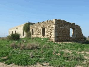
- Fate of the village: its buildings were subsequently destroyed, although traces of the site and some alleys remained.
Settlements on the Lands of al-Batani al-Gharbi
According to Walid Khalidi and PalQuest, no Israeli settlement was established directly on the lands of al-Batani al-Gharbi.
Azriqam, established in 1950, lies close to the village site to the south. It was, however, built on land belonging to the neighbouring Palestinian village of Bayt Daras and is therefore not listed as a settlement established on al-Batani al-Gharbi's lands.
al-Batani al-Gharbi Today
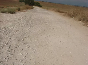
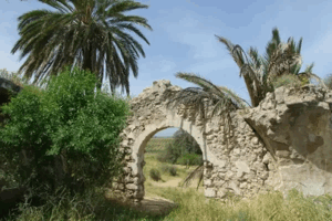
According to the field description published by Walid Khalidi in All That Remains, cactus plants and fig and sycamore trees grew on the village site, while some of its old alleys or streets remained recognizable.
Parts of the nearby land were being cultivated by residents of the neighbouring settlement, and a stone quarry was also located on village lands.
This principal description derives from field research published in Khalidi's book in 1992. The approved sources used here do not provide a sufficiently comprehensive, independent, and recent field survey to verify the precise condition of every part of the al-Batani al-Gharbi site in 2026. It should therefore be treated as a historical site description rather than a real-time account.
Sources
- PalQuestPalQuest – Interactive Encyclopedia of the Palestine Question: al-Batani al-Gharbi
- PalQuestPalQuest – Operation Barak
- Palestine RememberedPalestine Remembered – al-Batani al-Gharbi, Gaza District
- Palestine RememberedPalestine Remembered – al-Batani al-Gharbi entry from All That Remains
- Institute for Palestine StudiesInstitute for Palestine Studies – All That Remains, Walid Khalidi
Photo gallery


Photos from the village's people
Photos sent in by visitors and published after review.
Add a photo of this village
Log in to add photos of this village.
Other villages from Gaza
More from the archive


 Download Our Palestine App
The whole archive in the palm of your hand: depopulated villages, the Nakba, the massacres and Al-Aqsa — free, with no ads to erase the story.
Download Our Palestine App
The whole archive in the palm of your hand: depopulated villages, the Nakba, the massacres and Al-Aqsa — free, with no ads to erase the story.



Comments
No comments yet — be the first to write one.
Add your comment
Name and email are optional. Comments appear after review.