
The depopulated village of Burayr / District of Gaza

About the depopulated village of Burayr
- District
- Gaza
- Date Burayr was occupied
- 13 May 1948
- Population in 1948
- 3,180
- Military operation
- Operation Barak
- Brigade that carried it out
- Givati Brigade، Negev Brigade
- Distance from the governorate centre
- 18 (km) North East of Gaza
- Elevation above sea level
- 100 m
- Cause of displacement
- Military assault by Zionist troops
- Extent of destruction
- The The village was completely destroyed, and only house rubble left behind.
- Ethnic cleansing
- Burayr inhabitants were completely ethnically cleansed.
- Settlements built on the land of Burayr before 1948
- Bror Hail
- Settlements built on the built-up area of Burayr after 1948
- Heletz, Tlamim, Sde David, Zohar
Hover a dot to read the village name, or click to open its card.
Borders of the depopulated village of Burayr
Burayr: A Depopulated Palestinian Village in the Gaza District
Burayr was a Palestinian village in the Gaza District, located approximately 18 km northeast of Gaza city on the southern coastal plain, at an average elevation of about 100 metres above sea level. Its inhabitants were displaced during the Nakba and the occupation of Palestine in 1948. The decisive attack was launched by the Palmach's Negev Brigade during the night of 12–13 May 1948 in coordination with Operation Barak.
Location of Burayr
Burayr was situated on uneven ground on the southern coastal plain. Wadi al-Qa'a crossed the eastern edge of the village.
A major inland highway linking the towns of the coastal plain with Gaza passed east of the village and connected it with localities to the north and south. This route intersected the al-Faluja–al-Majdal highway, which ran east to west approximately 9 km north of Burayr.
History of Burayr
Burayr has been identified with Buriron, a settlement recorded in Byzantine sources.
In 1596, Burayr was a village in the nahiya of Gaza within the liwa of Gaza, with an estimated population of approximately 1,155. It paid taxes on wheat, barley, fruit, goats, beehives, and other forms of agricultural production.
In 1838, American traveller Edward Robinson described Burayr as a flourishing village and a central point in the plain, noting a large public well equipped with a water wheel. About four decades later, the village was described as large, with a water wheel to the east, a pool to the north, and a garden to the south.
Architecture and Services in Burayr
The village had a roughly semi-circular layout, although the placement of its houses was irregular. Most houses were built of adobe brick. During the British Mandate period, the built-up area expanded westward toward a slightly higher hill while agricultural land was preserved on the other sides.
The inhabitants of Burayr were Muslim, and a mosque stood at the centre of the village. The central area also contained the marketplace, a clinic, and a grain mill.
Three wells inside the village supplied water for domestic use. Toward the end of the Mandate period, the villagers also drilled artesian wells.
Education in Burayr
Two elementary schools were established in Burayr in 1920, one for boys and one for girls. By 1947, the two schools had a combined enrolment of 241 pupils.
Economic Life in Burayr
The inhabitants worked mainly in rainfed and irrigated agriculture, while some also raised livestock. They cultivated cereals, fruit—particularly citrus, grapes, and figs—and vegetables.
Commercial activity was strengthened by a weekly Wednesday market that attracted residents of neighbouring villages and Bedouin communities.
During the 1940s, the village economy received an additional boost when the Iraq Petroleum Company (IPC) discovered oil in the vicinity of Burayr and drilled a well approximately one kilometre north of the village.
According to the 1944/45 statistics, 43,319 dunums of Arab land were devoted to cereals, together with 617 dunums classified as Jewish-owned and 9 dunums of public land, for a total cereal area of 43,945 dunums. Another 409 dunums of Arab land were irrigated or used for plantations.
Land Ownership in Burayr
The total land area of Burayr was 46,184 dunums according to the 1944/45 statistics.
Land ownership in Burayr, 1944/45
- Arab44,220 dunums96%
- Jewish618 dunums1%
- Public1,346 dunums3%
Palestine Remembered presents the corresponding figures in its Arabic table as 44,220 Palestinian dunums, 618 dunums “transferred to Zionists,” and 1,346 dunums of communal land.
Land Use in Burayr, 1944/45
Land use in Burayr according to PalQuest
- Arab
- Jewish
- Public
- Cereals43,945 dunums
- Plantations and irrigable land409 dunums
- Built-up area130 dunums
- Non-cultivable land1,700 dunums
A total of 44,354 dunums was classified as cultivated or cultivable: 43,728 Arab, 617 Jewish, and 9 public dunums. Non-cultivable and built-up land together amounted to 1,830 dunums.
Palestine Remembered presents some of these figures differently by incorporating public land into the Palestinian column. This is why it gives 43,328 dunums for cereals rather than separating 43,319 Arab dunums from 9 public dunums.
Population of Burayr
Population of Burayr in selected years
- 15961,155Estimate derived from Ottoman records
- 19221,591Official British Mandate census
- 19311,894Official British Mandate census
- 1944/452,740Official statistics
- 19483,178Later estimate published by Palestine Remembered
- Estimated refugees in 199819,519Later estimate published by Palestine Remembered
Number of Houses in Burayr
Number of houses in Burayr
- 1931414Official census figure
- 1948694Later estimate published by Palestine Remembered
Archaeological Sites in Burayr
Burayr was built on an archaeological site where remains of earlier construction were visible. Four additional archaeological sites lay nearby: Khirbat Sha'ratta, Tall al-Mashanaqa, Khirbat al-Marashan, and Khirbat Umm Laqis.
Attacks on Burayr before its Occupation
Burayr experienced a series of attacks before its final occupation. On 29 January 1948, Zionist forces attacked using five armoured vehicles. According to the Palestinian newspaper Filastin, the attack was repulsed without casualties.
Another clash occurred on 14 February when a Jewish convoy passed through Burayr and exchanged fire with the village's defenders before withdrawing. The following day, two villagers were wounded when British troops forcibly removed a barricade at the village entrance.
On 20 April 1948, the military settlement of Beror Chayil was established on a hill less than one mile from Burayr. Walid Khalidi describes this development as the first direct step in the process that preceded the occupation of the village.
Occupation and Depopulation of Burayr during the Nakba
The decisive assault on Burayr occurred during the night of 12–13 May 1948. The Palmach's Negev Brigade attacked the village in coordination with Operation Barak, which was being conducted by the Giv'ati Brigade.
Operation Barak began on 9 May 1948, and PalQuest lists Burayr among the villages affected by the operation. Both the Giv'ati and Negev brigades participated in the broader operation, whose objectives included expanding military control before the end of the British Mandate and removing Palestinian residents from occupied villages.
Khalidi's entry reports that the History of the Haganah described Burayr as having been occupied “in one strike.” This account is mentioned only because it is quoted in the approved Palestinian reference and is not being used here as an independent Israeli source.
As for the precise date, Khalidi and PalQuest place the decisive attack during the night of 12–13 May 1948, while Palestine Remembered lists 12 May as the occupation date.
- Date of attack and occupation: night of 12–13 May 1948; Palestine Remembered specifically lists 12 May.
- Military operation: Operation Barak.
- Unit that directly attacked the village: the Palmach's Negev Brigade.
- Coordinating brigade: Giv'ati Brigade.
- Fate of the population: the Palestinian inhabitants of Burayr were displaced as a result of the military assault and occupation during the Nakba.
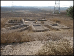
- Fate of the village: most structures were destroyed, although rubble, fragments of walls, and traces of some streets remained.
Palestine Remembered states in its summary data that a massacre occurred in Burayr and also contains local accounts concerning deaths during the assault. However, Khalidi's dedicated PalQuest entry does not provide independently documented details or a verified casualty figure for a specific massacre. No casualty number is therefore presented here as an established fact.
Settlements Established on the Lands of Burayr
Five settlements were established on village lands:
- Beror Chayil: established in 1948, on 20 April, before the final occupation of the village.
- Telamim: established in 1950.
- Heletz: established in 1950.
- Sde David: established in 1955.
- Zohar: established in 1956.
Burayr Today
According to the field description published by Walid Khalidi in All That Remains, scattered cactus plants grew across the village site together with some sycamore and lotus trees. Remains of houses were still visible, including a small section of a cement wall among eucalyptus trees near the entrance of one house, and parts of several village streets could still be identified.
The lands surrounding the village site were under cultivation.
This description derives from field research published in Khalidi's book in 1992. The approved sources used here do not provide a comprehensive and independent contemporary field survey sufficient to verify the exact condition of every part of the Burayr site in 2026.
Sources
Photo gallery

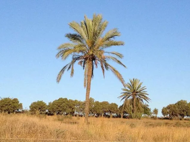
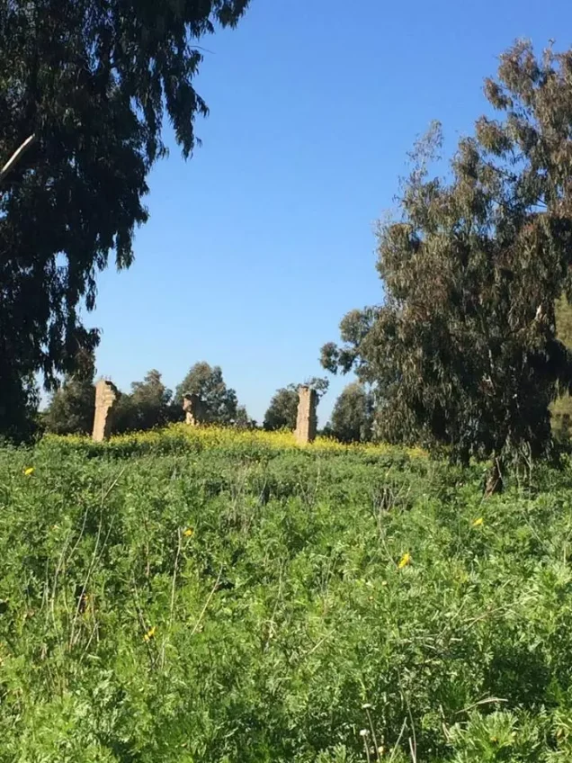

Photos from the village's people
Photos sent in by visitors and published after review.
Add a photo of this village
Log in to add photos of this village.
Other villages from Gaza

More from the archive

 Download Our Palestine App
The whole archive in the palm of your hand: depopulated villages, the Nakba, the massacres and Al-Aqsa — free, with no ads to erase the story.
Download Our Palestine App
The whole archive in the palm of your hand: depopulated villages, the Nakba, the massacres and Al-Aqsa — free, with no ads to erase the story.



Comments
No comments yet — be the first to write one.
Add your comment
Name and email are optional. Comments appear after review.