
The depopulated village of Kawfakha / District of Gaza
Kawfakha
About the depopulated village of Kawfakha
- District
- Gaza
- Date Kawfakha was occupied
- 27 May 1948
- Population in 1948
- 580
- Brigade that carried it out
- Negev Brigade
- Who defended the village
- Egyptian Army
- Distance from the governorate centre
- 19 km east of Gaza
- Elevation above sea level
- 150 m
- Cause of displacement
- Direct military assault by Israeli occupation forces, followed by the expulsion of the inhabitants despite their offers to surrender in exchange for remaining in their village
- Extent of destruction
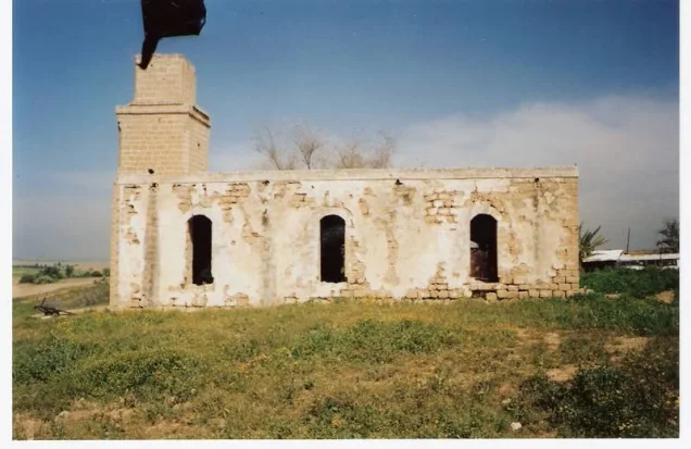
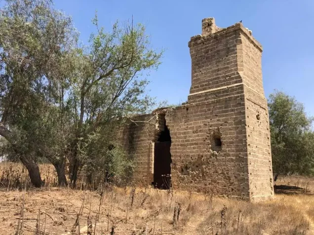
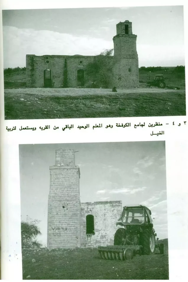
- The village has been completely obliterated with the exception of the village mosque (now functions as a horse stable)
- Ethnic cleansing
- Kawfakha inhabitants were completely ethnically cleansed.
- Settlements built on the built-up area of Kawfakha after 1948
- Nir 'Aqiva, established in 1953 on village lands, southwest of the village site
Hover a dot to read the village name, or click to open its card.
Borders of the depopulated village of Kawfakha
Kawfakha: A Depopulated Palestinian Village in the Gaza District
Kawfakha was a Palestinian village in the Gaza District, situated on rolling sandy terrain in the northern Negev approximately 19 kilometres east of Gaza, at an average elevation of about 150 metres above sea level. Its population reached 500 in the 1944/1945 statistics. Units of the Palmach's Negev Brigade attacked the village on the night of 27–28 May 1948, after which its Palestinian inhabitants were expelled during the Nakba and the occupation of Palestine in 1948.
- Subdistrict
- Gaza
- Distance from district center
- 19 km east of Gaza
- Average Elevation
- 150 m above sea level
- Population in 1931
- 317
- Number of Houses in 1931
- 56
- Population in 1944/1945
- 500
- Estimated Population in 1948
- About 580 – a later demographic estimate, not an official census
- Total Land Area in 1945
- 8,569 dunams
- Attack and Depopulation
- Units of the Palmach's Negev Brigade attacked the village on the night of 27–28 May 1948, according to Israeli historian Benny Morris as cited by Khalidi, and its inhabitants were driven out even though they had repeatedly offered to surrender in exchange for being allowed to stay.
- Final Israeli Control
- By 30 May 1948: the village was attacked on the night of 27–28 May, and the New York Times reported in its issue of 30 May that it had fallen together with the neighbouring village of al-Muharraqa; the available sources do not give the exact day of its occupation.
- Military Unit
- Units of the Palmach's Negev Brigade – according to Benny Morris as cited by Khalidi
- Cause of Depopulation
- Direct military assault by Israeli occupation forces, followed by the expulsion of the inhabitants despite their offers to surrender in exchange for remaining in their village
- Settlements Documented on Village Lands
- Nir 'Aqiva, established in 1953 on village lands, southwest of the village site
Location
Kawfakha stood on rolling sandy land in the northern Negev, approximately 19 kilometres east of Gaza and at an average elevation of about 150 metres above sea level.
The village lay along the southern bank of Wadi Abu Shunnar, a tributary of Wadi Hawdaj.
A network of secondary roads connected Kawfakha with the roads running between Gaza and Julis and with the coastal highway.
Palestinian reference maps place Huj roughly northwest of Kawfakha, al-Jammama to the northeast, al-Muharraqa to the southwest, and Bedouin lands of the Beersheba region to the east and southeast.
Foundation of Kawfakha
Kawfakha was a relatively recent Palestinian village. Walid Khalidi and PalQuest state that it was founded in the late nineteenth century by people from Gaza city who moved into the area to cultivate the surrounding lands.
Archaeological remains at Khirbat Kawfakha nevertheless indicate that the site itself had been occupied or used in much earlier historical periods.
Architecture and Public Facilities
The houses of Kawfakha extended along a northwest–southeast axis, giving the village an approximately rectangular layout.
A mosque stood at the centre of the village. It was constructed during the reign of Ottoman Sultan Abd al-Hamid II, between 1876 and 1909.
Kawfakha also had an elementary school and several small shops.
All of the village inhabitants were Muslims.
The built-up area covered approximately 31 dunams in the 1944/1945 statistics.
Population
Kawfakha had 203 inhabitants in the 1922 census.
In the 1931 census, the population increased to 317 people living in 56 houses.
According to the 1944/1945 statistics, the population reached 500.
The estimates of approximately 580 inhabitants in 1948 and 3,562 refugees and descendants in 1998 are later demographic estimates rather than official British Mandate census figures.
Population of Kawfakha
- 1922203Official census
- 1931317Official census
- 1944/1945500Government of Palestine statistics
- 1948About 580Later estimate
- 19983,562Estimate of refugees and their descendants
Number of Houses
The 1931 census recorded 56 houses in Kawfakha.
Later figures for the number of houses immediately before the Nakba are estimates rather than official census figures in the principal reference sources.
Land of Kawfakha
According to the 1944/1945 statistics, Kawfakha had a total land area of 8,569 dunams.
Private Arab ownership amounted to 87 dunams, while 8,482 dunams were classified as public or musha' land. No Jewish-owned land was recorded within the village's statistical unit.
Land Ownership in Kawfakha in 1944/1945
- Private Arab ownership87 dunums1%
- Jewish ownership0 dunums0%
- Public / musha' land8,482 dunums99%
Agriculture and Economic Life
Most inhabitants of Kawfakha worked in agriculture and relied on both rainfall and irrigation from wells, cisterns, and reservoirs that collected winter rainwater.
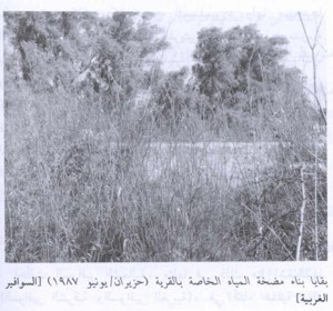
Two wells within the village supplied water for domestic use.
Fruit trees, including apricots, olives, almonds, grapes, and figs, were planted mainly on the northern side of the village, while cereals were grown across the surrounding lands.
According to the 1944/1945 statistics, 7,768 dunams were devoted to cereals, all classified as public or musha' land.
Irrigated and plantation land covered 87 dunams and was privately Arab-owned.
The principal reference sources do not provide a separate acreage for olive trees. Olives were one of several crops grown within the village's orchard land.
Land Use in Kawfakha in 1944/1945, in Dunams
- Private Arab
- Public / Musha'
- Irrigated and plantation land87 dunums
- Cereals7,768 dunums
- Built-up area31 dunums
- Uncultivable land683 dunums
Archaeology
The village contained archaeological remains known as Khirbat Kawfakha.
The Survey of Western Palestine recorded remains of cisterns, marble columns, a Corinthian capital, mosaic pavements, and pottery at the site.
These remains indicate human activity at the site long before the foundation of the modern village in the late nineteenth century.
The Nakba and the Attack on Kawfakha
Short summary sources differ over the initial date of occupation. Palestine Remembered gives 25 May 1948, while the detailed Walid Khalidi and PalQuest account provides a more specific chronology.
According to this detailed account, units of the Palmach's Negev Brigade attacked Kawfakha on the night of 27–28 May 1948.
A report published by the New York Times on 30 May stated that Kawfakha and neighbouring al-Muharraqa had fallen, indicating that both were under Israeli control by approximately 29 May.
This article therefore uses the night of 27–28 May as the best-documented date of the military assault rather than treating 25 May as the sole definitive occupation date.
Was Kawfakha Occupied During Operation Barak?
The Palestine Remembered summary tentatively associates Kawfakha with Operation Barak.
PalQuest, however, dates Operation Barak primarily to 9–13 May 1948 and lists numerous affected villages without including Kawfakha.
The detailed Kawfakha account instead dates the attack to 27–28 May and attributes it to the Negev Brigade.
Because of this chronological and documentary discrepancy, this article does not conclusively assign Kawfakha's occupation to Operation Barak. It records the attacking brigade and documented assault date instead.
Occupation and Depopulation Chronology
- 27–28 May 1948
Ground assault
Units of the Palmach's Negev Brigade attacked the village at night, according to Israeli historian Benny Morris as cited by Khalidi.
- By 30 May 1948
Final occupation
The New York Times reported in its issue of 30 May 1948 that Kawfakha and the neighbouring village of al-Muharraqa had fallen. The available sources do not give the exact day of the occupation.
- Late May 1948
Depopulation of the village
The inhabitants were driven out even though they had repeatedly offered to surrender and accept Jewish rule in exchange for being allowed to stay; the Israeli authorities rejected their request on the grounds that such requests were either insincere or unreliable.
- 1953
Settlement on village lands
The settlement of Nir 'Aqiva was established on village lands, southwest of the village site.
Displacement of the Inhabitants
The Negev Brigade's assault resulted in the occupation of Kawfakha and the expulsion of its Palestinian population.
PalQuest and Walid Khalidi, transmitting an account by Israeli historian Benny Morris, state that the villagers had previously offered to surrender in exchange for being allowed to remain in their homes, but their request was rejected.
The inhabitants were not permitted to re-establish their community after the occupation, and most of the displaced villagers moved toward the Gaza area.
The Israeli account concerning the villagers' request to remain is cited here only as transmitted through Walid Khalidi and PalQuest and not through direct reliance on the Israeli source.
Local accounts describing earlier armed clashes, the burning of grain threshing floors, and the use of armoured vehicles require additional independent documentation before being treated as conclusively established elements of the military chronology.
Israeli Settlements on Kawfakha's Lands
Nir 'Aqiva
In 1953, the settlement of Nir 'Aqiva was established on Kawfakha's lands southwest of the village site.
- 1953Nir 'Aqiva
Established on Kawfakha's lands southwest of the village site
Kawfakha After the Nakba
According to the field documentation relied upon by Walid Khalidi, the village mosque was the principal surviving building at the Kawfakha site.
The mosque is a stone structure with arched entrances and windows on all sides, and its roof is topped by three shallow domes.
At the time of field documentation, it was being used as a storehouse for animal fodder and as a horse stable.
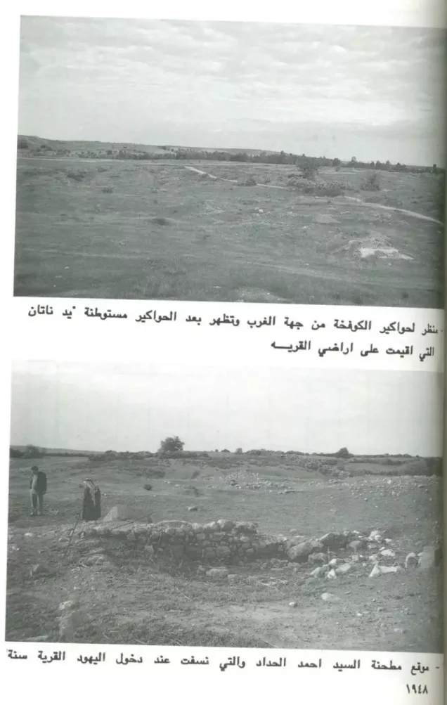
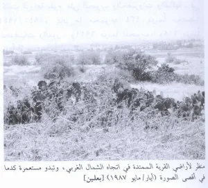
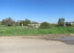
Rubble from destroyed houses, cactus plants, and other desert vegetation covered the site, which had been fenced and used as pasture.
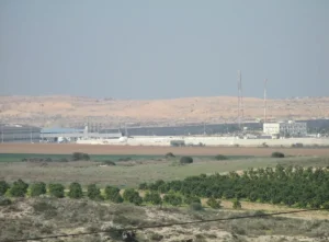
A citrus grove stood west of the site, while parts of the surrounding land were cultivated with cereals.
This description reflects the condition of the site during the field documentation relied upon by Walid Khalidi and should not necessarily be interpreted as a comprehensive survey updated to 2026.
Sources
- PalQuest – Interactive Encyclopedia of the Palestine Question: Kawfakha.
- PalQuest: Kawfakha.
- PalQuest: Operation Barak.
- Palestine Remembered: Kawfakha, Gaza District.
- Walid Khalidi, All That Remains: Kawfakha, as reproduced by Palestine Remembered.
- Sharif Kanaana and Rashad al-Madani, study of the depopulated village of Kawfakha.
- Walid Khalidi, All That Remains, entry on Kawfakha.
- Government of Palestine, censuses of 1922 and 1931.
- Government of Palestine, Department of Statistics, Village Statistics, 1945.
Photo gallery


Photos from the village's people
Photos sent in by visitors and published after review.
Add a photo of this village
Log in to add photos of this village.
Other villages from Gaza
More from the archive
 Download Our Palestine App
The whole archive in the palm of your hand: depopulated villages, the Nakba, the massacres and Al-Aqsa — free, with no ads to erase the story.
Download Our Palestine App
The whole archive in the palm of your hand: depopulated villages, the Nakba, the massacres and Al-Aqsa — free, with no ads to erase the story.



Comments
No comments yet — be the first to write one.
Add your comment
Name and email are optional. Comments appear after review.