
The depopulated village of Bayt Jirja / District of Gaza

Bayt Jirja
About the depopulated village of Bayt Jirja
- District
- Gaza
- Date Bayt Jirja was occupied
- 30 October 1948
- Population in 1948
- 1,090
- Military operation
- Operation Yoav
- Brigade that carried it out
- Givati Brigade
- Who defended the village
- Egyptian Army
- Distance from the governorate centre
- 15.5 (km) North East of Gaza
- Elevation above sea level
- 50 m
- Cause of displacement
- Military assault by Zionist troops
- Extent of destruction
- The village was completely destroyed, and only one house remains. If this house is yours, then your are welcome to claim it back!
- Ethnic cleansing
- Bayt Jirja inhabitants were completely ethnically cleansed.
Hover a dot to read the village name, or click to open its card.
Borders of the depopulated village of Bayt Jirja
Bayt Jirja – Gaza Subdistrict
Bayt Jirja was a depopulated Palestinian village in the Gaza subdistrict, situated on level ground in the southern coastal plain approximately 15.5 km northeast of Gaza at an average elevation of about 50 meters. It lay about one kilometer east of the coastal highway and a similar distance from the coastal railway, providing connections to Gaza, al-Majdal, Jaffa, and other coastal towns.
The official 1931 Census of Palestine recorded 619 inhabitants, and the 1944/45 statistics recorded 940. Its registered lands covered 8,481 dunums. Israeli occupation forces captured Bayt Jirja during the final phase of fighting in southern Palestine in 1948, in the context of Operation Yoav. The exact date of capture is uncertain, with the strongest evidence placing it between late October and the first days of November 1948.
Location of Bayt Jirja
Bayt Jirja stood on level ground in the southern coastal plain. Wadi al-'Abd crossed the western edge of its lands and formed part of the drainage system leading toward Wadi al-Hasi and the Mediterranean coast.
The village lay about one kilometer east of the main coastal road and approximately the same distance from the coastal railway line. These transportation links connected the villagers with Gaza to the south, al-Majdal to the north, and farther coastal centers such as Jaffa.
Several secondary roads and dirt tracks linked Bayt Jirja with the surrounding villages.
Boundaries and Neighboring Villages
Palestinian local documentation of the village-land boundaries identifies the following adjoining localities:
| Direction | Neighboring village / land |
|---|---|
| North | Barbara |
| East and southeast | SimSim |
| South | Dayr Sunayd |
| West | Hiribya |
Maps of the wider surroundings also place Bayt Tima, Hulayqat, al-Jiyya, and Dimra near Bayt Jirja. These nearby localities should be distinguished from villages whose cadastral lands directly bordered Bayt Jirja.
Name and Historical Background
The Arab geographer Yaqut al-Hamawi, who died in 1229, referred to the locality as Jirja and identified it as the birthplace of Abu al-Fadl al-Jirji, a noted authority on hadith in Palestine during his time.
In the Ottoman tax register of 1596, Bayt Jirja appeared in the nahiya and liwa' of Gaza, although its name was mistakenly written as Bayt Kharja. Its population has been estimated at approximately 468.
The villagers paid taxes on wheat, barley, fruit trees, goats, and beehives, demonstrating the mixed agricultural and pastoral economy of the community.
Khalidi records that the Ottoman-period village subsequently disappeared at an unknown date. A stone inscription in the village mosque indicated that modern Bayt Jirja was founded in 1825, or perhaps somewhat earlier.
By the mid-nineteenth century it was described as a small village surrounded by gardens and supplied with water from cisterns and a pond.
Built Environment
The village had a roughly trapezoidal layout. Its longest side was to the northwest, where most expansion took place along the road leading toward neighboring Barbara.
Most houses were constructed of mud and adobe brick and were separated by narrow streets. The village center contained the elementary school and several small shops.
The built-up area covered approximately 25 dunums in the 1944/45 statistics.
Population of Bayt Jirja
- 1596468Estimate derived from an Ottoman tax register; not a modern census
- 1922397Official Census of Palestine; all enumerated inhabitants were Muslims
- 1931619Official Census of Palestine; 302 males and 317 females, all Muslims
- 1944/45940Official Mandate-era statistics; all recorded inhabitants were Arabs
- 19481,090Later estimate published by Palestine Remembered; not an official census
- 19986,696 refugees and descendantsLater demographic estimate published by Palestine Remembered
The 1948 and 1998 figures should not be described as British Mandate census statistics; both are later estimates.
Number of Houses
- 1931115Official Census of Palestine
- 1948202Later estimate published by Palestine Remembered; not an official census figure
Land Ownership
Bayt Jirja's registered lands totaled 8,481 dunums in 1944/45. Palestine Remembered presents its simplified ownership categories as follows:
- Palestinian8,015 dunums95%
- Transferred to Zionists116 dunums1%
- Communal/Public350 dunums4%
PalQuest preserves the original official categories: 8,015 dunums Arab, 116 dunums Jewish, and 350 dunums Public.
Land Use in 1944/45
- Arab
- Jewish
- Public
- Citrus and bananas532 dunums
- Plantations and irrigable land636 dunums
- Cereals6,911 dunums
- Built-up land25 dunums
- Non-cultivable land377 dunums
This breakdown clarifies that the 377 dunums of non-cultivable land were not entirely privately Palestinian-held land: they consisted of 27 Arab dunums and 350 Public dunums.
A total of 8,079 dunums was classified as cultivable, consisting of 7,963 Arab dunums and 116 Jewish dunums.
Economic Life in Bayt Jirja
Agriculture formed the foundation of Bayt Jirja's economy. The fertile soil of the southern coastal plain and access to groundwater allowed the villagers to cultivate a wide variety of crops.
The inhabitants grew cereals, vegetables, and fruit. In 1944/45, 6,911 dunums were devoted to cereals, while 618 Arab dunums were irrigated or used for plantations and 434 Arab dunums were devoted to citrus and bananas.
Across the entire statistical unit, citrus and banana groves covered 532 dunums, of which 434 were Arab and 98 Jewish.
Several small shops in the village center served everyday needs, while agriculture remained the principal economic activity.
Water
A number of wells supplied Bayt Jirja with drinking and irrigation water. Their depths ranged from approximately 30 to 80 meters.
The locality also had a longer history of reliance on cisterns and surface water storage. In the mid-nineteenth century Bayt Jirja was described as obtaining water from cisterns and a pond.
The availability of groundwater supported irrigated orchards, vegetables, and citrus alongside extensive rain-fed cereal cultivation.
Education
An elementary school was established in Bayt Jirja in 1932 and stood in the village center.
By the mid-1940s it had an enrollment of 67 pupils. Both the founding date and enrollment figure are documented in the principal village source.
The Mosque and the Shrine of al-Nabi Jirja
Bayt Jirja's inhabitants were Muslims, and the village had a mosque. A stone inscription in the mosque provided important evidence that the modern village had been re-established around 1825.
The villagers also maintained a shrine on the eastern edge of the settlement overlooking Wadi al-'Abd. They believed it to be the tomb of “al-Nabi Jirja.”
The identification should be understood as a local religious tradition rather than as an archaeologically established identification of the person buried there.
Archaeological Remains
Before the Nakba, traces of the village predating its nineteenth-century re-establishment were still visible, including old building foundations and a well.
Several archaeological ruins also stood in the surrounding lands. Khirbat 'Amuda, known to Crusader sources as Amouhde, contained pottery fragments, cisterns, and a pool.
These remains indicate older settlement in the area, but the precise date and function of each feature require specialized archaeological investigation.
Bayt Jirja before Its Occupation in 1948
During much of the second half of 1948, the coastal sector between al-Majdal and Gaza remained under Egyptian military control longer than many other parts of Palestine.
After the second truce, Israeli forces launched Operation Yoav on 15 October 1948 in an effort to break through Egyptian positions and connect Israeli-controlled areas in the Negev with territory farther north.
Artillery and aerial bombardment played a major role in the offensive. PalQuest records that Israeli forces made extensive use of artillery and air attacks to “soften” villages before occupation, contributing to widespread fear and displacement in the region.
Operation Yoav
Operation Yoav formally lasted from 15 October to 4 November 1948.
The brigades participating in the operation as a whole included Giv'ati, Yiftach, HaNegev / Negev, and Har'el, while Egyptian forces constituted the principal Arab military force on this front.
As the offensive progressed, Egyptian positions collapsed across significant portions of southern Palestine, and Israeli occupation forces took control of most of the villages in the northern part of the Gaza subdistrict outside the territory that remained under Egyptian administration.
Bayt Jirja was among the villages affected during the final phase of the campaign.
Occupation and Depopulation of Bayt Jirja
The exact date of Bayt Jirja's occupation is not known.
Palestine Remembered gives 30 October 1948 in its statistical header, and some Palestinian local documentation repeats this date. Khalidi's detailed account is more cautious, stating that the village was most probably occupied in late October or early November 1948.
Khalidi relays Israeli historian Benny Morris's suggestion that Bayt Jirja may have been captured together with al-Majdal on 4–5 November, while also allowing that it may have fallen several days earlier.
This date also presents a chronological complication because PalQuest gives 4 November as the formal end of Operation Yoav. Accordingly, 4–5 November should itself be treated as a reported estimate rather than as an unquestionable occupation date.
The core sources do not provide a village-specific account of exactly how Bayt Jirja's inhabitants left. Khalidi relays that almost all inhabitants of the surrounding area either fled or were expelled during this phase, generally toward the Gaza Strip.
The safest conclusion is therefore that Bayt Jirja was depopulated in the context of the military assault and Israeli takeover of the coastal region during the closing phase of Operation Yoav, without inventing undocumented details concerning the departure of individual families.
Military Unit
Khalidi's village-specific entry does not identify one particular brigade as the formation that entered Bayt Jirja; it explicitly states that the circumstances of the village's occupation are unavailable.
At the broader operational level, the Giv'ati, Yiftach, Negev, and Har'el brigades participated in Operation Yoav. Palestine Remembered also suggests that the force attacking Bayt Jirja may have combined elements of the Giv'ati, Negev, and Yiftach brigades.
This remains a possibility rather than a securely documented village-specific unit identification. No single brigade is therefore presented here as definitively responsible for the capture of Bayt Jirja.
Occupation Chronology
- 15 October 1948
Beginning of Operation Yoav
The major Israeli offensive on the southern front began, aiming to break the Egyptian lines and connect the Negev with Israeli-held territory farther north.
- Second half of October 1948
Israeli advance through the Gaza subdistrict
Villages in the region were subjected to extensive artillery and aerial bombardment as Egyptian positions progressively withdrew.
- 30 October 1948
Different summary date in Palestine Remembered
This date appears in the site's statistical header and in some local documentation, but it is not established by Khalidi's detailed village account.
- Late October – early November 1948
Most likely occupation period
This is Khalidi's cautious dating in the absence of a detailed account of the village's capture.
- 4–5 November 1948
4–5 November estimate
Khalidi relays the possibility that Bayt Jirja was captured with al-Majdal at this time, while noting that it may have fallen several days earlier.
- During the final takeover of the region
Depopulation
No detailed village-specific account survives; the population of the wider area largely fled or was expelled, usually toward the Gaza Strip.
- After occupation; exact date not established
Destruction of most of the village
Most buildings were subsequently demolished. At least one house remained standing when the later field survey was conducted.
Refugees from Bayt Jirja
Palestine Remembered estimates Bayt Jirja's population in 1948 at approximately 1,090. This is a later estimate rather than an official Mandate census figure.
The same source estimates that refugees from Bayt Jirja and their descendants numbered approximately 6,696 in 1998.
The principal direction of displacement was toward the Gaza Strip, as was the case for much of the Palestinian population displaced from this part of the Gaza subdistrict.
Israeli Settlements on or near Bayt Jirja Village Lands
Walid Khalidi and PalQuest do not record an Israeli settlement as having been established directly on Bayt Jirja's village lands.
Mavqi'im, Ge'a, and Talmei Yafe were established on lands belonging to the neighboring depopulated village of Barbara. Khalidi notes, however, that the lands of Barbara and Bayt Jirja appear to have interpenetrated in places, bringing these settlements very close to Bayt Jirja's former lands.
Some Palestinian local summaries associate the three settlements with Bayt Jirja as well, but Khalidi's detailed village entry does not support describing them unqualifiedly as settlements founded on Bayt Jirja land. The more cautious distinction is retained here.
Bayt Jirja Today
In Walid Khalidi's field description, the village site was surrounded by barbed-wire fencing, with streets and scattered rubble among the few visible traces of the former village.
One house remained standing on the northern edge of the site, together with several sycamore trees and cactuses.
Some of the former village lands were cultivated, while other areas were covered by woodland.
This description does not constitute direct field verification of conditions at Bayt Jirja in 2026. It derives from the field research undertaken for All That Remains before the book was published in 1992.
Palestine Remembered also hosts later aerial photographs, community documentation, and filmed visits to the site. These materials can help trace later changes but do not by themselves constitute an independent, comprehensive contemporary field survey of all former village lands.
Sources
- PalQuestPalQuest – Bayt Jirja
- PalQuestPalQuest – Operation Yoav
- Palestine RememberedPalestine Remembered – Bayt Jirja, Gaza District
- Palestine RememberedPalestine Remembered – Bayt Jirja entry from Walid Khalidi's All That Remains
- Institute for Palestine StudiesInstitute for Palestine Studies – Walid Khalidi, All That Remains
- pcbs.gov.psGovernment of Palestine – Census of Palestine 1922, historical PCBS copy
- pcbs.gov.psGovernment of Palestine – Census of Palestine 1931: Locality Summary, historical PCBS copy
- sabil.meVillage Statistics 1945 – Population and Land Statistics
- palestinapedia.psPalestinian Encyclopedia – Bayt Jirja
- Palestine RememberedPalestine Remembered – Abbas Nimer's local study of Bayt Jirja, used for village-land boundaries
- PalQuestPalQuest – All That Remains: Methodology and Field Research
Photo gallery
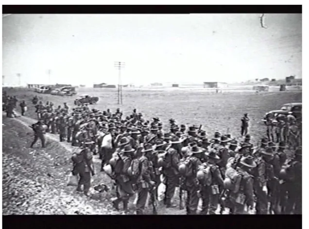


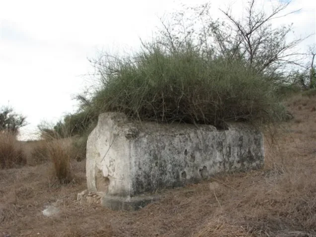
Photos from the village's people
Photos sent in by visitors and published after review.
Add a photo of this village
Log in to add photos of this village.
Other villages from Gaza

More from the archive

 Download Our Palestine App
The whole archive in the palm of your hand: depopulated villages, the Nakba, the massacres and Al-Aqsa — free, with no ads to erase the story.
Download Our Palestine App
The whole archive in the palm of your hand: depopulated villages, the Nakba, the massacres and Al-Aqsa — free, with no ads to erase the story.



Comments
No comments yet — be the first to write one.
Add your comment
Name and email are optional. Comments appear after review.