
The depopulated village of Summil (Gaza) / District of Gaza
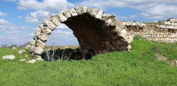
Summil (Gaza)
About the depopulated village of Summil (Gaza)
- District
- Gaza
- Date Summil (Gaza) was occupied
- 09 July 1948
- Population in 1948
- 1,100
- Distance from the governorate centre
- 36 (km) Noerth East of Gaza
- Elevation above sea level
- 125 m
- Cause of displacement
- Expulsion by Zionist troops
- Extent of destruction
- The village has been completely destroyed, and only house rubble left behind.
- Ethnic cleansing
- Summil inhabitants were completely ethnically cleansed.
- Settlements built on the land of Summil (Gaza) before 1948
- Qedma: established in 1946, before the Nakba and the depopulation of Summil.
- Settlements built on the built-up area of Summil (Gaza) after 1948
-
Segula: established in 1953.
Menucha: established in 1953.
Nachala: established in 1953.
Wardon: established in 1968 on land that had belonged to Summil.
Hover a dot to read the village name, or click to open its card.
Borders of the depopulated village of Summil (Gaza)
Summil: A Depopulated Palestinian Village in the Gaza District
Summil was a Palestinian village in the Gaza District, located approximately 36 km northeast of Gaza city. It stood on a sandy hill in the coastal plain at an average elevation of about 125 metres above sea level. Its inhabitants were displaced during the Nakba and the occupation of Palestine in 1948.
Location of Summil
Summil stood on a sandy hill surrounded by wadis in the coastal plain. Secondary roads linked the village to the main road between al-Majdal and Bayt Jibrin near the junction by the village of Iraq al-Manshiyya. Other paved and unpaved roads connected Summil with neighbouring villages.
The village relied on al-Faluja, approximately 6 km to the southwest, for a number of commercial, medical, and administrative services.
History and Name of Summil
Summil is believed to have been established in 1168 during the Crusader period by the Hospitallers to protect another fortress that had previously been built at Bayt Jibrin. The villagers believed that the name Summil derived from Samuel, one of the Crusaders associated with its establishment.
The village was also known as Barakat al-Khalil. Its tax revenues had been endowed by the Mamluk Sultan Barquq for the sanctuary of al-Khalil in Hebron.
In 1596, Summil was a village in the nahiya of Gaza in the liwa of Gaza, with an estimated population of 363. It paid taxes on wheat, barley, fruit, goats, beehives, and other agricultural production.
Architecture of Summil
In the late nineteenth century, Summil had a semi-circular layout. During the British Mandate period, construction expanded toward the southwest. Most village houses were built of adobe brick.
The inhabitants were Muslim, and the village had a mosque built on the remains of a Crusader church.
Economic Life in Summil
The villagers obtained domestic water from a well approximately 48 metres deep known as al-Khalil.
Rainfed agriculture and sheep raising formed the basis of the village economy. Grain, grapes, and figs were among the principal crops. In the 1944/45 statistics, 16,093 dunums of Arab-owned land were allocated to cereals, together with 2,619 dunums classified as Jewish-owned and 8 dunums of public land, for a total of 18,720 dunums devoted to cereals. Another 54 dunums of Arab-owned land were irrigated or used for orchards.
Land Ownership in Summil
According to the 1944/45 land statistics presented by PalQuest, the total area of Summil was 19,304 dunums.
Land ownership in Summil, 1944/45
- Arab16,261 dunums84%
- Jewish2,620 dunums14%
- Public423 dunums2%
These figures differ from the table currently displayed by Palestine Remembered, which gives 16,261 dunums as Palestinian-owned, 2,620 dunums as having passed to Zionists, and 42 dunums as communal land, for a total of 18,923 dunums. Because those figures do not equal the documented total area of the village, the PalQuest figures of 423 public dunums and a total of 19,304 dunums are used here.
Land Use in Summil
Land use in Summil, 1944/45
- Arab
- Jewish
- Public
- Cereals18,720 dunums
- Plantations and irrigable land54 dunums
- Non-cultivable land499 dunums
- Built-up area31 dunums
The total area classified as cultivated or cultivable was 18,774 dunums: 16,147 Arab, 2,619 Jewish, and 8 public dunums. Non-cultivable and built-up land together amounted to 530 dunums.
Population of Summil
Population of Summil in selected years
- 1596363Estimate derived from Ottoman-period records
- 1922561Official British Mandate census
- 1931692Official British Mandate census
- 1944/45950Official statistics
- 19481,102Later estimate, not a British Mandate census figure
- Estimated refugees in 19986,767Later estimate published by Palestine Remembered
Number of Houses in Summil
Number of houses in the village
- 1931178Official census figure
- 1948283Later estimate published by Palestine Remembered
Education in Summil
A school was established in Summil in 1936. By the mid-1940s, it had an enrolment of 88 pupils.
Occupation and Depopulation of Summil during the Nakba
Summil fell during one of the Givati Brigade's southward offensives in the period known as the “Ten Days,” between the truces of 8 and 18 July 1948, during the occupation of Palestine in 1948.
Walid Khalidi and PalQuest do not provide an exact date for the occupation of the village. They state that it probably fell during the early stages of the offensive, between 9 and 14 July 1948. Palestine Remembered's summary data, however, lists 8 July 1948. The precise day of occupation should therefore be treated as a point of disagreement between the sources.
- Probable occupation date: between 9 and 14 July 1948.
- Documented military unit: Givati Brigade.
- Military operation: the dedicated PalQuest entry for Summil does not explicitly name the operation, instead placing the capture within Givati's offensives during the “Ten Days.”
- Depopulation: the inhabitants were probably expelled eastward toward the Hebron area.
The capture of Summil formed part of a broader offensive in which Israeli forces occupied a large area south of the Ramla–Jerusalem road and displaced more than 20,000 Palestinians from the region.
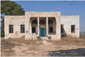
Most of the village's buildings were subsequently destroyed, although the sources record surviving fragments of walls and other remains at the site.
Settlements Established on the Lands of Summil
The sources identify several settlements associated with the lands of Summil. Qedma must be distinguished from those established after the Nakba because it was founded before the village was depopulated.
- Qedma: established in 1946, before the Nakba and the depopulation of Summil.
- Segula: established in 1953.
- Menucha: established in 1953.
- Nachala: established in 1953.
- Wardon: established in 1968 on land that had belonged to Summil.
Summil Today
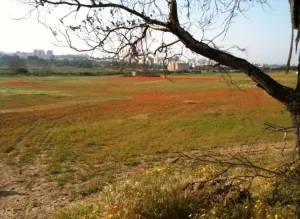
According to the description recorded by Walid Khalidi and made available through PalQuest, remnants of a wall that may once have surrounded the village were still visible at the site. Much of the area was covered by khubbayza, wild grasses, Christ's-thorn trees, and dense stands of cactus. An old village road lined with cactus was also visible, while adjacent lands were being cultivated.
This description derives from the material published in Walid Khalidi's All That Remains, issued in 1992 and later digitized through PalQuest. It should therefore not be treated as a field verification of conditions at the site in 2026.
Sources
Photo gallery
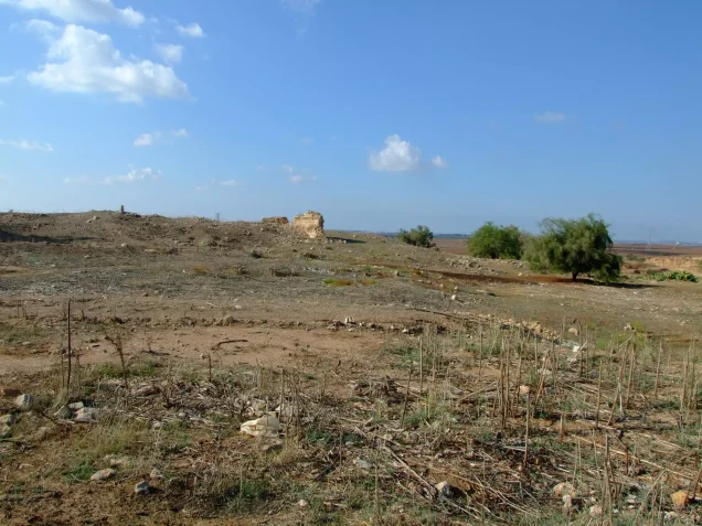
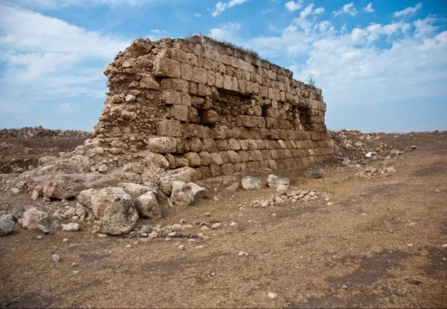
Photos from the village's people
Photos sent in by visitors and published after review.
Add a photo of this village
Log in to add photos of this village.
Other villages from Gaza
More from the archive


 Download Our Palestine App
The whole archive in the palm of your hand: depopulated villages, the Nakba, the massacres and Al-Aqsa — free, with no ads to erase the story.
Download Our Palestine App
The whole archive in the palm of your hand: depopulated villages, the Nakba, the massacres and Al-Aqsa — free, with no ads to erase the story.



Comments
No comments yet — be the first to write one.
Add your comment
Name and email are optional. Comments appear after review.