
The depopulated village of Al-Batani al-Sharqi / District of Gaza
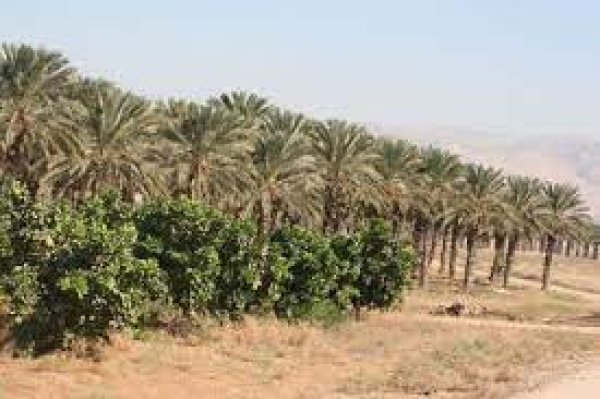
Al-Batani al-Sharqi
About the depopulated village of Al-Batani al-Sharqi
- District
- Gaza
- Date Al-Batani al-Sharqi was occupied
- 13 May 1948
- Population in 1948
- 750
- Military operation
- Operation Barak
- Brigade that carried it out
- الكتيبة الثامنة لجفعاتي
- Who defended the village
- Egyptian Army, and some local Palestinian militia
- Distance from the governorate centre
- 36.5 (km) North East of Gaza
- Elevation above sea level
- 50 m
- Cause of displacement
- Military assault by Zionist troops
- Extent of destruction
- The village was completely obliterated.
- Ethnic cleansing
- al-Batani al-Sharqi inhabitants were completely ethnically cleansed.
- Settlements built on the built-up area of Al-Batani al-Sharqi after 1948
- Orot
Hover a dot to read the village name, or click to open its card.
Borders of the depopulated village of Al-Batani al-Sharqi
Al-Batani al-Sharqi – Depopulated Palestinian Village of the Gaza District
Al-Batani al-Sharqi was a depopulated Palestinian village in the Gaza District. It stood on low, level ground on the southern coastal plain approximately 36.5 kilometers northeast of Gaza, at an average elevation of about 50 meters above sea level.
Wadi al-Mari bordered the village on the east. Al-Batani al-Sharqi was one of two neighboring villages bearing the name al-Batani, with its twin, al-Batani al-Gharbi, lying immediately to the west. As the eastern village expanded westward, the distance between their built-up areas became less than two kilometers.
The chronology of its occupation in 1948 is disputed. Walid Khalidi, citing Benny Morris, places its first fall to the Haganah's Giv'ati Brigade on 13 May. Another account dates the occupation to 10–11 June and identifies Giv'ati's Eighth Battalion. Khalidi suggests that the village may have changed hands during Israeli–Egyptian fighting before its final capture on the eve of the First Truce.
Location and Geography
Al-Batani al-Sharqi stood on the southern coastal plain approximately 36.5 kilometers northeast of Gaza.
The village occupied relatively low and level terrain at an average elevation of about 50 meters above sea level.
Wadi al-Mari bordered the eastern side of the village. Winter flooding impeded construction toward the east, causing the built-up area to expand increasingly westward.
Secondary roads connected al-Batani al-Sharqi with nearby villages and with localities on the main coastal highway, including Yasur and Isdud.
Al-Batani al-Gharbi lay to the west, Barqa to the north, Yasur to the northeast, Qastina to the east, al-Sawafir al-Shamaliyya to the south and southeast, and Bayt Daras to the southwest.
Al-Batani al-Sharqi and Al-Batani al-Gharbi
Al-Batani al-Sharqi was one of two neighboring Palestinian villages bearing the name al-Batani.
The adjectives al-Sharqi, “eastern,” and al-Gharbi, “western,” distinguished the two according to their relative positions.
As construction in al-Batani al-Sharqi expanded westward, less than two kilometers separated the two built-up areas.
The communities had strong social, economic, and educational links but remained separate demographic and cadastral units. Their population, land statistics, and occupation chronologies should therefore not be merged.
Early History
The earliest reference cited by Walid Khalidi states that al-Batani was originally established as an agricultural estate associated with the first Umayyad caliph, Mu'awiya ibn Abi Sufyan, who ruled from 661 to 680 CE.
In 1596, al-Batani al-Sharqi appeared in Ottoman records as a village in the nahiya of Gaza in the liwa' of Gaza.
Its population was approximately 39, and villagers paid taxes on wheat, barley, fruit, goats, beehives, vineyards, and other forms of production.
Nineteenth-Century Village
In the late nineteenth century, al-Batani al-Sharqi was described as lying on low ground and extending in a rectangular pattern from east to west.
Scattered gardens and a number of wells surrounded the village.
The houses were built mainly of adobe, roofed with timber and reeds, and clustered closely together along narrow lanes.
Built Environment and Military Airfield
Construction continued expanding westward because seasonal flooding of Wadi al-Mari restricted growth toward the east.
The official 1944/45 statistics classified approximately 32 dunams as built-up land.
During the British Mandate, a military airfield was constructed on level ground southwest of al-Batani al-Sharqi and south of al-Batani al-Gharbi.
Population and Houses
The inhabitants of al-Batani al-Sharqi were Muslims.
- 1596About 39Ottoman tax records
- 1922304Official Census of Palestine; all inhabitants were Muslims
- 1931424Official census: 219 males and 205 females, all Muslims
- 1945650Official statistics; all inhabitants were Palestinian Arab Muslims
- 1948About 754Later demographic estimate, not an official Mandate census
- 1998About 4,630 refugees and descendantsLater estimate published by Palestine Remembered
The official 1931 census recorded 85 houses in al-Batani al-Sharqi.
Some secondary references incorrectly give the 1931 population as 404. The official census table records 219 males and 205 females, giving a total of 424, the figure also used by PalQuest and Palestine Remembered.
The estimate of approximately 151 houses in 1948 is a later calculation rather than an official Government of Palestine census figure.
Mosque and Education
Al-Batani al-Sharqi had its own mosque and several small shops.
The eastern and western Batani villages shared an elementary school that opened in 1947.
The school had an initial enrollment of approximately 119 pupils.
It should therefore be described as a shared school rather than an institution belonging exclusively to al-Batani al-Sharqi.
Water Resources
Numerous wells stood on the village lands.
They supplied drinking water to the inhabitants and provided irrigation for orchards and some cultivated fields.
Agriculture therefore combined rainfed cultivation with irrigation from wells.
Economic Life
Agriculture was the principal occupation of the villagers.
Cereals and citrus were among the most important crops, together with orchards and irrigated cultivation.
The inhabitants also raised livestock and poultry.
Several small shops served everyday local needs.
Land Ownership, 1944/45
The total land area of al-Batani al-Sharqi was 5,764 dunams according to the official Government of Palestine statistics.
- Arab5,531 dunums96%
- Jewish70 dunums1%
- Public163 dunums3%
The official figures balance exactly: 5,531 + 70 + 163 = 5,764 dunams.
Palestine Remembered presents the same figures using its own terminology: 5,531 dunams “Palestinian,” 70 dunams “Transferred to Zionists,” and 163 dunams “Communal/Public.”
The wording “Transferred to Zionists” should be preserved when reproducing that source's classification rather than automatically replacing it with the official “Jewish” category.
Land Use, 1944/45
- Arab
- Jewish
- Public
- Citrus and bananas319 dunums
- Plantations and irrigable land474 dunums
- Cereals4,733 dunums
- Total cultivable/cultivated land5,526 dunums
- Non-cultivable land206 dunums
- Built-up land32 dunums
- Total non-cultivable and built-up238 dunums
The official figures balance exactly: 5,526 dunams of cultivated or cultivable land plus 238 dunams of built-up and non-cultivable land equal the total village area of 5,764 dunams.
Palestine Remembered's simplified table requires careful interpretation. Its 206 dunams of non-arable land are displayed under the Palestinian column, while the official table shows that only 43 dunams were Arab and 163 were Public.
Public land is therefore kept separate in the table above.
Archaeological Site
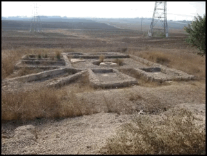
An archaeological site within al-Batani al-Sharqi contained several types of remains.
These included a mosaic floor, a basin, foundations of ruined buildings, and pottery fragments.
The principal source does not securely date all of these remains, so they are not collectively assigned to the Roman, Byzantine, or any other specific period without specialist archaeological evidence.
Operation Barak and Al-Batani al-Sharqi
The Haganah's Giv'ati Brigade launched Operation Barak in May 1948. PalQuest dates the principal phase of the operation from 9 to 13 May.
The offensive sought to expand Zionist control south and west of Ramla and to depopulate Palestinian villages before the end of the British Mandate.
Palestine Remembered and the Palestinian Villages Encyclopedia classify al-Batani al-Sharqi under Operation Barak, and the 13 May date for its first capture coincides with the operation's principal timeframe.
There is nevertheless a source-indexing complication: PalQuest's list of villages affected by Operation Barak does not include al-Batani al-Sharqi, even though its village entry states that Giv'ati captured it on 13 May while expanding southward.
The most cautious formulation is therefore that the village's first fall occurred during Giv'ati's southward expansion concurrent with Operation Barak, and several Palestinian sources classify it under that operation, although the attribution is not entirely consistent across PalQuest's own indexes.
The 13 May Occupation Account
According to Walid Khalidi, citing Benny Morris, the Haganah's Giv'ati Brigade captured al-Batani al-Sharqi on 13 May 1948.
The capture occurred just before the termination of the British Mandate as Giv'ati expanded southwestward in preparation for confrontation with Egyptian forces.
Bashshit and Barqa were captured in the same general phase.
13 May is the occupation date indexed by Palestine Remembered and a number of later Palestinian databases.
The 10–11 June Account and Possible Recapture
Khalidi also cites a different chronology from the History of the War of Independence, which dates the capture of al-Batani al-Sharqi to 10–11 June 1948.
This account attributes the operation to the Eighth Battalion of the Giv'ati Brigade.
The date immediately precedes the First Truce, which came into effect on 11 June.
Khalidi suggests that the two dates may indicate that the village changed hands during Israeli–Egyptian fighting on the southern front: the 13 May seizure may not have represented permanent control, with a final Israeli recapture occurring on 10–11 June.
The available evidence does not conclusively resolve the issue, so the two accounts should be preserved rather than merged into a single event.
Military Unit
The Giv'ati Brigade is securely associated with al-Batani al-Sharqi in both occupation accounts.
It is inaccurate, however, to state that “Giv'ati's Eighth Battalion captured the village on 13 May,” because that combines two separate source traditions.
The 13 May account identifies the Giv'ati Brigade generally.
The Eighth Battalion belongs specifically to the alternative account dating the occupation or recapture to 10–11 June.
Depopulation
Palestine Remembered classifies the cause of depopulation as a direct military assault by Zionist forces.
The possibility that control changed between May and June makes it difficult to identify a single securely documented moment at which every civilian resident departed.
No unsupported details are therefore added regarding the exact route, date, or circumstances of each family's departure.
What is securely established is that al-Batani al-Sharqi's Palestinian population was displaced during the Nakba and the village ultimately remained empty after final Israeli military control was established.
Occupation Chronology
- 9 May 1948
Beginning of Operation Barak
Giv'ati launched a broad offensive to occupy and depopulate Palestinian villages on the southern coastal plain and west of Ramla.
- 13 May 1948
Most widely indexed first capture
According to Morris as cited by Khalidi, al-Batani al-Sharqi fell to the Giv'ati Brigade as it expanded southward, during the same general phase as Bashshit and Barqa.
- 15 May 1948
End of the British Mandate
Under the first account, the village was already in Giv'ati hands before the termination of the Mandate.
- May–June 1948
Israeli–Egyptian fighting in the area
Khalidi suggests that changing control during the fighting may explain the second occupation date.
- 10–11 June 1948
Occupation or recapture in the second account
The History of the War of Independence attributes this capture to the Eighth Battalion of the Giv'ati Brigade.
- 11 June 1948
Beginning of the First Truce
If the second account is correct, final Israeli control was secured immediately before the truce came into effect.
- After occupation; exact date not documented
Destruction of the village
Village structures were later destroyed, while the Mandate-era police station, a village street, and vegetation remained visible.
Israeli Settlements on Village Lands
According to Walid Khalidi and PalQuest, no Israeli settlement was established on al-Batani al-Sharqi village land itself.
Settlements established on the lands of al-Batani al-Gharbi, Bayt Daras, or other neighboring Palestinian villages should therefore not be transferred to al-Batani al-Sharqi.
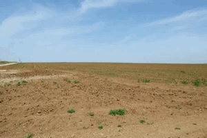
Al-Batani al-Sharqi Today
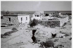
According to the field description published in Walid Khalidi's All That Remains, the principal surviving structure was a dilapidated Mandate-era police station.
The police complex consisted of three single-storey concrete buildings with flat roofs. One stood slightly higher than the other two, and all had rectangular doors and windows.
One of the former village streets remained clearly visible.
Cactuses and fig, eucalyptus, and sycamore trees were scattered across the site, while Israeli farmers cultivated citrus on adjacent land.
This description should not be treated as a comprehensive field verification of conditions in 2026. Fieldwork for All That Remains was conducted between 1987 and 1990 and therefore records the condition of the site during that survey period.
Sources
- PalQuest – Interactive Encyclopedia of the Palestine Question: al-Batani al-Sharqi
- PalQuest – Operation Barak
- Palestine Remembered – al-Batani al-Sharqi, Gaza District
- Palestinian Villages Encyclopedia – al-Batani al-Sharqi; supporting Palestinian documentation
- Village Statistics 1945 – Gaza Sub-District: population and land ownership
- Government of Palestine – Census of Palestine 1931: Batani Sharqi
- Institute for Palestine Studies – Walid Khalidi, All That Remains
- PalQuest – All That Remains: Methodology and Fieldwork
Photos from the village's people
Photos sent in by visitors and published after review.
Add a photo of this village
Log in to add photos of this village.
More from the archive


 Download Our Palestine App
The whole archive in the palm of your hand: depopulated villages, the Nakba, the massacres and Al-Aqsa — free, with no ads to erase the story.
Download Our Palestine App
The whole archive in the palm of your hand: depopulated villages, the Nakba, the massacres and Al-Aqsa — free, with no ads to erase the story.



Comments
No comments yet — be the first to write one.
Add your comment
Name and email are optional. Comments appear after review.