
The depopulated village of Hamama / District of Gaza

About the depopulated village of Hamama
- District
- Gaza
- Date Hamama was occupied
- 28 October 1948
- Population in 1948
- 5,812
- Military operation
- Operation Yoav
- Brigade that carried it out
- Givati Brigade
- Who defended the village
- Egyptian Army
- Distance from the governorate centre
- 24 (km) North East of Gaza
- Elevation above sea level
- 25 m
- Cause of displacement
- Military assault by Zionist troops
- Extent of destruction
- The village was completely obliterated.
- Ethnic cleansing
- Hamama inhabitants were completely ethnically cleansed.
- Settlements built on the land of Hamama before 1948
- Nitzanim, established in 1943; its original site later became Nitzanim Youth Village
- Settlements built on the built-up area of Hamama after 1948
- Nitzanim–Kefar ha-No'ar in 1949, Beyt Ezra in 1950, the relocated Nitzanim, and the Eshkolot farm during the 1950s
Hover a dot to read the village name, or click to open its card.
Borders of the depopulated village of Hamama
Hamama: A Depopulated Palestinian Village in the Gaza District
Hamama was a Palestinian village in the Gaza District, approximately 24 km northeast of Gaza city and about 2 km from the Mediterranean coast. It stood on flat terrain in the coastal plain at an average elevation of about 25 metres above sea level. Its inhabitants were displaced during the Nakba and the occupation of Palestine in 1948. Walid Khalidi and PalQuest place its occupation at approximately 28 October 1948, during the third stage of Operation Yoav.
Location of Hamama
Hamama stood on flat land in the coastal plain and was bordered by long sand dunes to the east and west. The main coastal highway and railway line passed a short distance east of the village.
The village was approximately 2 km from the Mediterranean coast, and fishing formed an additional source of livelihood alongside agriculture.
Name and History of Hamama
Hamama was built on the site of Tall Mishqafa, identified with Peleia in an early fifth-century Byzantine source. The name Peleia also means “dove,” corresponding to the meaning of the Arabic name Hamama.
The village stood near the site of a battle fought between Crusader and Muslim forces in 1099, which ended in a Crusader victory. The Mamluk Sultan al-Ashraf Barsbay was also reported to have passed through Hamama in 1432.
Hamama was said to have been the birthplace of Ahmad al-Shafi'i (1406–1465), a Muslim scholar, teacher, and preacher associated with al-Aqsa Mosque in Jerusalem.
In 1596, Hamama was a village in the nahiya of Gaza within the liwa of Gaza, with an estimated population of approximately 462. It paid taxes on goats and beehives.
Architecture and Services in Hamama
Houses in Hamama were constructed along the roads connecting the village centre with surrounding communities, producing a roughly star-shaped settlement pattern. The longest extensions of the built-up area ran toward the north and northwest.
The built-up area covered 167 dunums in the 1944/45 statistics.
Most inhabitants were Muslim. The village had a mosque, two elementary schools, and a local council that administered its affairs.
Education in Hamama
An elementary school for boys was established in Hamama in 1921, while an elementary school for girls opened in 1946.
By the mid-1940s, the boys' school enrolled 338 pupils, while the girls' school enrolled 46 pupils.
Palestine Remembered states that nine teachers worked at the boys' school and two teachers at the girls' school. Other circulated figures concerning a 400-volume school library and the number of literate men in Hamama could not be confirmed in the principal approved sources used here and are therefore not presented as established statistics.
Economic Life in Hamama
Agriculture was the principal economic activity. Villagers cultivated a wide variety of crops, including cereals, citrus, apricots, almonds, figs, olives, watermelons, and cantaloupes.
Because of the extensive sand dunes, particularly north of the village, residents planted trees in parts of the village lands to stabilize the soil and reduce sand encroachment.
Fishing also provided a source of livelihood because of Hamama's proximity to the Mediterranean coast.
According to the 1944/45 statistics, a total of 1,356 dunums was devoted to citrus and bananas, 28,890 dunums to cereals, and 4,459 dunums to other plantations and irrigable land.
Land Ownership in Hamama
The total land area of Hamama was 41,366 dunums according to the 1944/45 statistics.
Land ownership in Hamama, 1944/45
- Arab26,855 dunums65%
- Jewish1,693 dunums4%
- Public12,818 dunums31%
Palestine Remembered presents the corresponding categories in its Arabic table as 26,855 Palestinian dunums, 1,693 dunums “transferred to Zionists,” and 12,818 dunums of communal land.
Land Use in Hamama, 1944/45
Land use in Hamama according to PalQuest
- Arab
- Jewish
- Public
- Citrus and bananas1,356 dunums
- Plantations and irrigable land4,459 dunums
- Cereals28,890 dunums
- Built-up area167 dunums
- Non-cultivable land6,494 dunums
A total of 34,705 dunums was cultivated or cultivable: 26,276 Arab, 1,693 Jewish, and 6,736 public dunums.
Palestine Remembered presents some land-use figures differently by combining public land with the Palestinian column. This accounts for its figure of 27,726 dunums of cereal land rather than separating 20,990 Arab and 6,736 public dunums.
Population of Hamama
Population of Hamama in selected years
- 1596462Estimate based on Ottoman records
- 19222,731Official British Mandate census
- 19313,405Official British Mandate census
- 1944/455,070Official statistics: 5,010 Arabs and 60 Jews
- 19485,812Later estimate published by Palestine Remembered, including 60 Jews
- Estimated refugees in 199835,689Later estimate published by Palestine Remembered
Walid Khalidi describes most of Hamama's inhabitants as Muslim. The 60 Jews recorded in the 1944/45 statistics form part of the official population classification for the statistical unit associated with Hamama.
Number of Houses in Hamama
Number of houses in Hamama
- 1931865Official census figure
- 19481,476Later estimate published by Palestine Remembered
Archaeological Sites in Hamama
The area surrounding Hamama contained numerous visible archaeological remains. Walid Khalidi and PalQuest specifically identify Khirbat Khawr al-Bayk and Khirbat Shaykh Awad.
The identification of Tall Mishqafa with the Byzantine site of Peleia also points to a long history of settlement in the area.
Attacks on Hamama before its Occupation
Residents of Hamama were subjected to a series of attacks beginning in January 1948. On 22 January, a group of villagers working in fields between Hamama and Isdud was fired upon from the direction of the nearby Nitzanim settlement. According to the Palestinian newspaper Filastin, fifteen Arab workers were wounded, two seriously.
Two days later, another attack killed one villager and wounded another. On 17 February, fire was opened on villagers waiting for a bus on the Hamama–Isdud road, wounding two people.
Occupation and Depopulation of Hamama during the Nakba
Hamama was occupied during the third stage of Operation Yoav, the military offensive conducted by Israeli occupation forces on the southern front between 15 October and 4 November 1948.
According to the detailed narrative reproduced by Walid Khalidi and PalQuest, Hamama was occupied at approximately 28 October 1948. By then, the village had also become a refuge for Palestinians displaced from Isdud and other nearby areas.
The account states that the Yiftach Brigade entered Hamama and found the village crowded with refugees from Isdud and elsewhere. Following the occupation of the area, remaining villagers and refugees moved southward; the source records both flight and instances in which soldiers encouraged or ordered people to leave.
Palestine Remembered's summary table differs on two important points: it gives 4 November 1948 as the occupation date and identifies the Givati Brigade as the attacking unit, with the Egyptian Army as the defending force. Because Khalidi's detailed narrative gives approximately 28 October and specifically records the entry of the Yiftach Brigade, this disagreement is retained rather than resolved by assumption.
- Probable occupation date according to Khalidi/PalQuest: approximately 28 October 1948.
- Palestine Remembered date: 4 November 1948.
- Military operation: Operation Yoav, third stage.
- Unit associated with entry into the village in Khalidi's account: Yiftach Brigade.
- Unit listed by Palestine Remembered: Givati Brigade.
- Defending force according to Palestine Remembered: Egyptian Army.
- Fate of the inhabitants: remaining villagers and refugees in Hamama were displaced southward during the Nakba.
- Fate of the village: its houses and landmarks were subsequently destroyed.
Some details concerning flight and expulsion derive from Israeli accounts quoted by Khalidi. Those sources are not used independently here; they are mentioned only because the approved Palestinian reference reproduces them.
Settlements and Installations Established on the Lands of Hamama
Several settlements and installations were established on lands associated with Hamama. They should be distinguished according to whether they predated or followed the Nakba:
- Nitzanim: established in 1943 on land belonging to Hamama, northeast of the village site.
- Nitzanim–Kfar ha-No'ar: established in 1949 on village lands.
- Beit Ezra: established in 1950 on Hamama's lands.
- Eshkolot: a farm established on village lands during the 1950s.
A Palestine Remembered transcription of the Khalidi entry gives 1934 as the foundation year of Nitzanim, while PalQuest gives 1943. The 1943 date is used here.
Hamama Today
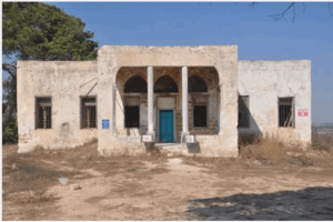
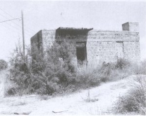
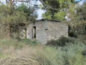
According to the field description published by Walid Khalidi in All That Remains, no visible traces of the village houses or landmarks remained. The site was overgrown with wild vegetation, including tall grasses, thorny bushes, brambles, and cactus. The surrounding land was described as unused.
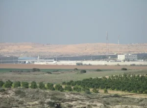
Palestine Remembered also contains later photographs of the Hamama area, including a set dated 2002. These photographs are more recent than Khalidi's published description but do not constitute a comprehensive independent contemporary field survey.
The approved sources used here therefore do not provide a sufficiently comprehensive and independent field verification of the precise condition of every part of the Hamama site in 2026.
Sources
- PalQuestPalQuest – Interactive Encyclopedia of the Palestine Question: Hamama
- PalQuestPalQuest – Operation Yoav
- Palestine RememberedPalestine Remembered – Hamama, Gaza District
- Palestine RememberedPalestine Remembered – Hamama entry from All That Remains
- Institute for Palestine StudiesInstitute for Palestine Studies – All That Remains, Walid Khalidi


Photos from the village's people
Photos sent in by visitors and published after review.
Add a photo of this village
Log in to add photos of this village.
Other villages from Gaza
More from the archive


 Download Our Palestine App
The whole archive in the palm of your hand: depopulated villages, the Nakba, the massacres and Al-Aqsa — free, with no ads to erase the story.
Download Our Palestine App
The whole archive in the palm of your hand: depopulated villages, the Nakba, the massacres and Al-Aqsa — free, with no ads to erase the story.



Comments
No comments yet — be the first to write one.
Add your comment
Name and email are optional. Comments appear after review.