
The depopulated village of Farwana / District of Baysan

About the depopulated village of Farwana
- District
- Baysan
- Date Farwana was occupied
- 11 May 1948
- Population in 1948
- 380
- Military operation
- Operation Gideon
- Brigade that carried it out
- Golani Brigade
- Distance from the governorate centre
- 4.5 (km) South of Baysan
- Elevation above sea level
- -125 m
- Cause of displacement
- Military assault by Zionist troops
- Extent of destruction
- On May 12th, 1948, Farwana was completely destroyed, and only house walls and rubble left behind.
- Ethnic cleansing
- Upon occupation, both Farwana and al-Ashrafiyya inhabitants fled towards Jordan.
- Settlements built on the built-up area of Farwana after 1948
- Havat Eden
Hover a dot to read the village name, or click to open its card.
Borders of the depopulated village of Farwana
Farwana – Depopulated Palestinian Village of the Baysan District
Farwana was a depopulated Palestinian village in the Baysan District. It stood on level ground in the Baysan Valley along the main road connecting Baysan with Jericho, approximately 4.5 kilometers south of Baysan, at an average elevation of about 125 meters below sea level.
Units of the Golani Brigade attacked and occupied Farwana on the night of 10–11 May 1948, at the same time as neighboring al-Ashrafiyya, in preparation for the assault on Baysan the following day. The village fell in the context of Operation Gideon, the campaign to conquer the Baysan Valley and displace its Palestinian population.
Location and Geography
Farwana stood on flat terrain in the central Baysan Valley at the foot of the western edge of the Jordan Valley.
It lay approximately 4.5 kilometers south of Baysan and at an average elevation of about 125 meters below sea level.
The village occupied an important position along the paved road connecting Baysan with al-Jiftlik and Jericho, facilitating contact with the district capital and communities farther south in the Jordan Valley.
Neighboring communities included al-Ashrafiyya to the west, Umm 'Ajra to the east, Jilbun to the southwest, al-Samiriyya to the south, and 'Arab al-Safa to the southeast, with Baysan to the north.
Name
Walid Khalidi suggests that the name Farwana may have been derived from the Arabic expression farana al-khubzu farnan, referring to bread being thoroughly baked, an interpretation associated with the intense heat of the Jordan Valley.
The Palestinian Encyclopedia gives a similar explanation linking the name with the area's hot climate.
The precise etymology is not conclusively established, so this interpretation remains tentative.
Built Environment
Farwana's houses were largely built of adobe brick and stood in a compact cluster separated by narrow pedestrian lanes.
The official 1944/45 statistics classified approximately 11 dunams as built-up land.
The principal sources reviewed do not document a formal village school or a specifically identified mosque. Palestinian community testimony refers to a place known as the zawiya, used for gatherings and receiving guests, but this alone is insufficient to classify it as a formally documented mosque.
Population and Houses
The inhabitants of Farwana were Muslims.
- 192284Figure given in references based on the official 1922 Census of Palestine
- 1931286Official census: 151 males and 135 females, all Muslims
- 1945330Official statistics; all inhabitants were Palestinian Arab Muslims
- 1948About 383Later Palestine Remembered estimate, not an official British census
- 1998About 2,351 refugees and descendantsLater demographic estimate
The official 1931 census recorded 72 houses in Farwana.
The figure of approximately 96 houses for 1948 is a later estimate rather than an official census count.
Palestine Remembered currently displays 48 inhabitants for 1922. The Palestinian Encyclopedia and references citing the official Mandate census give 84; this article therefore uses 84 and treats 48 as an online table error.
Education and Religious Life
Walid Khalidi and PalQuest do not document an independent formal school or a specifically identified mosque in Farwana.
Palestinian community testimony records a place known as the zawiya, where villagers gathered and received guests, and also states that the village cemetery remained identifiable.
These details are treated as supporting community documentation and are not used to infer a formal school or mosque without additional evidence.
Water Resources
Farwana benefited from abundant groundwater and a number of springs in the surrounding agricultural lands.
The springs fed Wadi al-Maddu', while the Palestinian Encyclopedia places many of them west of the village and identifies Wadi al-Maddu' as a tributary of Wadi Shubash, which ultimately drains toward the Jordan River.
The availability of water supported irrigated cultivation west of the village in addition to rainfed agriculture.
Economic Life and Agriculture
Agriculture was the principal livelihood of Farwana's inhabitants.
Cereals were the dominant crop, while villagers also cultivated vegetables and limited areas of fruit trees, including olives.
The fertile, level soils of the Baysan Valley and the availability of groundwater allowed a very high proportion of village land to be cultivated.
Land Ownership, 1944/45
The total land area of Farwana was 4,996 dunams. Under the official Government of Palestine classification, ownership was distributed as follows:
- Arab3,942 dunums79%
- Jewish0 dunums0%
- Public1,054 dunums21%
Palestine Remembered presents the same ownership totals using its simplified terminology: 3,942 dunams “Palestinian,” 0 dunams “Transferred to Zionists,” and 1,054 dunams “Communal/Public.” The wording “Transferred to Zionists” should be preserved when reproducing that source's classification.
Land Use, 1944/45
- Arab
- Public
- Cereals4,243 dunums
- Plantations and irrigable land42 dunums
- Total cultivable/cultivated land4,285 dunums
- Non-cultivable land700 dunums
- Built-up land11 dunums
- Total non-cultivable and built-up711 dunums
The official table balances exactly: 4,285 dunams of cultivable or cultivated land plus 711 dunams of built-up and non-cultivable land equal the total village area of 4,996 dunams.
Palestine Remembered's simplified display places the entire 4,243 cereal dunams in the Palestinian column, while the official table shows that 396 dunams were Public. Public land has therefore been kept separate above.
Palestine Remembered also lists approximately 6 dunams of olive groves. This is a crop-specific subset and should not be added again to the total agricultural area.
Tall al-Sarim and Archaeology
Tall al-Sarim lay approximately 300 meters southeast of Farwana. It is a large archaeological tell containing the remains of an ancient town divided into upper and lower sections.
Some researchers have identified the site with ancient Rehob, a center of Egyptian rule in Palestine during the second millennium BCE. This identification should be treated as a scholarly interpretation rather than an uncontested certainty.
Excavations approximately 200 meters south of the tell uncovered tombs dating to the late third and early second millennia BCE.
In 1969, the remains of a synagogue dating to the third century CE were discovered northeast of the former village site.
The February 1948 Attack
Farwana was attacked in mid-February 1948 while fighting was taking place near Tirat Tzvi.
The Palestinian newspaper Filastin reported on 19 February that Zionist forces attempted to encircle the village from the north and east but were repelled by Farwana's defenders.
According to the same account, the attackers blew up three empty houses before withdrawing.
This was not the village's final occupation; Farwana remained inhabited until May.
Operation Gideon
Operation Gideon began on 10 May and ended on 15 May 1948. It was carried out by the Golani Brigade to conquer the Baysan Valley and displace its Palestinian inhabitants before the end of the British Mandate.
PalQuest notes the possibility that Irgun may have taken part in the broader offensive, based on its announcement on 14 May that it had captured five Arab villages in the north.
This does not establish Irgun participation in the attack on Farwana itself. The village-specific source identifies Golani Brigade units.
Occupation and Depopulation
On the night of 10–11 May 1948, units of the Golani Brigade attacked and occupied Farwana together with neighboring al-Ashrafiyya.
The two villages were taken as preliminary steps toward the final assault on Baysan on 12 May.
Walid Khalidi, citing Benny Morris through his own account, records that Farwana's inhabitants fled across the Jordan River as Israeli forces approached.
Farwana was probably among the eight villages around Baysan reported by the Associated Press on 13 May as having fallen during the preceding days.
Some sources therefore index 11 May as the occupation date, consistent with the attack occurring during the night of 10–11 May. A 13 May date appearing in some later indexes is better understood as related to the press report announcing the fall of several villages rather than as a securely established village-specific capture date.
Military Unit
The military formation securely identified with the occupation of Farwana is the Golani Brigade.
The village-specific sources do not identify a particular battalion, so no battalion number is assigned.
Irgun is likewise not listed as a confirmed attacking unit at Farwana because its possible participation relates to Operation Gideon generally, not specifically to this village.
Destruction of the Village
Immediately after the capture of Farwana, Haganah sappers began blowing up the village houses.
The village was almost completely destroyed. Later field descriptions found only ruined walls and the floors of some houses.
Occupation Chronology
- Mid-February 1948
First documented attack
Zionist forces attempted to encircle Farwana from the north and east but were repelled; three empty houses were blown up before the attackers withdrew.
- 10 May 1948
Beginning of Operation Gideon
The Golani Brigade began the campaign to conquer the Baysan Valley and displace its Palestinian population.
- Night of 10–11 May 1948
Attack and occupation
Golani units attacked and occupied Farwana and al-Ashrafiyya in preparation for the assault on Baysan.
- During the advance, 10–11 May and immediately afterward
Flight of the population
Khalidi records that residents fled across the Jordan River as the troops approached.
- 12 May 1948
Assault on Baysan
The capture of Farwana and al-Ashrafiyya served as a preliminary step toward the district capital.
- 13 May 1948
Press report on villages captured
The Associated Press reported that eight villages near Baysan had fallen; Farwana was probably among them.
- Immediately after occupation
Demolition
Haganah sappers began demolishing village houses and largely destroyed the settlement.
- 15 May 1948
End of Operation Gideon
The campaign ended after Baysan and much of the surrounding valley had been conquered.
Israeli Settlements on Village Lands
Rehov was established in 1951 on Farwana's land north of the former village site.
The model farm known as Hawwat Eden also lies west of the site on village land.
'En ha-Natziv, established in 1946 immediately northeast of Farwana, was built on land belonging to the town of Baysan rather than on Farwana's lands.
Sde Terumot, established in 1951 west of the village site, was built on land belonging to al-Samiriyya.
'En ha-Natziv and Sde Terumot should therefore not be listed as settlements established on Farwana's village lands despite their geographical proximity.
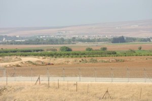
Farwana Today
According to the field description published in Walid Khalidi's All That Remains, only ruined house walls and floors remained at the village site.
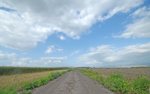
The site was overgrown with wild vegetation and included an archaeological excavation area, while the surrounding lands were under cultivation.
Palestinian community testimony also records that the village cemetery remained identifiable.
This description should not be treated as a comprehensive field verification of conditions in 2026. Fieldwork for All That Remains was conducted between 1987 and 1990 and therefore records the condition of the site during that survey period.
Sources
- PalQuest – Interactive Encyclopedia of the Palestine Question: Farwana
- PalQuest – Operation Gideon
- Palestine Remembered – Farwana, Baysan District
- Palestine Remembered – Walid Khalidi's account of Farwana
- Palestinian Encyclopedia – Farwana
- Palestinian Villages Encyclopedia – Farwana; supporting Palestinian local documentation
- Palestinian Central Bureau of Statistics – Historical Census Archive
- Census of Palestine 1931 – Baysan Sub-District: Farwana, 286 inhabitants and 72 houses
- Institute for Palestine Studies – Walid Khalidi, All That Remains
- PalQuest – All That Remains: Methodology
Photo gallery


Photos from the village's people
Photos sent in by visitors and published after review.
Add a photo of this village
Log in to add photos of this village.
Other villages from Baysan


More from the archive

 Download Our Palestine App
The whole archive in the palm of your hand: depopulated villages, the Nakba, the massacres and Al-Aqsa — free, with no ads to erase the story.
Download Our Palestine App
The whole archive in the palm of your hand: depopulated villages, the Nakba, the massacres and Al-Aqsa — free, with no ads to erase the story.



Comments
No comments yet — be the first to write one.
Add your comment
Name and email are optional. Comments appear after review.