
The depopulated village of Al-Murassas / District of Baysan

Al-Murassas
About the depopulated village of Al-Murassas
- District
- Baysan
- Date Al-Murassas was occupied
- 16 May 1948
- Population in 1948
- 530
- Military operation
- Operation Gideon
- Brigade that carried it out
- Golani Brigade
- Distance from the governorate centre
- 7 (km) North of Baysan
- Elevation above sea level
- 100 m
- Cause of displacement
- Influence of fall of, or exoduce from, neighboring town
- Extent of destruction
- The village was completely defaced.
- Ethnic cleansing
- al-Murassas inhabitants were completely ethnically cleansed.
Hover a dot to read the village name, or click to open its card.
Borders of the depopulated village of Al-Murassas
Al-Murassas – Depopulated Palestinian Village in Baysan Subdistrict
Al-Murassas was a Palestinian village in the Baysan subdistrict of Galilee. It stood approximately 7 kilometers north of the town of Baysan on a low rise between Wadi al-'Ashsha to the north and Wadi Jalud to the south, at an average elevation of about 100 meters above sea level.
The village had 460 inhabitants in the official 1944/45 statistics, including 450 Muslims and 10 Christians, and a registered land area of 14,477 dunums. Agriculture formed the basis of village life, particularly cereal and vegetable cultivation, while springs west of the village and rainwater-collecting wells provided water.
During the Nakba and the 1948 occupation of Palestine, Al-Murassas became depopulated during the campaign that brought the Baysan Valley under Israeli control. Palestine Remembered gives 16 May 1948 as the depopulation date, immediately after the official 10–15 May dates that PalQuest gives for Operation Gideon, carried out by the Golani Brigade.
Key Facts about Al-Murassas
| Field | Information |
|---|---|
| Name | Al-Murassas |
| Subdistrict | Baysan |
| Status | Depopulated Palestinian village |
| Distance from Baysan | Approximately 7 km north |
| Average elevation | Approximately 100 m above sea level |
| Population, 1944/45 | 460: 450 Muslims and 10 Christians |
| Houses, 1931 | 89 – official census |
| Registered land area | 14,477 dunums |
| Reported depopulation date | 16 May 1948 |
| Military context | Immediate aftermath of Operation Gideon and the conquest of the Baysan Valley |
| Military formation associated with the campaign | Golani Brigade, according to Palestine Remembered and the broader Operation Gideon context |
| Cause of depopulation | Influence of the fall or exodus of a neighboring town, according to Palestine Remembered |
| Extent of destruction | The village was almost completely destroyed; rubble and only minimal structures survived in later field documentation |
| Israeli settlements established on village lands | None documented |
Location of Al-Murassas
Al-Murassas stood on a low hill between Wadi al-'Ashsha to the north and Wadi Jalud to the south. The land descended gradually southward toward Wadi Jalud.
A secondary road northwest of the village connected it to the main Baysan–'Afula road and from there to Haifa on the Mediterranean coast. Other local roads linked Al-Murassas with neighboring Palestinian villages including Yubla, Kafra, Jabbul, al-Hamidiyya, and al-Sakhina.
Its location within the fertile Baysan Valley supported the village's predominantly agricultural economy.
The Name Al-Murassas
Neither Walid Khalidi's entry nor PalQuest provides a definitive etymology for the Arabic name Al-Murassas. Other sources offer linguistic interpretations related to stones or rubble, but these have not been presented here as established historical facts in the absence of confirmation from the principal sources.
Al-Murassas in the Ottoman and Nineteenth-Century Periods
Al-Murassas appears in Ottoman records in 1596 as a farm paying taxes to the Ottoman authorities.
The Swiss traveler Johann Ludwig Burckhardt mentioned passing the locality during his travels in the early nineteenth century but did not provide a detailed description.
In the late nineteenth century, the Survey of Western Palestine described Al-Murassas as a small mud-built village standing on elevated ground amid cultivated fields. A small wooded area lay west of the village.
Village Layout and Buildings
Al-Murassas had a roughly circular plan, with houses clustered around a crossroads in the center. A small number of additional houses were built on the elevated ground east of the main village nucleus.
The official 1944/45 land-use statistics record 26 dunums as built-up Arab land.
Population of Al-Murassas
- 1922319Official Government of Palestine census; all Muslims
- 1931381Official census: 375 Muslims and 6 Christians
- 1944/45460Official statistics: 450 Muslims and 10 Christians
- 1948534Later estimate reported by Palestine Remembered, not an official census
- 19983,277 refugeesLater estimate of refugees and descendants reported by Palestine Remembered
Palestine Remembered gives 312 inhabitants for 1922, but the official Government of Palestine census records 319. The official figure is therefore used here.
The 1948 and 1998 figures are necessarily later estimates and should not be attributed to the British Mandate's 1945 Village Statistics despite the general source note displayed beneath the Palestine Remembered table.
Number of Houses
- 193189Official 1931 census figure
- 1948124Later estimate reported by Palestine Remembered
Land Ownership in Al-Murassas
The registered land area of Al-Murassas in 1944/45 totaled 14,477 dunums. Using the ownership terminology employed by Palestine Remembered:
- Palestinian9,936 dunums69%
- Transferred to Zionists3,002 dunums21%
- Communal/Public1,539 dunums11%
The arithmetic is correct: 9,936 + 3,002 + 1,539 = 14,477 dunums.
The original official categories were 9,936 Arab dunums, 3,002 Jewish dunums, and 1,539 Public dunums.
Land Use in 1944/45
The official land-use categories should be kept distinct from the simplified ownership table:
- Arab
- Jewish
- Public
- Cereals12,896 dunums
- Plantations and irrigable land16 dunums
- Built-up land26 dunums
- Non-cultivable land1,539 dunums
The figures balance correctly: 12,896 + 16 + 26 + 1,539 = 14,477 dunums.
Palestine Remembered's simplified land-use display can make the 1,539 dunums of non-cultivable land appear to fall under Palestinian land. PalQuest's official-category table shows that this acreage was classified as Public land and should not be reassigned to private Palestinian ownership.
Economic Life in Al-Murassas
Agriculture was the principal economic activity. Cereals occupied the largest area, while villagers also cultivated vegetables and worked fields west and north of the village.
In 1944/45, a total of 12,896 dunums within the village's statistical boundaries was devoted to cereals, including 9,894 Arab dunums and 3,002 Jewish dunums. Another 16 Arab dunums were irrigated or used for plantations.
The principal sources do not provide reliable crop-by-crop acreage for the village's vegetables and fruit, and no unsupported estimates have been added.
Water Resources
Residents obtained water from springs west of the village and from wells used to collect rainwater.
These water resources supported both domestic life and agricultural activity around the village.
Education in Al-Murassas
Documents preserved and published by Palestine Remembered provide unusually useful evidence for education in Al-Murassas during the Mandate period.
A document dated 12 September 1922 concerns the appointment of teacher 'Abdallah Faraj to the Al-Murassas school, while additional correspondence from 1923 deals with his service and proposed transfer.
A letter dated 12 June 1943 from an education inspector to the Baysan district officer requested verification concerning the existence of an “unregistered school” in Al-Murassas. Another letter dated 14 December 1945 informed the village mukhtar and notables of the appointment of Muhammad Rashid Yunis of 'Ar'ara as a teacher at the school.
These documents confirm organized schooling in Al-Murassas from at least 1922. They do not, however, provide a complete administrative history demonstrating continuous operation under exactly the same status throughout the entire 1922–1945 period or a consistent enrollment series.
Archaeology and Birkat al-Fakht
An ancient pool known as Birkat al-Fakht stood in the southern part of the village and contained a water cistern.
The principal village entry does not provide a precise archaeological date for the pool or cistern, so they should not be assigned to a specific historical period without specialist evidence.
Operation Gideon
The Haganah's Golani Brigade carried out Operation Gideon between 10 and 15 May 1948 as the campaign for control of the Baysan Valley and the depopulation of a number of Palestinian communities in the area.
The town of Baysan fell on 12 May during this campaign, accelerating the collapse of Palestinian civilian life in surrounding villages.
Palestine Remembered associates Al-Murassas with Operation Gideon and identifies the Golani Brigade, but it dates the village's depopulation to 16 May—one day after the official end date of Operation Gideon given by PalQuest.
The most precise formulation is therefore that Al-Murassas was depopulated in the immediate aftermath of Operation Gideon and Golani's conquest of the Baysan Valley, rather than stating that 16 May itself fell within the operation's formal 10–15 May period.
Occupation and Depopulation of Al-Murassas
Palestine Remembered gives 16 May 1948 as the date on which Al-Murassas was occupied and depopulated. Palestinian compilations of depopulated villages likewise report 16 May.
The site classifies the immediate cause of depopulation as the influence of the fall or exodus of a neighboring town. In regional context, this corresponds with the fall of Baysan on 12 May and the rapid collapse of surrounding Palestinian communities.
Walid Khalidi's village entry, however, does not contain an independent detailed narrative of an assault on Al-Murassas itself and does not identify a specific battalion, battle inside the village, or direct expulsion order.
It is therefore reasonable to state that Al-Murassas was empty of its Palestinian population by 16 May according to Palestine Remembered, in the immediate context of Golani's conquest of the Baysan Valley, while the precise village-level mechanism of military entry remains insufficiently documented in Khalidi's account.
Palestine Remembered describes the outcome as complete ethnic cleansing. In directly descriptive terms supported by the sources, the village lost its entire Palestinian community during the Nakba and its built environment was subsequently almost completely destroyed.
Occupation Chronology
- 10 May 1948
Beginning of Operation Gideon
The Golani Brigade began the campaign for control of the Baysan Valley.
- 12 May 1948
Fall of Baysan
Golani forces captured the subdistrict capital, contributing to widespread displacement in surrounding villages.
- 15 May 1948
Formal end of Operation Gideon
This is the end date given by PalQuest for the operation.
- 16 May 1948
Depopulation of Al-Murassas
Date reported by Palestine Remembered and other Palestinian village compilations; immediately after the formal Operation Gideon period.
- May 1948
Military formation associated with the regional campaign
Golani Brigade; Khalidi's village entry does not independently identify the battalion that specifically entered Al-Murassas.
- Precise date not established in the principal sources reviewed
Destruction
The village was almost entirely destroyed, leaving a rubble-covered tell and only minimal later structures at the site.
Israeli Settlements and Al-Murassas's Lands
Walid Khalidi and PalQuest do not identify an Israeli settlement established directly on the lands of Al-Murassas.
| Settlement | Established | Relationship to Al-Murassas |
|---|---|---|
| Sde Nachum | 1937 | Located approximately 3 km south of Al-Murassas and established on lands belonging to the town of Baysan, not on Al-Murassas village land |
| Beyt ha-Shitta | 1935 | Located approximately 4 km west-southwest of the site and established on land purchased from the village of Shatta |
During Khalidi's field documentation, the agricultural zone containing the Al-Murassas site was being exploited by these two settlements. Later agricultural use, however, should not be confused with the original location of the settlements themselves.
Al-Murassas Today
According to Walid Khalidi's field description, the village site had become part of an agricultural zone exploited by Sde Nachum and Beyt ha-Shitta.
Very few physical features remained: telephone poles, a small shed, and a small tell covered with rubble and surrounded by plowed fields.
This description derives from field research undertaken before the publication of All That Remains in 1992. It therefore documents the site's condition during that period rather than providing a comprehensive direct field verification of Al-Murassas in 2026.
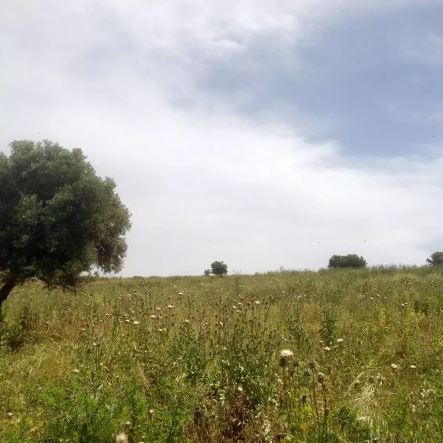
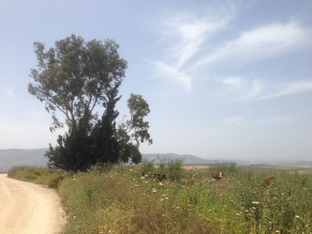
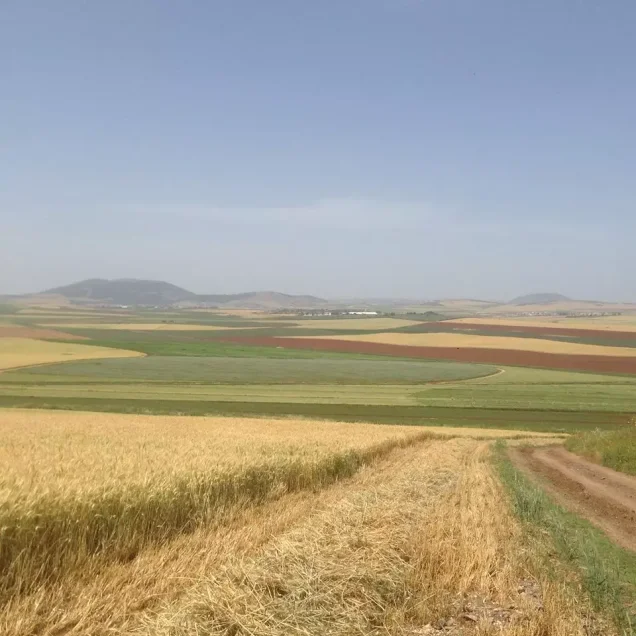
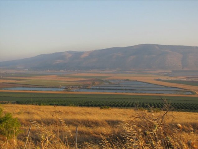
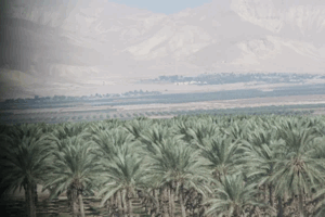
Palestine Remembered also contains later community documentation of wheat fields, olive groves, water sources, and village lands. Such material provides useful later visual documentation but does not constitute a comprehensive independent survey of the entire village site at present.
Sources
- PalQuest – Interactive Encyclopedia of the Palestine Question: Al-Murassas
- PalQuest – Operation Gideon
- Palestine Remembered – Al-Murassas, Baysan District
- Walid Khalidi – All That Remains: Al-Murassas
- School document – appointment of teacher 'Abdallah Faraj, 12 September 1922
- Education inspector's letter concerning the Al-Murassas school, 12 June 1943
- School document – appointment of Muhammad Rashid Yunis, 14 December 1945
- Government of Palestine – Census of Palestine 1922
- Institute for Palestine Studies – All That Remains, Walid Khalidi
Photo gallery

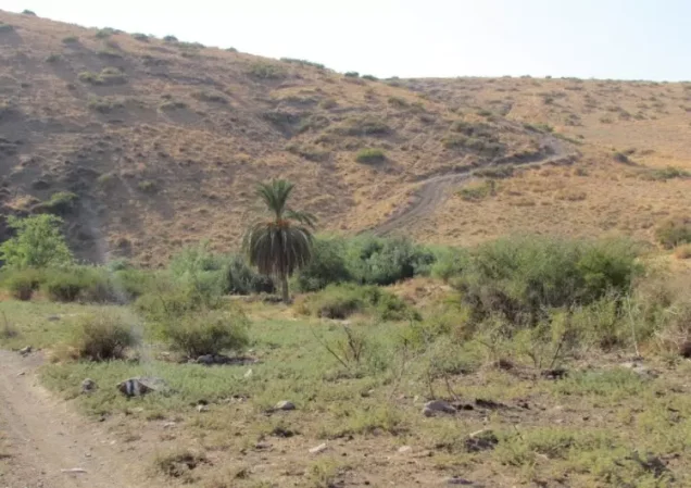
Photos from the village's people
Photos sent in by visitors and published after review.
Add a photo of this village
Log in to add photos of this village.
Other villages from Baysan

More from the archive


 Download Our Palestine App
The whole archive in the palm of your hand: depopulated villages, the Nakba, the massacres and Al-Aqsa — free, with no ads to erase the story.
Download Our Palestine App
The whole archive in the palm of your hand: depopulated villages, the Nakba, the massacres and Al-Aqsa — free, with no ads to erase the story.



Comments
No comments yet — be the first to write one.
Add your comment
Name and email are optional. Comments appear after review.