
The depopulated village of Al-Khunayzir / District of Baysan
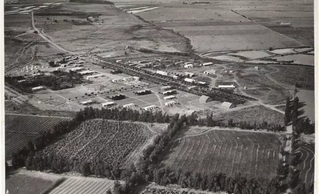
Al-Khunayzir
About the depopulated village of Al-Khunayzir
- District
- Baysan
- Date Al-Khunayzir was occupied
- 20 May 1948
- Population in 1948
- 300
- Military operation
- Operation Gideon
- Brigade that carried it out
- Golani Brigade
- Distance from the governorate centre
- 10 (km) South of Baysan
- Elevation above sea level
- -200 (m)
- Cause of displacement
- Influence of fall of, or exoduce from, neighboring town
- Extent of destruction
- The village was completely destroyed, and only the village cemetery remained.
- Ethnic cleansing
- al-Khunayzir inhabitants were completely ethnically cleansed.
- Settlements built on the built-up area of Al-Khunayzir after 1948
- Tirat Zvi expansion
Hover a dot to read the village name, or click to open its card.
Borders of the depopulated village of Al-Khunayzir
Al-Khunayzir – Depopulated Palestinian Village in Baysan Subdistrict
Al-Khunayzir was a Palestinian village in the Baysan subdistrict of Galilee. It is also rendered in Arabic as al-Khunayzar and was known as 'Arab al-Khunayzir.
The village stood on flat terrain approximately 10 kilometers south of Baysan, at an average elevation of about 200 meters below sea level, on the western side of the lands of al-Zarra'a. A secondary road linked it with the Baysan–Jericho highway, while other local roads connected it with neighboring communities.
Al-Khunayzir began as a seasonal Bedouin campsite before its residents settled there permanently. Its official population reached 260 in 1944/45, and its registered land area totaled 3,107 dunums.
Walid Khalidi does not provide a specific occupation date, military operation, or attacking unit for Al-Khunayzir. Palestine Remembered gives 20 May 1948 and associates the depopulation with Operation Gideon and the Golani Brigade. Since PalQuest formally dates Operation Gideon to 10–15 May, the most careful formulation is that Al-Khunayzir was depopulated in the aftermath of the Golani campaign in the Baysan Valley, while the village-specific military circumstances remain undocumented in Khalidi's entry.
Key Facts about Al-Khunayzir
| Field | Information |
|---|---|
| Name | Al-Khunayzir |
| Alternative Arabic rendering | Al-Khunayzar / الخنيزر |
| Alternative name | 'Arab al-Khunayzir |
| Subdistrict | Baysan |
| Distance from Baysan | Approximately 10 km south |
| Average elevation | Approximately 200 m below sea level |
| Population, 1931 | 200 in 47 houses |
| Population, 1944/45 | 260 – all Arab Muslims |
| Registered land area | 3,107 dunums |
| Occupation / depopulation date | Not available in Khalidi; Palestine Remembered gives 20 May 1948 |
| Military operation | Not identified by Khalidi; Palestine Remembered associates it with Operation Gideon |
| Military unit | Not independently documented for the village; Palestine Remembered identifies the Golani Brigade |
| Cause of depopulation | Not detailed by Khalidi; Palestine Remembered attributes it to the influence of the fall or exodus of a neighboring locality |
| Extent of destruction | The built-up village disappeared; Khalidi records only the cemetery as a surviving landmark |
| Settlement on village land | Tirat Zvi – established in 1937 on lands of Al-Khunayzir and al-Zarra'a |
Name of the Village
PalQuest uses the Arabic form al-Khunayzir, while Palestine Remembered commonly displays al-Khunayzar. The locality was also known as 'Arab al-Khunayzir.
Nineteenth-century survey material recorded nearby Tall al-Khanazir and 'Ayn al-Khanazir. The Arabic name is linguistically related to the word for swine, but the principal Palestinian sources used here do not provide a separate historical explanation establishing why the settlement itself received the name.
Location
Al-Khunayzir stood on level ground in the southern Baysan Valley, west of the village of al-Zarra'a.
A secondary road connected it with the Baysan–Jericho highway, while local roads linked it with neighboring communities.
Nearby localities included 'Arab al-'Arida, 'Arab al-Safa, al-Hamra, and al-Fatur, while the Jordan Valley and Jordan River lay farther east.
Al-Khunayzir before the Nakba
Al-Khunayzir originated as a seasonal Bedouin campsite and gradually developed into a permanent settlement.
Dwellings were widely dispersed. Some were constructed of adobe while some families continued to live in tents.
All of the villagers were Muslims.
Population
- 192283Official census: 54 males and 29 females, all Muslims
- 1931200Official census; all Muslims
- 1944/45260Official Village Statistics; all Arab Muslims
- 1948302Later Palestine Remembered estimate, not an official census
- 19981,852 refugeesLater estimate of refugees and descendants reported by Palestine Remembered
Number of Houses
- 193147Official census figure
- 194870Later Palestine Remembered estimate, not an official census count
Land Ownership in Al-Khunayzir
The total registered land area in 1944/45 was 3,107 dunums.
- Palestinian1,966 dunums63%
- Transferred to Zionists1,000 dunums32%
- Communal/Public141 dunums5%
The figures balance exactly: 1,966 + 1,000 + 141 = 3,107 dunums.
The original official categories were 1,966 Arab dunums, 1,000 Jewish dunums, and 141 Public dunums.
Land Use in 1944/45
- Arab
- Jewish
- Public
- Citrus and bananas18 dunums
- Plantations and irrigable land2,359 dunums
- Cereals555 dunums
- Non-cultivable land175 dunums
The land-use table balances exactly.
Palestine Remembered's simplified display places all 175 dunums of non-arable land under the Palestinian column. The official breakdown, however, consists of only 34 Arab dunums plus 141 Public dunums. The Public category has therefore been retained separately.
The reliable figure for citrus and bananas is 18 dunums, as recorded by PalQuest, Khalidi, and Palestine Remembered. It also reconciles the Arab land-use total exactly: 18 + 1,658 + 256 + 34 = 1,966 dunums.
Economic Life
Agriculture became the foundation of the village economy after the community developed from a seasonal encampment into a permanent settlement.
Villagers cultivated fruit, vegetables, and cereals and made extensive use of nearby springs for irrigation.
In 1944/45, 1,658 Arab dunums were irrigated or used for orchards, representing most of the cultivable Arab-held land.
A further 256 Arab dunums were devoted to cereals and 18 dunums to citrus and bananas.
Water Resources
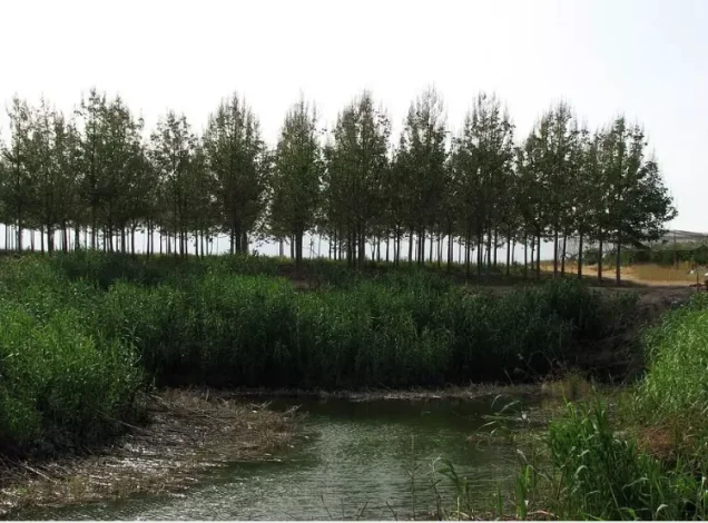
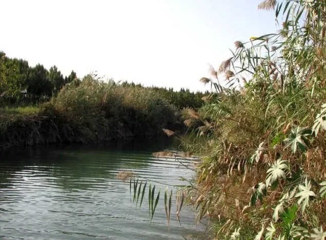
Residents drew water from springs north and southeast of the settlement for domestic use and irrigation.
Among the water sources that remained identifiable in the later site description were 'Uyun Umm al-Faraj and 'Ayn al-Khanazir.
The availability of spring water explains the unusually large proportion of village land classified as irrigated or orchard land.
Education and Public Institutions
Khalidi and PalQuest do not independently document a school in Al-Khunayzir and provide no founding year or enrollment figure.
The principal village sources likewise do not identify a specific mosque, marketplace, or other public institution. Such institutions have therefore not been inferred from neighboring villages.
Tall Abu al-Faraj and the Cemetery
Tall Abu al-Faraj stood north of the village site and was used by the villagers as a cemetery.
In Khalidi's field description, the cemetery was the only remaining physical landmark associated with the village.
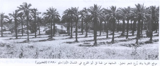
'Uyun Umm al-Faraj and 'Ayn al-Khanazir lay to the north and west, while palm trees covered most of the former village site and surrounding lands.
Operation Gideon and the Military Context
The Haganah's Golani Brigade carried out Operation Gideon between 10 and 15 May 1948 as part of the conquest of Baysan and the Baysan Valley.
Baysan fell on 12 May, after which Palestinian communities throughout the valley experienced rapid collapse and displacement.
Khalidi's Al-Khunayzir entry, however, gives no independent village-specific occupation or depopulation account and records the relevant information as unavailable.
Occupation and Depopulation
Palestine Remembered gives 20 May 1948 as Al-Khunayzir's occupation or depopulation date, associates it with Operation Gideon and the Golani Brigade, and classifies the cause of exodus as the influence of the fall or departure of a neighboring locality.
The stated date comes five days after PalQuest's formal end date for Operation Gideon, 15 May.
Khalidi provides no independent occupation date, attacking unit, or village-specific military narrative.
The most careful conclusion is therefore that Al-Khunayzir was depopulated amid the collapse that followed the occupation of Baysan and the Golani campaign in the valley during May 1948. The specific 20 May date and the classification of the direct attacking force as Golani remain Palestine Remembered's attribution rather than details independently established by Khalidi.
Ethnic Cleansing
Palestine Remembered characterizes the final outcome at Al-Khunayzir as complete ethnic cleansing.
Khalidi does not provide a village-specific expulsion account. What is directly established is that Al-Khunayzir's Palestinian community disappeared from the site during the Nakba. The term “ethnic cleansing” is therefore retained as an attributed characterization used by Palestine Remembered rather than as an independently assigned label.
Occupation Chronology
- 10 May 1948
Beginning of Operation Gideon
The Golani Brigade began its campaign for Baysan and the Baysan Valley.
- 12 May 1948
Fall of Baysan
The fall of the subdistrict center accelerated displacement throughout the valley.
- 15 May 1948
Formal end of Operation Gideon
This is the end date given by PalQuest.
- 20 May 1948
Date given by Palestine Remembered for Al-Khunayzir
The site associates the event with Operation Gideon and the Golani Brigade.
- Not available
Khalidi's village-specific information
All That Remains provides no specific date, operation, or attacking unit for Al-Khunayzir.
- May 1948, probably in the aftermath of the fall of Baysan
Depopulation
Palestine Remembered attributes the exodus to the influence of a neighboring locality's fall or departure.
- Precise date not documented
Destruction
The village's built environment disappeared; Khalidi later recorded only the cemetery as a surviving landmark.
Israeli Settlement on Al-Khunayzir's Lands
| Settlement | Established | Relationship to Al-Khunayzir |
|---|---|---|
| Tirat Zvi | 1937 | Established before the Nakba on lands belonging jointly to Al-Khunayzir and al-Zarra'a |
Tirat Zvi was therefore a pre-1948 settlement rather than a post-Nakba locality established after the village's depopulation.
Al-Khunayzir Today
According to Walid Khalidi's field description, the only remaining landmark of Al-Khunayzir was the cemetery on Tall Abu al-Faraj north of the village site.
The springs of 'Uyun Umm al-Faraj and 'Ayn al-Khanazir remained to the north and west.
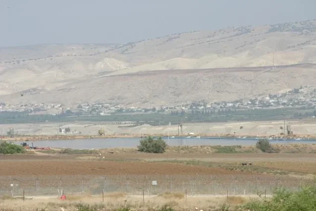
Palm trees covered most of the former village site and the surrounding lands.
PalQuest dates Hassan Hawari's field photograph of the site to May 1990. Khalidi's description therefore represents conditions documented before the publication of All That Remains in 1992 and should not be treated as a comprehensive direct field verification of conditions in 2026.
Palestine Remembered also contains later community documentation, including photographs dated 2007 of the former village site, springs, and surrounding lands. These images are useful later documentation but do not constitute a comprehensive independent present-day survey.
Sources
- PalQuest – Interactive Encyclopedia of the Palestine Question: Al-Khunayzir
- PalQuest – Operation Gideon
- Palestine Remembered – Al-Khunayzir, Baysan District
- Walid Khalidi – All That Remains: Al-Khunayzir
- Government of Palestine – Census of Palestine 1922
- WAFA – Encyclopedia of Depopulated Palestinian Villages: Al-Khunayzir
- Institute for Palestine Studies – All That Remains, Walid Khalidi
Photo gallery
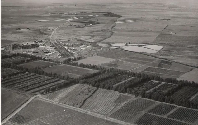
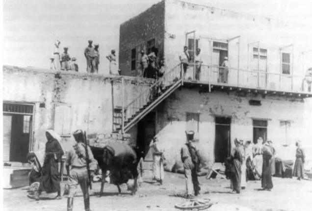
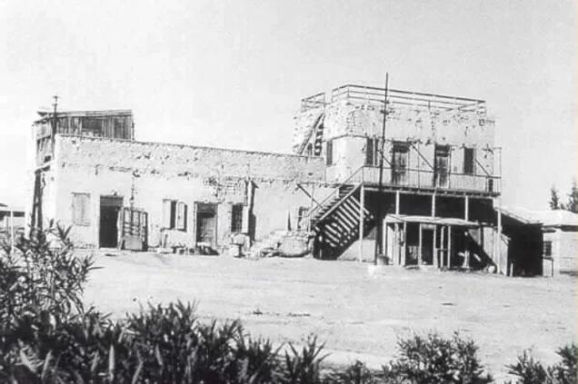
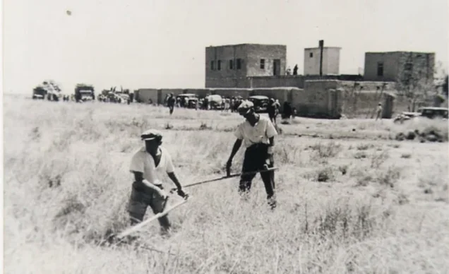


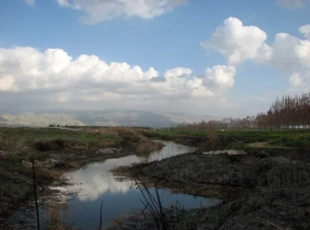
Photos from the village's people
Photos sent in by visitors and published after review.
Add a photo of this village
Log in to add photos of this village.
Other villages from Baysan
More from the archive



 Download Our Palestine App
The whole archive in the palm of your hand: depopulated villages, the Nakba, the massacres and Al-Aqsa — free, with no ads to erase the story.
Download Our Palestine App
The whole archive in the palm of your hand: depopulated villages, the Nakba, the massacres and Al-Aqsa — free, with no ads to erase the story.



Comments
No comments yet — be the first to write one.
Add your comment
Name and email are optional. Comments appear after review.