
The depopulated village of Al-Hamra (Baysan) / District of Baysan
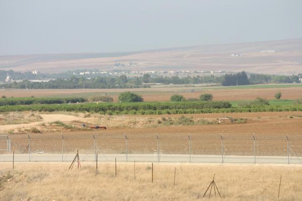
Al-Hamra (Baysan)
About the depopulated village of Al-Hamra (Baysan)
- District
- Baysan
- Date Al-Hamra (Baysan) was occupied
- 31 May 1948
- Population in 1948
- 850
- Military operation
- Operation Gideon
- Brigade that carried it out
- Golani Brigade
- Distance from the governorate centre
- 7.5 (km) South of Baysan
- Elevation above sea level
- -175 (m)
- Cause of displacement
- Influence of fall of, or exoduce from, neighboring town
- Extent of destruction
- al-Hamra was completely obliterated and defaced.
- Ethnic cleansing
- al-Hamra inhabitants were completely ethnically cleansed.
- Settlements built on the built-up area of Al-Hamra (Baysan) after 1948
- Tel Teomim, Rehov
Hover a dot to read the village name, or click to open its card.
Borders of the depopulated village of Al-Hamra (Baysan)
Al-Hamra ('Arab al-Hamra) – Depopulated Palestinian Village of the Baysan Subdistrict
Al-Hamra, also known as 'Arab al-Hamra, was a Palestinian village in the Baysan Subdistrict. It stood in the southern Baysan Valley approximately 7.5 km south of the town of Baysan and about 175 metres below sea level.
The Jordan River flowed approximately 8 km east of the village, while the Baysan–Jericho highway crossed the western part of its lands.
'Arab al-Hamra had an official population of 730 in 1944/45 and registered lands covering 11,511 dunums. Agriculture formed the basis of village life, with cereals, citrus, olives, and vegetables among the principal crops, while some features of the community's Bedouin pastoral background remained visible.
Name and Origins of 'Arab al-Hamra
The village took its name from 'Arab al-Hamra, a branch of the al-Suqur Bedouin tribe that settled in the Baysan Valley.
Walid Khalidi records that the community had established itself in the area centuries earlier, attracted by the valley's fertile soil and abundant water resources.
The earliest historical reference cited in the village entry dates to 1281 CE, when the Mamluk sultan Qalawun passed through the area while traveling from Syria toward Egypt.
Al-Hamra of Baysan should not be confused with al-Hamra' in the Safad Subdistrict; they were separate Palestinian communities with distinct populations, lands, and histories.
Location
'Arab al-Hamra stood in the southern portion of the Baysan Valley approximately 7.5 km south of Baysan at an average elevation of about 175 metres below sea level.
The Jordan River was approximately 8 km to the east, while the Baysan–Jericho highway passed through the western part of village land.
The village formed part of the fertile agricultural environment of the Baysan Valley, which supported extensive cereal cultivation as well as orchards and irrigated crops.
Village Layout
The physical form of 'Arab al-Hamra reflected a gradual transition from Bedouin pastoral life to permanent agricultural settlement.
Some residents lived in permanent adobe houses, while others continued to use tents made from camel hair.
Dwellings were relatively widely dispersed rather than concentrated in a dense village core.
The published statistics do not provide a securely documented independent built-up-area figure, so none is inferred.
Population of 'Arab al-Hamra
| Year | Population | Nature of Figure / Notes |
|---|---|---|
| 1931 | Not independently available | Khalidi lists the 1931 population as unavailable; no tribal or neighboring-community figure is substituted. |
| 1944/45 | 730 | Official Government of Palestine figure; the population was classified as Arab. |
| 1948 | 847 | Later Palestine Remembered estimate, not an official census. |
| 1998 | 5,200 refugees | Later Palestine Remembered estimate of refugees originating from the village and their descendants. |
The article therefore treats 730 in 1944/45 as the last securely documented independent official population figure, while clearly separating the later 1948 and 1998 estimates.
Number of Houses
No securely documented independent house count is available for 'Arab al-Hamra in the 1931 census. Khalidi lists the 1931 house total as unavailable.
No pre-Nakba house total is reconstructed from later population estimates.
Land Ownership in 'Arab al-Hamra
The registered lands of 'Arab al-Hamra totalled 11,511 dunums in 1944/45.
Using the ownership terminology employed by Palestine Remembered, corrected against the official Government of Palestine statistics, the distribution was:
- Palestinian8,623 dunums75%
- Transferred to Zionists2,153 dunums19%
- Communal/Public735 dunums6%
This corresponds to the official categories of 8,623 Arab dunums, 2,153 Jewish dunums, and 735 Public dunums.
Some online reproductions display different figures, including 753 Public dunums and a total of 10,902 dunums. Those figures do not reconcile with the official Government of Palestine table and are not used here.
Land Use in 1944/45
- Arab
- Jewish
- Public
- Citrus and Bananas57 dunums
- Plantations and Irrigable Land32 dunums
- Cereals10,582 dunums
- Total Cultivable Land10,671 dunums
- Non-Cultivable Land733 dunums
The published table does not provide a separate built-up-area figure. Cultivable and non-cultivable categories together total 11,404 dunums, 107 dunums short of the total registered land area of 11,511 dunums.
This article does not assume that the missing 107 dunums represent built-up land, because Khalidi explicitly lists the built-up area as unavailable. The published categories are therefore preserved without inventing an additional classification.
Economic Life in 'Arab al-Hamra
Agriculture formed the foundation of economic life after the community settled in the Baysan Valley.
Cereals were the dominant crop by area: 8,427 Arab dunums were devoted to cereal cultivation in the 1944/45 statistics.
The villagers also cultivated vegetables, olives, and citrus and benefited from the fertile soils and water resources of the valley.
Pastoral activity and livestock raising also remained part of the economy, reflecting the Bedouin origins of the community and its dispersed settlement pattern.
Water Resources
The village stood within the water-rich Baysan Valley.
Palestinian local documentation associates the village lands with Wadi Baysan, Wadi Yabla, and the Jordan River to the east.
These resources supported drinking water and agriculture, but the principal village entry does not provide a sufficiently secure list of village-specific wells or irrigation installations, so no unsupported names are added.
Education and Public Services
The principal Khalidi/PalQuest entry and the main sources reviewed do not securely document a formal school, mosque, or other specific public institution in 'Arab al-Hamra immediately before the Nakba.
No school, pupil count, or religious institution is therefore added without village-specific evidence.
Archaeological Sites
Archaeological sites east of the village included Tall al-Shuqaf and Tall Abu Kharaj.
Khalidi and PalQuest associate these sites with remains dating to the Canaanite period.
No more precise archaeological chronology is asserted than the principal sources support.
Occupation and Depopulation of 'Arab al-Hamra
Walid Khalidi's All That Remains does not provide a village-specific narrative describing the capture or depopulation of 'Arab al-Hamra. The occupation-and-depopulation field is listed as unavailable.
Exact dates appearing in later Palestinian databases must therefore be treated cautiously.
Palestine Remembered and later Palestinian compilations list 31 May 1948 as the date on which 'Arab al-Hamra was occupied or depopulated.
This date is chronologically compatible with the later phase of clearing Palestinian and Bedouin communities from the Baysan Valley, but it is not independently confirmed in Khalidi's village-specific account.
Operation Gideon
Palestine Remembered associates 'Arab al-Hamra with Operation Gideon.
Operation Gideon was carried out by the Golani Brigade from 10 to 15 May 1948 with the objective of capturing Baysan and the Baysan Valley and removing its Palestinian population.
If 31 May is used as the later database date for al-Hamra's depopulation, the village cannot be described as having been captured “during Operation Gideon” on that date, because the named operation had officially ended about two weeks earlier.
Operation Gideon is better understood as the principal military campaign that opened the way for Zionist control of the Baysan Valley, followed by additional clearing operations during the second half of May.
Golani Brigade and the Fourth Battalion
The Golani Brigade was the principal force conducting Operation Gideon, and its units remained active in the Baysan Valley after the formal end of the operation.
In its entry on al-Ghazzawiyya, PalQuest cites the History of the Haganah as stating that Golani's Fourth Battalion subsequently “cleared the entire Baysan Valley of Bedouins.”
The Fourth Battalion is also documented in late-May operations extending from the Baysan Valley toward the Jenin sector.
This makes its involvement in the wider campaign that affected 'Arab al-Hamra plausible, but it does not constitute village-specific proof that the Fourth Battalion itself entered al-Hamra.
The most precise formulation is therefore: military context: consolidation and clearing of the Baysan Valley after Operation Gideon; general force: Golani Brigade; Fourth Battalion involvement is plausible in the wider late-May sweep but not independently established for al-Hamra itself; 31 May 1948 is a later Palestinian database date rather than a date confirmed by Khalidi.
Occupation and Depopulation Chronology
- 10 May 1948
Beginning of Operation Gideon
The Golani Brigade launched the campaign to seize Baysan and the surrounding valley.
- 12 May 1948
Fall of Baysan
Baysan fell during the campaign and its Palestinian inhabitants were displaced.
- 15 May 1948
End of Operation Gideon
The formally named operation ended, but Golani activity in the valley continued.
- Second half of May 1948
Continued clearing of Baysan Valley communities
Palestinian sources quoting Haganah material document Fourth Battalion activity against Bedouin communities in the valley.
- Late May 1948
Fourth Battalion operations toward Jenin
The battalion remained active in military operations extending south and west from the Baysan Valley.
- 31 May 1948
Later reported date for occupation/depopulation of 'Arab al-Hamra
Palestine Remembered and later Palestinian compilations use this date, but it is not independently confirmed in Khalidi's village-specific account.
Israeli Settlements on 'Arab al-Hamra Village Lands
According to Walid Khalidi and PalQuest, no Israeli settlement is securely documented as having been established on 'Arab al-Hamra village land itself.
Some secondary sources associate settlements such as Rehov and Tel Teomim with al-Hamra, but these claims require correction or stronger documentation.
PalQuest explicitly identifies Rehov, founded in 1951, as having been established on land belonging to the depopulated Palestinian village of Farwana. It is therefore not listed as a settlement on 'Arab al-Hamra land.
No sufficiently strong village-specific Palestinian source was identified to establish Tel Teomim as a settlement founded on al-Hamra land.
The article therefore follows Khalidi's more cautious village-specific conclusion: no Israeli settlement is documented in the principal source as having been established directly on 'Arab al-Hamra village land.
'Arab al-Hamra Today
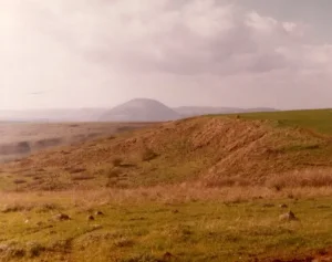
In the field description published by Walid Khalidi in All That Remains, nothing remained of the Palestinian village structures.
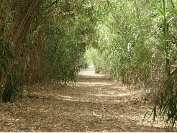
Scattered trees, including fig trees, as well as cactus and grass, grew across the former village site.
Palestine Remembered also hosts later community-contributed photographs of the site, village lands, and nearby water features. Such photographs provide useful partial documentation but do not constitute a comprehensive contemporary field survey.
Khalidi's description derives from fieldwork conducted before the publication of All That Remains in 1992 and therefore does not constitute direct and comprehensive verification of the site's condition in 2026.
Sources
- PalQuest – Al-Hamra, Baysan
- PalQuest – Operation Gideon
- PalQuest – Farwana, for verification of Rehov's location
- Palestine Remembered – Al-Hamra, Baysan
- Government of Palestine – Village Statistics 1944/45: Land Ownership, Baysan Subdistrict
- Government of Palestine – Village Statistics 1944/45: Land Use, Baysan Subdistrict
- Palestinian Villages Encyclopedia – Al-Hamra, Baysan
- WAFA – Depopulated Palestinian Villages and Reported Depopulation Dates
- Institute for Palestine Studies – Walid Khalidi, All That Remains
Photo gallery


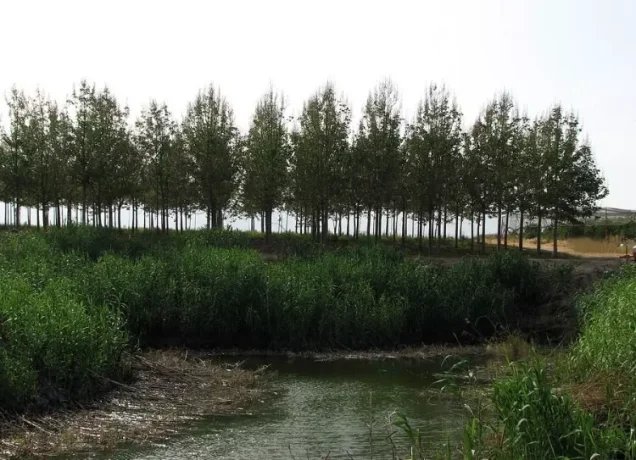

Photos from the village's people
Photos sent in by visitors and published after review.
Add a photo of this village
Log in to add photos of this village.
Other villages from Baysan

More from the archive


 Download Our Palestine App
The whole archive in the palm of your hand: depopulated villages, the Nakba, the massacres and Al-Aqsa — free, with no ads to erase the story.
Download Our Palestine App
The whole archive in the palm of your hand: depopulated villages, the Nakba, the massacres and Al-Aqsa — free, with no ads to erase the story.



Comments
No comments yet — be the first to write one.
Add your comment
Name and email are optional. Comments appear after review.