
The depopulated village of Masil / District of Baysan
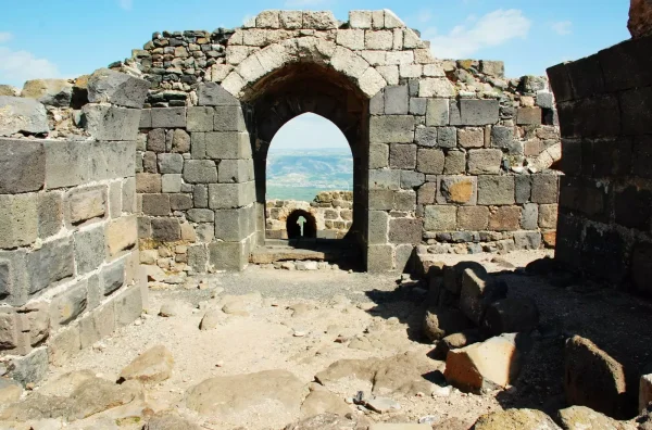
About the depopulated village of Masil
- District
- Baysan
- Date Masil was occupied
- 16 May 1948
- Population in 1948
- 350
- Military operation
- Operation Gideon
- Brigade that carried it out
- Golani Brigade
- Who defended the village
- Iraqi Army
- Distance from the governorate centre
- 11 (km) North of Baysan
- Elevation above sea level
- 300 m
- Cause of displacement
- Military assault by Zionist troops
- Extent of destruction
- In September 1948, Kawkab al-Hawa was completely obliterated.
- Ethnic cleansing
- Kawkab al-Hawa inhabitants were completely ethnically cleansed.
- Settlements built on the built-up area of Masil after 1948
- Shoshana
Hover a dot to read the village name, or click to open its card.
Borders of the depopulated village of Masil
Kawkab al-Hawa – Depopulated Palestinian Village of the Baysan District
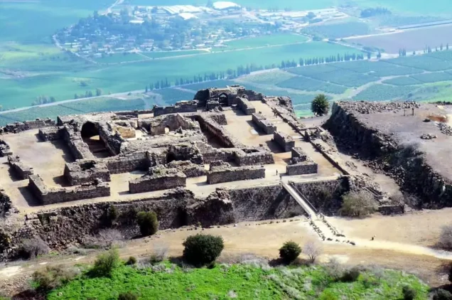
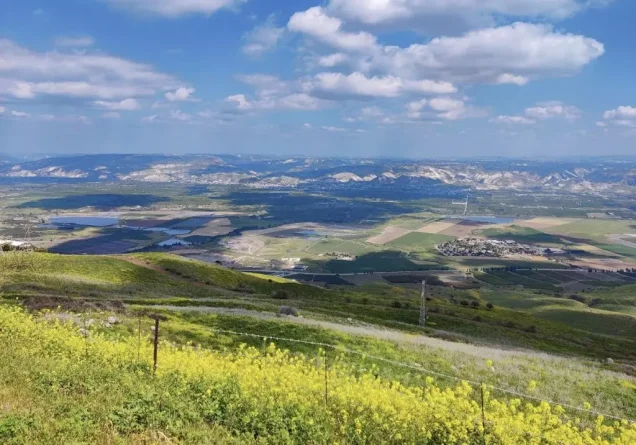
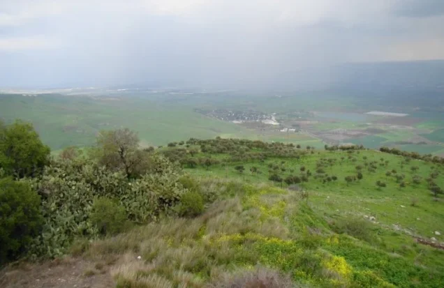
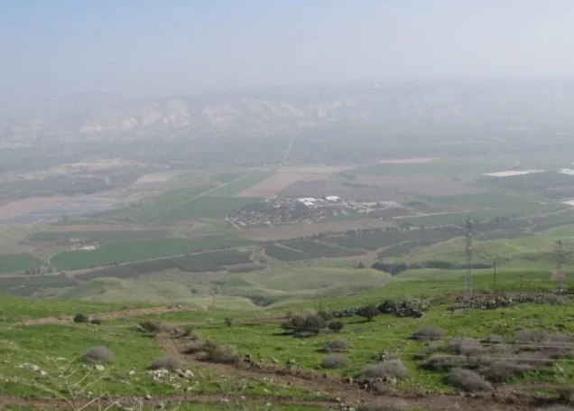
Kawkab al-Hawa, also known simply as Kawkab, was a depopulated Palestinian village in the Baysan District. It stood on a high hill overlooking the Jordan Valley and Jordan River to the east and Lake Tiberias to the northeast, approximately 11 kilometers north of Baysan, at an average elevation of about 300 meters above sea level.
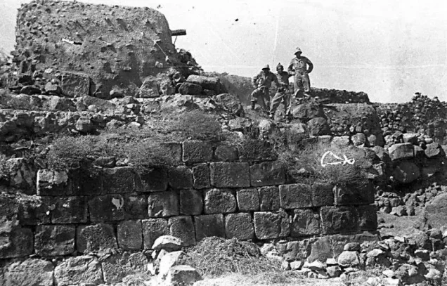
The village had exceptional historical and military importance because of its commanding position and because it developed within and around the Crusader fortress of Belvoir. Fighting around Kawkab al-Hawa intensified in May 1948 between Golani Brigade forces and Iraqi troops. The sources differ over the chronology: an Israeli attack is recorded on 16 May, while the History of the Haganah places the final occupation on 21 May and identifies the Third Battalion of the Golani Brigade as the force responsible.
Location and Geography
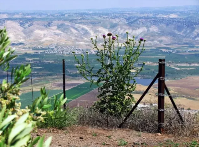
Kawkab al-Hawa stood on a hill that sloped gradually to the north, west, and south but dropped sharply on its eastern side toward the Jordan Valley.
Although the village itself stood approximately 300 meters above sea level, land only one kilometer east of the site fell to approximately 100 meters below sea level.
Kawkab al-Hawa was approximately 11 kilometers north of Baysan. Its commanding view over the Jordan River to the east and Lake Tiberias to the northeast gave the village major strategic importance.
The village's principal road led to Khirbat al-Taqa, from which it connected with the Baysan–Jericho highway. Secondary roads also linked Kawkab al-Hawa with surrounding villages.
Its lands bordered those of al-Bira, Wadi al-Bira, Kafra, Jabbul, Khirbat al-Zawiya, and communities of Arab al-Bashatiwa.
Kawkab al-Hawa and Belvoir Fortress
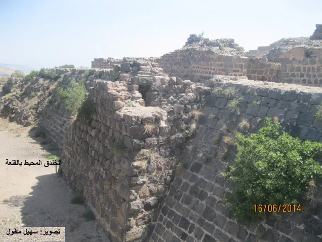
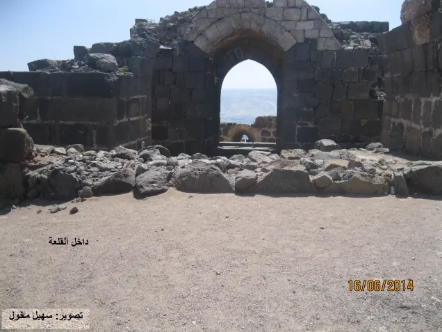
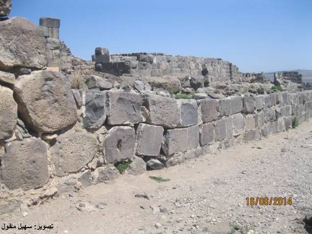
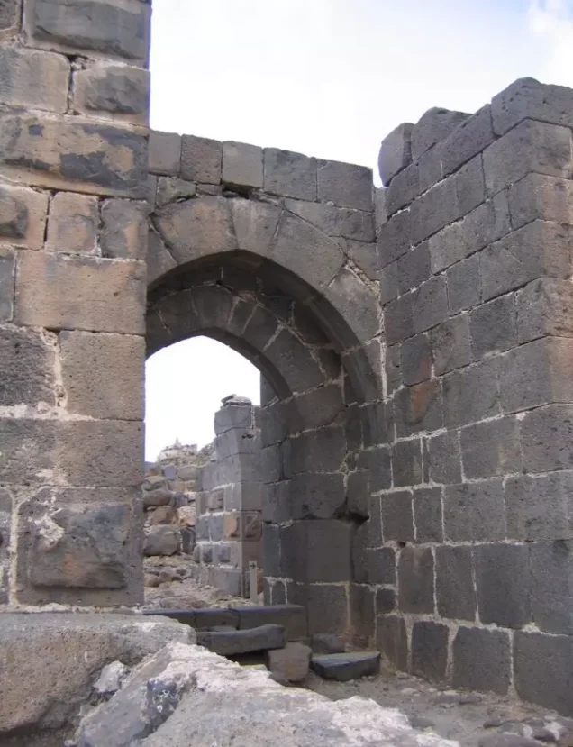
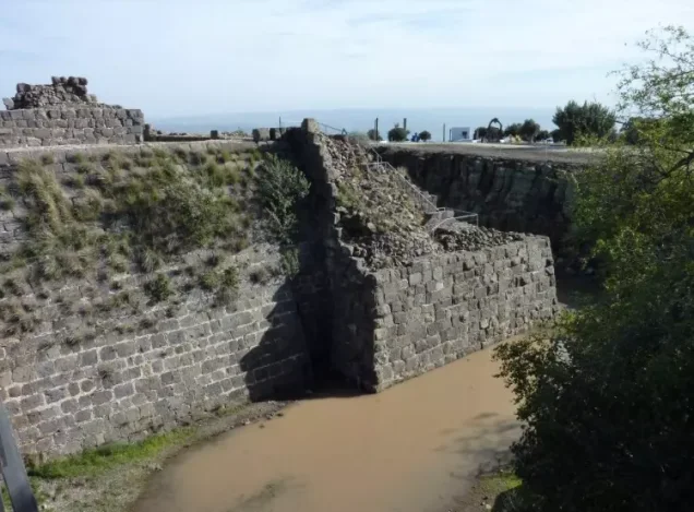
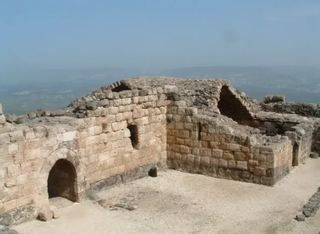
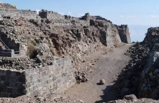
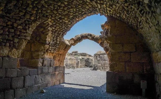
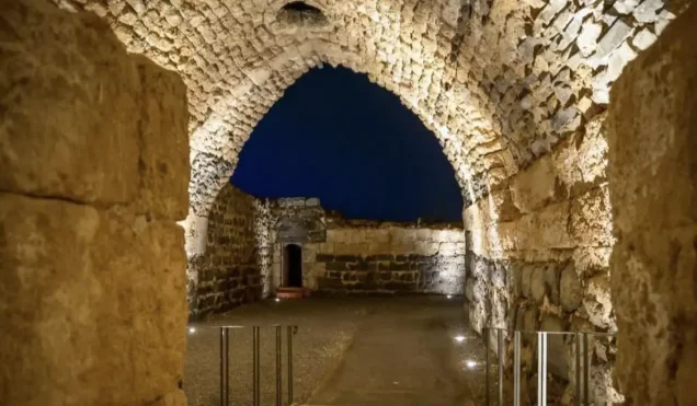
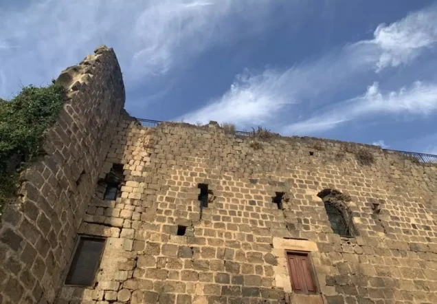
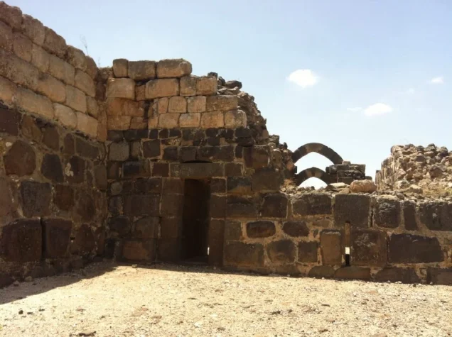
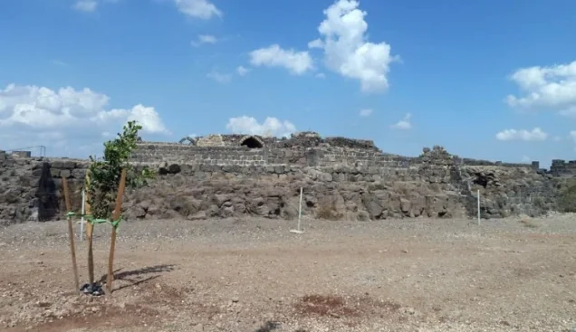
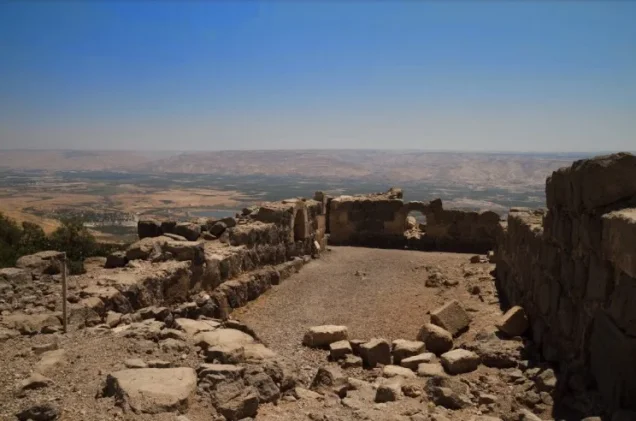
The Palestinian village of Kawkab al-Hawa should be distinguished from the Crusader fortress of Belvoir, although the village originally developed within the fortress perimeter and later expanded around it.
Belvoir was among the most important and formidable Crusader castles in Palestine because of its commanding position over the Jordan Valley and regional routes.
The site witnessed a series of battles between Crusader forces and the armies of Salah al-Din. The fortress continued to resist after the Battle of Hattin before eventually falling in the late twelfth century.
The Arab geographer Yaqut al-Hamawi, who died in 1229, referred to Kawkab al-Hawa as a fortress on a hill near Tiberias that had become ruined after the time of Salah al-Din.
Earlier History of the Site
Some scholars have proposed identifying Kawkab al-Hawa with a locality named Yarmuta recorded on an Egyptian stele discovered near Baysan and dated to the late thirteenth century BCE.
This is a scholarly archaeological hypothesis rather than a universally accepted identification, and this Yarmuta should not be confused with the separate Canaanite royal site associated with Khirbat Yarmuk.
Researchers have also suggested that a Roman signal station known as the Tower of Agrippina may once have stood at Kawkab al-Hawa.
Ottoman Period
In 1596, Kawkab al-Hawa belonged to the nahiya of Shafa in the liwa' of Lajjun and had an estimated population of approximately fifty.
The villagers paid taxes on wheat, beans, broad beans, melons, vineyards, and other agricultural products.
Because the village initially occupied the interior of Belvoir fortress, its physical expansion was slow.
In 1859, approximately 110 inhabitants lived within the fortress walls and cultivated about thirteen faddans of land outside them.
Built Environment
As the population grew, houses were constructed in a circular pattern around the fortress and gradually extended northward and westward.
The official 1944/45 statistics classified approximately 56 dunams as built-up land.
The principal sources reviewed do not document a specific independent school or mosque in Kawkab al-Hawa. Neither is therefore added without reliable Palestinian documentation.
Population and Houses
The inhabitants of Kawkab al-Hawa were Muslims.
- 1596About 50Historical estimate derived from Ottoman records
- 1859About 110Nineteenth-century estimate
- 1922167Official Mandate census; all inhabitants were Muslims
- 1931220Official census; all inhabitants were Muslims
- 1945300Official statistics; all inhabitants were Palestinian Arab Muslims
- 1948About 348Later Palestine Remembered estimate, not an official British census
- 1998About 2,137 refugees and descendantsLater demographic estimate
The official 1931 census recorded 46 houses in Kawkab al-Hawa.
Some Palestinian sources give a later estimate of approximately 54 houses for 1948; this is not an official Mandate census figure.
Water Resources
Two important springs lay south and southeast of the village: 'Ayn al-Hiluw and 'Ayn al-Jirani.
In the late nineteenth century, a badly weathered Arabic inscription carved into a basalt block was found near 'Ayn al-Hiluw.
Economic Life and Agriculture
Agriculture was the principal livelihood of Kawkab al-Hawa's inhabitants, who cultivated land outside the fortress perimeter.
The villagers grew cereals, legumes, vegetables, vineyards, and fruit trees, and the village was also known for olive cultivation.
In the 1944/45 official statistics, 5,851 dunams were devoted to cereals when Arab and Public land are combined, while 170 dunams were classified as plantations and irrigable land.
Palestinian sources also report approximately 600 dunams planted with olives. Because this crop-specific figure is reported separately and its exact accounting relationship to the 1944/45 official land-use table is unclear, it is not added again to the official totals.
Land Ownership, 1944/45
The total land area of Kawkab al-Hawa was 9,949 dunams. Under the official Government of Palestine classification, ownership was distributed as follows:
- Arab6,125 dunums62%
- Jewish0 dunums0%
- Public3,824 dunums38%
Palestine Remembered presents the same totals using its simplified terminology: 6,125 dunams “Palestinian,” 0 dunams “Transferred to Zionists,” and 3,824 dunams “Communal/Public.” The wording “Transferred to Zionists” should be preserved when reproducing that source's classification.
Land Use, 1944/45
- Arab
- Public
- Cereals5,851 dunums
- Plantations and irrigable land170 dunums
- Total cultivable/cultivated land6,021 dunums
- Non-cultivable land3,872 dunums
- Built-up land56 dunums
- Total non-cultivable and built-up3,928 dunums
The official table balances exactly: 6,021 dunams of cultivated or cultivable land plus 3,928 dunams of built-up and non-cultivable land equal the total village area of 9,949 dunams.
Palestine Remembered's simplified display places all 5,851 cereal dunams in the Palestinian column, while the official table shows that 12 of those dunams were classified as Public land.
Fighting in May 1948
Kawkab al-Hawa's strategic position made it militarily important after the fall of Baysan and the arrival of Iraqi troops in Palestine.
According to the account summarized by Walid Khalidi from Benny Morris, an Israeli military assault on the village began on 16 May 1948.
The struggle for the site did not end that day. Other accounts describe Iraqi troops attempting to capture or temporarily holding Kawkab al-Hawa during the following days.
Iraqi Forces at Kawkab al-Hawa
Palestinian historian 'Arif al-'Arif gives an account that differs in important respects from the Israeli narrative.
According to al-'Arif, the village garrison resisted Israeli forces before retreating. As the Israeli forces prepared to enter, Iraqi troops arrived and took control of the position.
He states that Iraqi troops remained at Kawkab al-Hawa for roughly two days, around 15–17 May, before Israeli attacks intensified on 18 May.
An Associated Press report from Baghdad dated 18 May likewise stated that Iraqi troops had captured what it described as a heavily fortified position at Kawkab al-Hawa.
The sources differ on the number of casualties and the exact timing of the Iraqi withdrawal. No single casualty figure is therefore treated as conclusively established.
Was Kawkab al-Hawa Captured during Operation Gideon?
Palestine Remembered currently classifies the village under Operation Gideon.
Operation Gideon officially ran from 10 to 15 May 1948 and was carried out by the Golani Brigade to conquer the Baysan Valley and displace its Palestinian inhabitants.
The first documented attack on Kawkab al-Hawa, however, is dated 16 May, while another source places the final occupation on 21 May.
The more precise formulation is therefore that Kawkab al-Hawa fell in the aftermath of Operation Gideon, during the continuation of Golani Brigade operations in the Baysan region, rather than simply within the operation's official dates.
Final Occupation and Military Unit
The sources disagree over the exact day on which Israeli control of Kawkab al-Hawa became final.
An attack began on 16 May, followed by fighting involving Iraqi troops and competing claims over control of the position.
The History of the Haganah, as cited through Khalidi, states that Kawkab al-Hawa was finally occupied on 21 May 1948 and identifies the attacking formation as the Third Battalion of the Golani Brigade.
This article therefore uses 21 May as the most precisely documented final occupation date while preserving the earlier 16 May attack and the intervening Iraqi presence.
Occupation Chronology
- 15 May 1948
Official end of Operation Gideon
The principal Golani campaign for the conquest of the Baysan Valley formally ended.
- 15 May 1948 and afterward
Arrival or advance of Iraqi forces
Iraqi forces entered this sector after crossing into Palestine, making Kawkab al-Hawa a strategically important objective.
- 16 May 1948
First documented Israeli assault
An Israeli military attack was launched on Kawkab al-Hawa after the fall of Baysan.
- Approximately 15–17 May 1948
Temporary Iraqi control according to 'Arif al-'Arif
Al-'Arif states that Iraqi troops seized and briefly held the position.
- 18 May 1948
Intensified fighting and Iraqi withdrawal
Israeli attacks intensified; al-'Arif records an Iraqi withdrawal after suffering casualties.
- 18–20 May 1948
Conflicting reports over control
Accounts continued to differ over control of the site and fighting with Iraqi forces.
- 21 May 1948
Final occupation according to the History of the Haganah
The Third Battalion of the Golani Brigade took final control of Kawkab al-Hawa according to the account cited by Khalidi.
- September 1948
Request to destroy the village
A local kibbutz leader requested official support and permission to destroy Kawkab al-Hawa and three other villages; the source does not establish whether formal permission was granted.
- Later
Removal of the village
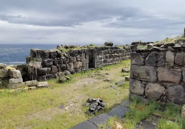
The Palestinian village structures were removed, while the historic fortress remained and was excavated and developed as a tourist site.
Israeli Settlements on Village Lands
According to Walid Khalidi and PalQuest, no Israeli settlement was established on Kawkab al-Hawa's village lands.
The Palestinian Encyclopedia refers to a locality called Kokhav HaYarden in connection with the village, but this conflicts with Khalidi's explicit cadastral statement that no Israeli settlement stands on village land.
Kokhav HaYarden is therefore not listed here as a securely documented residential settlement established on Kawkab al-Hawa's lands without independent cadastral evidence, and it should be distinguished from the modern Hebrew name associated with the fortress and tourist site.
Kawkab al-Hawa Today
According to the field description published in Walid Khalidi's All That Remains, the Palestinian village was removed from the site.
The Belvoir fortress underwent archaeological excavation and the location became a tourist center.
Fig and olive trees grew at the village site, while the slopes overlooking the Baysan Valley and Wadi al-Bira were used for grazing and nearby lands were cultivated.
This description should not be treated as a comprehensive field verification of conditions in 2026. Fieldwork for All That Remains was conducted between 1987 and 1990 and therefore records the condition of the site during that survey period.
Sources
- PalQuest – Interactive Encyclopedia of the Palestine Question: Kawkab al-Hawa
- PalQuest – Operation Gideon; used to distinguish its dates from the occupation of Kawkab al-Hawa
- Palestine Remembered – Kawkab al-Hawa, Baysan District
- Palestine Remembered – Walid Khalidi's account of Kawkab al-Hawa
- Palestinian Encyclopedia – Kawkab al-Hawa
- Palestinian Villages Encyclopedia – Kawkab al-Hawa; supporting Palestinian documentation
- Government of Palestine – Census of Palestine 1922
- Palestinian Central Bureau of Statistics – Historical Census Archive
- Institute for Palestine Studies – Walid Khalidi, All That Remains
- PalQuest – All That Remains: Methodology
Photo gallery


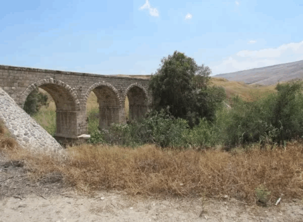
Photos from the village's people
Photos sent in by visitors and published after review.
Add a photo of this village
Log in to add photos of this village.
Other villages from Baysan

More from the archive


 Download Our Palestine App
The whole archive in the palm of your hand: depopulated villages, the Nakba, the massacres and Al-Aqsa — free, with no ads to erase the story.
Download Our Palestine App
The whole archive in the palm of your hand: depopulated villages, the Nakba, the massacres and Al-Aqsa — free, with no ads to erase the story.



Comments
No comments yet — be the first to write one.
Add your comment
Name and email are optional. Comments appear after review.