
The depopulated village of Danna / District of Baysan
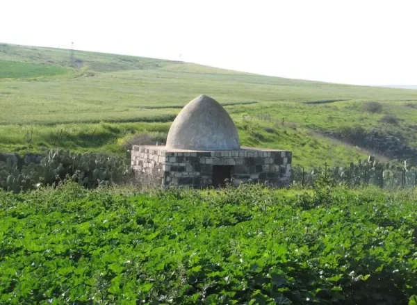
About the depopulated village of Danna
- District
- Baysan
- Date Danna was occupied
- 28 May 1948
- Population in 1948
- 220
- Military operation
- Operation Gideon
- Brigade that carried it out
- Golani Brigade
- Distance from the governorate centre
- 13 (km) North of Baysan
- Elevation above sea level
- 100 m
- Cause of displacement
- Expulsion by Zionist troops
- Extent of destruction
- In September 1948, the village was completely destroyed and only house rubble left behind.
- Ethnic cleansing
- Danna inhabitants were completely ethnically cleansed.
Hover a dot to read the village name, or click to open its card.
Borders of the depopulated village of Danna
Danna – Baysan Subdistrict
Danna, whose Arabic name is also rendered Danna, Danna/Dana in varying transliterations, was a depopulated Palestinian village in the Baysan subdistrict. It stood approximately 13 km north of the town of Baysan at an average elevation of about 100 meters, on the upper northeastern slope of Wadi Danna, a tributary of Wadi al-Bira.
The official 1931 Census of Palestine recorded 149 inhabitants, and the 1944/45 statistics recorded 190. Its registered lands totaled 6,614 dunums. The Golani Brigade established control over the Baysan Valley during Operation Gideon in May 1948. Danna's residents, however, were specifically expelled on 28 May, nearly two weeks after the formal end of the operation.
Location of Danna
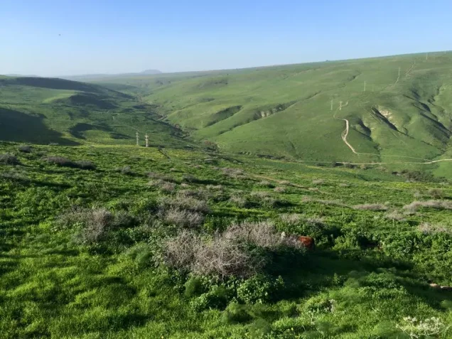
Danna stood on the upper northeastern slope of Wadi Danna, which flowed into Wadi al-Bira. Its site overlooked agricultural land on the western edge of the Baysan Valley.
A secondary road connected Danna with the Afula–Baysan highway. The Iraq Petroleum Company's pipeline also crossed village land on its route westward toward Haifa.
Palestine Remembered lists the lands of al-Bira, Wadi al-Bira, Kafra, al-Tayyiba, and al-Tira among the areas bordering Danna's lands. Its surrounding-villages diagram also places Sirin and Yubla in the wider vicinity.
The diagram places al-Tira roughly to the northwest, Sirin to the north, Wadi al-Bira to the northeast, al-Bira to the east, al-Tayyiba to the south, and Yubla to the southeast. Kafra lay approximately southwest of Danna. The distinction between directly adjoining village lands and settlements in the wider vicinity should be preserved.
Name and Early History
Walid Khalidi considers it possible that Danna was built on the site of a Roman-period settlement known as Tina'am. This should be treated as a possible historical identification rather than as definitive archaeological proof of continuous occupation.
In 1596, Danna belonged to the nahiya of Shafa in the liwa' of Lajjun. Its population has been estimated at approximately 28. The villagers paid Ottoman taxes on wheat, barley, goats, beehives, and other production.
The Swiss traveler Johann Ludwig Burckhardt mentioned Danna while traveling in the region in the early nineteenth century but did not provide a detailed description of the village.
Danna in the Late Nineteenth Century
Late nineteenth-century descriptions place Danna on a slope surrounded by cultivable land. A spring and watering trough lay west of the village.
The houses were constructed of stone and mud, and the built-up village had a roughly rectangular form whose longer axis ran north–south.
During the British Mandate, Danna expanded and new stone and adobe-brick houses were built along the road toward neighboring Kafra. The Palestine Index Gazetteer classified Danna as a small hamlet during this period.
Population of Danna
- 159628Estimate derived from an Ottoman tax register; not a modern census
- 1922176Official Census of Palestine; all inhabitants were Muslims
- 1931149Official Census of Palestine; all inhabitants were Muslims
- 1944/45190Official Mandate-era statistics; the population was Arab Muslim
- 1948220Later estimate published by Palestine Remembered; not an official census
- 19981,354 refugees and descendantsLater estimate published by Palestine Remembered
The 1948 and 1998 figures should not be described as British Mandate census statistics. The former is a later estimate and the latter is, by definition, a subsequent demographic estimate of refugees and their descendants.
Number of Houses
- 193128Official Census of Palestine
- 194841Later estimate published by Palestine Remembered; not an official census figure
The built-up area covered approximately 15 dunums in the 1944/45 land statistics, consistent with Danna's relatively small physical size.
Land Ownership
Danna's registered lands totaled 6,614 dunums in 1944/45. Palestine Remembered presents the simplified ownership categories as follows:
- Palestinian5,177 dunums78%
- Transferred to Zionists206 dunums3%
- Communal/Public1,231 dunums19%
PalQuest preserves the official statistical categories, recording 5,177 dunums as Arab, 206 dunums as Jewish, and 1,231 dunums as Public.
Land Use in 1944/45
The land-use presentation in Palestine Remembered requires correction because some Public land is folded into its Palestinian column. The official breakdown reproduced by PalQuest is:
- Arab
- Jewish
- Public
- Cereals5,338 dunums
- Plantations and irrigable land14 dunums
- Built-up land15 dunums
- Non-cultivable land1,247 dunums
The totals now balance exactly with the ownership figures and the village's registered land area.
The 5,132 dunums of cereals shown in Palestine Remembered's Palestinian column combine 5,097 Arab dunums with 35 dunums of Public land. Likewise, the displayed 1,247 dunums of non-arable land consist of only 51 Arab dunums plus 1,196 Public dunums.
Economic Life in Danna
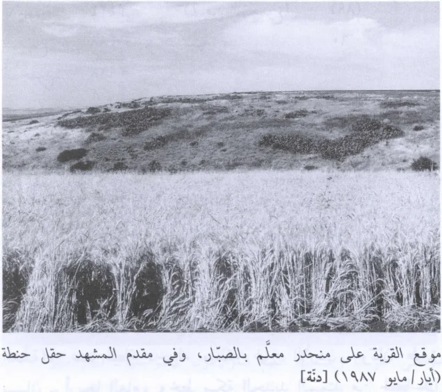
Most villagers depended on rain-fed agriculture. Cereals, particularly wheat and barley, were among the principal crops, continuing an agricultural pattern documented as early as the Ottoman tax registers.
In 1944/45, 5,097 Arab dunums were devoted to cereals, while only 14 dunums were classified as plantations or irrigable land.
Grass and leafy vegetation grew on the neighboring slopes and hilltops and were used as pasture, demonstrating the continuing importance of livestock alongside agriculture.
Danna also contained several small shops serving everyday village needs. The principal sources do not provide sufficiently detailed evidence of substantial additional craft or industrial activity.
Water
A spring and watering trough were located west of Danna, and the village spring was the principal documented source of water for the inhabitants.
Later Palestinian local descriptions refer to additional wells or water points in the western wadi. The principal Khalidi account, however, securely documents the spring and trough, and unsupported individual water-source names have not been added.
The Mosque and the Shrine of Shaykh Daniyal
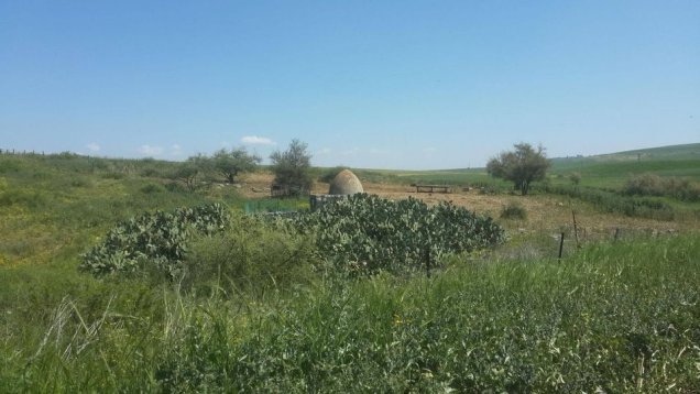
All of Danna's inhabitants were Muslims. The village had a mosque containing the shrine of Shaykh Daniyal, its best-documented religious landmark.
Palestine Remembered's summary box contains an automated line stating that a church existed in the village. Its detailed Khalidi text, however, mentions no church, and the principal sources reviewed provide no supporting evidence. A church has therefore not been included in this account.
Education
The core sources reviewed do not provide sufficiently documented information about a formal school in Danna or about where the village's children studied if they attended school elsewhere.
No school, founding date, or enrollment figure has therefore been inferred without supporting educational records or a reliable Palestinian source.
Danna and Operation Gideon
Operation Gideon was the military campaign through which the Haganah's Golani Brigade took control of the Baysan Valley. It ran from 10 to 15 May 1948 and was aimed at occupying Baysan and the surrounding valley and depopulating Palestinian communities in the area.
PalQuest notes that the Irgun may also have participated in the wider operation, based on its 14 May announcement that it had captured five Arab villages in the north. The village-specific evidence for Danna, however, does not establish an Irgun role there, so the organization is not identified as an attacking unit at Danna.
The formal dates of Operation Gideon should also not be confused with the date of Danna's expulsion. The operation ended on 15 May, while Danna's residents, or at least a substantial part of them, remained until 28 May.
Occupation and Depopulation of Danna
Walid Khalidi dates the expulsion of Danna's residents to 28 May 1948. On the same day, the Israeli army transferred the remaining Palestinian residents of the nearby town of Baysan to Nazareth.
The Golani Brigade was responsible for the occupation of the Baysan Valley and the expulsions associated with it.
The village-specific account does not, however, establish a separate date for the first entry of Golani troops into Danna, nor does it describe a distinct battle in the village on 28 May. The more precise formulation therefore distinguishes between military control of the Baysan Valley, achieved principally during Operation Gideon between 10 and 15 May, and the documented expulsion of Danna's residents on 28 May.
28 May is consequently the strongest documented date for the villagers' expulsion, but it should not automatically be treated as the date on which military control of the village site first began.
Did Some Villagers Remain or Return?
Khalidi records that the destruction of Danna was underway by September 1948 and that a nearby kibbutz leader objected to the village's demolition, arguing that the village might agree to allocate some land for settlement purposes.
Khalidi interprets this as an indication that at least some residents may have remained in Danna after the expulsion or returned to it afterward. The sources do not establish how many people were involved, how long they remained, or what ultimately happened to them.
It is therefore more accurate not to state categorically that every resident permanently left Danna at the same moment on 28 May.
Occupation Chronology
- 10 May 1948
Beginning of Operation Gideon
The Golani Brigade began its offensive to take control of the Baysan Valley and depopulate Palestinian communities in the region.
- 10–15 May 1948
Control of most of the Baysan Valley
During the formal operation, Golani forces captured Baysan and most of the valley. The Danna entry does not provide a separate date for the first military entry into the village.
- 15 May 1948
End of the formal Operation Gideon period
The operation formally ended, although Danna had not necessarily been emptied of all its inhabitants.
- 28 May 1948
Expulsion of Danna's residents
The villagers were expelled on the same day that the remaining residents of Baysan were transferred to Nazareth. The Golani Brigade was responsible for the occupation and expulsion operations in the valley.
- After 28 May 1948
Possible survival or return of some residents
Khalidi's source material suggests that some villagers may have remained or returned, but their later fate is unknown.
- By September 1948
Beginning of village destruction
Demolition of Danna was already underway. The core sources do not establish one exact date on which all houses were destroyed.
Military Unit
The military formation securely documented in connection with control of the Baysan Valley and the expulsion of Danna's population is the Golani Brigade.
The possible participation of the Irgun in Operation Gideon as a whole does not establish that it attacked Danna specifically. No village-specific role has therefore been assigned to it.
Refugees from Danna
Palestine Remembered estimates Danna's population in 1948 at approximately 220. This is a later estimate rather than an official British Mandate census figure.
The same source estimates that refugees from Danna and their descendants numbered approximately 1,354 in 1998. This should likewise be understood as a later demographic estimate.
Israeli Settlements on Danna Village Lands
Walid Khalidi and PalQuest record no Israeli settlement as having been established on Danna's village lands.
This does not mean that the lands remained unused. Khalidi's field description states that surrounding land was cultivated by Israeli farmers. Agricultural use, however, is distinct from the establishment of a settlement on village land.
Danna Today
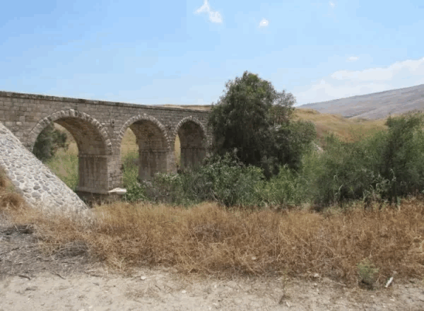
In the field description published by Walid Khalidi, bushes, thorns, brambles, cactuses, and grass grew around piles of rubble from the destroyed village houses. Dense vegetation also covered the wadi and the area near the village spring.
The surrounding lands were being cultivated by Israeli farmers.
This description is based on the field research undertaken for All That Remains before its publication in 1992 and does not constitute direct field verification of conditions at Danna in 2026.
Palestine Remembered also contains later community documentation of the village site, the shrine of Shaykh Daniyal, and surviving traces of Danna. Such material can help trace later changes but does not by itself constitute an independent, comprehensive contemporary field survey of all former village lands.
Sources
- PalQuestPalQuest – Danna
- PalQuestPalQuest – Operation Gideon
- Palestine RememberedPalestine Remembered – Danna, Baysan District
- Palestine RememberedPalestine Remembered – Danna entry from Walid Khalidi's All That Remains
- Institute for Palestine StudiesInstitute for Palestine Studies – Walid Khalidi, All That Remains
- fada.birzeit.eduBirzeit University – Census of Palestine 1931: Population of Villages, Towns and Administrative Areas
- pcbs.gov.psPalestinian Central Bureau of Statistics – Historical Census Reports
- PalQuestPalQuest – All That Remains: Methodology and Field Research
Photo gallery
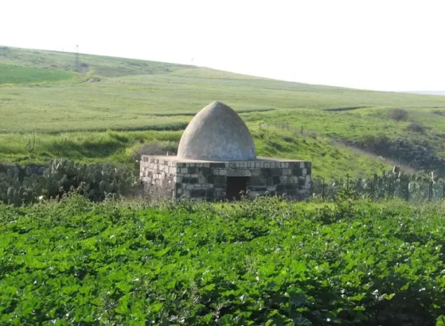
Photos from the village's people
Photos sent in by visitors and published after review.
Add a photo of this village
Log in to add photos of this village.
Other villages from Baysan
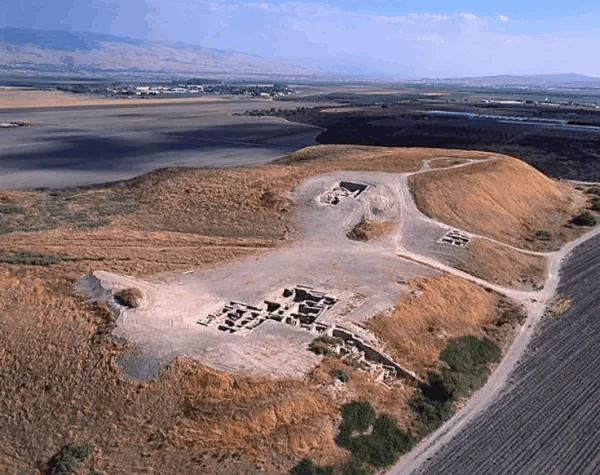
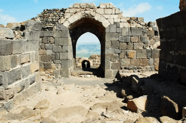
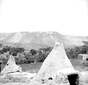
More from the archive



 Download Our Palestine App
The whole archive in the palm of your hand: depopulated villages, the Nakba, the massacres and Al-Aqsa — free, with no ads to erase the story.
Download Our Palestine App
The whole archive in the palm of your hand: depopulated villages, the Nakba, the massacres and Al-Aqsa — free, with no ads to erase the story.



Comments
No comments yet — be the first to write one.
Add your comment
Name and email are optional. Comments appear after review.