
The depopulated village of Kafra / District of Baysan
About the depopulated village of Kafra
- District
- Baysan
- Date Kafra was occupied
- 16 May 1948
- Population in 1948
- 500
- Military operation
- Operation Gideon
- Brigade that carried it out
- Golani Brigade
- Distance from the governorate centre
- 10.5 (km) North of Baysan
- Elevation above sea level
- 180 m
- Cause of displacement
- Influence of fall of, or exoduce from, neighboring town
- Extent of destruction
- The village was completely obliterated and defaced.
- Ethnic cleansing
- Kafra inhabitants were completely ethnically cleansed.
Hover a dot to read the village name, or click to open its card.
Borders of the depopulated village of Kafra
Kafra – Depopulated Palestinian Village in Baysan Subdistrict
Kafra was a Palestinian village in the Baysan subdistrict of Galilee. It stood in the middle of the Baysan Valley approximately 10.5 kilometers from the town of Baysan, at an average elevation of about 180 meters above sea level.
The village houses were built on both sides of the upper reaches of Wadi Kafra, a shallow valley. A secondary road connected Kafra with the Baysan–Jericho highway, while other roads linked it with neighboring Palestinian villages. Its central location made Kafra a local transport and commercial hub, although agriculture remained the foundation of its economy.
Kafra had 430 inhabitants in the official 1944/45 statistics and a registered land area of 9,172 dunums. Walid Khalidi provides no village-specific occupation date, military operation, or attacking unit. Palestine Remembered gives 16 May 1948 and associates Kafra with Operation Gideon and the Golani Brigade, but these details are not independently provided in Khalidi's village entry.
Key Facts about Kafra
| Field | Information |
|---|---|
| Name | Kafra |
| Subdistrict | Baysan |
| Distance from Baysan | Approximately 10.5 km |
| Average elevation | Approximately 180 m above sea level |
| Population, 1931 | 298 in 81 houses |
| Population, 1944/45 | 430 |
| Registered land area | 9,172 dunums |
| Occupation / depopulation date | Not available in Khalidi; Palestine Remembered gives 16 May 1948 |
| Military operation | Not identified by Khalidi; Palestine Remembered associates Kafra with Operation Gideon |
| Military unit | Not independently documented for Kafra; Palestine Remembered identifies the Golani Brigade |
| Cause of depopulation | Not detailed by Khalidi; Palestine Remembered attributes it to the influence of the fall or exodus of a neighboring locality |
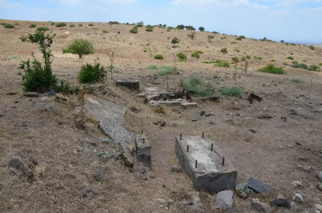
| Extent of destruction | The village's built environment was largely destroyed; rubble and archaeological remains survived |
| Israeli settlements on village land | None documented |
Location of Kafra
Kafra stood in the central Baysan Valley at the foot of the hills forming the valley's western edge. Its houses occupied both sides of the upper reaches of Wadi Kafra.
A secondary road connected the village with the Baysan–Jericho highway, and local roads linked Kafra with surrounding villages, making it an important rural crossroads.
According to the Palestinian Encyclopedia, neighboring villages included Kawkab al-Hawa to the east, al-Bira to the north, Danna to the northeast, al-Tayyiba to the west, al-Murassas to the south, Jabbul to the southeast, and Yubla to the southwest.
A small wooded area lay south of the village. The locality also stood near a drainage divide between wadis flowing north toward Wadi al-Bira and those flowing south toward Wadi al-'Ashsha.
The Name and Historical Site
The village had been known by essentially the same name since at least the Crusader period, when it appeared as “Caffra.”
Victor Guérin visited the locality in 1875 and recorded extensive basalt remains. The late nineteenth-century Survey of Western Palestine also described a ruined settlement with traces of antiquity.
These descriptions indicate that the site experienced different phases of settlement, abandonment, and renewed habitation over time.
Village Layout and Buildings
Kafra's built-up area extended along the valley between agricultural lands. Limits imposed by farmland to the east and west encouraged expansion more strongly along a northwest–southeast axis.
The official 1944/45 statistics recorded approximately 18 dunums as built-up land.
A shrine dedicated to Shaykh Muhammad, described by Khalidi as a local religious scholar, stood east of the village.
Population of Kafra
- 1922273Official British Mandate census; all Muslims
- 1931298Official census, in 81 houses
- 1944/45430Official Village Statistics; Arab population
- 1948499Later Palestine Remembered estimate, not an official census
- 19983,063 refugeesLater estimate of refugees and descendants reported by Palestine Remembered
The 1948 and 1998 figures are later estimates and should not be attributed to British Mandatory Village Statistics.
Number of Houses
- 193181Official Census of Palestine figure
- 1948135Later Palestine Remembered estimate, not an official census count
Land Ownership in Kafra
Kafra's total registered land area in 1944/45 was 9,172 dunums.
- Palestinian7,409 dunums81%
- Transferred to Zionists0 dunums0%
- Communal/Public1,763 dunums19%
The figures balance exactly: 7,409 + 0 + 1,763 = 9,172 dunums.
The original official categories were 7,409 Arab dunums, no Jewish-owned land, and 1,763 Public dunums.
Land Use in 1944/45
- Arab
- Public
- Cereals8,379 dunums
- Plantations and irrigable land36 dunums
- Built-up land18 dunums
- Non-cultivable land739 dunums
The land-use figures balance exactly: 8,379 + 36 + 18 + 739 = 9,172 dunums.
Some simplified Palestine Remembered displays present the full 8,379 dunums of cereal land without separating the 1,095 Public dunums from the 7,284 Arab dunums. The Public category has therefore been retained separately.
Note on Olive Acreage
The Palestinian Encyclopedia, drawing on Mustafa Murad al-Dabbagh, states that approximately 83 dunums on the higher eastern lands were planted with olives.
This does not reconcile directly with the official 1944/45 Village Statistics table, which records only 36 dunums in the entire “plantations and irrigable land” category.
The 83-dunum olive figure has therefore not been merged into the official land-use table or added to the village total. It is retained as a separate descriptive figure from another Palestinian source whose classification method differs from the official table.
Economic Life
Kafra benefited from its position at the intersection of roads connecting several villages and became a local center of commercial activity.
Agriculture nevertheless remained the principal economic activity. Grain, vegetables, and olives were among the main crops.
The official 1944/45 statistics recorded 7,284 Arab dunums devoted to cereals and 36 dunums used for plantations or irrigation.
Cereal fields and vegetable gardens extended particularly to the west and north, while a small wooded area lay on the southern village lands.
Water Resources
Khalidi and PalQuest do not provide a detailed written inventory of Kafra's wells and springs during the Mandate period.
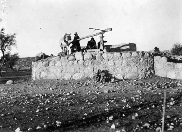
Later community documentation in Palestine Remembered records the village well and other wells and water installations. A historical photograph is also labeled as showing the village near its well around 1920.
The existence of these water installations can therefore be documented, but no unsupported names, capacities, or irrigation figures have been added.
Education in Kafra
Khalidi and PalQuest do not provide a founding year or enrollment figure for a village school.
A Mandate-era education document dated 3 September 1943, preserved by Palestine Remembered, records the transfer of teacher Mahmud al-Sa'id from the school at al-Tantura to the school at Kafra.
The document confirms that a school existed in Kafra by 1943, but it does not establish when the school was founded or how many pupils it had.
Shrine of Shaykh Muhammad
A shrine dedicated to Shaykh Muhammad stood east of the village. Khalidi identifies him as a local religious scholar.
The principal village source does not provide a construction date or a fuller documented biography of Shaykh Muhammad, so later local traditions have not been added as established historical facts.
Archaeological Remains
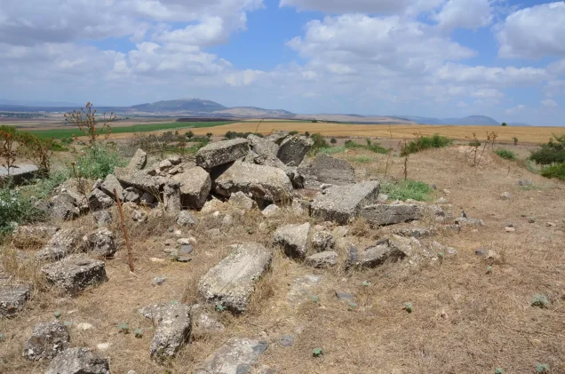
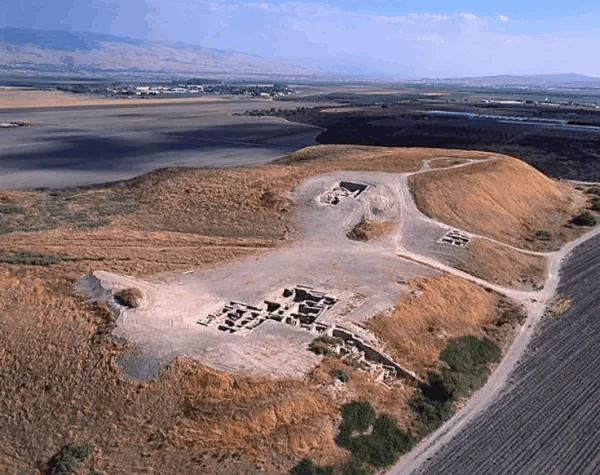
Kafra was also an archaeological locality. A trough carved from black basalt and the remains of an older settlement were found on the village site.
Nineteenth-century travelers and surveyors also recorded basalt ruins and other ancient remains, indicating the long history of occupation at the locality.
In Khalidi's later field description, the basalt trough and remains of the ancient village were still visible, although he noted that they had not been archaeologically examined at the time of his research.
Operation Gideon and the Military Context
The Haganah's Golani Brigade carried out Operation Gideon between 10 and 15 May 1948. The campaign led to the occupation of Baysan and much of the Baysan Valley and to the depopulation of several Palestinian communities.
Baysan itself fell on 12 May, accelerating the collapse of Palestinian civilian life in the surrounding valley.
However, PalQuest's Operation Gideon page does not list Kafra among its short list of affected villages, while Khalidi's Kafra entry records the occupation and depopulation details as unavailable.
Occupation and Depopulation of Kafra
Walid Khalidi provides no specific date for Kafra's occupation, does not identify the military operation or the brigade or battalion that entered the village, and gives no independent village-specific account of how the inhabitants left.
Palestine Remembered instead gives 16 May 1948, associates the village with Operation Gideon and the Golani Brigade, and classifies the cause of exodus as the influence of the fall or departure of a neighboring locality.
This attribution requires caution because PalQuest formally dates Operation Gideon to 10–15 May, meaning that Palestine Remembered's date for Kafra falls one day after the operation's stated end.
The most defensible formulation is therefore that Kafra lost its Palestinian population amid the collapse of the Baysan Valley and the Golani-led military campaign in May 1948, while the precise date, operation, and village-specific attacking unit remain unestablished in Khalidi's account.
Ethnic Cleansing
Palestine Remembered characterizes the outcome at Kafra as complete ethnic cleansing.
Khalidi does not provide a village-specific occupation or expulsion narrative. What is directly established is that Kafra's Palestinian community disappeared from the site during the Nakba and did not return to the village. The term “ethnic cleansing” is therefore retained here as an attributed characterization used by Palestine Remembered rather than as an independently assigned label.
Occupation Chronology
- 10 May 1948
Beginning of Operation Gideon
The Golani Brigade began its campaign for control of Baysan and the Baysan Valley.
- 12 May 1948
Fall of Baysan
Golani forces occupied the subdistrict center, contributing to widespread displacement in surrounding communities.
- 15 May 1948
Formal end of Operation Gideon
This is the end date provided by PalQuest.
- 16 May 1948
Date given by Palestine Remembered for Kafra
Palestine Remembered associates the date with Operation Gideon and the Golani Brigade, although it falls one day after the operation's formal end.
- Not available
Date established by Khalidi
All That Remains provides no village-specific occupation date, operation, or attacking unit for Kafra.
- Probably in May 1948 amid the collapse of the Baysan Valley
Depopulation
Palestine Remembered attributes the departure to the influence of the fall or exodus of a neighboring locality; Khalidi provides no independent mechanism.
- Precise date not documented
Destruction
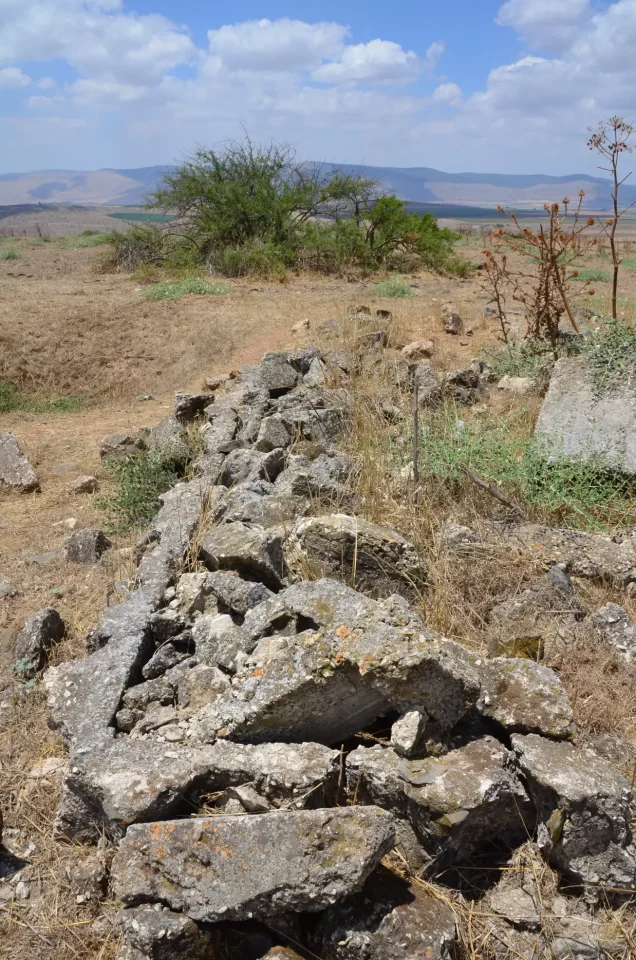
Most of the Palestinian built environment disappeared, leaving rubble, vegetation, and archaeological remains.
Israeli Settlements on Kafra's Lands
Khalidi and PalQuest explicitly state that no Israeli settlement was established on Kafra's village lands.
Nearby Israeli localities should therefore not be described as settlements built on Kafra's lands solely because of geographical proximity without independent cadastral evidence.
Kafra Today
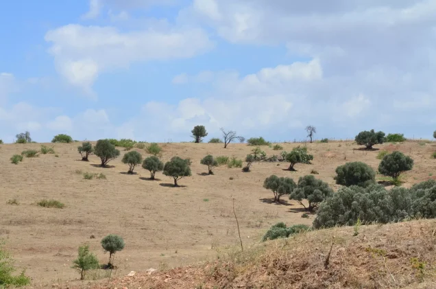
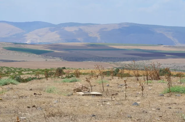
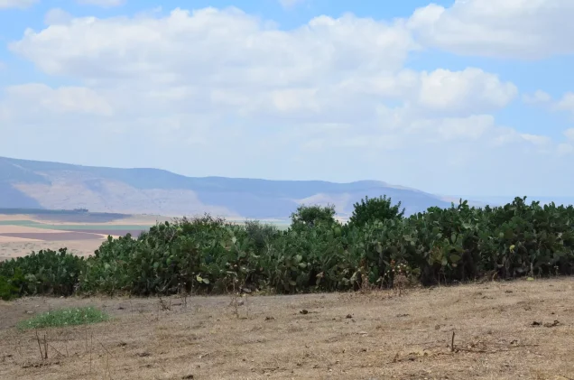
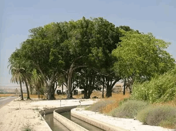
According to Walid Khalidi's field description, cactus plants grew amid the village rubble, together with almond, olive, and fig trees.
A fence surrounded much of the nearby land. Parts of the surrounding area were used for grazing, while land near the hill was cultivated, particularly with chickpeas.
The basalt trough and remains of the older village were still visible.
This account derives from fieldwork undertaken before the publication of All That Remains in 1992 and is therefore a documented historical description rather than direct comprehensive field verification of Kafra's condition in 2026.
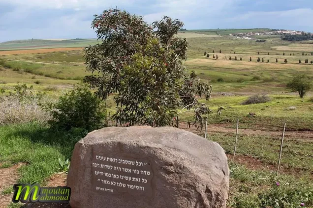
Palestine Remembered contains later community documentation, including a filmed visit to Kafra on 15 June 2013 and photographs of rubble, wells, cactus hedges, and agricultural lands. These materials help trace the site at later dates but do not constitute a comprehensive independent present-day survey.
Sources
- PalQuest – Interactive Encyclopedia of the Palestine Question: Kafra
- PalQuest – Operation Gideon
- Palestine Remembered – Kafra, Baysan District
- Walid Khalidi – All That Remains: Kafra
- Mandate education document – transfer of teacher Mahmud al-Sa'id to Kafra School, 3 September 1943
- Palestinian Encyclopedia – Kafra, drawing on Mustafa Murad al-Dabbagh
- Government of Palestine – Census of Palestine 1922
- Government of Palestine – Census of Palestine 1931
- Institute for Palestine Studies – All That Remains, Walid Khalidi
Photo gallery





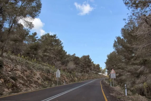
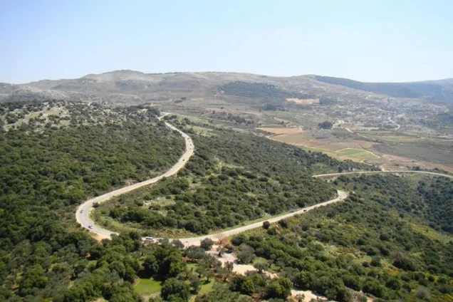
Photos from the village's people
Photos sent in by visitors and published after review.
Add a photo of this village
Log in to add photos of this village.
Other villages from Baysan
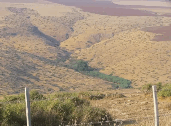
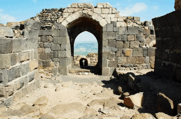
More from the archive



 Download Our Palestine App
The whole archive in the palm of your hand: depopulated villages, the Nakba, the massacres and Al-Aqsa — free, with no ads to erase the story.
Download Our Palestine App
The whole archive in the palm of your hand: depopulated villages, the Nakba, the massacres and Al-Aqsa — free, with no ads to erase the story.



Comments
No comments yet — be the first to write one.
Add your comment
Name and email are optional. Comments appear after review.