
The depopulated village of Al-Tira (Baysan) / District of Baysan
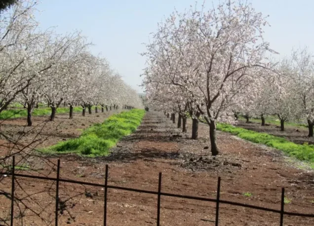
Al-Tira (Baysan)
About the depopulated village of Al-Tira (Baysan)
- District
- Baysan
- Date Al-Tira (Baysan) was occupied
- 15 April 1948
- Population in 1948
- 170
- Military operation
- Operation Gideon
- Brigade that carried it out
- Golani Brigade
- Distance from the governorate centre
- 17.5 (km) North of Baysan
- Elevation above sea level
- 125 m
- Cause of displacement
- Haganah 'Wispering' campaign (psychological warfare)
- Extent of destruction
- al-Tira was completely destroyed and defaced.
- Ethnic cleansing
- On 26th of March 1948, the village was ethnically cleansed based on the orders of Yosef Weitz (a Jewish National Fund official).
- Settlements built on the land of Al-Tira (Baysan) before 1948
- Irgun Borohov (Today Gazit)
Hover a dot to read the village name, or click to open its card.
Borders of the depopulated village of Al-Tira (Baysan)
Al-Tira (Tirat al-Marj / al-Tira al-Zu'biyya) – Depopulated Palestinian Village of the Baysan District
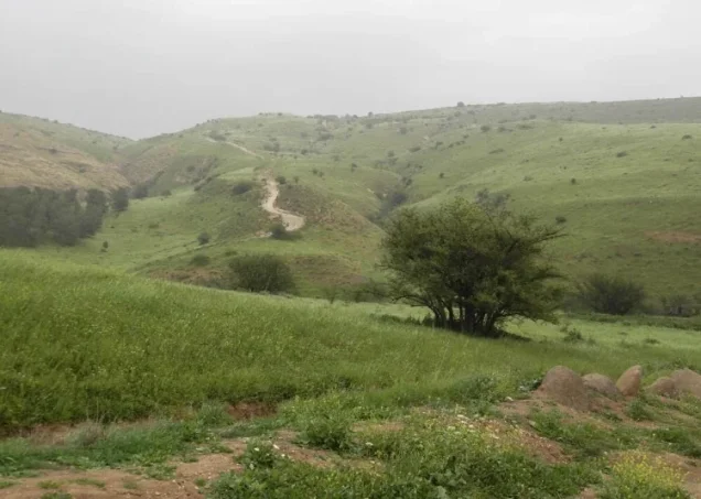
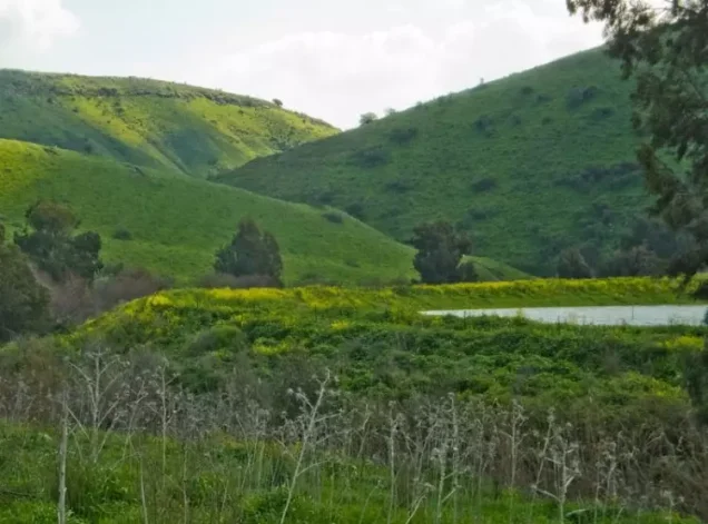
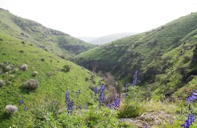
Al-Tira, also known as Tirat al-Marj and al-Tira al-Zu'biyya, was a depopulated Palestinian village in the Baysan District. It stood on the side of a low hill overlooking the steep slopes of Wadi al-Bira to the north and northeast and flatter land to the west and southwest.
The village lay approximately 17.5 kilometers north of Baysan at an average elevation of about 125 meters above sea level.
Al-Tira was depopulated on 15 April 1948, after officials of the Jewish National Fund had earlier discussed forcing its inhabitants to leave and after pressure from the Haganah. The village's depopulation cannot securely be attributed to Operation Gideon, which did not begin until 10 May, approximately four weeks later.
Location and Geography
Al-Tira lay in the northernmost part of the Baysan District, close to the administrative boundaries of the Tiberias and Nazareth districts.
The village occupied the side of a low hill overlooking the steep slopes of Wadi al-Bira to the north and northeast, while flatter terrain extended westward and southwestward.
A secondary road connected the village with the main route leading north to Samakh and south to Baysan. Other tracks linked al-Tira with neighboring villages and its water sources.
Palestinian sources place Ma'dhar to the north, 'Awlam to the northeast, Sirin to the east, Danna to the southeast, al-Tayyiba al-Zu'biyya to the south, Tamra to the southwest, and Kafr Misr to the west.
Name
PalQuest records the official name al-Tira and the alternative names Tirat al-Marj and al-Tira al-Zu'biyya.
The principal Palestinian sources reviewed do not provide a securely established historical explanation for the name al-Tira or for the epithet al-Zu'biyya. No definitive linguistic or tribal derivation is therefore adopted here.
Built Environment
Al-Tira's houses stood along the side of the hill in a relatively compact settlement.
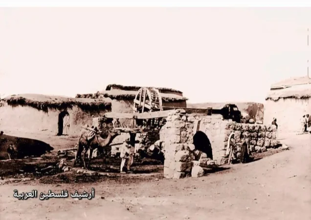
Late nineteenth-century descriptions portray it as a small village, largely built of adobe, standing on a hill above a deep gorge.
In the 1944/45 statistical unit, 29 dunams of Arab-owned land were classified as built-up, while one additional built-up dunam belonged to the Jewish settlement of Irgun Borokhov.
Population and Houses
The Palestinian inhabitants of al-Tira were Muslims.
- 1922130Official census; all inhabitants were Muslims
- 1931108Official census; all inhabitants were Muslims
- 1945150 ArabsPopulation of the Palestinian village itself
- 1945 – Irgun Borokhov50 JewsPopulation of the adjacent Jewish settlement included in the broader statistical context
- 1945 – Combined Total200150 Arabs in al-Tira plus 50 Jews in Irgun Borokhov
The official 1931 census recorded 24 inhabited houses in al-Tira.
Later estimates for 1948 and 1998 are inconsistent across Palestinian websites. Figures of approximately 170–174 appear for 1948, while estimates of refugees and descendants in 1998 range between 1,069 and 1,609. Because the underlying calculations are unclear and some statistical tables combine al-Tira with Irgun Borokhov, no single later estimate is treated here as definitive.
Water Resources
'Ayn al-Bayda was the principal source of water for al-Tira's inhabitants, and tracks connected the village with the spring.
The Palestinian Encyclopedia also records 'Ayn al-Mazarib north of the village along a watercourse and 'Ayn al-Mustafa among a group of springs farther north.
The abundance of springs in the area supplied domestic water and supported agriculture.
Shrine, Education, and Public Services
A shrine dedicated to Shaykh Dhiab stood south of the village.
Walid Khalidi's principal village entry does not document an independent formal school, while the Palestinian Encyclopedia describes al-Tira as lacking public facilities and services.
No formal school or separately documented mosque is therefore added without stronger village-specific evidence.
Economic Life and Agriculture
Agriculture was the principal livelihood of al-Tira's Palestinian inhabitants.
Cereals were the dominant crop, with a smaller area devoted to plantations and irrigable land.
The principal village source does not provide securely documented crop-specific acreage for additional crops such as olives, so no unsupported figures are added.
Methodological Note on the 1944/45 Statistics
The land statistics for al-Tira must be read carefully because the official land unit presented by PalQuest includes the Jewish settlement of Irgun Borokhov, established near the village in 1943.
The Jewish ownership and land-use figures below therefore do not mean that Jewish residents lived within the Palestinian residential core of al-Tira itself. They belong to the combined land-statistical unit.
Land Ownership, 1944/45
- Arab4,463 dunums44%
- Jewish2,604 dunums26%
- Public3,140 dunums31%
The official table balances exactly: 4,463 + 2,604 + 3,140 = 10,207 dunams.
Palestine Remembered presents the same figures using its simplified terminology: 4,463 dunams “Palestinian,” 2,604 dunams “Transferred to Zionists,” and 3,140 dunams “Communal/Public.” The phrase “Transferred to Zionists” should be preserved when reproducing that source's classification.
Land Use, 1944/45
- Arab
- Jewish
- Public
- Cereals7,227 dunums
- Plantations and irrigable land56 dunums
- Total cultivable/cultivated land7,283 dunums
- Non-cultivable land2,894 dunums
- Built-up land30 dunums
- Total non-cultivable and built-up2,924 dunums
The official table balances exactly: 7,283 dunams of cultivated or cultivable land plus 2,924 dunams of built-up and non-cultivable land equal the total 10,207 dunams.
Palestine Remembered displays 4,624 cereal dunams in the Palestinian column. The official table shows that this number combines 4,326 Arab dunams with 298 Public dunams, so Public land has been kept separate above.
Khirbat al-Tira and Archaeology
Khirbat al-Tira lay south of the village.
Archaeological investigations uncovered ancient remains including caves and water cisterns.
The principal sources reviewed do not provide sufficient dating to assign all of these remains to a single historical period.
The March 1948 Decision to Remove the Population
Efforts to remove al-Tira's Palestinian inhabitants began before the major military campaigns in the Baysan Valley.
On 26 March 1948, Jewish National Fund officials discussed forcing the inhabitants of al-Tira and neighboring Qumya to leave, arguing that the villagers had not prevented Palestinian irregular fighters from entering the area.
The decision was not implemented on that date. 26 March was therefore not the date of al-Tira's occupation or final depopulation.
Depopulation of Al-Tira
Walid Khalidi, citing Benny Morris through his own account, states that al-Tira was emptied on 15 April 1948 after the inhabitants received pressure or “friendly advice” from the Haganah to leave.
Khalidi also notes that Morris gives a contradictory account elsewhere, stating that the villagers left on 20 May after orders from Arab irregular forces.
The two accounts are separated by more than a month and cannot both describe the same initial depopulation event without qualification.
This article therefore retains 15 April 1948 as the depopulation date given in the detailed village narrative, while recording 20 May as a conflicting later claim rather than as an equally established alternative date.
Was Al-Tira Depopulated during Operation Gideon?
Palestine Remembered and some later Palestinian databases classify al-Tira under Operation Gideon and identify the Golani Brigade as the executing force.
This attribution is chronologically inconsistent.
Operation Gideon began on 10 May 1948 and ended on 15 May, whereas al-Tira had already been emptied on 15 April, approximately four weeks earlier.
Operation Gideon is therefore not treated here as the military operation that depopulated al-Tira, and the Golani Brigade is not assigned as the village-level force responsible for its removal.
The organization directly identified in the village-specific depopulation narrative is the Haganah, with no specific brigade or battalion documented.
Occupation and Depopulation Chronology
- 26 March 1948
Decision to remove the population
Jewish National Fund officials discussed forcing the inhabitants of al-Tira and Qumya to leave; this was not the date of physical occupation.
- 15 April 1948
Depopulation of al-Tira
According to the detailed account cited by Khalidi, residents left after pressure from the Haganah.
- 10 May 1948
Beginning of Operation Gideon
The Golani Brigade began Operation Gideon in the Baysan Valley after al-Tira had already been emptied.
- 20 May 1948
Contradictory later departure account
A second Morris account, cited by Khalidi, states that villagers left on orders from Arab irregular forces; it conflicts with the 15 April account.
- 10 September 1948
Irgun Borokhov renamed Gazit
A new settler organization took over the settlement and renamed it Kibbutz Gazit.
- Late 1948
Village site absorbed by Gazit
Gazit incorporated the al-Tira village site and lands.
- Exact date not documented
Destruction of village buildings
Most structures were subsequently destroyed, leaving stone ruins.
Military Unit
The village-specific account does not identify a Golani Brigade unit as the force responsible for al-Tira's depopulation.
The organization directly mentioned in connection with the villagers' departure is the Haganah.
No specific brigade or battalion is identified in the principal source, so none is assigned without direct village-level evidence.
Israeli Settlements on Village Lands
Irgun Borokhov was established in 1943 near the al-Tira village site and appears within the land-statistical unit associated with the village in 1944/45.
On 10 September 1948, another settler organization took over the settlement and renamed it Gazit.
By late 1948, Gazit had absorbed the al-Tira village site and lands. It lies approximately 1.5 kilometers south or southwest of the former village site on al-Tira's land.
Kefar Qish, established in 1946 approximately one kilometer northwest of al-Tira, stands on the lands of Ma'dhar in the Tiberias District and should not be listed as a settlement on al-Tira's lands.
Al-Tira Today
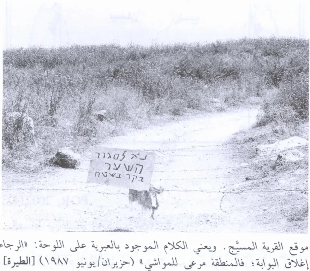
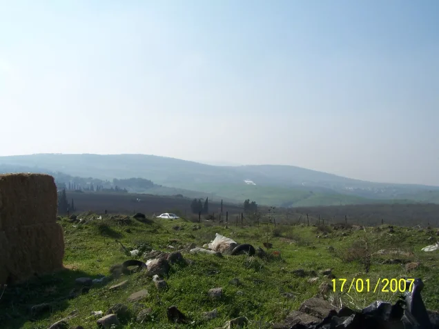
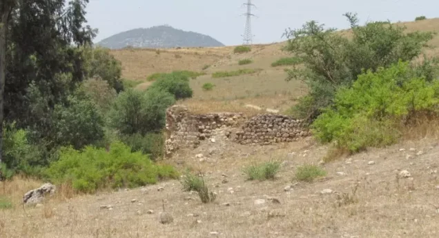
According to the field description published in Walid Khalidi's All That Remains, only the ruins of stone houses remained, covered by grass and thorns.
The site was fenced and used by Israeli farmers as grazing land, while cypress trees grew on surrounding land.
Later Palestinian community documentation, including material from 2007 and 2012, records house rubble, the cemetery site, and locations associated with former village families.
None of these descriptions constitutes a comprehensive field verification of conditions in 2026. The principal All That Remains fieldwork dates from 1987–1990.
Sources
- PalQuest – Interactive Encyclopedia of the Palestine Question: al-Tira, Baysan
- Palestine Remembered – al-Tira, Baysan District
- Palestine Remembered – Walid Khalidi's account of al-Tira
- Palestinian Encyclopedia – al-Tira; Baysan section
- Palestinian Villages Encyclopedia – al-Tira / Tirat al-Marj / al-Tira al-Zu'biyya; used comparatively to correct the 26 March dating
- PalQuest – Operation Gideon; used to establish that the operation began after al-Tira had already been depopulated
- Institute for Palestine Studies – Walid Khalidi, All That Remains
- PalQuest – All That Remains: Methodology
Photo gallery


Photos from the village's people
Photos sent in by visitors and published after review.
Add a photo of this village
Log in to add photos of this village.
Other villages from Baysan
More from the archive



 Download Our Palestine App
The whole archive in the palm of your hand: depopulated villages, the Nakba, the massacres and Al-Aqsa — free, with no ads to erase the story.
Download Our Palestine App
The whole archive in the palm of your hand: depopulated villages, the Nakba, the massacres and Al-Aqsa — free, with no ads to erase the story.



Comments
No comments yet — be the first to write one.
Add your comment
Name and email are optional. Comments appear after review.