
The depopulated village of Yubla / District of Baysan
About the depopulated village of Yubla
- District
- Baysan
- Date Yubla was occupied
- 16 May 1948
- Population in 1948
- 240
- Military operation
- Operation Gideon
- Brigade that carried it out
- Golani Brigade
- Distance from the governorate centre
- 9 (km) North of Baysan
- Elevation above sea level
- 25 m
- Cause of displacement
- Influence of fall of, or exoduce from, neighboring town
- Extent of destruction
- The village was completely defaced.
- Ethnic cleansing
- Yubla inhabitants were completely ethnically cleansed.
Hover a dot to read the village name, or click to open its card.
Borders of the depopulated village of Yubla
Yubla – Depopulated Palestinian Village in Baysan Subdistrict
Yubla was a Palestinian village in the Baysan subdistrict of Galilee. It stood approximately 9 kilometers from Baysan in the southern part of a shallow natural basin through which Wadi al-Tayyiba flowed, at an average elevation of about 25 meters above sea level.
The village had an official population of 210 in 1944/45, all Arab Muslims, and a registered land area of 5,165 dunums. Agriculture was the principal source of livelihood, particularly cereals, vegetables, orchards, and other crops.
Walid Khalidi does not provide a specific occupation date, named operation, or attacking military unit for Yubla. Palestine Remembered, however, gives 16 May 1948, associates the village with Operation Gideon and the Golani Brigade, and attributes the exodus to the influence of the fall or departure of a neighboring locality. Since PalQuest formally dates Operation Gideon to 10–15 May and Khalidi lists the occupation and depopulation details as unavailable, these items are treated here as Palestine Remembered's classification rather than as independently established village-specific facts.
Key Facts about Yubla
| Field | Information |
|---|---|
| Name | Yubla |
| Subdistrict | Baysan |
| Mandate classification | Hamlet in the Palestine Index Gazetteer |
| Distance from Baysan | Approximately 9 km |
| Average elevation | Approximately 25 m above sea level |
| Population, 1931 | 88 in 23 houses – official census |
| Population, 1944/45 | 210 – all Arabs and Muslims |
| Registered land area | 5,165 dunums |
| Occupation / depopulation date | Not established by Khalidi; Palestine Remembered gives 16 May 1948 |
| Military operation | Not identified in Khalidi's village entry; Palestine Remembered associates Yubla with Operation Gideon |
| Military unit | Not independently established for the village; Palestine Remembered gives the Golani Brigade |
| Cause of depopulation | Not detailed by Khalidi; Palestine Remembered classifies it as the influence of the fall or exodus of a neighboring locality |
| Extent of destruction | The Palestinian built environment was largely erased; Khalidi's field description records no surviving village houses |
| Israeli settlements established on village land | None documented |
Location of Yubla
Yubla stood on the southern side of a shallow natural basin through which Wadi al-Tayyiba flowed. The village lay south of 'Ayn Yubla, which flowed beneath the hill to the north between the settlement and the wadi.
Marshes covered much of the land north and northwest of the village. A secondary road passing through several villages connected Yubla with the main road to Baysan, while dirt tracks connected it with other communities in the area.
Nearby villages included Kafra, Jabbul, al-Murassas, Qumya, Danna, and al-Tayyiba.
The Name and Historical Site
The Crusaders referred to the locality as Hubeleth. Khalidi does not provide a definitive linguistic explanation for the Arabic name Yubla.
In the late nineteenth century, the Survey of Western Palestine recorded heaps of stones at Khirbat Yubla but found no evidence allowing their date to be established.
Yubla during the British Mandate
Yubla was classified as a hamlet in the Palestine Index Gazetteer.
Village houses were constructed along the roads, particularly the road leading toward 'Ayn Yubla. The inhabitants were Muslims and depended primarily on agriculture.
Population of Yubla
- 192273Official census: 36 males and 37 females, all Muslims
- 193188Official census: 48 males and 40 females, all Muslims
- 1944/45210Official Village Statistics; all Arabs and Muslims
- 1948244Later Palestine Remembered estimate, not an official census
- 19981,496 refugeesLater Palestine Remembered estimate of refugees and descendants
Palestine Remembered incorrectly displays 37 as Yubla's 1922 population. The original census lists 36 males and 37 females, producing an official total of 73. The website appears to have reproduced the female count alone as the total.
The 1948 and 1998 figures are later estimates and should not be attributed to British Mandatory census statistics.
Number of Houses
- 193123Official Census of Palestine figure
- 194863Later Palestine Remembered estimate, not an official census count
Land Ownership in Yubla
The total registered land area of Yubla in the 1944/45 statistics was 5,165 dunums.
- Palestinian2,051 dunums40%
- Transferred to Zionists1,758 dunums34%
- Communal/Public1,356 dunums26%
The ownership figures balance correctly: 2,051 + 1,758 + 1,356 = 5,165 dunums.
The original official categories were 2,051 Arab dunums, 1,758 Jewish dunums, and 1,356 Public dunums.
Land Use in 1944/45
Yubla presents an important internal discrepancy in the published 1945 land-use tables. The figures reproduced by Hadawi and PalQuest add up to 25 dunums more than the village's official registered land total.
- Arab
- Jewish
- Public
- Published Total
- Citrus and bananas50 dunums
- Plantations and irrigable land74 dunums
- Cereals8,126 dunums
- Built-up land44 dunums
- Non-cultivable land2,086 dunums
- Sum of the published categories10,380 dunums
The resulting 5,190 dunums exceeds the official ownership total of 5,165 by 25 dunums. The Arab-use column likewise exceeds the officially registered 2,051 Arab dunums by exactly 25.
The discrepancy is present in the reproduced official tables themselves. Because the principal sources do not provide sufficient evidence to determine which entry should be reduced by 25 dunums, no unsupported correction has been imposed.
Palestine Remembered introduces a separate presentation problem by listing 2,315 dunums of cereals as Palestinian land. That number combines 1,971 Arab dunums with 344 Public dunums. It likewise presents the entire 1,043 dunums of non-cultivable land without separating the 31 Arab dunums from 1,012 Public dunums. The categories have therefore been kept separate here.
Economic Life
Agriculture was the principal source of livelihood. Villagers cultivated cereals, vegetables, orchards, and other crops.
The published 1944/45 figures record 1,971 Arab dunums of cereals, 37 Arab dunums of plantations and irrigable land, and 25 dunums of citrus and bananas, subject to the 25-dunum accounting discrepancy described above.
The shallow basin and local water resources supported cultivation, although marshes covered extensive areas north and northwest of the village.
Water and 'Ayn Yubla
'Ayn Yubla was one of the defining features of the village and supplied most of the inhabitants' drinking water.
The spring flowed north of the village between the settlement and Wadi al-Tayyiba, and the road leading toward it was one of the principal axes along which village houses were constructed.
Education and Public Institutions
Khalidi and PalQuest do not independently document a village school in Yubla or provide a founding year or enrollment figure.
The principal sources reviewed likewise do not independently identify a village mosque or other public institution. No such institutions have therefore been inferred from neighboring communities.
Archaeology and Khirbat Umm al-Su'ud
Khirbat Umm al-Su'ud lay approximately 1.5 kilometers southeast of Yubla.
Khalidi records rough-stone enclosures and traces of walls at the archaeological locality.
The Crusaders called Yubla Hubeleth, while the nineteenth-century Survey of Western Palestine recorded heaps of stones at Khirbat Yubla without assigning them a secure date.
Operation Gideon and the Baysan Valley Context
The Haganah's Golani Brigade carried out Operation Gideon between 10 and 15 May 1948 as the campaign for control of Baysan and the Baysan Valley.
Khalidi's Yubla entry, however, does not identify an operation, attacking unit, or occupation date for the village and records the occupation-and-depopulation information as unavailable.
Palestine Remembered instead associates Yubla with Operation Gideon and the Golani Brigade and gives 16 May 1948 as the occupation date.
This creates a chronological problem: 16 May falls one day after PalQuest's formal 15 May end date for Operation Gideon. Yubla is also absent from the short list of affected villages shown on PalQuest's Operation Gideon page.
The Operation Gideon/Golani attribution should therefore be understood as Palestine Remembered's classification within the broader Baysan Valley campaign rather than as a village-specific conclusion independently established by Khalidi.
Occupation and Depopulation of Yubla
Walid Khalidi provides no precise date or independent village-specific account of how Yubla's inhabitants left.
Palestine Remembered gives 16 May 1948 and classifies the cause of departure as the influence of the fall or exodus of a neighboring locality, while associating the village with the Golani Brigade.
Given the lack of such detail in Khalidi's entry and the chronological tension with the formal dates of Operation Gideon, the more cautious conclusion is that Yubla was depopulated during the collapse of Palestinian communities in the Baysan Valley in May 1948, while the precise day, operation, and unit that specifically entered the village remain insufficiently established in the principal village source.
Ethnic Cleansing
Palestine Remembered describes the outcome at Yubla as complete ethnic cleansing.
Khalidi does not provide a village-specific account of expulsion or occupation. What is directly established across the sources is that the Palestinian community disappeared from Yubla during the Nakba and did not return to the village. The term “ethnic cleansing” is therefore retained as an attributed characterization used by Palestine Remembered rather than presented here as an independent classification.
Occupation Chronology
- 10 May 1948
Beginning of Operation Gideon
The Golani Brigade began its campaign for control of Baysan and the Baysan Valley.
- 12 May 1948
Fall of Baysan
The fall of the subdistrict center formed part of the wider military and civilian collapse in the valley.
- 15 May 1948
Formal end of Operation Gideon
This is the end date provided by PalQuest.
- 16 May 1948
Date given by Palestine Remembered for Yubla
The site associates this date with Operation Gideon and Golani, although it falls one day after the operation's formal end date.
- Not available
Date established by Khalidi
All That Remains does not provide a specific occupation date, operation, or attacking unit for Yubla.
- Probably during the May 1948 collapse of Palestinian communities in the Baysan Valley
Depopulation
Palestine Remembered attributes the exodus to the influence of a neighboring locality's fall; Khalidi provides no independent village-specific mechanism.
- Precise date not documented
Destruction
The Palestinian built environment was largely removed, and Khalidi's later site description records no surviving village houses.
Israeli Settlements and Yubla's Lands
Khalidi and PalQuest explicitly state that no Israeli settlement was established on Yubla's village lands.
| Settlement | Established | Relationship to Yubla |
|---|---|---|
| Benei Brit / Moledet | 1937; renamed Moledet in 1952 | Located approximately 2 km northwest of Yubla but established on land belonging to the still-existing village of al-Tayyiba, not on Yubla's lands |
Moledet should therefore not be described as a settlement established on Yubla's land, despite the automated Palestine Remembered settlement field suggesting otherwise. Khalidi's detailed village account explicitly places it on al-Tayyiba land.
Yubla Today
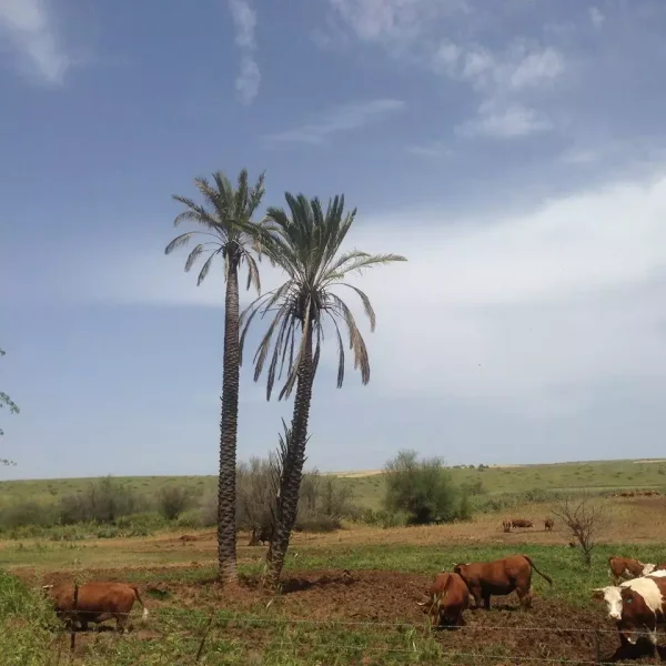
In Walid Khalidi's field description, the village site and part of its lands were enclosed by barbed-wire fencing and used for cattle grazing.
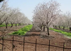
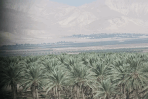
A number of tall date palms, several almond trees, and cactus plants grew near 'Ayn Yubla.
Khalidi does not record surviving Palestinian houses at the site, reflecting the extensive disappearance of the village's built environment by the time of his documentation.
This description derives from fieldwork undertaken before the publication of All That Remains in 1992. It is therefore a documented historical site description rather than comprehensive direct field verification of Yubla's condition in 2026.
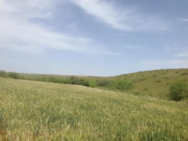
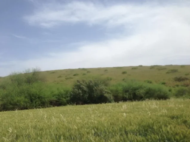
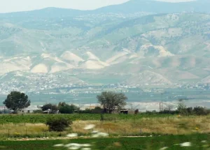
Palestine Remembered contains later community documentation, including photographs uploaded in 2015 showing the village landscape, wadi, and grazing areas. These materials provide useful later documentation but do not constitute a comprehensive independent present-day survey.
Sources
- PalQuest – Interactive Encyclopedia of the Palestine Question: Yubla
- PalQuest – Operation Gideon
- Palestine Remembered – Yubla, Baysan District
- Walid Khalidi – All That Remains: Yubla
- Government of Palestine – Census of Palestine 1922
- Government of Palestine – Census of Palestine 1931, PCBS reproduction
- Sami Hadawi – Village Statistics 1945
- Institute for Palestine Studies – All That Remains, Walid Khalidi
Photo gallery


Photos from the village's people
Photos sent in by visitors and published after review.
Add a photo of this village
Log in to add photos of this village.
Other villages from Baysan

More from the archive


 Download Our Palestine App
The whole archive in the palm of your hand: depopulated villages, the Nakba, the massacres and Al-Aqsa — free, with no ads to erase the story.
Download Our Palestine App
The whole archive in the palm of your hand: depopulated villages, the Nakba, the massacres and Al-Aqsa — free, with no ads to erase the story.



Comments
No comments yet — be the first to write one.
Add your comment
Name and email are optional. Comments appear after review.