
The depopulated village of 'Arab al-'Arida / District of Baysan
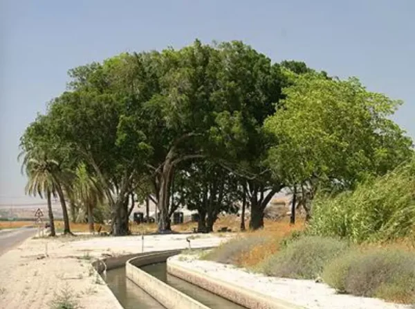
'Arab al-'Arida
About the depopulated village of 'Arab al-'Arida
- District
- Baysan
- Date 'Arab al-'Arida was occupied
- 20 May 1948
- Population in 1948
- 170
- Military operation
- Operation Gideon
- Brigade that carried it out
- Golani Brigade
- Distance from the governorate centre
- 6 (km) South of Baysan
- Elevation above sea level
- -200 (m)
- Cause of displacement
- Influence of fall of, or exoduce from, neighboring town
- Extent of destruction
- The village was completely destroyed and defaced.
- Ethnic cleansing
- 'Arab al-'Arida inhabitants were completely ethnically cleansed.
- Settlements built on the land of 'Arab al-'Arida before 1948
- Sde Eilyahu
Hover a dot to read the village name, or click to open its card.
Borders of the depopulated village of 'Arab al-'Arida
'Arab al-'Arida – Depopulated Palestinian Village of Baysan
'Arab al-'Arida, also known simply as al-'Arida, was a Palestinian community in the Baysan Subdistrict. It stood on broad, level terrain approximately 6 kilometers south of Baysan and about 200 meters below sea level.
The village lay east of the main Baysan-Jericho highway and was connected to it by a secondary road. A broad wadi ran east-west along its northern boundary, while the highlands east of the Jordan River were visible from the settlement.
The inhabitants were originally Bedouin pastoralists who gradually became sedentary. Their economy combined grain cultivation, livestock raising, and vegetable growing along small spring-fed streams.
The Palestinian population was 150 in the official 1944/45 statistics. The commonly displayed total of 330 also includes 180 Jewish residents of Sde Eliyyahu, a settlement founded on village land in 1939, and should not be presented as the population of Palestinian 'Arab al-'Arida itself.
Basic Information
| Field | Information |
|---|---|
| Name | 'Arab al-'Arida |
| Arabic name | عرب العريضة |
| Alternative name | al-'Arida |
| Subdistrict | Baysan |
| Location | South of Baysan in the Baysan Valley |
| Distance from Baysan | Approximately 6 km |
| Average elevation | Approximately 200 m below sea level |
| Population in 1922 | No independently documented figure located in the principal sources used |
| Population in 1931 | 182, all Muslims |
| Houses in 1931 | 38 |
| Palestinian population in 1944/45 | 150 |
| Combined statistical-unit population in 1944/45 | 330: 150 Arabs in 'Arab al-'Arida + 180 Jews in Sde Eliyyahu |
| 1948 population estimate | Approximately 174 – later estimate, not an official census |
| Combined statistical land area | 2,280 dunums, including Sde Eliyyahu |
| Probable depopulation date | 20 May 1948 in Palestine Remembered; not independently narrated in Khalidi's village entry |
| Military context | After Operation Gideon and the fall of Baysan, during continued military consolidation of the valley |
| Military unit | Golani Brigade – probable secondary attribution; no village-specific battalion is independently documented |
| Cause of depopulation | Impact of Baysan's fall and the depopulation of neighboring communities; immediate village-level circumstances remain undocumented |
| Pre-1948 settlement | Sde Eliyyahu, founded on village land in 1939 |
| New post-1948 settlement | No new settlement is identified by Khalidi as having been founded on the village lands after the Nakba |
Name and Formation of the Community
The locality appears in the principal sources as 'Arab al-'Arida and, in shortened form, al-'Arida.
The inhabitants were originally Bedouin groups who gradually settled permanently in the Baysan Valley and combined pastoralism with agriculture.
No securely documented linguistic derivation of the name al-'Arida was located in the principal sources reviewed.
Location and Geography
'Arab al-'Arida stood on a broad flat expanse from which the highlands east of the Jordan River could be seen.
A wide wadi ran east to west along its northern boundary.
The village stood on the eastern side of the main highway linking Baysan in the north with Jericho in the south and was connected to it by a secondary road.
The Palestine Encyclopedia places 'Arab al-Safa and 'Arab al-Zaydan to the east and al-Samiriyya to the west, with roads linking 'Arab al-'Arida to Baysan, al-Samiriyya, Masil al-Jizl, and al-Fatur.
Bayt al-Ahmar and Local Roads
The Palestine Encyclopedia records a locality known as Bayt al-Ahmar immediately east of 'Arab al-'Arida.
It stood near a road junction receiving routes from the zawr lands along the Jordan River, al-Khunayzir to the south, and al-Samiriyya to the west, after which the roads joined toward Baysan.
This road network connected the village with agricultural and pastoral communities throughout the southern Baysan Valley.
Population
| Year | Population | Status |
|---|---|---|
| 1922 | No independently documented figure located | No number is inferred from neighboring communities |
| 1931 | 182 | Official census; all Muslims |
| 1944/45 | 150 Palestinians | Palestinian population within the statistical unit |
| 1944/45 – entire unit | 330 | 150 Arabs + 180 Jewish residents of Sde Eliyyahu |
| 1948 | Approx. 174 | Later Palestine Remembered estimate; another Palestinian page rounds it to 170 |
| 1998 | 1,069 | Later estimate of refugees and descendants |
The figure of 330 must not be presented as the 1945 population of Palestinian 'Arab al-'Arida because it includes Sde Eliyyahu.
Number of Houses
The official 1931 census recorded 38 houses at 'Arab al-'Arida.
Palestine Remembered repeats 38 as a later 1948 estimate, but there was no new official government house census in 1948.
Land Ownership, 1944/45
The land figures require special caution because the statistical unit explicitly includes Sde Eliyyahu.
The original Government of Palestine categories were Arab, Jewish, and Public:
- Arab700 dunums31%
- Jewish1,362 dunums60%
- Public218 dunums10%
The figures balance exactly: 700 + 1,362 + 218 = 2,280 dunums.
The entire 2,280-dunum figure should therefore not be described as privately owned Palestinian village land, since the statistical unit included the pre-1948 settlement of Sde Eliyyahu.
Land Use, 1944/45
- Arab
- Jewish
- Public
- Cereals1,773 dunums
- Built-up area60 dunums
- Non-cultivable land447 dunums
The land-use figures reconcile exactly with the ownership totals.
No separate Arab built-up acreage appears in the published table, so no unsupported Palestinian built-up figure is introduced.
Economy and Agriculture
The inhabitants relied on grain cultivation and livestock breeding.
In 1944/45 the Palestinian inhabitants devoted 600 dunums to cereals.
They also cultivated vegetables along the banks of small streams fed by local springs.
Livestock raising remained important because of the community's Bedouin origins and the extensive grazing environment of the Baysan Valley.
Water and Springs
Numerous springs in and around the village supplied water for domestic use and irrigation.
The Palestine Encyclopedia records local names including 'Ayn Tall al-Ru'yan, 'Ayn al-'Arida, and 'Ayn al-Wubdi.
Additional springs lay east of Tall al-Ru'yan and south of the village settlement area.
Their water fed small channels flowing toward the Jordan River, and vegetables were cultivated along these watercourses.
Vegetation
Khalidi specifically notes that ullayq, a blackberry-like thorny plant, covered part of the village lands.
The Palestine Encyclopedia also describes a landscape marked by water channels and broken ground, consistent with the spring-fed terrain of the area.
Education and Services
No independently documented village school, founding date, pupil enrollment, or teacher total was located for 'Arab al-'Arida in the principal Palestinian sources reviewed.
No school is therefore asserted without direct evidence.
Religious Buildings
The 1931 inhabitants were all Muslims, but the principal sources reviewed do not independently document a specific mosque or shrine at 'Arab al-'Arida.
Religious affiliation alone is not treated as sufficient evidence for a particular building.
Archaeology – Tall al-Ru'yan and Tall al-Qurud
Two archaeological sites stood south of the village: Tall al-Ru'yan and Tall al-Qurud.
Tall al-Qurud was particularly noted for pottery found on its surface dating to the late Islamic periods.
This dating applies to the documented surface pottery and should not automatically be extended to every archaeological layer at either mound.
Sde Eliyyahu before the Nakba
Sde Eliyyahu was established on 'Arab al-'Arida's lands in 1939, east of the Palestinian village site.
Its existence before 1948 explains why the 1945 statistical unit included 180 Jewish residents and 1,362 dunums in the Jewish ownership category.
The combined statistical totals should therefore not be mistaken for figures belonging solely to the Palestinian community.
Operation Gideon and the Military Context
The Golani Brigade conducted Operation Gideon in the Baysan Valley from 10 to 15 May 1948.
The offensive resulted in the conquest of Baysan and much of the surrounding valley and triggered widespread Palestinian displacement.
Baysan fell on 12 May, after which military control over surrounding communities continued to expand.
When Was 'Arab al-'Arida Depopulated?
Khalidi's village entry and the current PalQuest page do not provide a separate narrative identifying the exact occupation date or describing how the inhabitants left.
Palestine Remembered records 20 May 1948, attributes the event to the Golani Brigade, and classifies the cause as the influence of the fall or exodus of a neighboring locality.
Another Palestinian secondary page displays 1 May, but its own material does not provide an independent narrative supporting that date.
This article therefore uses 20 May 1948 as the most widely repeated secondary date, while clearly noting that it is not independently established in Khalidi's village-level narrative.
Was the Village Depopulated during Operation Gideon?
Palestine Remembered labels the military operation as Operation Gideon.
PalQuest, however, dates Operation Gideon from 10 to 15 May, while the commonly cited date for 'Arab al-'Arida is 20 May.
The chronologically more precise description is therefore that the village was depopulated in the aftermath of Operation Gideon and the fall of Baysan, during the continued consolidation of military control over the Baysan Valley.
Military Unit
Palestine Remembered identifies the Golani Brigade as the force associated with 'Arab al-'Arida's depopulation.
This is consistent with Golani's central role in conquering the Baysan Valley.
The PalQuest village entry, however, does not independently identify the village-level attacking unit or a particular battalion.
The military attribution is therefore recorded as Golani Brigade – probable secondary attribution; no specific battalion is securely documented for the village itself.
Cause of Depopulation
Palestine Remembered classifies the cause as the influence of the fall or exodus of a neighboring town or village.
The most significant regional event was the fall of Baysan on 12 May and the subsequent collapse of Palestinian control across the valley.
No independent village-level narrative documents a pitched battle inside 'Arab al-'Arida or a specific expulsion order.
The most cautious formulation is therefore: depopulation under the impact of Baysan's fall, the depopulation of neighboring communities, and continued military consolidation throughout the Baysan Valley; the immediate circumstances of the villagers' departure remain undocumented.
Destruction
The Palestinian settlement at 'Arab al-'Arida later disappeared completely from the site.
Palestine Remembered classifies the village as completely destroyed, while Khalidi's field description records the end result more specifically: no trace of the village remained.
No independently documented demolition date is available.
The May 1948 displacement and the later disappearance of the built environment should therefore be treated as separate historical stages.
Ethnic Cleansing in Source Classification
Palestine Remembered uses the term “complete ethnic cleansing” to classify the depopulation of 'Arab al-'Arida. The phrase is retained here only as an attributed source classification.
The more specifically documented facts are the fall of Baysan, disappearance of the Palestinian population of 'Arab al-'Arida during May 1948, absence of permanent collective return, and later disappearance of the village's buildings.
Occupation and Depopulation Chronology
| Date | Event |
|---|---|
| 10 May 1948 | Operation Gideon begins under the Golani Brigade in the Baysan Valley. |
| 12 May 1948 | Baysan, the subdistrict capital, falls. |
| 15 May 1948 | Operation Gideon formally ends according to PalQuest. |
| After 15 May 1948 | Military consolidation and depopulation continue across communities in the Baysan Valley. |
| 20 May 1948 | Date recorded by Palestine Remembered for the depopulation of 'Arab al-'Arida; the same source associates Golani with the event. |
| Later period | The village buildings disappear completely; no separate demolition date is documented. |
Israeli Settlements on 'Arab al-'Arida's Lands
Sde Eliyyahu was founded in 1939 on the lands of 'Arab al-'Arida, east of the Palestinian village site.
It is therefore a pre-Nakba settlement rather than a settlement founded after the village's 1948 depopulation.
Khalidi and PalQuest do not identify a new Israeli settlement established independently on the village lands after 1948.
'Arab al-'Arida Today
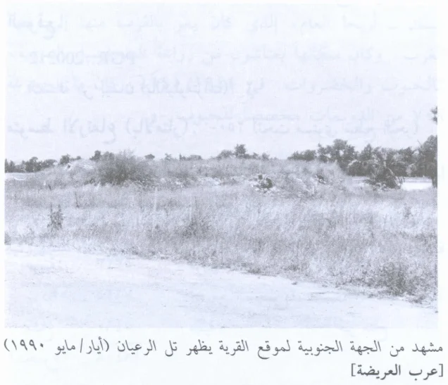
According to the field description used by Walid Khalidi, no visible trace of the Palestinian village remained.
The entire village site was planted in wheat, while the archaeological site of Tall al-Ru'yan had been transformed into a garbage dump.
Field photographs associated with the All That Remains project were taken in May 1990 and document the former village site and Tall al-Ru'yan.
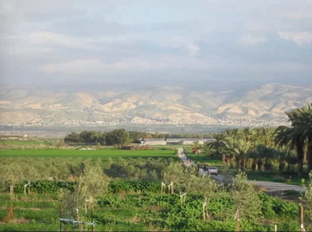
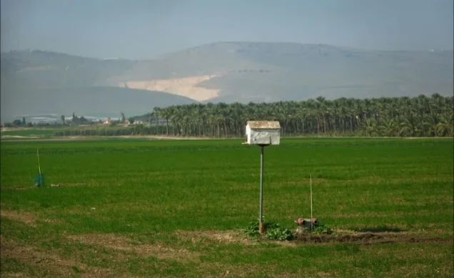
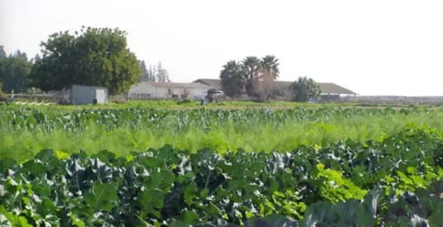
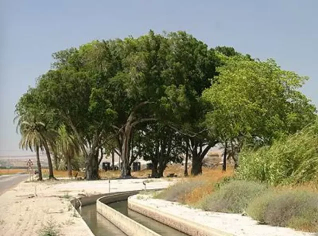
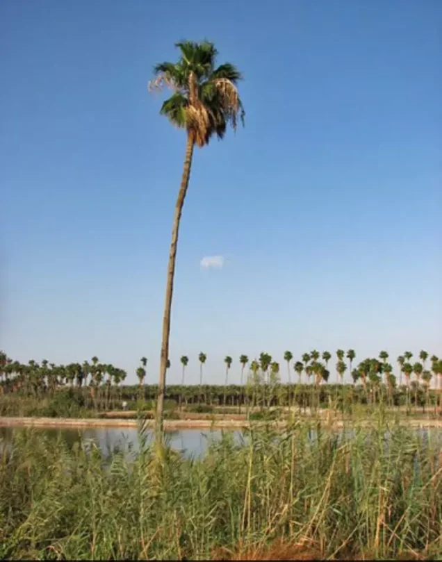
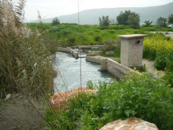
Later Palestinian community photographs also document the agricultural lands, water channels, and surrounding landscape. These are valuable community records but do not constitute a comprehensive archaeological or cadastral survey.
Khalidi's description should therefore be understood as historical field documentation from around 1990 rather than as a comprehensive direct survey of the entire village area in 2026.
Sources
- PalQuest – Interactive Encyclopedia of the Palestine Question: 'Arab al-'Arida
- PalQuest – Operation Gideon
- Palestine Remembered – 'Arab al-'Arida, Baysan Subdistrict
- Palestine Encyclopedia – 'Arab al-'Arida, drawing on Mustafa Murad al-Dabbagh's Biladuna Filastin
- Palestinian Villages Encyclopedia – 'Arab al-'Arida / al-'Arida
- Falastinuna – 'Arab al-'Arida, Baysan Subdistrict
Photo gallery



Photos from the village's people
Photos sent in by visitors and published after review.
Add a photo of this village
Log in to add photos of this village.
Other villages from Baysan
More from the archive



 Download Our Palestine App
The whole archive in the palm of your hand: depopulated villages, the Nakba, the massacres and Al-Aqsa — free, with no ads to erase the story.
Download Our Palestine App
The whole archive in the palm of your hand: depopulated villages, the Nakba, the massacres and Al-Aqsa — free, with no ads to erase the story.



Comments
No comments yet — be the first to write one.
Add your comment
Name and email are optional. Comments appear after review.