
The depopulated village of Kafr Lam / District of Haifa
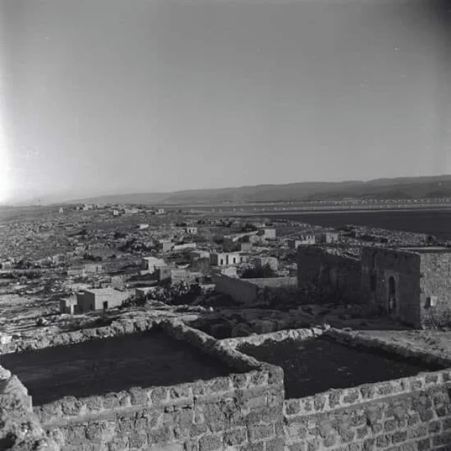
Kafr Lam
About the depopulated village of Kafr Lam
- District
- Haifa
- Date Kafr Lam was occupied
- 16 July 1948
- Population in 1948
- 390
- Military operation
- Coastal Clearing
- Who defended the village
- Local Palestinian militia, some Arab Liberation Army volunteers, and some support from the Iraqi Army in Tulkarm.
- Distance from the governorate centre
- 21.5 (km) South West of Haifa
- Elevation above sea level
- 25 m
- Cause of displacement
- Military assault by Zionist troops
- Extent of destruction
- The village has been mostly destroyed with the exception of two village house
- Ethnic cleansing
- Kafr Lam inhabitants were completely ethnically cleansed.
- Settlements built on the built-up area of Kafr Lam after 1948
- Part of Ein Ayala
- Refugees' migration routes
- The refugees were mostly expelled to the Triangle area and others to nearby POW camps.
Hover a dot to read the village name, or click to open its card.
Borders of the depopulated village of Kafr Lam
Kafr Lam – Depopulated Palestinian Village of the Haifa District
Kafr Lam was a depopulated Palestinian village in the Haifa District. It stood on a sandstone hill on the coastal plain approximately 21.5 kilometers southwest of Haifa, at an average elevation of about 25 meters above sea level.
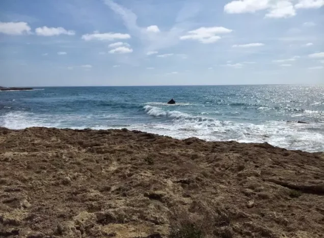
The village lay approximately one kilometer from the Mediterranean coast, while the coastal railway passed about 200 meters west of the built-up area.
Israeli occupation forces captured Kafr Lam in a limited offensive on 15–16 July 1948 during the Ten Days between the two truces. The attack was notable for naval fire support: two warships fired their light weapons toward Kafr Lam and neighboring Sarafand in support of the ground assault.
Location and Geography
Kafr Lam stood on a low sandstone hill on the Palestinian coastal plain close to the Mediterranean Sea.
It lay approximately 21.5 kilometers southwest of Haifa and at an average elevation of about 25 meters above sea level.
The Mediterranean coast was about one kilometer to the west, while the coastal railway linking Haifa with Jaffa and Egypt passed approximately 200 meters west of the village.
Kafr Lam's lands bordered Sarafand to the north, al-Tantura to the south, the Mediterranean Sea to the west, and the lands of Jaba', 'Ayn Ghazal, and Ijzim to the east.
Name
The name Kafr Lam appears in medieval Arabic geographical writing. Yaqut al-Hamawi referred to a locality near Caesarea by this or a closely related name.
Palestinian local tradition also associates the name with Banu Lam, a branch of the Tayy tribe said to have settled in the area.
The principal source does not conclusively establish this tribal etymology, so it is retained as a possible local tradition rather than a proven historical derivation.
Early Islamic and Medieval History
Walid Khalidi, citing Yaqut al-Hamawi, states that the town of Kafr Lam near Caesarea was founded by order of the Umayyad caliph Hisham ibn 'Abd al-Malik, who ruled from 724 to 743 CE.
The site formed part of the fortified coastal zone that acquired particular importance because of maritime threats and the coastal communications route.
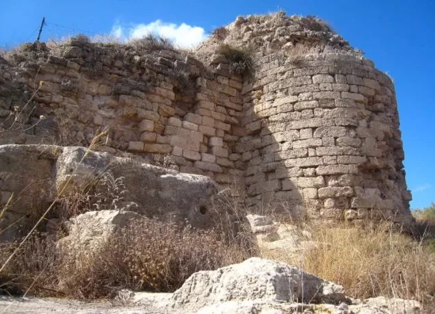
During the Crusader period a fortress known as Cafarlet was built at Kafr Lam.
Muslim forces captured it in 1265. It later returned to Crusader control before the Mamluks finally took it in 1291.
Ottoman Period
In 1596, Kafr Lam was recorded as a farm paying taxes to the Ottoman government.
In the nineteenth century, French traveler Victor Guérin described the village as standing on a small hill within an old stone enclosure and estimated its population at approximately 300.
In 1856, Mary Rogers described houses of stone and mud and surrounding fields rich in Indian corn, millet, sesame, tobacco, and gardens.
Built Environment
Modern houses in Kafr Lam were built of stone bonded with mud or cement and clustered closely together.
The official 1944/45 statistics classified approximately 14 dunams as built-up land.
The village contained a mosque and a school, while the historic fortress remained its most prominent architectural landmark.
Population and Houses
The inhabitants of Kafr Lam during the Mandate period were Muslims.
- 19th centuryAbout 300Estimate by Guérin
- 1922156Official Census of Palestine; all inhabitants were Muslims
- 1931215Official census including Kafr Lam Station: 107 males and 108 females
- 1945340Official statistics; all inhabitants were Palestinian Arab Muslims
- 1948About 394Later demographic estimate, not an official Mandate census
- 1998About 2,422 refugees and descendantsLater estimate published by Palestine Remembered
The official 1931 census recorded 50 houses, with the entry including Kafr Lam Station.
The Palestinian Encyclopedia gives a 1945 population figure of 240, but the official Village Statistics record 340. The official figure is therefore used here.
Mosque and Education
Kafr Lam had a mosque serving its Muslim inhabitants.
A boys' elementary school was established in 1882 during Ottoman rule.
Walid Khalidi records that the school was later closed during the British Mandate.
This article does not add later claims about reopening or pupil numbers because they are not sufficiently documented in the principal sources reviewed.
Water Resources
Five wells stood on Kafr Lam's village lands and supplied water for domestic and agricultural use.
The Palestinian Encyclopedia describes them as lying roughly along a north–south line and states that the village lands had no permanent springs.
Economic Life and Agriculture
Agriculture and livestock raising formed the basis of Kafr Lam's economy.
Cereals were the principal crops. Nineteenth-century descriptions also mention Indian corn, millet, sesame, tobacco, and gardens.
A relatively small area was devoted to plantations and irrigated cultivation.
Land Ownership, 1944/45
The total land area of Kafr Lam was 6,838 dunams according to the official Government of Palestine statistics.
- Arab5,104 dunums75%
- Jewish0 dunums0%
- Public1,734 dunums25%
The official figures balance exactly: 5,104 + 1,734 = 6,838 dunams.
Palestine Remembered presents the same totals using its own terminology: 5,104 dunams “Palestinian,” 0 dunams “Transferred to Zionists,” and 1,734 dunams “Communal/Public.”
The wording “Transferred to Zionists” should be preserved when reproducing that source's classification rather than automatically replacing it with the official “Jewish” category.
Land Use, 1944/45
- Arab
- Public
- Cereals5,052 dunums
- Plantations and irrigable land75 dunums
- Total cultivable/cultivated land5,127 dunums
- Non-cultivable land1,697 dunums
- Built-up land14 dunums
- Total non-cultivable and built-up1,711 dunums
The official table balances exactly: 5,127 dunams of cultivated or cultivable land plus 1,711 dunams of built-up and non-cultivable land equal the total village area of 6,838 dunams.
Palestine Remembered's simplified table lists 5,052 cereal dunams and 1,697 non-arable dunams in its Palestinian column. The official Government table shows that each figure includes Public land, so Arab and Public land have been separated above.
Archaeology and the Fortress
Kafr Lam was an important historic site on the Palestinian coast.
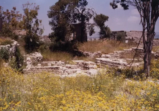
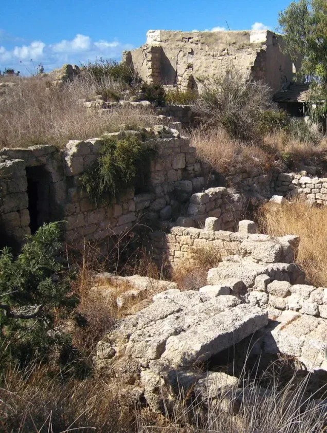
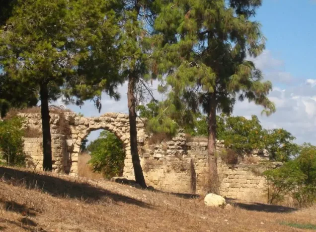
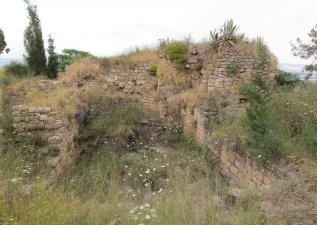
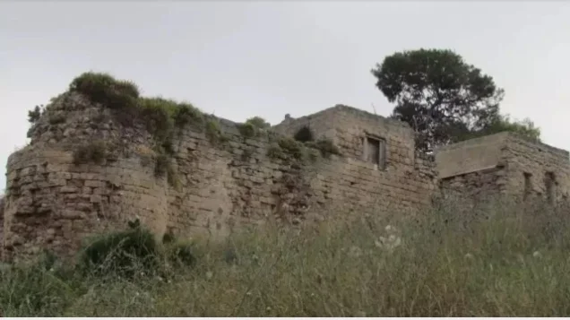
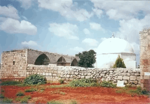
The old fortress was its most prominent surviving monument, reflecting successive Islamic, Crusader, and Mamluk phases.
Stone quarries, rock-cut features, cisterns, and other archaeological remains were also visible on village land.
The site should therefore not be reduced simply to a “Crusader fortress,” since the historical occupation and coastal fortification of Kafr Lam span a longer and more complex chronology.
Military Developments in 1948
Some secondary accounts state that Kafr Lam was temporarily evacuated in early May 1948, that some inhabitants subsequently returned, and that Carmeli Brigade troops briefly entered Kafr Lam and neighboring Sarafand on 15 May.
These details do not appear in Khalidi's principal Kafr Lam narrative and are therefore not used as the basis for dating the village's final occupation.
The principal source securely establishes a limited offensive against Kafr Lam, al-Tira, and Sarafand during the Ten Days between the two truces.
Final Occupation of Kafr Lam
The final assault on Kafr Lam took place on 15–16 July 1948.
Palestine Remembered and Falastinuna index 16 July as the village's single occupation date, consistent with Khalidi's broader 15–16 July range.
The assault was distinguished by naval fire support. Two warships fired light weapons toward Kafr Lam and Sarafand in support of the ground forces.
The source describes this as the first use of naval fire support in this form during the attacks on villages in that phase of the war.
Was Kafr Lam Captured during Operation Shoter?
No.
Kafr Lam was captured on 15–16 July, more than a week before Operation Shoter began.
Operation Shoter was launched on 24 July and primarily targeted the “Little Triangle” of Ijzim, 'Ayn Ghazal, and Jaba', which had continued resisting until late July.
Classifying Kafr Lam under Operation Shoter therefore confuses the mid-July coastal assault with the later operation against the Little Triangle.
Operation Name and Military Unit
Walid Khalidi does not give the 15–16 July assault on Kafr Lam a separate formal operational name. He describes it as one of the smaller operations carried out during the Ten Days between the truces.
Palestine Remembered uses the label “possibly the Coastal Clearing Operation,” but its own wording is explicitly tentative and the principal source does not establish this as a confirmed formal operation name.
Khalidi's Kafr Lam entry also does not identify a specific brigade or battalion as the ground formation that carried out the final occupation.
The most accurate village-level attribution is therefore: Israeli occupation forces in a ground assault supported by naval gunfire; the specific ground brigade is not established in the principal village source.
Depopulation
Khalidi's village-specific account does not give a detailed description of what happened to Kafr Lam's civilian population during the final assault.
It notes that neighboring al-Tira, captured during the same operation, was cleared of its inhabitants and that some residents of al-Tira were sent toward the Triangle while others were placed in prisoner-of-war camps.
Those details refer to al-Tira and should not automatically be transferred to Kafr Lam.
What is securely established is that Kafr Lam's Palestinian inhabitants were displaced in 1948 and prevented from returning.
Occupation Chronology
- Early May 1948
Reported temporary early departure
Secondary accounts state that villagers temporarily left and that some later returned; this phase is not described in Khalidi's principal village narrative.
- 15 May 1948
Reported temporary military entry
Secondary accounts describe a brief Carmeli Brigade presence in Kafr Lam and Sarafand; this is not treated as the final occupation.
- 15 July 1948
Beginning of the final assault
A limited offensive began against Kafr Lam, al-Tira, and Sarafand during the Ten Days.
- 15–16 July 1948
Naval fire support
Two warships fired toward Kafr Lam and Sarafand in support of the ground assault.
- 16 July 1948
Final occupation
The village was fully occupied; this is the single date indexed by several Palestinian sources.
- 24–26 July 1948
Operation Shoter
A later operation against Ijzim, 'Ayn Ghazal, and Jaba'; it was not the operation that captured Kafr Lam.
- After 1948
Later demolition
Most village houses were demolished, while the fortress and several buildings remained.
Israeli Settlements on Village Lands
Two Israeli settlements were established on Kafr Lam village land in 1949.
HaBonim was established west of the village site by Zionist immigrants from South Africa and Britain.
Ein Ayala was established southeast of the village site, also on Kafr Lam's lands.
These should be distinguished from nearby Israeli localities established on the lands of neighboring Palestinian villages.
Kafr Lam Today
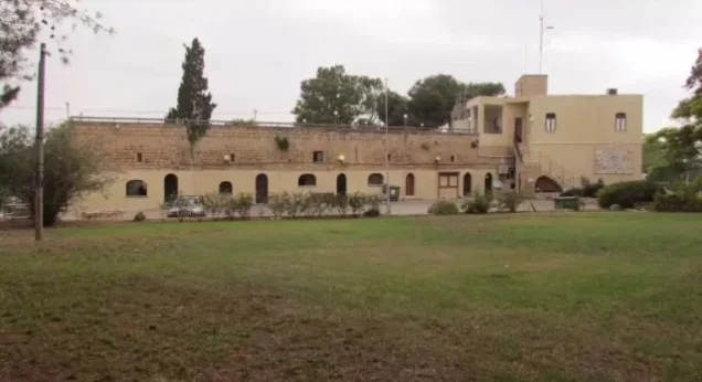
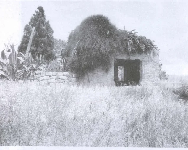
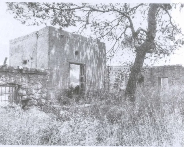
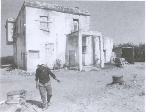
According to the field description published in Walid Khalidi's All That Remains, the historic fortress remained standing together with several Palestinian houses.
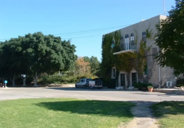
The house of Ahmad Bey Khalil had been converted into a school, while another Palestinian house was being used as a post office.
Most of the village's other structures had been demolished or their use altered after Israeli settlements were established on the land.
This account should not be treated as a comprehensive field verification of conditions in 2026. Field research for All That Remains was conducted between 1987 and 1990 and therefore documents the site's condition during that survey period.
Sources
- PalQuest – Interactive Encyclopedia of the Palestine Question: Kafr Lam
- Palestine Remembered – Kafr Lam, Haifa District
- Palestine Remembered – Walid Khalidi's account of Kafr Lam
- Palestinian Villages Encyclopedia – Kafr Lam; supporting Palestinian documentation
- Falastinuna – Kafr Lam
- Palestinian Encyclopedia – Kafr Lam
- Government of Palestine / PCBS – Census of Palestine 1931: Kafr Lam and Kafr Lam Station
- Government of Palestine – Census of Palestine 1922
- Village Statistics 1945 – Population and Land Ownership, Haifa Sub-District
- Village Statistics 1945 – Kafr Lam Land Use
- Institute for Palestine Studies – Walid Khalidi, All That Remains
- PalQuest – All That Remains: Methodology
Photo gallery

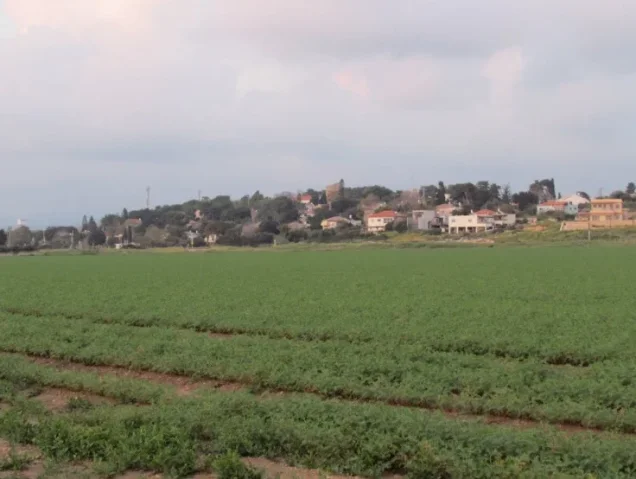
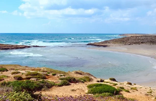
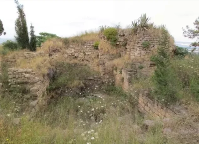
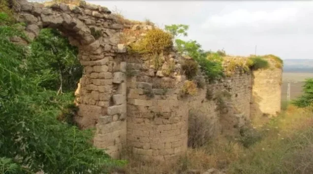
Photos from the village's people
Photos sent in by visitors and published after review.
Add a photo of this village
Log in to add photos of this village.
Other villages from Haifa

More from the archive
 Download Our Palestine App
The whole archive in the palm of your hand: depopulated villages, the Nakba, the massacres and Al-Aqsa — free, with no ads to erase the story.
Download Our Palestine App
The whole archive in the palm of your hand: depopulated villages, the Nakba, the massacres and Al-Aqsa — free, with no ads to erase the story.



Comments
No comments yet — be the first to write one.
Add your comment
Name and email are optional. Comments appear after review.