
The depopulated village of Al-Sarafand / District of Haifa
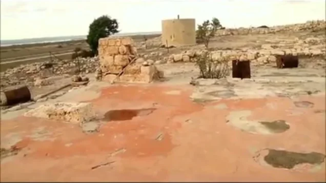
Al-Sarafand
About the depopulated village of Al-Sarafand
- District
- Haifa
- Date Al-Sarafand was occupied
- 16 July 1948
- Population in 1948
- 340
- Military operation
- Operation Shoter (“Policeman”)
- Brigade that carried it out
- Alexandroni Brigade، The Carmeli Brigade
- Who defended the village
- Local Palestinian militia, some Arab Liberation Army volunteers, and possibly some help from the Iraqi army in Tulkarm and Jinin
- Distance from the governorate centre
- 19 (km) South West of Haifa
- Elevation above sea level
- 25 m
- Cause of displacement
- Military assault by Zionist troops
- Extent of destruction
- al-Sarafand inhabitants were completely ethnically cleansed.
- Ethnic cleansing
- لقد تم تطهير البلدة عرقياً بالكامل
- Settlements built on the built-up area of Al-Sarafand after 1948
- Tzrufa
- Refugees' migration routes
- The refugees were mostly expelled first eastward to al-Tira, and then they were expelled again to but this time to Jinin (West Bank)
Hover a dot to read the village name, or click to open its card.
Borders of the depopulated village of Al-Sarafand
Al-Sarafand – A Depopulated Palestinian Village in the Haifa Subdistrict
Al-Sarafand was a Palestinian village in the Haifa Subdistrict, situated approximately 19 km southwest of Haifa on the narrow coastal plain south of 'Atlit. It stood on a low sandstone hill at an average elevation of about 25 meters above sea level.
Secondary roads connected the village with neighboring Palestinian communities and with the coastal highway, which passed approximately two kilometers east of the site.
Al-Sarafand was occupied by Israeli forces on 16 July 1948 during a limited offensive in the “Ten Days” between the two truces. Two warships provided covering fire for a ground assault against al-Sarafand and nearby Kafr Lam in an operation that also resulted in the capture of al-Tira.
- Subdistrict
- Haifa
- Distance from Haifa
- Approximately 19 km southwest
- Elevation
- Approximately 25 m above sea level
- Physical setting
- Narrow coastal plain on a low sandstone hill south of 'Atlit
- Population, 1944/45
- 290
- Total land area
- 5,409 dunums
- Date of occupation
- 16 July 1948
- Military operation
- A limited offensive during the “Ten Days”; no specific operation name is securely established by the principal village source
- Military force
- Israeli ground forces supported by two warships; the village-specific Khalidi entry does not conclusively identify the assault brigade
- Israeli settlement on village land
- Tzerufa, established in 1949
Location and Geography of Al-Sarafand
Al-Sarafand stood on a low sandstone hill in the narrow coastal plain south of 'Atlit. The hill rose only slightly above the surrounding countryside.
The main coastal highway ran about two kilometers east of the village, while secondary roads linked al-Sarafand with 'Atlit, Kafr Lam, Jaba', Ijzim, 'Ayn Ghazal, and other nearby communities.
Local Palestinian geographical sources place the Mediterranean Sea along the western edge of the village lands, 'Atlit and al-Mazar to the north, Kafr Lam to the south, and the lands of Jaba', Ijzim, and 'Ayn Ghazal generally to the east.
Name and Earlier History
Crusader sources referred to the locality as Sarepta Yudee.
The Palestinian Encyclopedia suggests that the Arabic name Sarafand may derive from the Syriac root “Sarfa,” associated with smelting or refining metals. This is best treated as a proposed etymology rather than a conclusively established origin.
Al-Sarafand of Haifa should not be confused with Sarafand al-'Amar or Sarafand al-Kharab in the Ramla Subdistrict, or with another locality called Sarafand near Sidon in Lebanon.
Al-Sarafand under Ottoman Rule
In 1596, al-Sarafand was recorded in the nahiya of Shafa in the liwa' of Lajjun, with an estimated population of approximately 61.
Villagers paid taxes on wheat and barley as well as on goats, beehives, and other forms of production.
In the late nineteenth century, al-Sarafand was described as a village standing on elevated ground between the plain and the coast, with an estimated population of about 150 cultivating approximately sixteen faddans.
Built Form of the Village
The village extended generally from north to south. Its houses were closely clustered and built of stone bonded with either mud or cement.
The built-up area was small: the 1944/45 Village Statistics classified only 6 dunums as built-up land.
Later Palestinian local documentation records a mosque and a local shrine known as the maqam of al-Hajj Ahmad 'Abd Allah al-Masri. Khalidi's principal village entry does not describe these structures in detail, so their history is presented as local documentation.
Population of Al-Sarafand
The official 1922 Census of Palestine recorded 204 inhabitants in al-Sarafand.
By the official 1931 census, the population stood at 188, living in 38 occupied houses.
The 1944/45 Village Statistics recorded 290 Arabs.
Palestine Remembered later estimated the village population at 336 in 1948 and the number of refugees and their descendants at 2,066 in 1998. These are retrospective estimates rather than official British Mandate census counts.
- 1596Approximately 61Estimate derived from Ottoman tax records
- Late 19th centuryApproximately 150Historical estimate
- 1922204Official Census of Palestine
- 1931188Official census
- 1944/45290Official British Mandate statistics
- 1948336Later Palestine Remembered estimate, not an official census
- 19982,066 refugeesLater estimate of refugees and their descendants
Number of Houses
- 193138Occupied houses recorded in the official census
- 194867Later estimate reported by Palestine Remembered
Land Ownership in Al-Sarafand
The total land area of al-Sarafand in the 1944/45 statistics was 5,409 dunums. Palestine Remembered presents the simplified ownership categories as follows:
- Palestinian3,486 dunums64%
- Transferred to Zionists0 dunums0%
- Communal/Public1,923 dunums36%
The official Village Statistics use the categories Arab and Public: 3,486 dunums were classified as Arab land and 1,923 dunums as public land. No land was recorded under the Jewish category.
Land Use in 1944/45
- Arab
- Public
- Cereals3,249 dunums
- Plantations and irrigable land22 dunums
- Built-up land6 dunums
- Non-cultivable land2,132 dunums
Cultivable land totaled 3,271 dunums, approximately 60 percent of the village area: 3,266 Arab dunums and 5 public dunums.
The full 3,249-dunum cereal total should not be treated as privately Palestinian-owned land; it comprised 3,244 Arab and 5 public dunums.
Likewise, the 2,132 dunums of non-cultivable land consisted of 214 Arab and 1,918 public dunums.
Economic Life
Agriculture, livestock raising, and salt extraction formed the principal basis of village life. Grain was the main agricultural crop.
In 1944/45, 3,244 Arab dunums were devoted to cereals, while 22 dunums were classified as plantations and irrigable land.
Date palms grew in small patches on the western side of the village lands. Later local Palestinian documentation also refers to fishing as a source of livelihood because of the village's proximity to the Mediterranean, although Khalidi's principal entry emphasizes agriculture, animal husbandry, and salt production.
Water
Al-Sarafand did not depend on a major natural spring. Instead, villagers dug numerous wells across the village lands to provide domestic water.
Khalidi records more than ten wells, while later local documentation specifies approximately eleven.
Wadi al-Mughar also crossed the northwestern edge of the village lands before reaching the Mediterranean.
Education
Khalidi's principal village entry does not identify an independent school building within al-Sarafand.
A later local study states that the village did not have its own school and that some children walked to neighboring villages for education.
However, documentary material preserved by Palestine Remembered from 1945–1947 refers to a teacher appointed to a “Kafr Lam and al-Sarafand School”. A letter dated 11 November 1945 from the mukhtars and leading residents of both villages to the Inspector of Education also discusses that teacher.
The most cautious conclusion is therefore that the sources do not securely establish a separate school building inside al-Sarafand, but they do provide evidence of a joint educational arrangement associated with Kafr Lam and al-Sarafand during the final years of the Mandate.
Mosque and Cemetery
Later Palestinian local documentation records a mosque in al-Sarafand, as well as a local shrine associated with al-Hajj Ahmad 'Abd Allah al-Masri.
Community documentation after the Nakba also records the village cemetery and surviving remains of the mosque.
Khalidi's principal entry does not provide a detailed history of these structures, so information concerning the mosque's age and the shrine is presented as local historical documentation.
Archaeological Remains
The Crusader name “Sarepta Yudee” demonstrates that the locality was known in medieval sources.
Palestinian local documentation also reports graves, burials, pottery fragments, and other antiquities across the village lands, although no detailed archaeological study is cited that would allow every remain to be securely dated.
It is therefore appropriate to describe al-Sarafand as containing archaeological traces from earlier periods without assigning all remains to specific dates in the absence of stronger archaeological documentation.
The July 1948 Assault
During the “Ten Days” between the two truces, from 8 to 18 July 1948, Israeli occupation forces conducted several offensives south of Haifa.
A limited military thrust was carried out on 15–16 July against a cluster of coastal villages. On 16 July 1948, two warships fired on al-Sarafand and Kafr Lam to provide covering fire for the main land assault.
Khalidi, citing the History of the War of Independence, describes this as the first instance in which naval fire support was coordinated with ground troops in an assault of this kind.
The same operation resulted in the occupation of Kafr Lam, al-Sarafand, and al-Tira, and possibly 'Ayn Hawd.
Was Al-Sarafand Occupied during Operation Shoter?
Palestine Remembered classifies the occupation of al-Sarafand under Operation Shoter and describes a force composed of naval personnel and elements of the Carmeli and Alexandroni brigades.
This classification creates a clear chronological problem. Operation Shoter proper began on 24 July 1948, roughly eight days after al-Sarafand had already been occupied, and its principal targets were the “Little Triangle” villages of Ijzim, Jaba', and 'Ayn Ghazal.
This article therefore does not describe al-Sarafand's capture as part of Operation Shoter. The more precise formulation is that it was occupied in a limited offensive on 15–16 July during the Ten Days, involving ground forces supported by naval fire.
The village-specific Khalidi entry does not conclusively identify the ground brigade that physically entered al-Sarafand, so the occupation is not attributed definitively to either Carmeli or Alexandroni without additional independent documentation.
Depopulation of Al-Sarafand
Khalidi considers it possible that the villagers were expelled after the occupation, as occurred in neighboring al-Tira, which was captured in the same operation.
For al-Tira, the sources document that most remaining inhabitants were expelled toward the Jenin–Nablus–Tulkarm Triangle, while others were held in prisoner-of-war camps. This provides important regional context but does not independently establish the route taken by every family from al-Sarafand.
Later local Palestinian documentation also recounts the killing of eleven young men on 16 July. This incident is not documented in Khalidi's principal village entry or the core PalQuest account, so it should be treated as a local historical account requiring independent corroboration rather than as an equally established fact.
- 8 July 1948
Beginning of the “Ten Days”
Fighting resumed between the two truces
- 15–16 July 1948
Limited offensive south of Haifa
Attack on Kafr Lam, al-Sarafand, and al-Tira with naval support
- 16 July 1948
Occupation of al-Sarafand
Two warships provided covering fire for the ground assault
- July 1948
Depopulation
Khalidi considers expulsion after occupation probable
- 24–26 July 1948
Operation Shoter
Later operation directed principally against Ijzim, Jaba', and 'Ayn Ghazal; not treated here as the operation that captured al-Sarafand
Israeli Settlements on the Lands of Al-Sarafand
On 3 August 1948, Kibbutz Neve-Yam requested that the Israeli agricultural authorities allocate the lands of depopulated al-Sarafand to it for expansion.
Tzerufa: Established in 1949 on the lands of al-Sarafand, approximately one kilometer northeast of the former village site.
Geva' Karmel: Also established in 1949 east of al-Sarafand. Khalidi, however, places it on the lands of neighboring Jaba', so it is not classified here as a settlement founded on al-Sarafand's land.
Al-Sarafand Today
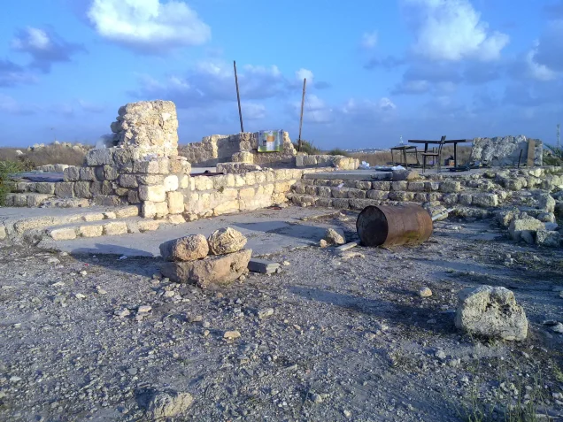
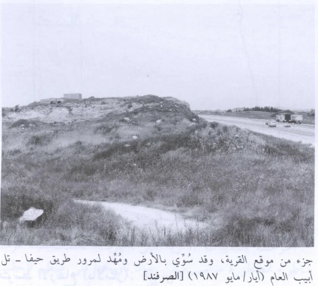
According to Walid Khalidi's field description in All That Remains, only one village house remained standing—a relatively large structure with two arches in its façade.
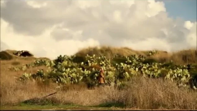
The Haifa–Tel Aviv highway crossed part of the former village site, while another part had been fenced with barbed wire and was covered with thorns and cactus.
This description derives from fieldwork conducted before the publication of All That Remains in 1992 and should not by itself be treated as direct field verification of conditions in 2026.
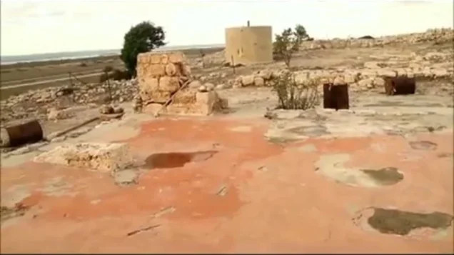
Palestine Remembered contains later community documentation of the cemetery, mosque remains, a water reservoir, and house rubble. It also includes material associated with a visit to the village site in 2025 and additional material published in 2026. This later documentation indicates that a number of identifiable traces remain, but it does not constitute a comprehensive professional archaeological or architectural survey of the site.
Sources
- PalQuestPalQuest – Interactive Encyclopedia of the Palestine Question: al-Sarafand
- PalQuestPalQuest – Kafr Lam: the limited 15–16 July 1948 offensive
- PalQuestPalQuest – Ijzim: Operation Shoter and its chronology
- Palestine RememberedPalestine Remembered – al-Sarafand, Haifa
- Palestine RememberedPalestine Remembered – al-Sarafand entry from All That Remains
- Institute for Palestine StudiesInstitute for Palestine Studies – Walid Khalidi, All That Remains
- pcbs.gov.psGovernment of Palestine – Census of Palestine 1922
- fada.birzeit.eduBirzeit University Repository – Census of Palestine 1931
- maktabatsabil.comGovernment of Palestine – Village Statistics 1945: Haifa Sub-District, Population and Land Ownership
- palqura.comPalestinian Villages Encyclopedia – al-Sarafand: local documentation on education, mosque, families, and landmarks
Photo gallery
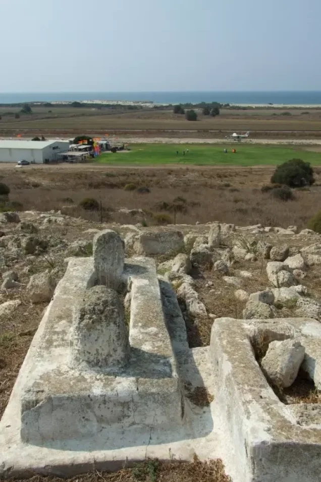

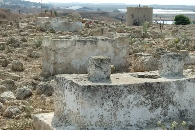
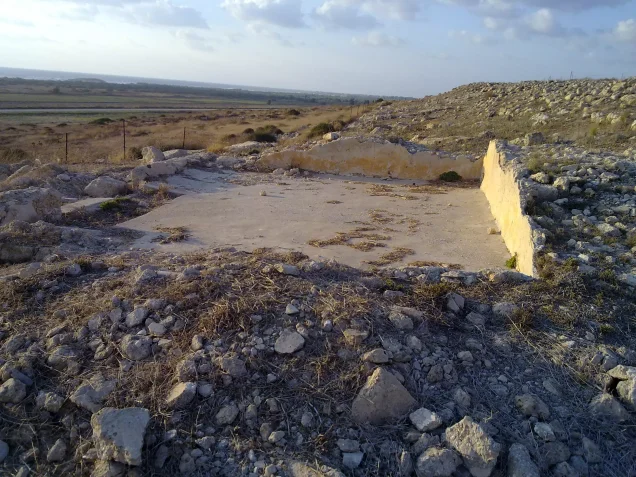


Photos from the village's people
Photos sent in by visitors and published after review.
Add a photo of this village
Log in to add photos of this village.
Other villages from Haifa
More from the archive



 Download Our Palestine App
The whole archive in the palm of your hand: depopulated villages, the Nakba, the massacres and Al-Aqsa — free, with no ads to erase the story.
Download Our Palestine App
The whole archive in the palm of your hand: depopulated villages, the Nakba, the massacres and Al-Aqsa — free, with no ads to erase the story.



Comments
No comments yet — be the first to write one.
Add your comment
Name and email are optional. Comments appear after review.