
The depopulated village of 'Atlit / District of Haifa

About the depopulated village of 'Atlit
- District
- Haifa
- Population in 1948
- 174
- Distance from the governorate centre
- 12.5 km from Haifa
- Elevation above sea level
- 25 m
- Settlements built on the land of 'Atlit before 1948
- 'Atlit, established by the Zionists in 1903 near the village and given the same name; Newe Yam, established in 1939; both are now on village lands
Hover a dot to read the village name, or click to open its card.
'Atlit – A Depopulated Palestinian Village in the Haifa Subdistrict
'Atlit was a Palestinian village in the Haifa Subdistrict, approximately 12.5 km southwest of the city of Haifa. It stood on a sandstone hill overlooking the Mediterranean Sea at an average elevation of about 25 meters above sea level.
The history of Palestinian 'Atlit must be distinguished from that of the Jewish settlement established nearby in 1903 under the same name. Later British Mandate statistics frequently combined the Palestinian village, the Jewish settlement, and several industrial and administrative sites into a single statistical unit. Total population and housing figures from those censuses should therefore not automatically be treated as figures for the Palestinian village alone.
The principal sources do not establish a definite date or method for the depopulation of Palestinian 'Atlit in 1948. Palestine Remembered lists 15 May 1948 as the occupation date, but Walid Khalidi explicitly states that it is not known when the Arab village fell into Zionist hands or by what means.
- Subdistrict
- Haifa
- Distance from Haifa
- 12.5 km from Haifa
- Elevation
- 25 m above sea level
- Population in 1931
- 452 – Arab population; the same statistical unit also recorded 496 Jews (total 948)
- Number of Houses in 1931
- 193 – for the whole statistical unit, which included the settlement of 'Atlit, not the Palestinian village alone
- Physical setting
- Sandstone hill overlooking the Mediterranean
- Arab population, 1944/45
- 150 – Arab population (90 Muslims and 60 Christians); the same statistical unit also recorded 510 Jews (total 660)
- Estimated Population in 1948
- About 174 – a later demographic estimate, not an official census
- Total statistical-unit population, 1944/45
- 660: 150 Arabs and 510 Jews
- Total land area
- 9,083 dunams – total for the statistical unit, of which only 15 dunams remained in Arab hands; 5,262 dunams were Jewish-owned and 3,806 dunams public
- Attack and Depopulation
- The sources do not say how or when the Palestinian village fell and its inhabitants were displaced: Khalidi states that it is not clear when the Arab village of 'Atlit fell into Zionist hands or by what means, and that Israeli historian Benny Morris does not list it among the villages captured and depopulated in 1948.
- Final Israeli Control
- Not documented: according to Khalidi, it is not clear when the village fell into Zionist hands or by what means
- Date and method of depopulation
- Not established by the principal sources
- Military unit
- The sources identify no unit; the History of the Haganah, as cited by Khalidi, refers to the settlement of 'Atlit as a base of Haganah activity and a source of recruits living there
- Settlements established on village land
- 'Atlit, established by the Zionists in 1903 near the village and given the same name, and Newe Yam, established in 1939; both are now on village lands
Location and Geography of 'Atlit
'Atlit stood on a sandstone hill overlooking the Mediterranean. Coastal agricultural land extended to the east, while large evaporation pans used for extracting salt from seawater lay to the southwest.
The village occupied an important location near the coast and regional transportation routes. A railway line passed through the area, and 'Atlit had a railway station serving the locality and its surroundings.
Ancient and Medieval History
The area around 'Atlit contains exceptionally rich archaeological evidence. Excavations in Wadi al-Mughara, approximately three kilometers southeast of the village, identified evidence of early human occupation in the caves of al-Wad, al-Tabun, and al-Sukhul.
Approximately three kilometers northeast, at the entrance to Wadi Falah, excavations in a cave revealed evidence of Neolithic human presence.
Archaeological work east of the village also revealed a site occupied from the second millennium BCE to the seventh century CE. A Hellenistic source names the site Adarus and identifies it as a colony of Sidon.
The Arab geographer Yaqut al-Hamawi referred to a fortress at 'Atlit known as al-Ahmar, or “the Red Fortress.”
In 1218 the Crusaders constructed a fortified town and a major fortress at the site, naming it Castellum Peregrinorum, the “Castle of the Pilgrims.” It remained in Crusader hands until 1291.
In 1296 descendants of the 'Uwayrat tribe settled in 'Atlit and its vicinity. Ottoman records from 1596 refer to a farm at 'Atlit that paid taxes to the Ottoman government.
'Atlit in the Nineteenth Century
The British traveler James Buckingham observed the ruins of 'Atlit in the early nineteenth century. Later in the century, William Thomson described the Palestinian village as having been constructed within the ruins of the Crusader town.
The Survey of Western Palestine described 'Atlit as a small adobe-built hamlet with approximately 200 inhabitants cultivating about twenty faddans of land.
The Jewish Settlement of 'Atlit before the Nakba
In 1903 a Jewish settlement was established near the Palestinian village and given the same name, 'Atlit. This later created a complicated statistical situation in which the name referred to a wider unit containing both communities and several associated facilities.
During the First World War, the Jewish settlement became an important base for Nili, a Zionist intelligence network that supported Britain against the Ottoman Empire.
During the 1920s, the Palestinian village itself belonged to a regional cooperative association of approximately twenty-five villages in the Haifa Subdistrict that sought to improve the conditions of Palestinian peasants.
Population of Palestinian 'Atlit
Population statistics for 'Atlit must be read with particular care because the boundaries of the statistical unit changed over time.
In the official 1922 census, historical Palestinian 'Atlit was recorded separately with 81 inhabitants, all Muslims. The Jewish colony and the salt works were listed separately.
By the 1931 census, a broader statistical unit contained 948 inhabitants: 413 Muslims, 39 Christians, and 496 Jews. The Arab total was therefore 452, compared with 496 Jews.
The 1931 unit included historical 'Atlit, the Jewish settlement, the salt company, a labour group, the quarry, the Aaronsohn farm, the railway station, and the police post. The figures of 948 inhabitants and 193 houses therefore do not describe the Palestinian village alone.
By 1938, the combined village and settlement population stood at 732, including 508 Arabs and 224 Jews.
In 1944/45, the Arab population had fallen to 150—90 Muslims and 60 Christians—while the Jewish population stood at 510, producing a total statistical-unit population of 660.
Palestine Remembered gives a later estimate of 174 Arabs for 1948 and estimates the number of refugees and their descendants at 1,069 in 1998. These are retrospective estimates rather than official British Mandate census counts.
- Late 19th centuryApproximately 200Survey of Western Palestine estimate for the Palestinian hamlet
- 192281Official census for historical Palestinian 'Atlit; all Muslims
- 1931948 totalExpanded statistical unit: 452 Arabs and 496 Jews; not the Palestinian village alone
- 1938732 total508 Arabs and 224 Jews in the village and settlement combined
- 1944/45660 total150 Arabs—90 Muslims and 60 Christians—and 510 Jews
- 1948174 ArabsLater Palestine Remembered estimate, not an official census
- 19981,069 refugeesLater estimate of refugees and their descendants
Number of Houses
The 1931 census recorded 193 houses, but this figure applies to the wider statistical unit containing both the Palestinian village and the Jewish settlement and associated facilities.
- 1931193For the expanded statistical unit as a whole, not the Palestinian village alone
Land Ownership in 1944/45
The total area of the 'Atlit statistical unit was 9,083 dunums. Palestine Remembered presents the simplified ownership categories as follows:
- Palestinian15 dunums<1%
- Transferred to Zionists5,262 dunums58%
- Communal/Public3,806 dunums42%
The official Village Statistics use the categories Arab, Jewish, and Public: 15 dunums were classified as Arab, 5,262 as Jewish, and 3,806 as Public.
These figures show the dramatic change in landholding before the Nakba: by 1944/45 only 15 dunums remained classified as Arab land.
Land Use in 1944/45
- Arab
- Jewish
- Public
- Cereals3,416 dunums
- Plantations and irrigable land1,273 dunums
- Built-up land124 dunums
- Non-cultivable land4,270 dunums
Cultivable land totaled 4,689 dunums: 14 Arab, 4,431 Jewish, and 244 public dunums. Built-up and non-cultivable land totaled 4,394 dunums.
The present Palestine Remembered land-use table contains a display problem that assigns some public-land figures to the Palestinian column. The detailed PalQuest table reproducing the official Village Statistics has therefore been used for the breakdown above.
Economic Life
In the late nineteenth century Palestinian 'Atlit was a small agricultural hamlet, and the Survey of Western Palestine recorded its inhabitants as cultivating approximately twenty faddans.
The structure of landholding changed dramatically during the following decades. By 1944/45 only fifteen dunums remained in the Arab ownership category: three dunums of cereals, eleven dunums of plantations or irrigable land, and one non-cultivable dunum.
The wider 'Atlit area also contained salt evaporation works, quarries, and railway facilities. Because these belonged to the larger economic and statistical unit, they should not automatically be attributed to the economy of the Palestinian villagers alone.
The Railway Station
'Atlit had a railway station serving the village and the surrounding locality during the British Mandate period.
Khalidi's later field description recorded the station as still operating after the depopulation of the Palestinian village.
Archaeological Heritage
The 'Atlit area is exceptionally rich in archaeological remains. In addition to the prehistoric caves of Wadi al-Mughara and Wadi Falah, excavation has documented settlement extending from the second millennium BCE through the seventh century CE.
A Hellenistic source refers to the site as Adarus, while Yaqut al-Hamawi recorded a fortress called al-Ahmar.
The most prominent surviving monument is the Crusader Castle of the Pilgrims, constructed in 1218. During the 1930s, C. N. Johns excavated the Crusader town and fortress on behalf of the Department of Antiquities of Palestine.
Later research suggested that the northern harbor may originally have been Hellenistic. A Muslim cemetery east of the Crusader fortress contains an Arabic inscription dated to 1800.
Depopulation of Palestinian 'Atlit in 1948
The depopulation of 'Atlit is one of the cases for which the principal sources do not provide a securely established date or military operation.
Khalidi, citing the History of the Haganah, notes that the Jewish settlement at 'Atlit was a center of Haganah activity and a source of recruits.
At the same time, Khalidi observes that Israeli historian Benny Morris does not list Palestinian 'Atlit among the villages for which he documents capture and depopulation in 1948. Khalidi therefore concludes that it is not known when the Arab village fell into Zionist hands or by what means.
Palestine Remembered lists 15 May 1948 as the occupation date. Its own Khalidi-derived narrative, however, states that the timing and circumstances remain unknown. The 15 May date should therefore not be treated as a securely verified historical occupation date.
No specific military unit can be established with confidence as the force responsible for depopulating the Palestinian village. Haganah activity in the nearby Jewish settlement does not by itself establish which unit, if any, carried out the final removal of the Arab inhabitants.
| Issue | Historical Assessment |
|---|---|
| Date listed by Palestine Remembered | 15 May 1948 |
| Khalidi's assessment | The date and method by which Palestinian 'Atlit fell are unknown |
| Military unit | Not securely identified |
| Documented military context | The Jewish settlement of 'Atlit was a center of Haganah activity and recruitment |
Occupation and Depopulation Chronology
- 1903
Settlement on village lands
The Zionists established a settlement near 'Atlit and gave it the same name; during World War I it became a centre of Nili, a pro-British Zionist intelligence organisation. It now stands on village lands.
- 1939
Settlement on village lands
The settlement of Newe Yam was established; it now stands on village lands.
- 1938–1944/1945
Decline of the Arab population and its land
In 1938 the village and the settlement together had 732 inhabitants, 508 Arabs and 224 Jews; by 1944/45 the Arab inhabitants had fallen to 150, and only 15 dunams of land remained in Arab hands, according to Khalidi.
- Not given in the sources
Fall of the village and displacement of its inhabitants
Khalidi states that it is not clear when the Arab village of 'Atlit fell into Zionist hands or by what means; he notes that the History of the Haganah refers to the settlement as a base of Haganah activity, and that Benny Morris does not list 'Atlit among the villages captured and depopulated in 1948.
Israeli Settlements on the Lands of 'Atlit
'Atlit: A Jewish settlement bearing the same name was established in 1903 near the Palestinian village. Khalidi and PalQuest identify it as having been established on village land.
Newe Yam: Established in 1939 on land belonging to 'Atlit, also before the Nakba.
'Atlit therefore differs from many depopulated Palestinian villages in that Zionist settlements had already been established on its lands decades before 1948, and by the mid-1940s the Palestinian village had become part of a much larger settlement and economic complex carrying the same name.
'Atlit Today
According to the field description published by Walid Khalidi in All That Remains, no recognizable traces of the Arab houses remained. The railway station that had served the village was still in operation at the time of his documentation.
Khalidi also mentioned a nearby prison that Israel used in 1989 to hold Palestinian and Lebanese detainees. This describes the facility's use at that particular historical moment and should not automatically be treated as a statement about its present function.
Khalidi's description derives from fieldwork conducted before the publication of All That Remains in 1992 and therefore does not constitute direct field verification of conditions at the site in 2026.
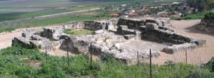
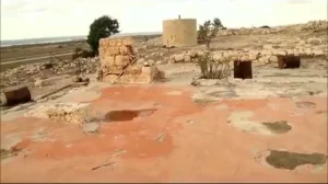
Palestine Remembered contains later community documentation of ruins, shrines, wells, and archaeological sites in the wider 'Atlit area. Some of this material also concerns neighboring localities such as Khirbat al-Shaykh Burayk, so not every later photograph should automatically be treated as evidence of surviving houses from Palestinian 'Atlit itself without more precise site identification.
Sources
- PalQuestPalQuest – Interactive Encyclopedia of the Palestine Question: 'Atlit
- Palestine RememberedPalestine Remembered – 'Atlit, Haifa
- Palestine RememberedPalestine Remembered – 'Atlit entry from All That Remains
- Institute for Palestine StudiesInstitute for Palestine Studies – Walid Khalidi, All That Remains
- pcbs.gov.psPalestinian Central Bureau of Statistics – Historical Census Reports, including the 1922 and 1931 censuses
- fada.birzeit.eduBirzeit University Repository – Census of Palestine 1931: Population of Villages, Towns and Administrative Areas
Photo gallery


Photos from the village's people
Photos sent in by visitors and published after review.
Add a photo of this village
Log in to add photos of this village.
Other villages from Haifa


More from the archive



 Download Our Palestine App
The whole archive in the palm of your hand: depopulated villages, the Nakba, the massacres and Al-Aqsa — free, with no ads to erase the story.
Download Our Palestine App
The whole archive in the palm of your hand: depopulated villages, the Nakba, the massacres and Al-Aqsa — free, with no ads to erase the story.



Comments
No comments yet — be the first to write one.
Add your comment
Name and email are optional. Comments appear after review.