
The depopulated village of Al-Sawamir / District of Haifa

Al-Sawamir
About the depopulated village of Al-Sawamir
- District
- Haifa
- Date Al-Sawamir was occupied
- 26 July 1948
- Military operation
- Operation Shoter (“Policeman”)
- Brigade that carried it out
- Alexandroni Brigade، Golani Brigade، The Carmeli Brigade
- Who defended the village
- Local Palestinian militia, Arab Liberation Army volunteers, and some assistance from the Iraqi army in Tulkarm and Jinin.
- Distance from the governorate centre
- 22 (km) South of Haifa
- Elevation above sea level
- 50 m
- Extent of destruction
- The village has been completely destroyed, and only house rubble left behind.
- Ethnic cleansing
- al-Sawamir inhabitants were completely ethnically cleansed.
- Refugees' migration routes
- Villagers were expelled eastward to Jinin
Hover a dot to read the village name, or click to open its card.
Al-Sawamir (Khirbat al-Sawamir) – Depopulated Palestinian Village in Haifa Subdistrict
Al-Sawamir, also known as Khirbat al-Sawamir, was a Palestinian village in the Haifa subdistrict. It stood on the lower western slopes of Mount Carmel overlooking the coastal plain, approximately 22 kilometers south of Haifa and about 50 meters above sea level.
Al-Sawamir was a small settlement and was classified as a hamlet in the Palestine Index Gazetteer during the British Mandate.
Its demographic and land statistics require particular caution. In the 1931 census Al-Sawamir was enumerated together with 'Ayn Ghazal and was not assigned a separate population or house total. It also does not appear as a separate locality in the published 1944/45 Village Statistics. Figures belonging to 'Ayn Ghazal should therefore not be transferred to Al-Sawamir.
The precise date of Al-Sawamir's occupation in 1948 is uncertain. Walid Khalidi considers it likely that the village fell well before the occupation of the Little Triangle at the end of July and suggests that it may have fallen around the same time as nearby al-Tantura, which was attacked on the night of 22–23 May 1948.
Key Facts about Al-Sawamir
| Field | Information |
|---|---|
| Name | Al-Sawamir |
| Alternative name | Khirbat al-Sawamir |
| Subdistrict | Haifa |
| Distance from Haifa | Approximately 22 km south |
| Average elevation | Approximately 50 m above sea level |
| Mandate classification | Hamlet |
| Population, 1922 | 17 Muslims |
| Population, 1931 | No independent figure; enumerated with 'Ayn Ghazal |
| Population, 1944/45 | No independent figure available |
| Land area | No independent 1944/45 land table has been established for Al-Sawamir |
| Occupation date | Uncertain; Khalidi suggests a date around the occupation of al-Tantura on 22–23 May 1948 |
| Military operation | No independently established village-specific operation |
| Military unit | No independently established village-specific attacking unit |
| Cause of depopulation | Military occupation and pressure amid the collapse of Palestinian coastal communities south of Haifa; village-specific circumstances remain unclear |
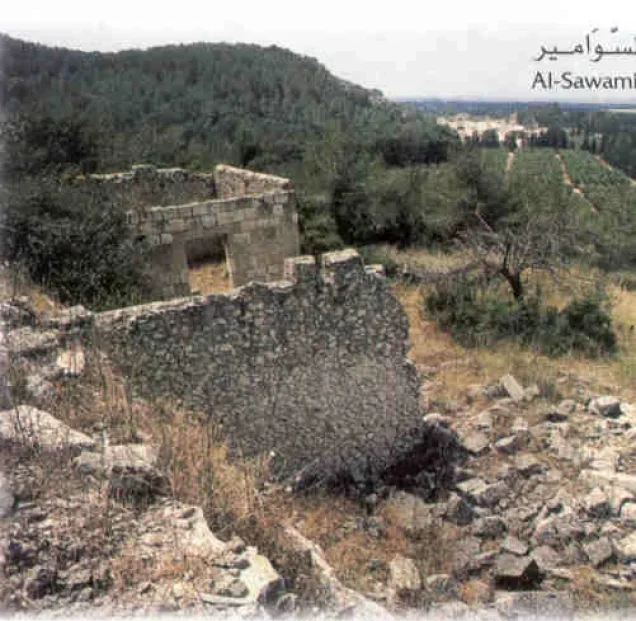
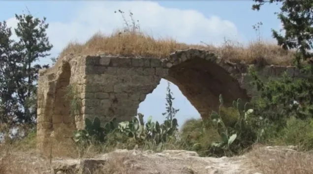
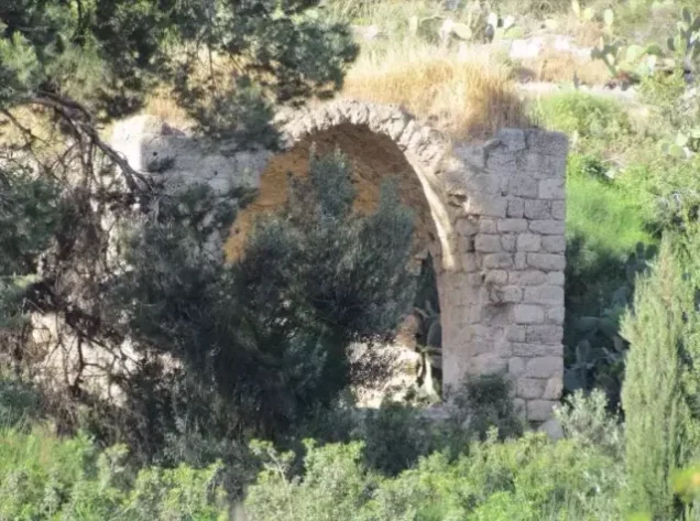
| Extent of destruction | Most of the village disappeared; two wall ruins and archaeological remains survived in later field documentation |
| Settlement on village land | Ofer – established in 1950 partly on Al-Sawamir land and partly on 'Ayn Ghazal land |
Name of the Village
The principal Palestinian sources use Al-Sawamir and Khirbat al-Sawamir. A slightly different Arabic spelling also appears in Mandate-era census material.
Khalidi does not provide a definitive explanation for the origin of the village name.
The nineteenth-century Survey of Western Palestine offered a linguistic gloss for “Suamir,” but because the principal Palestinian sources do not establish a clear historical etymology, that interpretation is not treated here as a definitive origin of the name.
Location
Al-Sawamir stood on the lower western slopes of Mount Carmel where the hills descended toward the coastal plain.
It lay immediately south of the group of villages later known as the Little Triangle: Jaba', 'Ayn Ghazal, and Ijzim.
'Ayn Ghazal was one of its closest neighboring villages, while Kafr Lam and al-Tantura were also nearby along the coastal zone and the main north–south road system.
Al-Sawamir in the Ottoman Period
In 1596 Al-Sawamir appeared in Ottoman fiscal records as a very small settlement with an estimated population of approximately 17.
Its inhabitants paid taxes on wheat and barley as well as goats, beehives, and other forms of production.
The records indicate an agricultural and pastoral economy at that time.
The 1596 population total is an estimate derived from a tax register rather than a modern census.
Al-Sawamir in the Nineteenth Century
British consul Edward Rogers estimated the population at approximately 120 in 1859 and recorded about 15 feddans under cultivation.
In 1882 the Survey of Western Palestine described Suamir as a small mud-built village at the edge of the plain with a well to the west.
These descriptions document the continued existence of a small agricultural community between the Carmel slopes and the coastal plain.
Population
| Year | Population | Nature of Figure |
|---|---|---|
| 1596 | Approximately 17 | Estimate derived from an Ottoman tax register |
| 1859 | Approximately 120 | Estimate by British consul Rogers, not an official census |
| 1922 | 17 | Official British Mandate census; all Muslims |
| 1931 | Not independently available | Al-Sawamir was enumerated together with 'Ayn Ghazal |
| 1944/45 | Not independently available | Al-Sawamir does not appear as a separate population unit in the published Village Statistics |
Correction to the 1931 Census Figure
Some websites display 1,439 as Al-Sawamir's 1931 population. This is incorrect.
The official 1931 census grouped 'Ayn Ghazal and Al-Sawamir together. The combined unit contained 1,439 Muslims—685 males and 754 females—in 247 houses.
Al-Sawamir appears in the official table without a separate population or house count.
Neither the 1,439 population nor the 247 houses can therefore be assigned to Al-Sawamir alone.
No Independent 1944/45 Statistics
Al-Sawamir does not appear as a separate locality in the published 1944/45 Village Statistics.
'Ayn Ghazal, by contrast, appears independently with a population of 2,170 and 18,079 dunums of registered land.
There is no basis for treating those 1945 figures as joint Al-Sawamir–'Ayn Ghazal data or for dividing them between the two localities.
No independent 1944/45 population, ownership, or land-use table has therefore been constructed for Al-Sawamir.
Number of Houses
No independent 1931 house count is available for Al-Sawamir because the published total of 247 houses belongs to the combined census unit with 'Ayn Ghazal.
No reliable independent 1948 house total has been identified either.
Land Ownership
Khalidi and PalQuest provide no independent 1944/45 land-ownership table for Al-Sawamir.
The 18,079 dunums officially recorded for 'Ayn Ghazal should not be reassigned to Al-Sawamir or artificially divided between the two villages.
The same applies to 'Ayn Ghazal's cereal, orchard, built-up, and non-cultivable land statistics.
Economic Life
Sixteenth-century fiscal records document wheat and barley cultivation, goats, and beehives at Al-Sawamir.
In 1859 cultivated land was again recorded around the village, and later nineteenth-century surveyors described it as a small settlement at the edge of the coastal plain.
These records establish its agricultural character, but the absence of an independent 1944/45 land table prevents a precise reconstruction of crop acreage immediately before the Nakba.
Water Resources
The Survey of Western Palestine recorded a well west of the village.
Khalidi also lists a well among the archaeological and structural remains at the locality.
The principal sources reviewed do not provide a complete independent inventory of the village's water system immediately before 1948.
Education and Public Institutions
Khalidi and PalQuest do not document an independent school, founding date, or enrollment figure for Al-Sawamir.
Nor do the principal village sources provide clear independent documentation of a mosque or other formal public institution.
Institutions belonging to 'Ayn Ghazal or other neighboring villages have therefore not been transferred to Al-Sawamir.
Archaeological Remains
The village site contained substantial older remains.
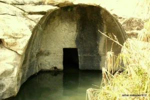
Khalidi records building foundations, cut building stones, caves, tombs, and a well.
The nineteenth-century Survey of Western Palestine also documented ruins, caves, and burial features in the surrounding area.
Khalidi does not securely date all of these remains, so they should not all be assigned to a single archaeological period without specialist evidence.
Occupation and Depopulation
No surviving village-specific account establishes the precise day on which Al-Sawamir was occupied or identifies the force that entered it.
Walid Khalidi notes that although Al-Sawamir lay immediately south of the Little Triangle villages that resisted until late July 1948, it probably fell considerably earlier.
He suggests that it may have fallen around the same time as nearby al-Tantura, which was attacked on the night of 22–23 May 1948.
This is a chronological inference rather than a confirmed occupation date. Khalidi does not state that the force that captured al-Tantura necessarily captured Al-Sawamir.
Correcting the Operation Shoter Attribution
Palestine Remembered's statistical header displays 22 May 1948 as the occupation date while simultaneously identifying Operation Shoter and a combined force from the Golani, Carmeli, and Alexandroni brigades.
These elements do not describe a single event.
Operation Shoter took place in late July 1948 and principally targeted the Little Triangle villages of Ijzim, 'Ayn Ghazal, and Jaba'. The main assault began on 24 July and the three villages were occupied by 26 July.
Khalidi's Al-Sawamir entry, by contrast, considers the village likely to have fallen before this operation, possibly in late May.
This article therefore does not identify Operation Shoter as the operation that occupied Al-Sawamir and does not assign its combined Golani–Carmeli–Alexandroni force as the village's direct attacking formation.
Did Al-Sawamir Fall with al-Tantura?
Al-Tantura was attacked on the night of 22–23 May 1948 by the Thirty-Third Battalion, identified in Khalidi's account as the Third Battalion of the Alexandroni Brigade.
For Al-Sawamir, however, Khalidi uses only the qualified suggestion that the village “may” have fallen at approximately the same time.
The Alexandroni attribution documented for al-Tantura should therefore not be transferred to Al-Sawamir without independent village-specific evidence.
Cause of Depopulation and Ethnic Cleansing
Al-Sawamir's Palestinian community disappeared during the military conquest of the coastal region south of Haifa in 1948.
Khalidi does not provide a village-specific account establishing whether the inhabitants were directly expelled, departed immediately before occupation, or left under the pressure created by the fall of surrounding communities.
Palestine Remembered characterizes the final outcome as complete ethnic cleansing.
The term is therefore retained as an attributed characterization used by Palestine Remembered, while the directly established descriptive fact is the complete depopulation of the Palestinian community at Al-Sawamir.
Occupation Chronology
- May 1948
Remaining Palestinian coastal communities
Several Palestinian localities remained along the coastal belt south of Haifa after the city's fall.
- Night of 22–23 May 1948
Occupation of al-Tantura
The Thirty-Third Battalion of the Alexandroni Brigade attacked and captured al-Tantura.
- Around late May 1948
Probable occupation period for Al-Sawamir
Khalidi suggests that Al-Sawamir may have fallen at approximately the same time as al-Tantura; the precise date and attacking unit remain unconfirmed.
- 18 June and 8 July 1948
Failed attacks on the Little Triangle
Attempts were made against the Ijzim–'Ayn Ghazal–Jaba' pocket; these should not automatically be treated as attacks on Al-Sawamir.
- 24–26 July 1948
Operation Shoter
The operation targeted the Little Triangle and ended with the occupation of Ijzim, 'Ayn Ghazal, and Jaba'; Khalidi does not identify it as Al-Sawamir's occupation operation.
- Precise date not documented
Destruction
Most of the village disappeared, leaving two wall ruins and other remains in Khalidi's later site description.
Israeli Settlements and Al-Sawamir's Lands
| Settlement | Established | Relationship to Al-Sawamir |
|---|---|---|
| En Ayyala | 1949 | Established west of Al-Sawamir on land belonging to Kafr Lam, not on Al-Sawamir land |
| Ofer | 1950 | Partly established on Al-Sawamir land and partly on land formerly belonging to 'Ayn Ghazal |
Ofer is therefore the settlement that Khalidi directly identifies as partly occupying Al-Sawamir's land. En Ayyala was geographically close and its residents cultivated adjacent coastal land, but the settlement itself was established on Kafr Lam's land.
Al-Sawamir Today
According to Walid Khalidi's field description, the ruins of two walls that had once formed part of a village building remained visible at the site.
The former village site had been enclosed by barbed wire.
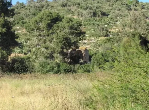
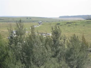
Pine trees covered a large portion of the locality, while pomegranate and fig trees and cactus plants were scattered across it.
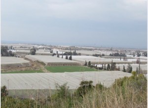
The surrounding coastal lands were used by Israeli farmers to grow vegetables and fruit, particularly bananas.
This description derives from fieldwork undertaken before the publication of All That Remains in 1992 and should therefore be treated as documented historical site evidence rather than comprehensive direct verification of conditions in 2026.
Sources
- PalQuest – Interactive Encyclopedia of the Palestine Question: Al-Sawamir
- Palestine Remembered – Al-Sawamir, Haifa District
- Walid Khalidi – All That Remains: Al-Sawamir
- PalQuest – al-Tantura, for the 22–23 May 1948 military chronology
- PalQuest – Ijzim, documenting Operation Shoter and the Little Triangle
- PalQuest – 'Ayn Ghazal, confirming the combined 1931 census unit
- Government of Palestine – Census of Palestine 1922
- Government of Palestine – Census of Palestine 1931
- Survey of Western Palestine, Volume II – nineteenth-century description of Suamir
- Institute for Palestine Studies – All That Remains, Walid Khalidi
Photo gallery
Photos from the village's people
Photos sent in by visitors and published after review.
Add a photo of this village
Log in to add photos of this village.
Other villages from Haifa
More from the archive



 Download Our Palestine App
The whole archive in the palm of your hand: depopulated villages, the Nakba, the massacres and Al-Aqsa — free, with no ads to erase the story.
Download Our Palestine App
The whole archive in the palm of your hand: depopulated villages, the Nakba, the massacres and Al-Aqsa — free, with no ads to erase the story.



Comments
No comments yet — be the first to write one.
Add your comment
Name and email are optional. Comments appear after review.