
The depopulated village of Balad al-Shaykh / District of Haifa
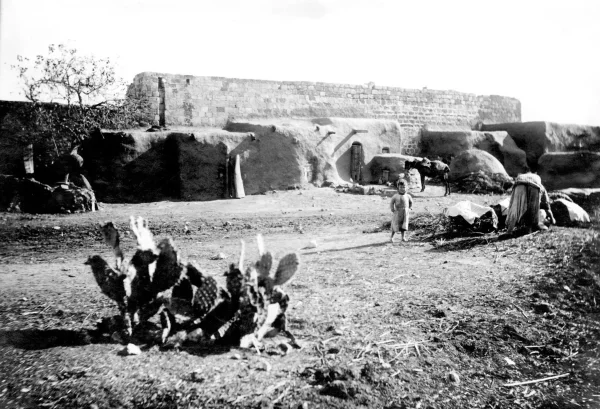
Balad al-Shaykh
About the depopulated village of Balad al-Shaykh
- District
- Haifa
- Date Balad al-Shaykh was occupied
- 24 April 1948
- Population in 1948
- 4,779
- Military operation
- Operation Bi'ur Hametz (part of Operation Misparayim)
- Brigade that carried it out
- The Carmeli Brigade
- Distance from the governorate centre
- 7 km southeast of Haifa
- Elevation above sea level
- 75 m
- Cause of displacement
- Direct military assault by Zionist forces: the massacre of December 1947, then the siege and shelling of 24 April 1948, which ended with the evacuation of the inhabitants under a truce arranged by the British
- Extent of destruction
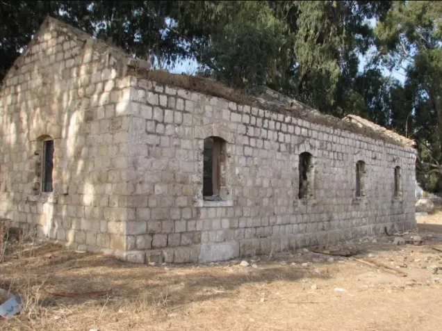
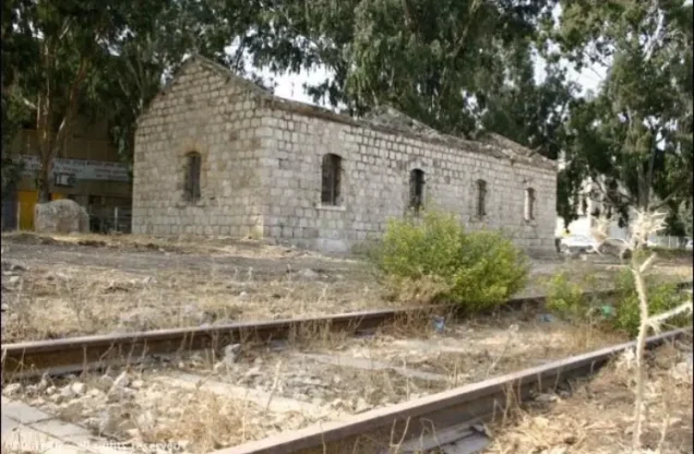
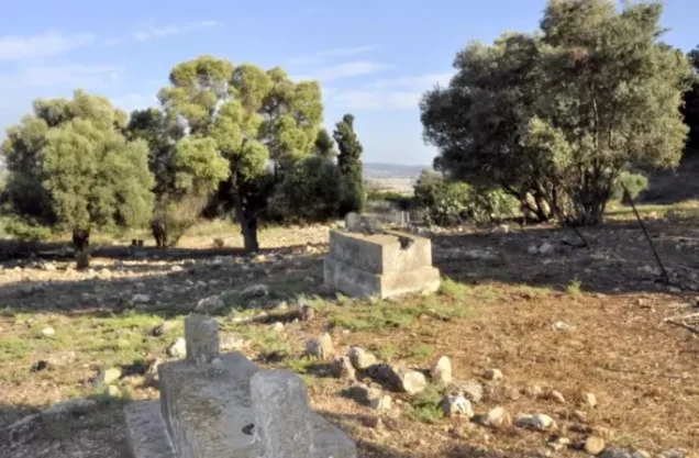
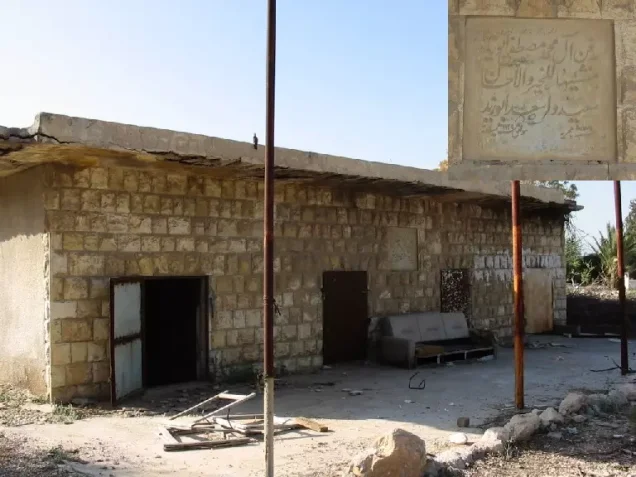
- Mostly the village has survived destruction. Many of the houses and shops are still standing and are occupied by Jewish settlers. The cemetery is visible and it's in a state of neglect. Late 1999, the cemetery and the grave of 'Izz al-Din al-Qassam were desecrated.
- Ethnic cleansing
- Partial ethnical cleansing took place already soon after the New Year's Eve massacre and on 24.April 1948, the rest of the inhabitants were ethnically cleansed and bused out by British troops.
- Settlements built on the built-up area of Balad al-Shaykh after 1948
- Tel Chanan: Zionist immigrants settled the village itself in 1949 and renamed it Tel Chanan; it is now part of Nesher. Nesher had developed during the Mandate around a cement factory and buildings established by Zionist investors on part of the village lands that they had leased
- Refugees' migration routes
- Some went to Haifa harbor, and some went to Acre.
Hover a dot to read the village name, or click to open its card.
Borders of the depopulated village of Balad al-Shaykh
Balad al-Shaykh: A Depopulated Palestinian Village in the Haifa District
Balad al-Shaykh was a Palestinian village in the Haifa District, situated on the Haifa Plain at the foot of the northwestern extension of Mount Carmel, approximately 7 kilometres southeast of Haifa and at an average elevation of about 75 metres above sea level. Its population reached 4,120 in the 1944/1945 statistics, all Muslims. A Palmach force of the Haganah carried out a massacre in the village on 31 December 1947. The village was subsequently partially evacuated, and its remaining inhabitants were displaced as Haganah forces occupied it on 24–25 April 1948 in the context of Operation Bi'ur Hametz, conducted primarily by the Carmeli Brigade.
- Subdistrict
- Haifa
- Distance from district center
- 7 km southeast of Haifa
- Average Elevation
- 75 m above sea level
- Population in 1931
- 747 – the figure includes al-Suwaytat, Arab al-Qulaylat, Arab al-Samniyya and Arab al-Tuqiyya
- Number of Houses in 1931
- 144 – the figure includes al-Suwaytat, Arab al-Qulaylat, Arab al-Samniyya and Arab al-Tuqiyya
- Population in 1944/1945
- 4,120
- Estimated Population in 1948
- About 4,779 – a later demographic estimate, not an official census
- Total Land Area in 1945
- 9,849 dunams
- Attack and Depopulation
- The Haganah committed a massacre in the village on 31 December 1947, carried out by a Palmach force of 170 men, in which more than 60 villagers, including women and children, were killed; the village was then partially evacuated on 7 January 1948. At dawn on 24 April 1948 Haganah units surrounded the village and shelled it with mortars and machine guns, after which its inhabitants were evacuated under a truce arranged by the British.
- Final Israeli Control
- Late April 1948: Zionist forces did not occupy the village until the end of April, after surrounding and shelling it at dawn on 24 April and the evacuation of its inhabitants under a truce arranged by the British; the available sources give no day for the forces' entry into the village
- Military Operation
- Operation Bi'ur Hametz (part of Operation Misparayim)
- Military Unit
- Haganah units, in an operation carried out mainly by Carmeli Brigade units, Plan Dalet having assigned the occupation of the village to the Carmeli Brigade; the available sources do not name the specific unit that entered the village. The massacre of 31 December 1947 was carried out by a Palmach force of 170 men
- Cause of Depopulation
- Direct military assault by Zionist forces: the massacre of December 1947, then the siege and shelling of 24 April 1948, which ended with the evacuation of the inhabitants under a truce arranged by the British
- Settlements Documented on Village Lands
- Tel Chanan: Zionist immigrants settled the village itself in 1949 and renamed it Tel Chanan; it is now part of Nesher. Nesher had developed during the Mandate around a cement factory and buildings established by Zionist investors on part of the village lands that they had leased
Location
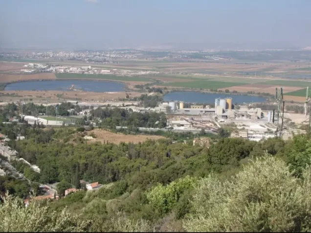
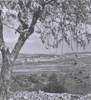
Balad al-Shaykh stood on the Haifa Plain at the foot of the northwestern extension of Mount Carmel, approximately 7 kilometres southeast of Haifa.
Its average elevation was about 75 metres above sea level.
The Haifa–Jenin highway passed east of the village, as did the Haifa–Samakh railway, approximately half a kilometre away.
An airstrip was located at the northern end of the village lands, about two kilometres from the built-up area.
Its proximity to Haifa, major roads, railways, and industrial facilities closely linked the village economy with the city.
Name and Historical Background
Balad al-Shaykh was named after the Sufi Shaykh 'Abdallah al-Sahli.
According to Walid Khalidi, Ottoman Sultan Selim I, who ruled from 1512 to 1520, granted Shaykh 'Abdallah al-Sahli the tax revenues of the village during the early years of Ottoman rule in Palestine.
Local Palestinian oral history provides a more detailed account of the al-Sahli family and its early settlement in the area, although some of these details rely primarily on family and village oral traditions and should be distinguished from the broader reference record.
In 1859, British vice-consul Edward Rogers visited Balad al-Shaykh and estimated its population at approximately 350.
French traveller Victor Guérin estimated approximately 500 inhabitants in 1875 and noted olive and palm trees as well as springs around the village.
Architecture and Public Facilities
The village had a generally rectangular layout, with closely clustered houses built mainly of stone and cement.
Balad al-Shaykh contained a mosque and a shrine dedicated to Shaykh 'Abdallah al-Sahli, as well as coffeehouses, shops, and other facilities.
Two fuel stations stood along the Haifa–Jenin highway.
The village became increasingly connected to urban and industrial services as the Haifa area expanded during the British Mandate.
Population
The 1922 census recorded 407 inhabitants in Balad al-Shaykh.
By the 1931 census, the population had risen to 747 people living in 144 houses. This total included al-Suwaytat, Arab al-Qulaylat, Arab al-Samniyya, and Arab al-Tuqiyya.
According to the 1944/1945 statistics, Balad al-Shaykh had 4,120 inhabitants, all Arab Muslims.
In 1945, it was the second-largest village in the Haifa subdistrict by population.
The figure of approximately 4,779 inhabitants in 1948 is a later estimate rather than an official Mandate census count.
Palestine Remembered estimates the number of refugees and their descendants at approximately 29,349 in 1998.
Population of Balad al-Shaykh
- 1859About 350Estimate by Edward Rogers
- 1875About 500Estimate by Victor Guérin
- 1922407Official census
- 1931747Official census; includes nearby Bedouin groups
- 1944/19454,120Government of Palestine statistics
- 1948About 4,779Later estimate
- 199829,349Estimate of refugees and their descendants
Number of Houses
The 1931 census recorded 144 houses in Balad al-Shaykh.
The figure of approximately 921 houses in 1948 is a later estimate rather than an official census count.
Education
Walid Khalidi and PalQuest document an elementary school established in Balad al-Shaykh in 1887 during the Ottoman period.
A detailed local Palestinian study records that education expanded later and that three schools existed in the village by 1948.
According to this local study, there was a government school administered by the Mandate Department of Education, a private school known as the Shaykh 'Abdallah School, and a girls' school.
The study places the likely opening of the government and girls' schools in the 1930s, although these dates rely largely on local oral-history documentation and are not established in the same detail by the principal reference source.
Economic Life
The economy of Balad al-Shaykh depended primarily on agriculture and livestock raising.
Olives, cereals, and fruit were among the principal crops, and the villagers used presses to produce olive oil.
A significant number of inhabitants also worked in nearby Haifa as the city's industrial and commercial economy expanded.
The village contained several coffeehouses and two fuel stations on the Haifa–Jenin highway.
During the Mandate period, Zionist investors leased part of the village lands on which a cement factory and related buildings were constructed. The settlement of Nesher subsequently developed around these facilities.
Land of Balad al-Shaykh
According to the 1944/1945 statistics, Balad al-Shaykh had a total land area of 9,849 dunams.
Arab ownership amounted to 5,844 dunams, Jewish ownership to 285 dunams, while 3,720 dunams were classified as public land.
Land Ownership in Balad al-Shaykh in 1944/1945
- Arab ownership5,844 dunums59%
- Jewish ownership285 dunums3%
- Public land3,720 dunums38%
Land Use
In the 1944/1945 statistics, cereal cultivation covered 4,641 dunams: 4,410 Arab-owned dunams, 78 Jewish-owned dunams, and 153 dunams of public land.
A further 368 Arab-owned dunams were irrigated or used for plantations.
Palestine Remembered records approximately 418 dunams planted with olive trees. This represents a crop category within cultivated land and should not be added separately to the overall land-use total.
The built-up area covered 241 dunams: 221 Arab-owned dunams and 20 dunams of public land.
Uncultivable land covered 4,599 dunams: 845 Arab-owned dunams, 207 Jewish-owned dunams, and 3,547 dunams of public land.
Land Use in Balad al-Shaykh in 1944/1945, in Dunams
- Arab
- Jewish
- Public
- Irrigated and plantation land368 dunums
- Cereals4,641 dunums
- Built-up area241 dunums
- Uncultivable land4,599 dunums
The Shrine of Shaykh 'Abdallah and Archaeological Remains
The shrine of Shaykh 'Abdallah al-Sahli stood north of the village.
A khan nearby was believed to date to the Mamluk period.
A stone grape press and several basins, said to date to the Byzantine period, were also found in the area.
Local village documentation records additional agricultural installations, presses, wells, and other features across the village lands.
Izzeddin al-Qassam and the Cemetery
Shaykh Izzeddin al-Qassam was killed on 20 November 1935 during a battle with British forces in the wooded area near Ya'bad in the Jenin district.
Haifa witnessed a major funeral procession the following day, and al-Qassam was buried in a cemetery located on the lands of Balad al-Shaykh.
Walid Khalidi and PalQuest refer generally to the village cemetery as containing his grave.
A local Palestinian study provides a more detailed distinction between the old village cemetery near the Shaykh 'Abdallah mosque and a second cemetery in the northeastern part of the village lands, known as al-Istiqlal Cemetery and later as al-Qassam Cemetery, which was associated with the waqf of al-Istiqlal Mosque in Haifa.
Al-Qassam and several of his comrades were buried there, and the cemetery later became the burial place of other Palestinian fighters killed during the 1936–1939 revolt.
The Balad al-Shaykh Massacre of 31 December 1947
On 31 December 1947, Balad al-Shaykh was attacked by a Palmach force operating under the Haganah.
According to Walid Khalidi and PalQuest, the attacking force consisted of approximately 170 men and had been instructed to surround the village, inflict casualties among the men, and damage property.
The attack killed more than 60 Palestinians, including women and children, and dozens of houses were destroyed.
The massacre followed the violence at the Haifa oil refinery the previous day. According to the Palestinian newspaper Filastin, as transmitted by PalQuest, an Irgun bomb attack near Palestinian workers killed six Palestinians and wounded dozens. Violence then broke out inside the refinery, in which dozens of Jewish workers were killed. The Haganah attack on Balad al-Shaykh followed as a retaliatory assault.
Details derived from Israeli records are cited here only as transmitted through Walid Khalidi and PalQuest and not through direct reliance on the original Israeli sources.
Partial Evacuation in January 1948
Following the massacre, Balad al-Shaykh was partially evacuated on 7 January 1948.
The village did not come under final Zionist control at that stage, however, and part of the population remained until late April.
Operation Bi'ur Hametz
Operation Bi'ur Hametz was conducted from 22 to 24 April 1948 as part of the broader Operation Misparayim in the Haifa area.
The Carmeli Brigade carried out most of the operation, which sought to extend Zionist control into the hinterland of Haifa after the offensive against the city.
PalQuest states that Operation Bi'ur Hametz began with attacks on Balad al-Shaykh and that Plan Dalet had assigned the Carmeli Brigade responsibility for occupying the village.
The sources reviewed do not identify a specific battalion as the unit that directly entered Balad al-Shaykh.
The Occupation and Depopulation of Balad al-Shaykh
After the fall of Haifa on 22 April 1948, a number of women and children from Balad al-Shaykh were moved away in anticipation of a possible attack.
At dawn on 24 April, Haganah units surrounded the village and demanded that the inhabitants surrender their weapons.
PalQuest reports that the villagers handed over twenty-two old rifles and requested a truce, but the Haganah rejected the request unless the remaining weapons were surrendered.
At approximately 5:00 a.m., the attacking forces opened fire with machine guns and mortars.
A British unit reached the area and subsequently arranged a truce under which the inhabitants, including women and children, were evacuated under British protection.
Palestine Remembered gives 25 April 1948 as the occupation date. The most precise formulation is therefore that the final evacuation and occupation of Balad al-Shaykh took place on 24–25 April 1948.
Some of the displaced inhabitants initially moved toward Acre, while others eventually became refugees elsewhere in Palestine and in neighbouring Arab countries.
The village was depopulated during the Nakba and the occupation of Palestine in 1948, in the context of Carmeli Brigade operations around Haifa and Operation Bi'ur Hametz.
Occupation and Depopulation Chronology
- 31 December 1947
Massacre
The Haganah committed a massacre in the village, carried out by a force of 170 Palmach men who, according to the History of the Haganah as cited by Khalidi, were ordered to 'encircle the village, harm the largest possible number of men, damage property, and refrain from attacking women and children'; yet the more than 60 villagers killed included women and children, and several dozen houses were destroyed. The massacre was meant as retaliation for the killing of Jewish workers at the Haifa oil refinery the previous day, which followed an Irgun bombing at the refinery gates that killed 6 Palestinian workers and wounded 42, according to the newspaper Filastin.
- 7 January 1948
Beginning of the exodus
The village was partially evacuated after the massacre, but Zionist forces did not occupy it until the end of April 1948.
- 22 April 1948
Beginning of the military operation
Operation Bi'ur Hametz, part of the larger Operation Misparayim, began with attacks on Balad al-Shaykh, according to PalQuest's page on the operation, and was carried out mainly by Carmeli Brigade units. With the fall of Haifa, some of the village's women and children were moved to safety in anticipation of an attack.
- 24 April 1948
Shelling of the village
Haganah units surrounded the village at dawn and demanded that the villagers surrender their arms; they handed over '22 old rifles' and asked for a truce, but the Haganah refused and threatened to attack. At 5:00 a.m. it opened fire with mortars and machine guns, and a British unit that arrived at 6:00 a.m. reported 'virtually no reply' from the village.
- Late April 1948
Depopulation and final occupation
After the shelling, the British negotiated a truce providing for the evacuation of the villagers, including women and children, under British escort, and Zionist forces did not occupy the village until the end of April; the available sources give no day for their entry. Some villagers went to Acre and fled it a few days later when panic gripped the city, according to Morris as cited by Khalidi.
- 1949
Settlement on village lands
Zionist immigrants settled in the village and renamed it Tel Chanan; it is now part of Nesher.
Nesher and Tel Hanan
The industrial settlement of Nesher had begun developing during the Mandate period around the cement factory and other facilities built on leased portions of Balad al-Shaykh's lands.
After the displacement of the Palestinian inhabitants, Jewish immigrants settled the village site in 1949 and named it Tel Hanan.
Tel Hanan later became part of the city of Nesher.
| Name | Period | Relationship to the Village |
|---|---|---|
| Nesher | British Mandate period | Developed around a cement factory and buildings established on leased village land |
| Tel Hanan | 1949 | Established on the village site after its depopulation and later incorporated into Nesher |
Balad al-Shaykh After the Nakba
According to the field documentation relied upon by Walid Khalidi, many of the Palestinian houses and shops remained standing and were used by residents of Tel Hanan and Nesher.
The village cemetery also remained visible, although it was neglected at the time of Khalidi's documentation.
Palestine Remembered records that al-Qassam Cemetery and the grave of Shaykh Izzeddin al-Qassam were desecrated in late 1999.
Khalidi's description reflects the condition of the site during his field documentation and should not necessarily be interpreted as a comprehensive survey updated to 2026.
Sources
- PalQuest – Interactive Encyclopedia of the Palestine Question: Balad al-Shaykh.
- PalQuest: Operation Bi'ur Hametz.
- PalQuest: Izzeddin al-Qassam.
- Palestine Remembered: Balad al-Shaykh, Haifa District.
- Walid Khalidi, All That Remains: Balad al-Shaykh, as reproduced by Palestine Remembered.
- Rasha al-Sahli, Qaryat Balad al-Shaykh, Encyclopedia of Palestinian Villages.
- Walid Khalidi, All That Remains, entry on Balad al-Shaykh.
- Government of Palestine, censuses of 1922 and 1931.
- Government of Palestine, Department of Statistics, Village Statistics, 1945.
Photo gallery

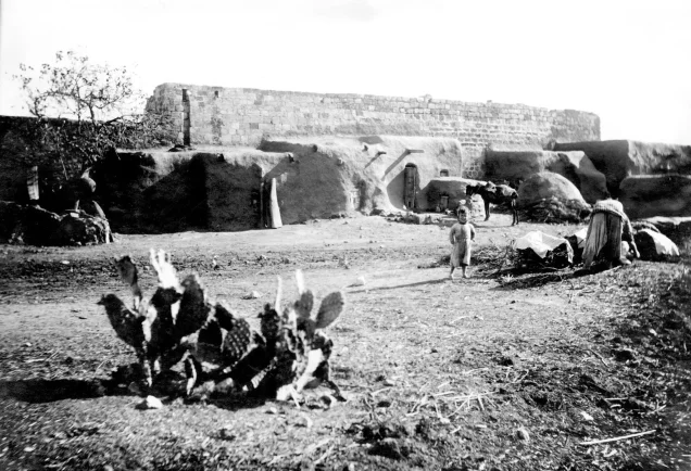


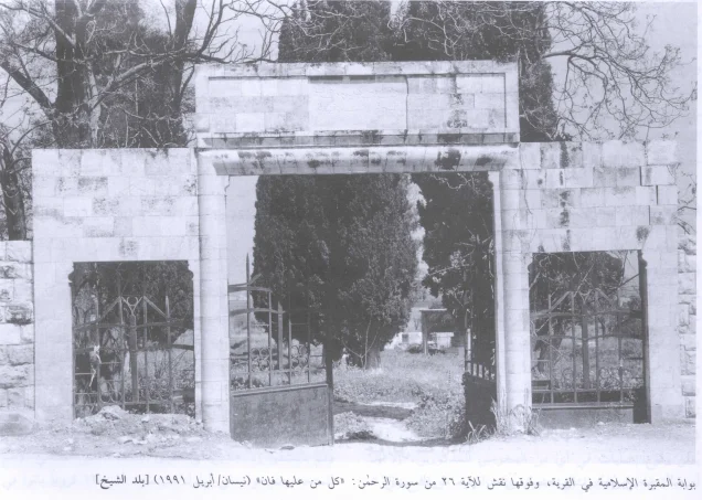


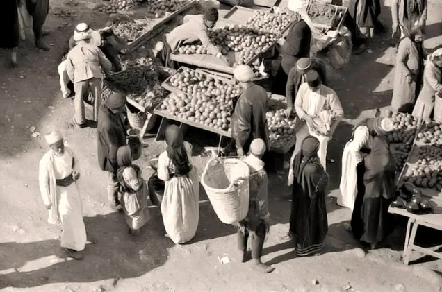




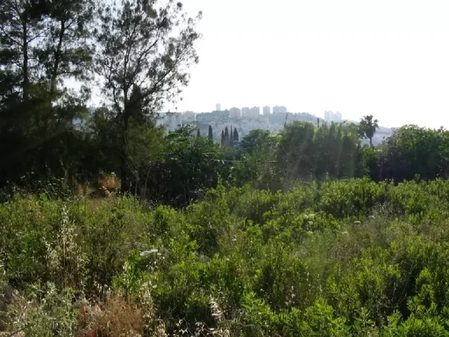
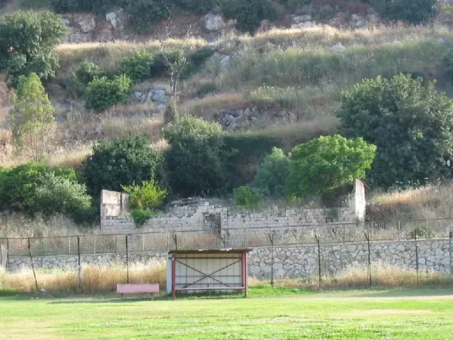

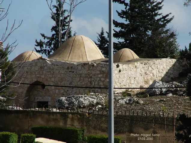
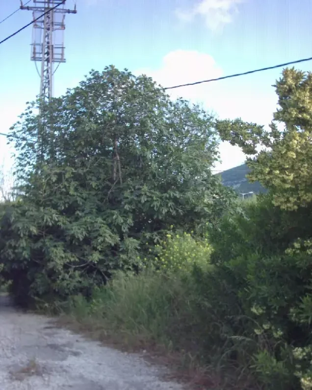


Photos from the village's people
Photos sent in by visitors and published after review.
Add a photo of this village
Log in to add photos of this village.
Other villages from Haifa
More from the archive



 Download Our Palestine App
The whole archive in the palm of your hand: depopulated villages, the Nakba, the massacres and Al-Aqsa — free, with no ads to erase the story.
Download Our Palestine App
The whole archive in the palm of your hand: depopulated villages, the Nakba, the massacres and Al-Aqsa — free, with no ads to erase the story.



Comments
No comments yet — be the first to write one.
Add your comment
Name and email are optional. Comments appear after review.