
The depopulated village of Qannir / District of Haifa
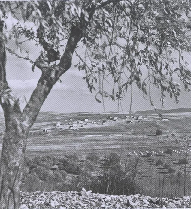
About the depopulated village of Qannir
- District
- Haifa
- Population in 1948
- 870
- Brigade that carried it out
- The Haganah, according to Arab Liberation Army records as cited by Khalidi; the available sources do not identify the unit
- Who defended the village
- Arab Liberation Army headed by Fawzi al-Qawuqji.
- Distance from the governorate centre
- 35 km south of Haifa
- Elevation above sea level
- 100 m
- Cause of displacement
- Fear of a Zionist attack after the fall of Haifa and under the influence of the offensive against it, according to Benny Morris as cited by Khalidi, following repeated attacks on the village from March 1948
- Extent of destruction
- The village has been completely obliterated.
- Ethnic cleansing
- Qannir inhabitants were completely ethnically cleansed.
- Settlements built on the built-up area of Qannir after 1948
- Regavim, established on village lands in 1949; according to Morris, it had first been established at the nearby village of al-Butaymat in July 1948 and was then moved to Qannir
Hover a dot to read the village name, or click to open its card.
Borders of the depopulated village of Qannir
Qannir: A Depopulated Palestinian Village in the Haifa District
Qannir was a depopulated Palestinian village in the Haifa District, located approximately 35 kilometers south of the city of Haifa in Bilad al-Rawha', near the lower foothills of Mount Carmel, at an average elevation of about 100 meters above sea level.
- Subdistrict
- Haifa
- Distance from district center
- 35 km south of Haifa
- Average Elevation
- 100 m above sea level
- Population in 1931
- 483
- Number of Houses in 1931
- 92
- Population in 1944/1945
- 750
- Estimated Population in 1948
- About 870 – a later demographic estimate, not an official census
- Total Land Area in 1945
- 11,331 dunams
- Attack and Depopulation
- The village was attacked repeatedly in early March 1948, and its national guard contingent repulsed the attack of 5 March. After the fall of Haifa, Benny Morris states that its inhabitants fled on 25 April 1948 out of fear of an attack, but Arab Liberation Army records indicate that it was still in Arab hands in early May, when the Haganah briefly occupied it, and that an armoured assault on it and on Kafr Qar' at 4:00 a.m. on 8 May 1948 was repelled and both villages were recovered.
- Final Israeli Control
- Not established by the sources, which do not make clear when Haganah forces finally entered the village; Morris dates the villagers' flight to 25 April 1948, while Arab Liberation Army records indicate that the village was recovered after the assault of 8 May 1948
- Military Unit
- The Haganah, according to Arab Liberation Army records as cited by Khalidi; the available sources do not identify the unit
- Cause of Depopulation
- Fear of a Zionist attack after the fall of Haifa and under the influence of the offensive against it, according to Benny Morris as cited by Khalidi, following repeated attacks on the village from March 1948
- Settlements Documented on Village Lands
- Regavim, established on village lands in 1949; according to Morris, it had first been established at the nearby village of al-Butaymat in July 1948 and was then moved to Qannir
The village stood on slightly elevated terrain that sloped gently toward the northern section of Palestine's coastal plain, and a secondary road connected it with the coastal highway. Its Muslim inhabitants depended primarily on agriculture and animal husbandry. During the Nakba and the occupation of Palestine in 1948, Qannir was subjected to repeated attacks. The sources differ on the date of its depopulation and final occupation, while Arab Liberation Army records demonstrate that it remained under Arab control into early May 1948.
Location of Qannir
- Qannir was located approximately 35 kilometers south of Haifa.
- Its average elevation was about 100 meters above sea level.
- It stood in Bilad al-Rawha' on low ground near the lower foothills of Mount Carmel.
- Its lands sloped gradually toward the northern part of the coastal plain.
- A secondary road connected the village with the coastal highway.
- Its lands bordered those of Umm al-Shuf, Kafr Qara, al-Sindiyana, al-Murrah, and other rural localities.
The Built Environment of Qannir
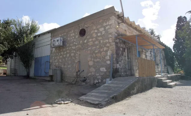
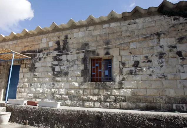
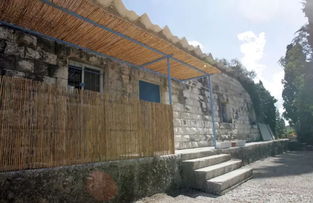
In the late nineteenth century, Qannir was described as a village situated on a low hill, with houses constructed of adobe bricks. A later account described stone houses standing side by side.
All of the inhabitants were Muslims, and the village stood amid agricultural fields that surrounded it on most sides.
The built-up area covered approximately 22 dunums according to the 1944/1945 statistics.
Population of Qannir
The population was estimated at approximately 250 in the late nineteenth century. The 1922 census recorded 400 inhabitants. This increased to 483 in the 1931 census, when 92 houses were recorded.
The Government of Palestine's 1944/1945 statistics recorded 750 inhabitants, all Arab Muslims.
The figures of 870 inhabitants for 1948 and 5,343 refugees for 1998 published by Palestine Remembered are later estimates and are not official Government of Palestine censuses.
Population of Qannir
- Late 19th centuryAbout 250Historical estimate
- 1922400Official census under the British Mandate
- 1931483Official census under the British Mandate
- 1944/1945750Government of Palestine statistics
- 1948870Later estimate published by Palestine Remembered
- 19985,343Later refugee-population estimate published by Palestine Remembered
Number of Houses in Qannir
The 1931 census recorded 92 houses in Qannir. The figure of 165 houses for 1948 published by Palestine Remembered is a later estimate rather than an official Government of Palestine census figure.
Number of Houses in Qannir
- 193192Official census
- 1948165Estimate published by Palestine Remembered
Land Ownership in Qannir
The total land area recorded for Qannir in the 1944/1945 statistics was 11,331 dunums.
The Arabic Palestine Remembered table uses the categories “Palestinian,” “Transferred to Zionists,” and “Masha'.” These terms are preserved below to reflect the terminology used by that source. The Government of Palestine statistics use the official categories “Arab,” “Jewish,” and “Public.”
Land Ownership in Qannir, 1944/1945, Using the Terminology of Palestine Remembered
- Palestinian10,826 dunums96%
- Transferred to Zionists50 dunums<1%
- Masha' / Communal455 dunums4%
Land Use in Qannir in 1944/1945
A total of 6,270 dunums was cultivated or classified as cultivable land, consisting of 6,220 dunums of Arab land and 50 dunums of Jewish land.
Cereals covered 5,790 dunums: 5,760 dunums of Arab land and 30 dunums of Jewish land. Plantations and irrigable land covered another 480 dunums, including 460 dunums of Arab land and 20 dunums of Jewish land.
Non-cultivable land totaled 5,039 dunums, consisting of 4,584 dunums of Arab land and 455 dunums of public land. The built-up area covered another 22 dunums of Arab land.
Land Use in Qannir According to the 1944/1945 Statistics
- Arab
- Jewish
- Public
- Cereals5,790 dunums
- Plantations and Irrigable Land480 dunums
- Built-up Area22 dunums
- Non-Cultivable Land5,039 dunums
Palestine Remembered separately records approximately 780 dunums planted with olive trees. This figure does not appear as an independent additive category in the official 1944/1945 land-use table and is therefore presented as supplementary agricultural information rather than added again to the totals above.
Economic Life in Qannir
Qannir's economy depended primarily on agriculture and animal husbandry. Cereals and vegetables were among its principal crops, alongside olive cultivation.
Agricultural fields surrounded the village on most sides, while portions of the surrounding land were also used for grazing livestock.
Water Sources in Qannir
Palestinian local documentation identifies several water sources used by the people of Qannir, including Bi'r Qannir, locally also known as Bi'r Fajr, Bi'r al-Fari east of the village, 'Ayn al-Rashrasha to the south, and 'Ayn al-Hanana, which was used to water livestock.
Local accounts describe Bi'r Qannir as an ancient well and attribute it to the Roman period, noting that its waters overflowed during winter. This dating is presented as local historical tradition because neither Walid Khalidi nor PalQuest provides an independent archaeological dating of the well.
Vegetables were also cultivated near 'Ayn al-Rashrasha.
Education in Qannir
Qannir had a privately funded elementary school built and supported by the villagers, who contributed to the salaries of its teachers.
Published archival documentation provides a more precise chronology than accounts that date the school simply to 1937. Student records indicate that the school had been operating since at least 1935.
On 19 February 1937, the Government of Palestine's Department of Education sent a letter to the school's headmaster, Mahmud Ahmad Dawud al-Khatib, allocating financial assistance to the school for the 1936/1937 academic year. The school taught the early elementary grades.
The Mosque and Shrines of Qannir
According to local Palestinian documentation, Qannir had one mosque measuring approximately one hundred square meters. It had a minaret and a mihrab and served as a central institution in the village's religious and social life.
Local accounts also identify several shrines, including one associated with al-Nabi Bilya south of the village and others connected with Shaykh Amin al-'Utayli, Shaykh Amin al-'Arqub, and Shaykh Salih.
The village also had an old cemetery, and local accounts report that a number of its grave markers remained visible after the Nakba.
Archaeological Sites in Qannir
Qannir's lands contained several khirbas and archaeological sites where remains of walls and cisterns were found. Walid Khalidi notes that the village itself appears to have been constructed over an older inhabited site whose historical name has not been identified.
Palestinian local sources identify Khirbat Umm al-Kudaysh, Khirbat al-Nabi Bilyan, and Khirbat Qannir among the archaeological localities surrounding the village.
The March 1948 Attacks on Qannir
Qannir was subjected to repeated attacks during the early phase of the Nakba. The Palestinian newspaper Filastin reported that an attack on 5 March 1948 was the third assault on the village within a single week.
According to the report cited by Walid Khalidi, a local National Guard unit resisted and repelled the attack. No casualties were reported.
Qannir therefore remained outside Zionist control during this phase despite the repeated attempts to attack it.
Flight After the Fall of Haifa and Conflicting Accounts
After the fall of Haifa in late April 1948, a number of surrounding Palestinian villages were attacked or evacuated, and fear and instability spread throughout the region.
Walid Khalidi cites Israeli historian Benny Morris as stating that the villagers of Qannir left on 25 April because they feared an attack and were affected by the offensive against Haifa. This account is included through the Palestinian intermediary source Khalidi/PalQuest rather than through independent reliance on an Israeli source.
Arab Liberation Army records, however, contradict any interpretation of 25 April as the date of Qannir's final occupation or complete depopulation, since they demonstrate that the village remained under Arab control into early May.
The Battle of Qannir and Kafr Qara on 8 May 1948
Arab Liberation Army commander Fawzi al-Qawuqji reported that an armored assault was launched against Qannir and neighboring Kafr Qara at 4:00 a.m. on 8 May 1948.
According to his dispatch, Arab forces resisted and repelled the assault, after which the attackers withdrew and the two villages were recovered.
This account is important because it demonstrates that Qannir had not permanently fallen from Arab control on 25 April, as some abbreviated statistical entries might suggest.
Walid Khalidi and PalQuest conclude that the available accounts do not make clear the precise date on which Haganah forces finally entered and retained control of the village.
Name of the Military Operation and the Occupation of Qannir
Neither Walid Khalidi nor PalQuest identifies a confirmed formal military operation that definitively resulted in the final occupation of Qannir, and the exact date of its permanent capture remains unclear in the sources they present.
Palestine Remembered classifies Qannir under the designation “Coastal Clearing,” while its English-language entry describes the village's association with that operation as only possible. The term is therefore not presented here as a firmly established formal operation name for the capture of Qannir.
The most precise historical formulation is that Qannir was subjected to repeated attacks during March, April, and May 1948; the armored attack of 8 May was repelled, while the principal Palestinian sources used here do not establish an exact date for the village's final occupation.
The Displacement of Qannir's Inhabitants
The military developments surrounding Haifa and the repeated assaults on the area led the population of Qannir to leave in stages during the Nakba, before the villagers ultimately lost their homes and were prevented from returning.
Palestinian local sources report that people from Qannir were dispersed to Jordan and Syria, to the Jenin and Nur Shams refugee camps, and to Palestinian localities and areas including 'Attil, Kafr Rumman, Wadi 'Ara, Kafr Qara, 'Ara, and Barta'a.
The principal sources used here do not provide comprehensive figures for the number of displaced villagers in each location, so this list should not be treated as an exhaustive distribution of the village population.
Occupation and Depopulation Chronology
- 5 March 1948
Attack on the village (the third in a week)
Qannir was attacked repeatedly in early March 1948; the Palestinian daily Filastin reported that the attack of 5 March was the third on the village in a week and that it was repulsed by the village contingent of the national guard. No mention was made of casualties.
- 25 April 1948 (according to Morris)
Beginning of the exodus
After the fall of Haifa in late April some of the surrounding villages were attacked or evacuated, and Israeli historian Benny Morris, as cited by Khalidi, states that the villagers of Qannir fled on 25 April out of fear of an attack and under the influence of the offensive against Haifa. Arab Liberation Army records, however, indicate that the village was still in Arab hands in early May.
- Early May 1948
Temporary occupation
Arab Liberation Army records, as cited by Khalidi, indicate that the Haganah briefly occupied the village in early May 1948.
- 8 May 1948
Armoured assault and withdrawal of the attacking force
Arab Liberation Army commander Fawzi al-Qawuqji stated in one of his dispatches that at 4:00 a.m. on 8 May an armoured assault was launched against Qannir and neighbouring Kafr Qar', and that it was 'resisted and repelled'; the attackers withdrew and both villages were recovered.
- Not established (probably after 8 May 1948)
Final occupation
According to Khalidi, it is not clear from either Morris's account or al-Qawuqji's dispatches when Haganah forces actually entered the village.
- 1949
Settlement on village lands
The settlement of Regavim was established on village lands. Morris, as cited by Khalidi, writes that it was moved to Qannir after having first been established at the nearby village of al-Butaymat in July 1948.
Settlement Established on the Lands of Qannir
The settlement of Regavim was established on the lands of Qannir in 1949.
Walid Khalidi cites Benny Morris as stating that Regavim had initially been established near the Palestinian village of al-Butaymat in July 1948 before being transferred to the lands of Qannir. This information is included through the Palestinian intermediary source Khalidi/PalQuest rather than through independent reliance on an Israeli source.
- Regavim: established in 1949 on the lands of Qannir.
The Site of Qannir After the Nakba
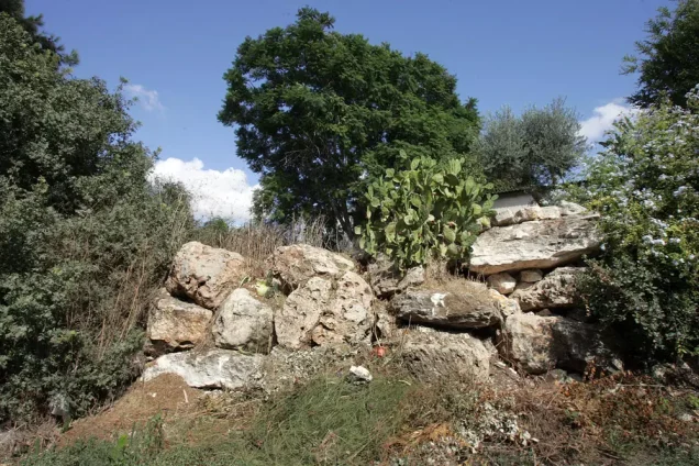
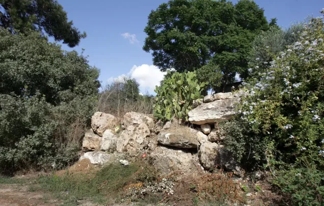
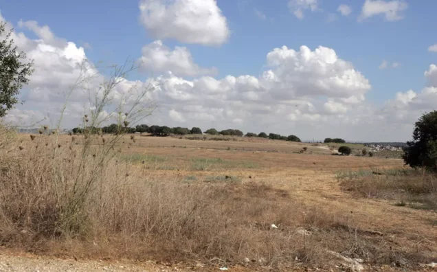
According to Walid Khalidi's field description, stone rubble was scattered across the site of Qannir, which was covered with thorns, fig trees, and cactuses.
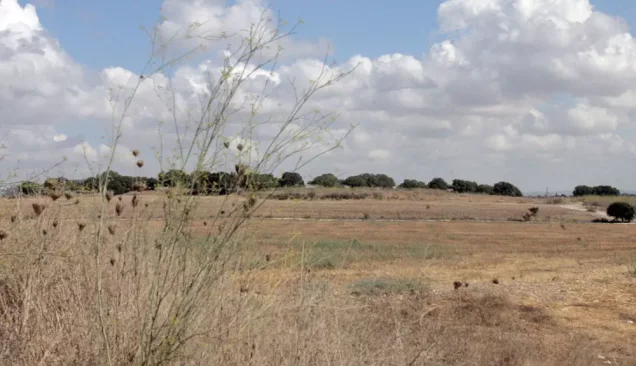
Part of the surrounding land was used for grazing livestock, while another part was cultivated.
This description is based on fieldwork conducted for Walid Khalidi's All That Remains and should not necessarily be treated as a field survey updated to the present day.
Sources
- PalQuestPalQuest – Interactive Encyclopedia of the Palestine Question: Qannir
- Institute for Palestine StudiesInstitute for Palestine Studies: Walid Khalidi, All That Remains
- Palestine RememberedPalestine Remembered: Qannir – Haifa District
- Palestine RememberedPalestine Remembered: Documents on the Depopulated Village of Qannir – Dr. Muhammad 'Aql
- pal48.psFilastunna: Qannir – Local Documentation of Village Facilities and Water Sources
- maktabatsabil.comSami Hadawi: Village Statistics 1945 – Population and Land Ownership, Haifa Sub-District
- maktabatsabil.comSami Hadawi: Village Statistics 1945 – Built-up and Non-Cultivable Land, Haifa Sub-District
Photo gallery

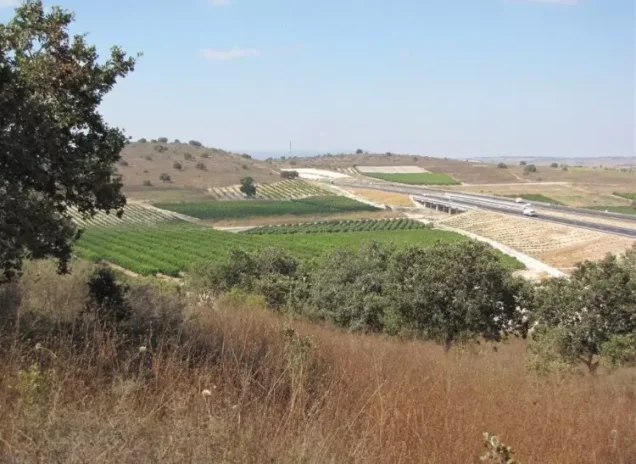
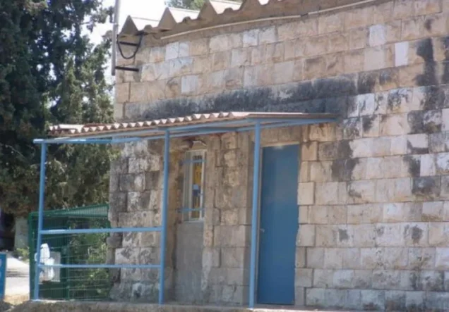
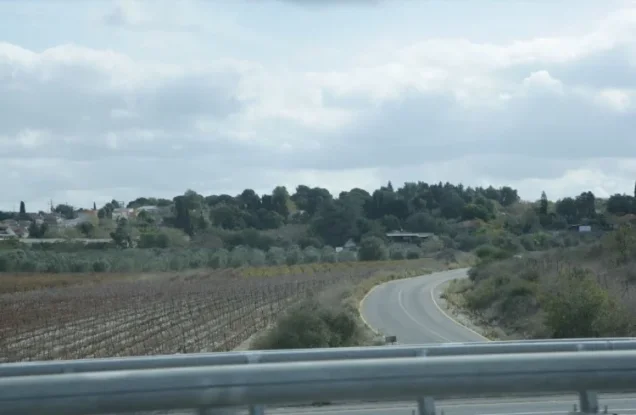
Photos from the village's people
Photos sent in by visitors and published after review.
Add a photo of this village
Log in to add photos of this village.
Other villages from Haifa
More from the archive



 Download Our Palestine App
The whole archive in the palm of your hand: depopulated villages, the Nakba, the massacres and Al-Aqsa — free, with no ads to erase the story.
Download Our Palestine App
The whole archive in the palm of your hand: depopulated villages, the Nakba, the massacres and Al-Aqsa — free, with no ads to erase the story.



Comments
No comments yet — be the first to write one.
Add your comment
Name and email are optional. Comments appear after review.