
The depopulated village of 'Arab Zahrat al-Dumayri / District of Haifa
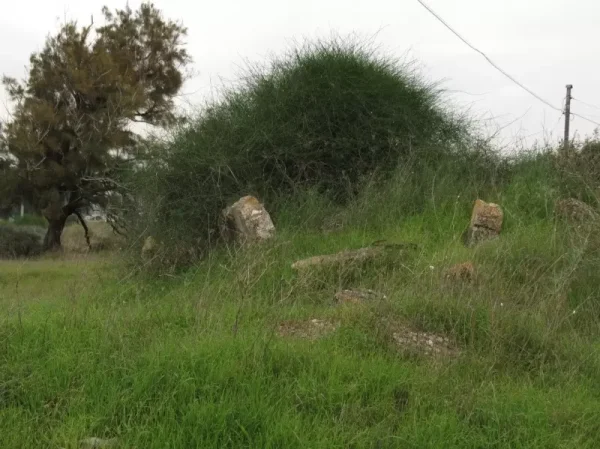
'Arab Zahrat al-Dumayri
About the depopulated village of 'Arab Zahrat al-Dumayri
- District
- Haifa
- Date 'Arab Zahrat al-Dumayri was occupied
- 01 April 1948
- Population in 1948
- 620
- Distance from the governorate centre
- 41 (km) South of Haifa
- Elevation above sea level
- 25 m
- Extent of destruction
- The village has been completely defaced
- Ethnic cleansing
- 'Arab Zahrat al-Dumayri inhabitants were completely ethnically cleansed.
Hover a dot to read the village name, or click to open its card.
'Arab Zahrat al-Dumayri – Depopulated Palestinian Village of Haifa
'Arab Zahrat al-Dumayri, also locally known as 'Arab al-Damayra and 'Arab al-Dumayri, was a Palestinian village in the Haifa Subdistrict. It stood on sandy hills approximately 41 kilometers south of Haifa and about five kilometers southeast of Qisarya, at an average elevation of approximately 25 meters above sea level.
The village overlooked the marshy plains surrounding Wadi al-Mafjar. Palestinian oral history places Qisarya to the north of the community's local territory, Wadi al-Mafjar to the south, the railway to the east, and the coastal area to the west.
The official 1944/45 population was 620. The statistical village land unit covered 1,387 dunums. Agriculture was the principal livelihood and drew on local wells, springs, cereals, vegetables, and other crops.
The village was attacked and experienced major displacement during the spring of 1948. Palestinian sources differ over the precise date: 1 April appears in one Palestine Remembered summary field, while 10 April is recorded by the Palestinian Villages Encyclopedia and other Palestinian registers. Oral testimony confirms a Haganah attack and threats but also shows that some residents remained for a period after the first major departure.
Basic Information
| Field | Information |
|---|---|
| Name | 'Arab Zahrat al-Dumayri |
| Arabic name | عرب ظهرة الضميري |
| Alternative names | 'Arab al-Damayra, 'Arab al-Dumayri, Zahrat al-Dumayri |
| Subdistrict | Haifa |
| Location | Coastal plain south of Haifa and southeast of Qisarya |
| Distance from Haifa | Approximately 41 km south |
| Distance from Qisarya | Approximately 5 km southeast |
| Average elevation | Approximately 25 m above sea level |
| Palestine Grid | 141/207 in mapping references |
| Population in 1922 | 227, all Muslims |
| Population in 1931 | No independent village figure; local archival research indicates the community was counted with Hadera |
| Population in 1944/45 | 620 |
| 1948 estimates | Later estimates give about 719–720; one Palestinian oral account gives about 380. None is an official 1948 census |
| Total land area | 1,387 dunums |
| Probable main attack/departure date | 10 April 1948; a Palestine Remembered summary field gives 1 April, so the precise day remains disputed |
| Military force | Haganah according to Palestinian oral testimony; no brigade or battalion is independently documented |
| Named military operation | No independently documented named operation for the village |
| Cause of depopulation | Military attack and threats caused major flight; oral testimony indicates that some residents remained afterward |
| Israeli settlements on village lands | None according to Walid Khalidi and PalQuest |
Name and Community Origins
The name Zahrat al-Dumayri became associated with the Dumayri or Damayra community that settled on the sandy rise.
Palestinian local traditions preserve several accounts of the family's origin. One connects the earliest ancestor with al-Dumayr north of Damascus, while another connects the group with the Dumur Arabs of the Karak region.
Researcher Muhammad 'Aql records another tradition in which three brothers—al-Hajj Mahmud, al-Hajj Salih, and al-Hajj Ibrahim—came from a locality called Damra and settled between Qisarya and 'Arab al-Fuqara.
Because the traditions differ, this article does not select one origin story as conclusively established history.
Ottoman Records and the Early Community
The Dumayri community appears in local and Ottoman-era documentation predating the British Mandate.
Muhammad 'Aql records a 1912 population count conducted in the presence of mukhtar Jabr al-Hajj Mahmud al-Dumayri that listed sixty-four residents.
This indicates that the community was an identifiable settlement before British rule, although it remained relatively small in the early twentieth century.
Location and Geography
'Arab Zahrat al-Dumayri extended across sandy hills in Palestine's coastal plain approximately five kilometers southeast of Qisarya.
The village overlooked the marshy plains around Wadi al-Mafjar.
According to the oral testimony of village-born Rafiq Dumayri, Qisarya bordered the wider local landscape to the north, Wadi al-Mafjar to the south, the railway to the east, and the coastal area to the west.
These remembered territorial limits describe the wider local landscape and should be distinguished from the official 1,387-dunum statistical land unit recorded in 1945.
Local Hills and Place-Names
Palestinian oral history preserves several internal landscape features.
Rafiq Dumayri recalled three principal rises: one carrying the village houses, a smaller one associated with the cemetery, and another used for threshing wheat, maize, and barley.
He also recalled Abu Tantur, a sandy area with large carob and other trees that was used for grazing.
Population
| Year | Population | Status |
|---|---|---|
| 1912 | 64 | Ottoman/local count reported by researcher Muhammad 'Aql |
| 1922 | 227 | Official Government of Palestine census; all Muslims |
| 1931 | No independent figure | Archival research indicates that the community was counted with Hadera |
| 1944/45 | 620 | Official Mandate-period estimate |
| 1948 | About 719–720 in later estimates | Not an official census; Palestinian oral testimony separately gives about 380 |
The strongest documented pre-Nakba population figure is therefore the official 620 recorded in 1944/45.
The oral-history estimate of approximately 380 inhabitants in 1948 is preserved as community testimony but is not used to override the official statistical record without additional documentation.
Number of Houses
No independent 1931 house count is securely available because archival research indicates that the Dumayri community was counted with Hadera.
No official government house census for 1948 is available either.
Oral testimony describes stone houses of varying sizes according to family means, but it does not provide a complete independently verified house total.
Land Ownership, 1944/45
The Government of Palestine tables used the categories Arab, Jewish, and Public. Those categories are retained here:
- Arab775 dunums56%
- Jewish612 dunums44%
- Public0 dunums0%
The ownership figures balance exactly: 775 + 612 = 1,387 dunums.
One Palestinian secondary source gives 1,338 dunums, but this differs from the Village Statistics total reproduced by Khalidi, PalQuest, and Palestine Remembered. The 1,387-dunum figure is therefore used here.
Land Use, 1944/45
| Total land | 1,387 | 875 + 512 |
|---|---|---|
| Use | Dunums | Note |
| Cultivable land | 875 | Total land classified as cultivable |
| Of which cereals | 263 | A subset of the 875 cultivable dunums; it must not be added a second time |
| Non-cultivable land | 512 | The difference between total land and cultivable land |
The 875 cultivable dunums equal approximately 63.1 percent of the total land area. PalQuest displays 65 percent in parentheses, which does not precisely match the direct arithmetic.
Khalidi's village profile does not provide a complete crop-by-crop breakdown of the remaining cultivable land, so additional acreage categories are not invented.
Economy and Agriculture
Agriculture was the principal basis of village life.
Khalidi specifically records 263 dunums devoted to cereals in 1944/45.
Palestinian oral history adds wheat, maize, and barley as older crops and describes later cultivation of tomatoes, cucumbers, eggplants, vetch, lupine, peanuts, watermelons, and other produce.
The oral account also states that agricultural products were marketed regularly to Palestinian towns and cities.
Carob trees and grazing also formed part of the wider village landscape, particularly around the sandy Abu Tantur area.
Water and Wells
The village landscape was associated with Wadi al-Mafjar and with numerous local wells and water sources.
Palestinian oral testimony recalls approximately twelve springs and wells, including Bir al-'Arayis, Bir al-Marqa'iyya, and a place remembered as al-Bayka.
These names are preserved through community testimony and should not be confused with an official Mandate-era hydrological inventory.
Education – al-Damayra Government School
The village had a government school remembered as Madrasat al-Damayra al-Amiriyya.
Documents from 1946 confirm that teacher Ahmad Husayn al-Sharif of Saffuriyya was serving at the Dumayri school, and village oral testimony independently remembers him as the local teacher.
The community account states that pupils who continued beyond the village school pursued further study in Tulkarm or Acre.
No enrollment total is supplied without a direct school register.
Cemetery and Abu Faraj
Palestinian oral testimony documents the village cemetery known as Abu Faraj on one of the nearby rises.
Rafiq Dumayri stated that he saw the cemetery during later visits and that an early ancestor of the family had been buried there more than 170 years before the interview.
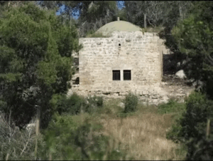
Local material also refers to a shrine associated with Abu Faraj, but the principal sources used here do not provide an independent architectural description sufficient to reconstruct its date or form.
Mosque
Local Palestinian material records a mosque at 'Arab Zahrat al-Dumayri.
Khalidi's short village profile does not provide a construction date, dimensions, or architectural description, so no unsupported detail is added.
Conditions before the 1948 Displacement
Village testimony describes growing military insecurity along the coastal plain during the spring of 1948 and the spread of news about attacks on neighboring Palestinian communities.
Rafiq Dumayri recalled that Palestinian fighters received food and assistance in the village and that one of his brothers was involved with them.
He further recalled a Haganah attack and a threat directed at his father over assistance given to the fighters, after which much of the family departed toward Tulkarm.
When Did the Attack and Depopulation Occur?
Khalidi's concise entry and the current PalQuest page do not provide a separate detailed occupation narrative for 'Arab Zahrat al-Dumayri.
Palestine Remembered displays 1 April 1948 in its statistical occupation field.
The Palestinian Villages Encyclopedia and Palestinian registers instead record 10 April 1948.
One broader Palestinian list also repeats the village under 15 May, indicating a problem in the compiled chronology and making that listing unsuitable as the sole basis for determining the final date.
This article therefore uses 10 April 1948 as the probable date of the principal attack and major departure, while explicitly recognizing that the precise date is not conclusively resolved by the principal village-level sources.
Military Unit
Palestinian oral testimony identifies the Haganah as the force that attacked the village and threatened the family because of assistance provided to Palestinian fighters.
No reliable Palestinian village-level source reviewed here identifies a particular brigade or battalion responsible for the attack.
The military-unit field is therefore recorded as Haganah – subordinate unit not independently documented.
Military Operation
Khalidi and PalQuest do not assign a named military operation to the occupation of 'Arab Zahrat al-Dumayri.
The village's displacement occurred during a closely timed wave affecting Palestinian communities along the coastal area south of Haifa, including 'Arab al-Fuqara and 'Arab al-Nufay'at.
That regional context is not sufficient to impose a formal operation name on the village without village-specific documentation.
The most accurate entry is therefore: no independently documented named military operation; the attack formed part of the wider military pressure and evacuation of Palestinian communities in the coastal Qisarya-Hadera area.
Cause of Depopulation
Palestinian oral testimony supports a direct connection between military attack, threats, and the departure of a substantial part of the population.
Rafiq Dumayri recalled that his father took family members toward Tulkarm, while the village mukhtar had already departed with his children.
However, several relatives remained behind, hoping that the displacement would be temporary.
The most accurate formulation is therefore flight under military attack and threat, followed by the later departure of residents who initially remained, rather than assuming that every inhabitant was removed at one moment.
Residents Who Remained after the Initial Attack
The oral account provides an important qualification to simplified depopulation dates.
Rafiq Dumayri's mother and several relatives remained in the village after the main family group left.
According to his testimony, his father returned approximately four months later and took his mother away.
Thus, even if 10 April is used for the main attack and displacement, it should not automatically be treated as the exact date on which the site became completely empty of all Palestinian residents.
Refuge and Displacement Destinations
Palestinian testimony documents the movement of Dumayri villagers toward the Tulkarm area, and Rafiq Dumayri later lived in Tulkarm refugee camp.
Other local accounts record members of the extended community in Jordan and elsewhere.
No numerical distribution of the refugees is supplied without a sufficiently documented population register.
Destruction
The village's built environment was demolished after the population was displaced.
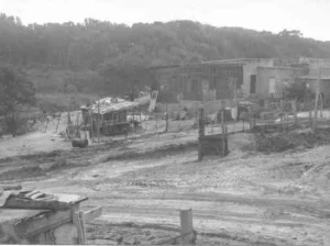
Local testimony describes the former residential area as devastated and records that when Rafiq Dumayri first returned to visit in 1972, he could identify house locations but found virtually no intact structures.
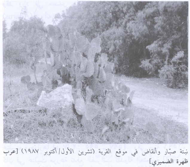
Khalidi's later field documentation likewise records rubble, cactus, and vegetation at the site.
No independently documented day or month for the demolition of all village buildings is available, so the spring 1948 displacement and later destruction are treated as separate historical stages.
Ethnic Cleansing in Source Classification
Palestine Remembered classifies the displacement of 'Arab Zahrat al-Dumayri using the term “ethnic cleansing.” The phrase is retained here only as an attributed source classification.
The more specifically documented facts are military attack and threats, the departure of a substantial proportion of the villagers, the continued presence of some residents for a period afterward, the absence of permanent collective return, and the later demolition of the village's residential buildings.
Occupation and Depopulation Chronology
| Date | Event |
|---|---|
| Spring 1948 | Military insecurity and attacks intensify among Palestinian communities along the coastal plain south of Haifa. |
| 1 April 1948 | Date appearing in the Palestine Remembered statistical field; Khalidi's village narrative does not independently substantiate this specific day. |
| 10 April 1948 | Date recorded by the Palestinian Villages Encyclopedia and other Palestinian registers for the main displacement; used here as the probable principal attack date. |
| April 1948 | Palestinian oral testimony records a Haganah attack and threats followed by the departure of family members toward Tulkarm. |
| After the main departure | Some villagers and family members remain in the village, showing that depopulation was not necessarily completed on the first day. |
| Approximately four months later | Oral testimony states that Rafiq Dumayri's father returned and removed his mother, who had remained in the village. |
| Later period | The village houses are demolished; no independently documented demolition date is available. |
Israeli Settlements on 'Arab Zahrat al-Dumayri's Lands
According to Walid Khalidi and PalQuest, no Israeli settlement was established on the village lands of 'Arab Zahrat al-Dumayri.
This distinction is important because the village stood close to existing settlements and agricultural projects and because part of the 1945 land unit was recorded under the Jewish ownership category.
Pre-1948 Jewish landownership or later agricultural and infrastructural use of the surrounding area does not by itself establish that a new post-1948 settlement was founded on the former village site.
'Arab Zahrat al-Dumayri Today
According to the field description used by Walid Khalidi before the publication of All That Remains in 1992, sand dunes dominated the former village site.
Grass and other vegetation covered the area, with cactus and tamarisk trees also growing there. Some adjacent land was under cultivation.
A field photograph dated October 1987 records cactus and rubble at the village site.
Later Palestinian oral testimony states that former residents could still identify the locations of houses despite the disappearance of the buildings and that the Abu Faraj cemetery and some local wells and landscape features remained recognizable.
The testimony also describes some former cultivated land as later planted with citrus, while the sandy residential area remained largely empty.
Khalidi's account should be treated as historical field documentation from before 1992, while the later Palestinian testimony provides valuable community memory. Neither constitutes a comprehensive archaeological or cadastral survey of the entire village territory in 2026.
Sources
- PalQuest – Interactive Encyclopedia of the Palestine Question: 'Arab Zahrat al-Dumayri
- Palestine Remembered – 'Arab Zahrat al-Dumayri, Haifa Subdistrict
- Palestine Remembered – 'Arab Zahrat al-Dumayri entry from Walid Khalidi's All That Remains
- WAFA – “Arab al-Damayra: The Village Preserved in the Memory of Rafiq Dumayri”
- Muhammad 'Aql – “Arab al-Damayra in the Official Records”
- Palestinian Villages Encyclopedia – Arab al-Damayra
- Palestinian Ministry of Foreign Affairs – Register of Palestinian Localities Depopulated in 1948
Photo gallery
Photos from the village's people
Photos sent in by visitors and published after review.
Add a photo of this village
Log in to add photos of this village.
Other villages from Haifa

More from the archive


 Download Our Palestine App
The whole archive in the palm of your hand: depopulated villages, the Nakba, the massacres and Al-Aqsa — free, with no ads to erase the story.
Download Our Palestine App
The whole archive in the palm of your hand: depopulated villages, the Nakba, the massacres and Al-Aqsa — free, with no ads to erase the story.



Comments
No comments yet — be the first to write one.
Add your comment
Name and email are optional. Comments appear after review.