
The depopulated village of Al-Mazar (Haifa) / District of Jenin
Al-Mazar (Haifa)
About the depopulated village of Al-Mazar (Haifa)
- District
- Jenin
- Date Al-Mazar (Haifa) was occupied
- 30 May 1948
- Population in 1948
- 240
- Military operation
- Operation Gideon
- Brigade that carried it out
- Golani Brigade
- Who defended the village
- Yarmuk Battalion of Arab Liberation Army volunteers, and some local Palestinian militia and Iraqi Army.
- Distance from the governorate centre
- 9 (km) Northeast of Jinin
- Elevation above sea level
- 400 m
- Cause of displacement
- Military assault by Zionist troops
- Extent of destruction
- al-Mazar was completely obliterated and defaced.
- Ethnic cleansing
- al-Mazar inhabitants were completely ethnically cleansed.
- Settlements built on the built-up area of Al-Mazar (Haifa) after 1948
- Ein Carmel
Hover a dot to read the village name, or click to open its card.
Borders of the depopulated village of Al-Mazar (Haifa)
Al-Mazar – Depopulated Palestinian Village of the Jenin District
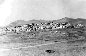
Al-Mazar was a depopulated Palestinian village in the Jenin District. It stood on the flat, rounded summit of Mount al-Mazar in the Mount Gilboa and Marj Ibn 'Amir region, approximately 9 kilometers northeast of Jenin, at an average elevation of about 400 meters above sea level.
Israeli occupation forces captured al-Mazar on 30 May 1948 after taking the nearby villages of Zir'in and Nuris. The village's capture formed part of the military advance toward Jenin. The village-specific attacking formation was the Fourth Battalion of the Golani Brigade.
Distinguishing al-Mazar of Jenin from al-Mazar of Haifa
This village should not be confused with another depopulated Palestinian village named al-Mazar in the Haifa District.
The al-Mazar discussed here stood on Mount al-Mazar northeast of Jenin. The Haifa village of the same name stood on the western slopes of Mount Carmel and had a completely different population, land structure, and occupation history.
Location and Geography
Al-Mazar occupied the flat, rounded summit of Mount al-Mazar. The mountain descended steeply on almost every side except the southeast, where the terrain rose to meet the neighboring heights of the Gilboa range.
The village was approximately 9 kilometers northeast of Jenin and had an average elevation of about 400 meters above sea level.
A dirt track linked al-Mazar with Nuris on the lower ground to the north, while other tracks connected it with neighboring communities.
Supporting Palestinian local documentation places Nuris to the north, 'Arrana to the south and southwest, Sandala to the west and southwest, Zir'in to the northwest, and Arab al-Sakhina encampments toward the east and southeast.
Name and Connection with the Battle of 'Ayn Jalut
The Arabic word mazar means a shrine or a place of visitation.
Walid Khalidi suggests that the village may have received its name because of the burial places of people who fell in the Battle of 'Ayn Jalut in 1260, when the Mamluks defeated the Mongols.
This is a historical interpretation rather than conclusive archaeological identification of all burials in the area.
Al-Mazar was nevertheless a place of Muslim pilgrimage. Members of a Sufi order lived in the village, and the villagers traced their origins to the al-Sa'diyyun Bedouin, traditionally associated with Shaykh Sa'd al-Din al-Shaybani, who died in 1224.
Built Environment
The village houses stood on the summit of the mountain, surrounded by agricultural land.
Late nineteenth-century descriptions portray al-Mazar as a primarily stone-built village. Although the terrain around the houses was very rocky, some olive trees grew nearby.
The official 1944/45 statistics classified only 9 dunams as built-up land.
Population and Houses
The inhabitants of al-Mazar were Muslims.
- 1922223Official Mandate census; all inhabitants were Muslims
- 1931257Official census; all inhabitants were Muslims
- 1945270Official statistics; all inhabitants were Palestinian Arab Muslims
- 1948About 313Later estimate, not an official British census
- 1998About 1,923 refugees and descendantsLater demographic estimate published by Palestine Remembered
The 1931 census recorded 62 houses. The figure of approximately 75 houses for 1948 is a later estimate rather than an official census count.
Mosque and Religious Life
Al-Mazar had a mosque in the eastern part of the village.
The village also had a religious character. Members of a Sufi order resided there, and the locality was visited as a Muslim pilgrimage site.
Supporting Palestinian community documentation records several shrines and graves traditionally associated with martyrs of the Battle of 'Ayn Jalut. It also mentions a shrine locally called Maqam al-Nabi 'Azar or Azar.
The same local documentation acknowledges that identifying this shrine with Azar, the father of the Prophet Abraham in popular tradition, lacks reliable religious or historical evidence. That attribution is therefore not presented here as an established fact.
Education
Walid Khalidi's village entry and PalQuest do not document an independent formal school in al-Mazar before the Nakba.
The Palestinian sources reviewed likewise do not provide securely documented information on a village school's enrollment or grade levels. No school is therefore added without stronger evidence.
Shaykh Farhan al-Sa'di
Al-Mazar was the home village of Shaykh Farhan al-Sa'di, one of the prominent leaders of the Palestinian Arab Revolt that began in 1936 against the British Mandate and Zionist settlement.
This connection gives the village particular significance in the history of Palestinian resistance during the Mandate period.
Water Resources
Walid Khalidi records a well on the southeastern side of the village.
Supporting Palestinian local documentation states that the area also had a spring known as 'Ayn al-Mazar, supplied by seasonal channels and small valleys.
Local names include Khallat al-Wis east of the village, which flowed during winter and fed 'Ayn al-Mazar, and Khallat Zaytun al-Masiri northeast of the village between al-Mazar and Nuris, as well as another channel south of the village.
These names are treated as supporting community documentation, while the southeastern well remains the water feature directly documented in Khalidi's principal account.
Economic Life and Agriculture
Agriculture formed the backbone of the village economy. The villagers cultivated cereals, fruit, legumes, vegetables, and olives.
In 1944/45, 5,221 dunams were devoted to cereals and 229 dunams were irrigated or used for plantations and orchards.
Of the agricultural land, approximately 68 dunams were planted with olives. This is a crop-specific figure within the broader agricultural categories and should not be added again to the land-use total.
Land Ownership, 1944/45
The total land area of al-Mazar was 14,501 dunams. Under the official Government of Palestine classification, ownership was distributed as follows:
- Arab14,472 dunums100%
- Jewish0 dunums0%
- Public29 dunums<1%
Palestine Remembered presents the same figures using its simplified terminology: 14,472 dunams “Palestinian,” 0 dunams “Transferred to Zionists,” and 29 dunams “Communal/Public.” The phrase “Transferred to Zionists” should be retained when reproducing that source's terminology.
Land Use, 1944/45
- Arab
- Public
- Cereals5,221 dunums
- Plantations and irrigable land229 dunums
- Total cultivable/cultivated land5,450 dunums
- Non-cultivable land9,042 dunums
- Built-up land9 dunums
- Total non-cultivable and built-up9,051 dunums
The official table balances exactly: 5,450 dunams of cultivable or cultivated land plus 9,051 dunams of built-up and non-cultivable land equal the village's total area of 14,501 dunams.
Earlier Military Orders
The late-May assault was not the first military planning directed at al-Mazar.
In April 1948, Palmach headquarters issued orders to its First Battalion to destroy what it described as enemy bases in al-Mazar, Nuris, and Zir'in.
Walid Khalidi notes that these orders do not appear to have been carried out immediately, since the villages remained until the Golani Brigade's advance at the end of May.
The Advance toward Jenin
After the conquest of the Baysan Valley, Golani Brigade units advanced south through the Mount Gilboa area and the villages north of Jenin in preparation for an assault on the town.
The Fourth Battalion of the Golani Brigade captured Zir'in on 28 May 1948. Nuris was attacked on 29–30 May, after which the force reached al-Mazar.
This advance occurred after Operation Gideon had already ended. Operation Gideon had run from 10 to 15 May and had focused on the Baysan Valley.
Occupation and Depopulation
Israeli occupation forces captured al-Mazar on 30 May 1948, after the fall of Nuris and Zir'in.
Walid Khalidi, citing the official Israeli war history through his own account, identifies the attacking unit as the Fourth Battalion of the Golani Brigade.
Shortly after taking al-Mazar, Israeli forces advanced on Jenin. They failed, however, to retain control of the town and later withdrew after fighting with Arab and Iraqi forces.
The inhabitants of al-Mazar were displaced as a direct result of the military assault.
Correction of the Military Operation
Some online databases, including Palestine Remembered and the Palestinian Villages Encyclopedia, classify the capture of al-Mazar under “Operation Gideon.”
This is chronologically problematic. Operation Gideon was carried out by the Golani Brigade in the Baysan Valley between 10 and 15 May 1948, fifteen days before al-Mazar was captured.
PalQuest's village-specific account does not name Operation Gideon. Instead, it places the capture of al-Mazar after Nuris and Zir'in and immediately before the Israeli assault on Jenin.
The occupation of al-Mazar is therefore described here more precisely as part of the Golani Brigade's southward advance toward Jenin in late May 1948, rather than as part of Operation Gideon.
Military Unit
The formation securely identified with the capture of al-Mazar is the Fourth Battalion of the Golani Brigade.
Some Palestinian local documentation incorrectly names the Fourth Battalion of the Giv'ati Brigade. This conflicts with Khalidi and PalQuest, which explicitly identify Golani.
The Palmach's First Battalion had received an earlier April order concerning al-Mazar, Nuris, and Zir'in, but this does not make it the force that captured al-Mazar on 30 May.
Occupation Chronology
- April 1948
Earlier order targeting the village
Palmach headquarters ordered its First Battalion to destroy what it called enemy bases in al-Mazar, Nuris, and Zir'in, but the order was apparently not immediately implemented.
- 28 May 1948
Capture of Zir'in
The Fourth Battalion of the Golani Brigade occupied Zir'in as part of the advance toward Jenin.
- 29–30 May 1948
Attack on Nuris
The same Golani formation attacked Nuris and expelled its inhabitants.
- 30 May 1948
Occupation of al-Mazar
The Fourth Battalion of the Golani Brigade captured the village after the fall of Nuris and Zir'in, displacing its residents.
- Immediately afterward
Assault on Jenin
Israeli forces continued south toward Jenin but failed to maintain control of the town.
- Exact date not documented
Destruction of the village
The village was later destroyed; the subsequent field survey found no surviving houses or standing village landmarks.
Israeli Settlements on Village Lands
Three Israeli settlements were established on al-Mazar's lands:
| Settlement | Year Established |
|---|---|
| Perazon | 1953 |
| Meytav | 1954 |
| Gan Nir | 1987 |
Walid Khalidi explicitly identifies all three as being on the village's lands.
Al-Mazar Today
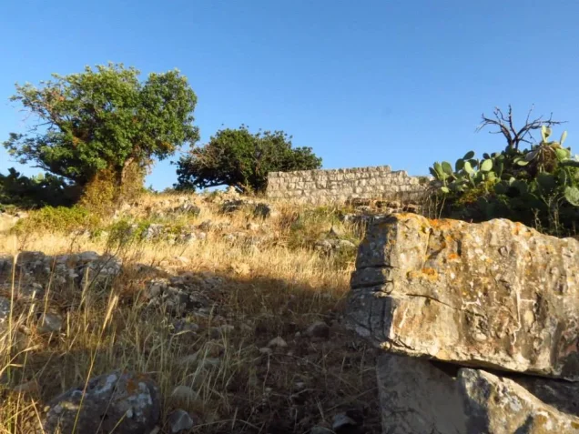
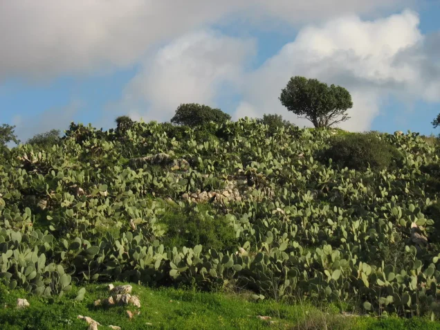
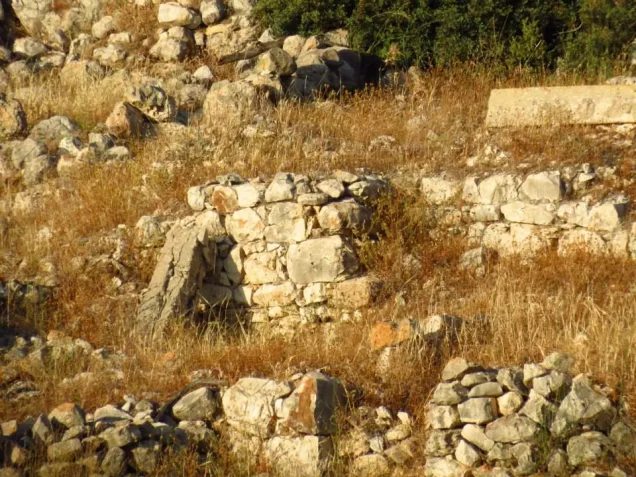
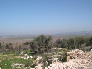
According to the field description published in Walid Khalidi's All That Remains, the village site was overgrown with thorns and cactuses and strewn with stone rubble.
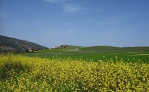
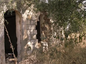
No village houses or recognizable standing landmarks remained at the time of the survey. Almond trees and cactuses grew on parts of the village lands, while some of the hilly terrain was used for grazing and other parts were covered by forest.
This description should not be treated as a comprehensive field verification of conditions in 2026. Fieldwork for All That Remains was conducted between 1987 and 1990 and therefore documents the site's condition during that survey period.
Sources
- PalQuest – Interactive Encyclopedia of the Palestine Question: al-Mazar, Jenin
- Palestine Remembered – al-Mazar, Jenin District
- Palestinian Villages Encyclopedia – al-Mazar, Jenin; supporting Palestinian local documentation
- PalQuest – Nuris; for the chronology of the Fourth Golani Battalion's advance
- PalQuest – Zir'in; for the chronology of the advance toward Jenin
- PalQuest – Operation Gideon; used to distinguish its dates from the occupation of al-Mazar
- Institute for Palestine Studies – Walid Khalidi, All That Remains
- PalQuest – All That Remains: Methodology
Photo gallery

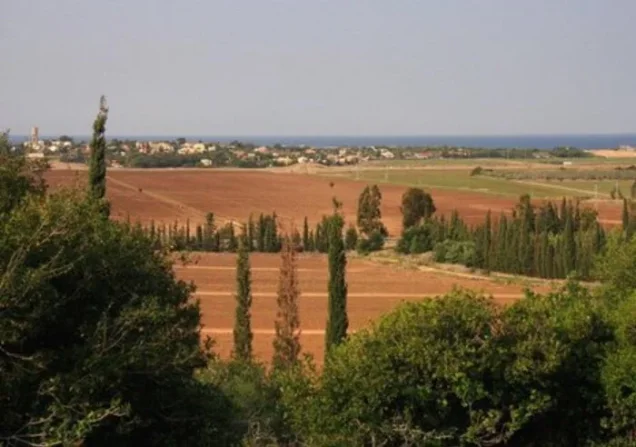
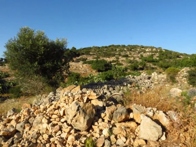

Photos from the village's people
Photos sent in by visitors and published after review.
Add a photo of this village
Log in to add photos of this village.
Other villages from Jenin
More from the archive
 Download Our Palestine App
The whole archive in the palm of your hand: depopulated villages, the Nakba, the massacres and Al-Aqsa — free, with no ads to erase the story.
Download Our Palestine App
The whole archive in the palm of your hand: depopulated villages, the Nakba, the massacres and Al-Aqsa — free, with no ads to erase the story.



Comments
No comments yet — be the first to write one.
Add your comment
Name and email are optional. Comments appear after review.