
The depopulated village of Khirbat al-Jawfa / District of Jenin
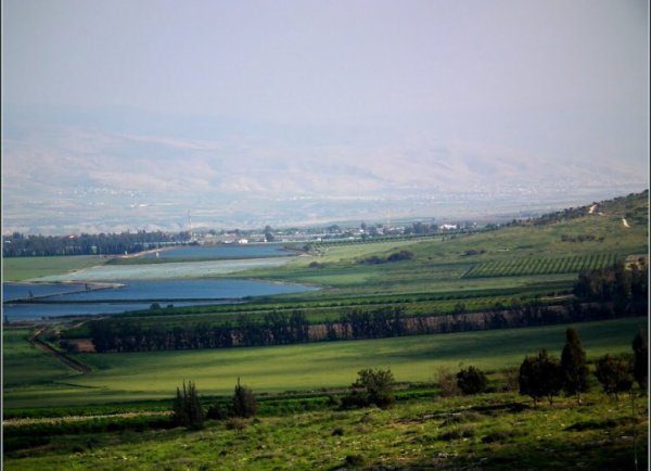
Khirbat al-Jawfa
About the depopulated village of Khirbat al-Jawfa
- District
- Jenin
- Date Khirbat al-Jawfa was occupied
- 12 May 1948
- Military operation
- Operation Gideon
- Brigade that carried it out
- Golani Brigade
- Distance from the governorate centre
- 12 (km) Northeast of Jinin
- Elevation above sea level
- -5 m
- Cause of displacement
- Influence of fall of, or exoduce from, neighboring town
- Extent of destruction
- Khirbat al-Jawfa was completely obliterated, and only house rubble left behind.
- Ethnic cleansing
- al-Jawfa, Khirbat inhabitants were completely ethnically cleansed.
- Settlements built on the built-up area of Khirbat al-Jawfa after 1948
- Kibbutz Ma'ale Gilbo'a
- Refugees' migration routes
- After the fall of Baysan on the May 15th, 1948, al-Jawfa's remaining population mostly fled to the Jinin area.
Hover a dot to read the village name, or click to open its card.
Borders of the depopulated village of Khirbat al-Jawfa
Khirbat al-Jawfa – Depopulated Palestinian Village of the Jenin District
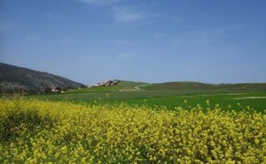
Khirbat al-Jawfa, also known as Mazra'at al-Jawfa, was a depopulated Palestinian hamlet in the Jenin District. It stood on the top of a small rounded plateau extending from the northern slope of Jabal Faqqu'a and overlooked the Jordan Valley to the north and northeast.
The village lay approximately 12 kilometers northeast of Jenin. Jabal Faqqu'a physically separated it from the district center, however, and Khirbat al-Jawfa was therefore more directly affected by events in the Baysan Valley. The town of Baysan lay only about 7 kilometers away.
The inhabitants probably left on 12 May 1948 under the impact of the fall of Baysan and the Golani Brigade's military advance through the valley. Walid Khalidi considers it likely that Khirbat al-Jawfa itself subsequently fell to the Golani Brigade during its May push toward Baysan, in the operational context of Operation Gideon.
Location and Geography
Khirbat al-Jawfa stood on a small rounded plateau extending from the northern slope of Jabal Faqqu'a.
Its elevated position overlooked the Jordan Valley from the north and northeast.
The village lay approximately 12 kilometers northeast of Jenin.
Jabal Faqqu'a separated Khirbat al-Jawfa from Jenin, making the settlement geographically more closely connected with developments in the Baysan Valley.
A dirt road linked it with Tall al-Shawk in the Baysan District.
Supporting Palestinian documentation places 'Arab al-Sakhina to the north and northeast, Tall al-Shawk to the east, Jalbun to the south, Dayr Abu Da'if to the southwest, and Faqqu'a to the west and northwest.
Elevation
The online sources contain a clear inconsistency regarding elevation.
The PalQuest data card displays an elevation of -5 meters, which conflicts with its own geographical description of Khirbat al-Jawfa as standing on a plateau extending from Jabal Faqqu'a.
The Palestinian Villages Encyclopedia gives an elevation of approximately 400 meters above sea level, a figure much more consistent with the mountainous location.
This article therefore uses approximately 400 meters, treating the -5-meter PalQuest entry as an apparent data error.
Name and Classification
The settlement appears in the sources as Khirbat al-Jawfa and was also known as Mazra'at al-Jawfa.
Walid Khalidi does not provide a documented linguistic derivation for the name, so no unsupported etymology is added.
During the British Mandate, the Palestine Index Gazetteer classified Khirbat al-Jawfa as a hamlet.
Population and Houses
Khirbat al-Jawfa differs from many larger depopulated Palestinian villages because the principal sources reviewed do not provide a reliable separate population figure for the hamlet in 1922, 1931, or 1945.
Khalidi's village entry also does not provide a securely documented independent house count.
This article therefore does not invent population estimates or transfer figures from neighboring Faqqu'a, Jalbun, or other villages.
Village Land and Ownership
No reliable independent figure for the total pre-1948 land area of Khirbat al-Jawfa was found in the principal sources reviewed.
The Palestinian Villages Encyclopedia explicitly states that accurate information on the village's land area is unavailable.
No independent official table of Arab, Jewish, and Public land ownership was identified for Khirbat al-Jawfa.
Accordingly, no land-ownership table is constructed from neighboring village figures or unsupported estimates.
Land Use and Economy
Khalidi's Khirbat al-Jawfa entry does not provide independent 1944/45 acreage for cereals, orchards, olives, or irrigated cultivation.
The principal sources reviewed likewise do not provide enough detailed information to reconstruct the hamlet's agricultural economy securely.
No undocumented crops or land-use figures are therefore added.
Education, Religious Institutions, and Water
The principal village entry does not document an independent school, a specifically identified mosque or shrine, or a detailed list of water sources at Khirbat al-Jawfa.
Because the settlement was very small and separate village-level data are scarce, these fields are left without speculative additions.
Operation Gideon
Operation Gideon began on 10 May and ended on 15 May 1948.
It was carried out by the Haganah's Golani Brigade and was directed at occupying the Baysan Valley and depopulating its Palestinian communities.
Baysan fell to the Golani Brigade on 12 May, after which the brigade continued taking villages and small settlements throughout the valley.
Because Khirbat al-Jawfa lay close to Baysan and was separated from Jenin by Jabal Faqqu'a, it was affected more directly by the campaign in the Baysan Valley than by events around Jenin itself.
Was Khirbat al-Jawfa Part of Operation Gideon?
Palestine Remembered classifies Khirbat al-Jawfa under Operation Gideon and identifies the Golani Brigade as the relevant formation.
Walid Khalidi likewise considers it likely that the hamlet fell to Golani during the brigade's May advance toward Baysan and the surrounding valley.
However, Khirbat al-Jawfa is not named in the list of affected villages displayed on PalQuest's Operation Gideon page.
The most precise formulation is therefore that Khirbat al-Jawfa probably fell to the Golani Brigade in the operational context of Operation Gideon's conquest of the Baysan Valley, although the village-level attribution is not explicitly listed in PalQuest's operation index.
Depopulation
The best-supported date for the departure of Khirbat al-Jawfa's inhabitants is 12 May 1948.
Walid Khalidi, citing Benny Morris through the village entry, states that the residents may have fled on that date as a consequence of the fall of Baysan.
The documented mechanism of flight is therefore not a detailed direct assault on Khirbat al-Jawfa itself, but rather the impact of Baysan's fall and the Golani Brigade's advance through the valley.
12 May should consequently not automatically be described as a securely documented day of direct village assault.
Military Occupation
Walid Khalidi considers it probable that Khirbat al-Jawfa fell to the Golani Brigade during May 1948 as the brigade advanced toward Baysan and the surrounding valley.
Palestine Remembered indexes 12 May as the village's occupation date.
Because the principal account uses cautious language, this article distinguishes between:
12 May 1948: the best-supported date for the inhabitants' flight.
May 1948: the probable period during which the village site fell under Golani control.
Military Unit
The formation most strongly associated with the occupation of Khirbat al-Jawfa is the Golani Brigade.
Khalidi's village-specific account does not identify a particular battalion.
No battalion number is therefore transferred from neighboring Baysan-area villages such as al-Ashrafiyya or Farwana, whose military accounts are more specific.
Occupation and Depopulation Chronology
- 10 May 1948
Beginning of Operation Gideon
The Golani Brigade launched its campaign to occupy the Baysan Valley and depopulate its Palestinian communities.
- 12 May 1948
Fall of Baysan
Baysan fell to the Golani Brigade, directly affecting nearby rural communities.
- 12 May 1948
Probable departure of Khirbat al-Jawfa's residents
Khalidi reports that the villagers may have fled as a result of Baysan's fall and the military advance in the valley.
- May 1948 – exact date uncertain
Probable military control of Khirbat al-Jawfa
Khalidi considers it likely that Golani captured the hamlet during its advance toward Baysan and the surrounding valley.
- 15 May 1948
End of Operation Gideon
By the end of the operation, most of the Baysan Valley had been occupied and most of its Palestinian population displaced.
- After occupation; exact date not documented
Destruction
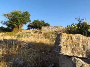
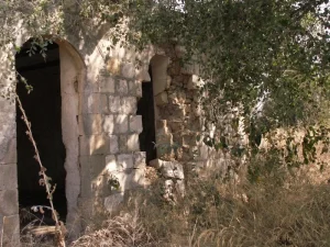
Most village houses were reduced to rubble, although sections of several walls remained.
The Armistice Line and Faqqu'a Lands
After 1948, the armistice line between Israel and the West Bank passed a short distance west of Khirbat al-Jawfa and cut across the lands of neighboring Faqqu'a.
The portions of Faqqu'a's land lying east of the line came under Israeli control.
These lands were subsequently combined with land associated with Khirbat al-Jawfa.
Khalidi states that it consequently became impossible to distinguish clearly between the former lands of Faqqu'a and Khirbat al-Jawfa in this area.
Ma'ale Gilbo'a and the Village Lands
Ma'ale Gilbo'a was established in 1962 southwest of the former Khirbat al-Jawfa site.
It lies within the amalgamated tract formed from Khirbat al-Jawfa's lands and portions of Faqqu'a's land that fell east of the armistice line.
The most accurate wording is therefore not that Ma'ale Gilbo'a was conclusively established exclusively “on Khirbat al-Jawfa land,” but that it was established within the amalgamated lands where the former boundaries between Khirbat al-Jawfa and parts of Faqqu'a could no longer be distinguished.
Khirbat al-Jawfa Today
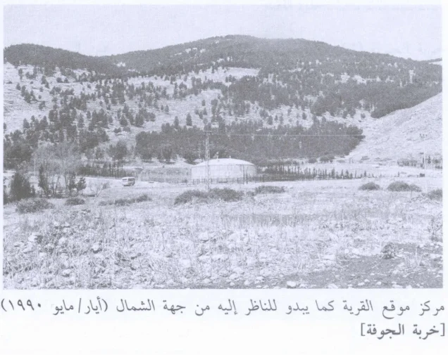
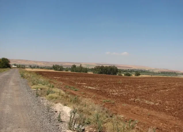
According to the field description published in Walid Khalidi's All That Remains, sections of several walls still stood, while most former houses had been reduced to rubble.
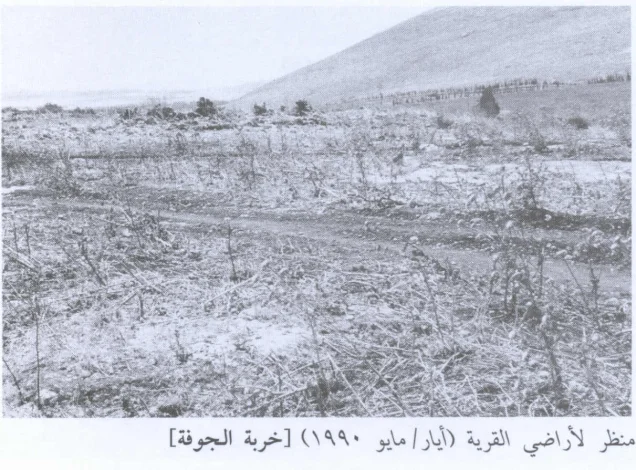
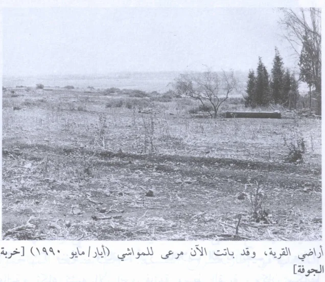
The entire area was fenced and used as pasture for cattle at the time of the survey.
A large water reservoir used by Ma'ale Gilbo'a stood on the village site.
Palestine Remembered preserves field photographs of the village site and its lands dated 1990.
This description should not be treated as a comprehensive field verification of conditions in 2026. Fieldwork for All That Remains was conducted between 1987 and 1990 and therefore documents the site's condition during that survey period.
Sources
- PalQuest – Interactive Encyclopedia of the Palestine Question: Khirbat al-Jawfa
- PalQuest – Operation Gideon
- Palestine Remembered – Khirbat al-Jawfa, Jenin District
- Palestinian Villages Encyclopedia – Khirbat al-Jawfa; supporting Palestinian local documentation
- Institute for Palestine Studies – Walid Khalidi, All That Remains
- Government of Palestine – Palestine Index Gazetteer: Khirbat al-Jawfa classified as a hamlet
Photo gallery
Photos from the village's people
Photos sent in by visitors and published after review.
Add a photo of this village
Log in to add photos of this village.
Other villages from Jenin
More from the archive
 Download Our Palestine App
The whole archive in the palm of your hand: depopulated villages, the Nakba, the massacres and Al-Aqsa — free, with no ads to erase the story.
Download Our Palestine App
The whole archive in the palm of your hand: depopulated villages, the Nakba, the massacres and Al-Aqsa — free, with no ads to erase the story.



Comments
No comments yet — be the first to write one.
Add your comment
Name and email are optional. Comments appear after review.