
The depopulated village of Nuris / District of Jenin

About the depopulated village of Nuris
- District
- Jenin
- Date Nuris was occupied
- 29 May 1948
- Population in 1948
- 660
- Military operation
- Operation Gideon
- Brigade that carried it out
- Golani Brigade
- Who defended the village
- Local militia & Arab Liberation Army
- Distance from the governorate centre
- 9 (km) Northeast of Jinin
- Elevation above sea level
- 150 m
- Cause of displacement
- Expulsion by Zionist troops
- Extent of destruction
- Nuris was completely destroyed and defaced.
- Ethnic cleansing
- Nuris inhabitants were completely ethnically cleansed.
Hover a dot to read the village name, or click to open its card.
Borders of the depopulated village of Nuris
Nuris – A Depopulated Palestinian Village in the Jenin Subdistrict
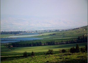
Nuris was a Palestinian village in the Jenin Subdistrict, located approximately 9 km northeast of Jenin on both sides of a shallow wadi below the steep slope of Mount al-Mazar, at an average elevation of about 150 meters above sea level.
The Haifa–Samakh railway, which ultimately connected with the Hijaz railway network, passed northeast of the village. A dirt path climbed the mountain toward al-Mazar, while another road linked Nuris with Zir'in.
Nuris was repeatedly attacked during the Nakba and the occupation of Palestine in 1948. Following major fighting in March, the Fourth Battalion of the Golani Brigade attacked on 29–30 May and the inhabitants were expelled. About six weeks later, however, Iraqi army units and Palestinian fighters reportedly drove Israeli forces out of Nuris. Khalidi states that the sources do not establish how or when Israeli forces subsequently reoccupied the village.
- Subdistrict
- Jenin
- Distance from Jenin
- Approximately 9 km northeast
- Elevation
- Approximately 150 m above sea level
- Population, 1944/45
- 570
- Estimated population, 1948
- 661
- Total land area
- 6,256 dunums
- Initial occupation and expulsion
- 29–30 May 1948
- Military unit
- Fourth Battalion, Golani Brigade
- Military context
- Golani advance toward Jenin; not Operation Gideon itself
- Later Arab recapture
- Approximately six weeks later, according to an Associated Press report
- Date of final Israeli reoccupation
- Not established by the principal source
- Israeli settlement on village land
- Nurit, established in 1950
Location and Geography of Nuris
Nuris was built on both sides of a shallow wadi beneath the steep slope of Mount al-Mazar. The modern village had a rectangular plan extending along a northeast–southwest axis.
The Haifa–Samakh railway passed northeast of the village and eventually connected with the Hijaz railway system, placing Nuris close to an important transportation corridor in northern Palestine.
A dirt path connected Nuris with al-Mazar on the mountain to the south, while another road linked it to Zir'in to the northwest.
Neighboring Villages and Localities
Mandate-era maps and later Palestinian documentation place Nuris approximately among the following communities:
- North: Na'ura.
- Northeast: Qumya.
- East: al-Sakhina.
- Southeast: 'Arabbuna.
- South: al-Mazar.
- Southwest: 'Arrana.
- Northwest: Zir'in.
- West: land on which Zionist colonies appeared on late-Mandate maps.
These are approximate geographical relationships rather than substitutes for detailed historical cadastral boundaries.
Name and Historical Background
Crusader sources referred to the village as Nurith.
The surrounding Nuris–'Ayn Jalut area was the scene of the famous Battle of 'Ayn Jalut in 1260, in which Mamluk forces defeated the Mongol army.
This association should not be interpreted to mean that the entire historical battlefield lay within the built-up area of the modern Palestinian village; the sources refer more broadly to the surrounding region.
Nuris under Ottoman Rule
In 1596, Nuris was recorded in the nahiya of Jenin in the liwa' of Lajjun, with an estimated population of approximately 88.
The inhabitants paid taxes on wheat, barley, and olives, as well as goats, beehives, and other agricultural production.
In the early nineteenth century, British traveler James Silk Buckingham observed that Nuris was surrounded by olive trees.
By the late nineteenth century, the village was described as a small settlement on rocky terrain, partly hidden among the hills and standing approximately 185 meters above a valley.
Built Form of Nuris
The village had a rectangular plan extending northeast to southwest. Most houses were built of mud and cement.
As Nuris expanded, new construction extended westward along both sides of the road connecting the village with Zir'in.
The 1944/45 Village Statistics classified 36 dunums as built-up land.
A mosque, a small market, and an elementary school stood in the village center.
Population of Nuris
The official 1922 Census of Palestine recorded 364 inhabitants in Nuris, all Muslims.
In the 1931 census, the population rose to 429, all Arab Muslims, living in 106 occupied houses.
The 1944/45 Village Statistics recorded 570 Arabs.
Palestine Remembered later estimated the population at 661 in 1948 and the number of refugees and their descendants at 4,061 in 1998. These are retrospective estimates rather than official British Mandate census counts.
- 1596Approximately 88Estimate derived from Ottoman tax records
- 1922364Official census; all Muslims
- 1931429Official census; all Arab Muslims
- 1944/45570Official British Mandate statistics
- 1948661Later Palestine Remembered estimate, not an official census
- 19984,061 refugeesLater estimate of refugees and their descendants
Number of Houses
- 1931106Occupied houses recorded in the official census
- 1948163Later Palestine Remembered estimate, not an official census count
Education in Nuris
Nuris had an elementary school for boys founded in 1888 during Ottoman rule.
It was therefore among the relatively early rural schools established in the area before the British Mandate.
Khalidi's village entry does not provide securely documented pupil numbers for the final years before the Nakba, so no unsupported enrollment figures have been added.
Mosque and Marketplace
The inhabitants of Nuris were Muslims, and a mosque stood in the center of the village.
A small marketplace was also located there and served the everyday commercial and social needs of the community.
Land Ownership in Nuris
The total village land area in the 1944/45 Village Statistics was 6,256 dunums.
Palestine Remembered presents the simplified ownership categories as follows:
- Palestinian6,247 dunums100%
- Transferred to Zionists0 dunums0%
- Communal/Public9 dunums<1%
The official Village Statistics use the original categories Arab and Public: 6,247 dunums were classified as Arab land and 9 dunums as public land. No land was recorded under the Jewish category within the Nuris statistical unit in 1944/45.
Land Use in 1944/45
- Arab
- Public
- Citrus and bananas4 dunums
- Plantations and irrigable land243 dunums
- Cereals2,935 dunums
- Built-up land36 dunums
- Non-cultivable land3,038 dunums
Cultivable land totaled 3,182 dunums, approximately 51 percent of the village area.
Built-up and non-cultivable land totaled 3,074 dunums, approximately 49 percent.
Approximately 40 dunums were planted with olive trees. This was a crop-specific figure within the 243 dunums classified as plantations and irrigable land and should not be added separately to the cultivable total.
Economic Life
Agriculture formed the principal basis of life in Nuris. Fertile land and abundant water supported cereal cultivation, orchards, olives, and a small amount of citrus.
In 1944/45, 2,935 dunums were devoted to cereals and 243 dunums to plantations and irrigable land, including approximately 40 dunums of olives.
Four additional dunums were devoted to citrus and bananas.
The small central market also served the everyday economic needs of the villagers.
Water and the Springs of Nuris
Several springs lay north of Nuris. The best known was 'Ayn Jalut, or 'Ayn Jalud, one of Palestine's largest and most famous springs.
Its water was used for domestic needs and for the irrigation of village orchards.
Water from the Nuris area also fed local streams flowing toward the Jalud River, making water a central element of the village agricultural economy.
The Battle of 'Ayn Jalut
The area surrounding Nuris is associated with one of the most famous battles in the history of Palestine and the wider region: the Battle of 'Ayn Jalut in 1260.
Mamluk forces defeated the Mongol army there, bringing a major phase of Mongol westward expansion to a halt.
Khalidi's sources place the battle in the Nuris–'Ayn Jalut region rather than defining the built-up area of modern Nuris as the precise boundary of the entire battlefield.
Archaeological Remains
Ancient remains were visible in and around Nuris, including a stone sarcophagus.
Khalidi noted that no comprehensive archaeological study of these remains had been conducted by the time his work was prepared.
The sarcophagus and other traces should therefore not be assigned to a specific historical period without independent archaeological evidence.
The March 1948 Battles
Nuris and Zir'in held strategic positions overlooking the road between Haifa and Baysan, making them important military objectives during the early months of the war.
On 18 March 1948, an Arab Liberation Army commander informed headquarters that the “battle of Nuris” had ended following intervention by the British army.
ALA forces were controlling the area around Nuris and the hills north of the village.
On 19 March, Haganah forces continued their attacks against Nuris and Zir'in in an attempt to seize the two villages.
The account reproduced by Khalidi states that a Haganah raiding party approaching Nuris suffered very heavy losses at the hands of the Arab defenders, while a larger force arriving later in the day lost additional men.
British troops intervened and fired mortars at the Arab forces. The fighting ended without the occupation of Nuris.
April 1948 Destruction Orders
Khalidi, citing Benny Morris, states that Palmach headquarters issued orders on 19 April 1948 to “destroy enemy bases” in Nuris and two other villages.
The source explicitly notes that it is unclear whether those orders were carried out at the time. The date should therefore not be treated as an occupation or destruction date for Nuris.
Occupation and Expulsion in May 1948
Nuris was attacked again on 29–30 May 1948.
According to Benny Morris, as cited by Khalidi, the inhabitants were expelled during the assault.
The History of the War of Independence identifies the attacking unit as the Fourth Battalion of the Golani Brigade. The battalion had earlier participated in the occupation of the Baysan Valley and was now preparing to assist in the advance against Jenin.
A New York Times correspondent likewise reported that two Israeli columns advanced toward the Triangle area against strong resistance and captured Nuris and neighboring al-Mazar.
Was Nuris Captured during Operation Gideon?
Palestine Remembered classifies the occupation of Nuris under Operation Gideon, and some later local sources repeat this designation.
Operation Gideon proper, however, was conducted in the Baysan Valley from 10 to 15 May 1948 and had ended roughly two weeks before the assault on Nuris.
The probable source of the confusion is that Golani's Fourth Battalion, which attacked Nuris, had previously participated in Operation Gideon.
By 29–30 May, the battalion was participating in the Israeli advance toward Jenin and operations against Nuris, al-Mazar, and other villages north of the town.
This article therefore does not classify the capture of Nuris itself as Operation Gideon. The more accurate description is: an assault by the Fourth Battalion of the Golani Brigade during the late-May advance toward Jenin.
Arab Recapture of Nuris
The history of military control over Nuris did not end with the 29–30 May occupation.
Approximately six weeks later, the Associated Press reported that Iraqi army units and Palestinian irregulars attacked Israeli positions north of Jenin and succeeded in driving Israeli forces out of Nuris and six neighboring villages.
The report described Arab infantry advancing across the open plain with armored-car, artillery, and mortar support.
Khalidi states that some of these villages remained in Arab hands afterward, but adds that the sources do not establish how or when Nuris was later reoccupied by Israeli forces.
The initial occupation and expulsion on 29–30 May should therefore be distinguished from the establishment of permanent Israeli control over the village site, whose precise date is uncertain in the principal account.
- 18–19 March 1948
First major battle
Haganah attacks resisted by the ALA and local defenders, with British intervention
- 19 April 1948
Palmach destruction orders
Orders to destroy “enemy bases” in Nuris and two other villages; execution at that time is uncertain
- 29–30 May 1948
Initial occupation and expulsion
Fourth Battalion of the Golani Brigade attacks Nuris and expels the inhabitants
- Late May 1948
Military context
Golani advance toward Jenin, not Operation Gideon itself
- Approximately six weeks later
Later Arab recapture
Iraqi army and Palestinian fighters reportedly drive Israeli forces out of Nuris
- Uncertain
Final Israeli reoccupation
Khalidi states that it is not known how or when Nuris was subsequently reoccupied
Israeli Settlements on the Lands of Nuris
Nurit: Established in 1950 on the lands of Nuris, northwest of the former village site.
The 1944/45 official land-ownership table records no land under the Jewish category within the Nuris statistical unit at that date.
Nuris Today
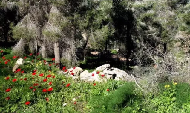
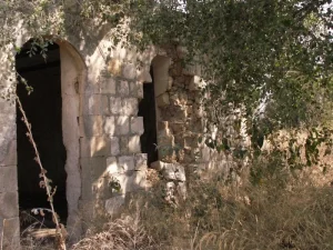
According to Walid Khalidi's field description in All That Remains, piles of stones were scattered throughout the village site, which was dominated by pine and oak trees.
Part of the surrounding land had been fenced and was used for grazing, while another part was cultivated.
Cactus, fig trees, and olive trees also grew near the former village site.
This description derives from fieldwork carried out before the publication of All That Remains in 1992 and should not be treated as direct field verification of conditions in 2026.
Palestine Remembered contains later community documentation, including a series titled “A Tour among the Village's Destroyed Houses” uploaded on 7 June 2025, as well as additional materials added in 2025 and 2026.
These materials are useful evidence of continued identification of house rubble and other parts of the village landscape. However, an upload date does not necessarily establish the date on which every photograph was taken, and the material does not constitute a comprehensive independent archaeological or architectural survey of Nuris in 2026.
Sources
- PalQuestPalQuest – Interactive Encyclopedia of the Palestine Question: Nuris
- PalQuestPalQuest – al-Mazar: context of the Golani advance toward Jenin
- Palestine RememberedPalestine Remembered – Nuris, Jenin
- Palestine RememberedPalestine Remembered – Nuris entry from All That Remains
- Palestine RememberedPalestine Remembered – later community documentation of the Nuris site, uploaded in 2025
- Institute for Palestine StudiesInstitute for Palestine Studies – Walid Khalidi, All That Remains
- pcbs.gov.psGovernment of Palestine – Census of Palestine 1922
- fada.birzeit.eduBirzeit University Repository – Census of Palestine 1931
- maktabatsabil.comGovernment of Palestine – Village Statistics 1945: Jenin Sub-District
- palestinapedia.psPalestinian Encyclopedia – Nuris
- palqura.comPalestinian Villages Encyclopedia – Nuris: local boundaries, water sources, and community documentation
Photo gallery


Photos from the village's people
Photos sent in by visitors and published after review.
Add a photo of this village
Log in to add photos of this village.
Other villages from Jenin
More from the archive
 Download Our Palestine App
The whole archive in the palm of your hand: depopulated villages, the Nakba, the massacres and Al-Aqsa — free, with no ads to erase the story.
Download Our Palestine App
The whole archive in the palm of your hand: depopulated villages, the Nakba, the massacres and Al-Aqsa — free, with no ads to erase the story.



Comments
No comments yet — be the first to write one.
Add your comment
Name and email are optional. Comments appear after review.